In December we discovered and shared here a trove of glass plate negatives taken by a photographer from the Department of Public Works who was out to document the giant gravel pit at NE 33rd and Fremont.
In that same series of glass negatives we found one labeled “High Water Columbia Slough,” clearly shot at a different time of year (the trees are leafed out), but contemporary with other images in that collection from 1911-1913, showing a finger of river overflowing its banks. Trees in the mid-ground are standing in water. A gravel road is inundated, but a plank walkway allows foot passage. Off behind through a curtain of brush is open water, an island in the distance, the far shore in the distance beyond that.
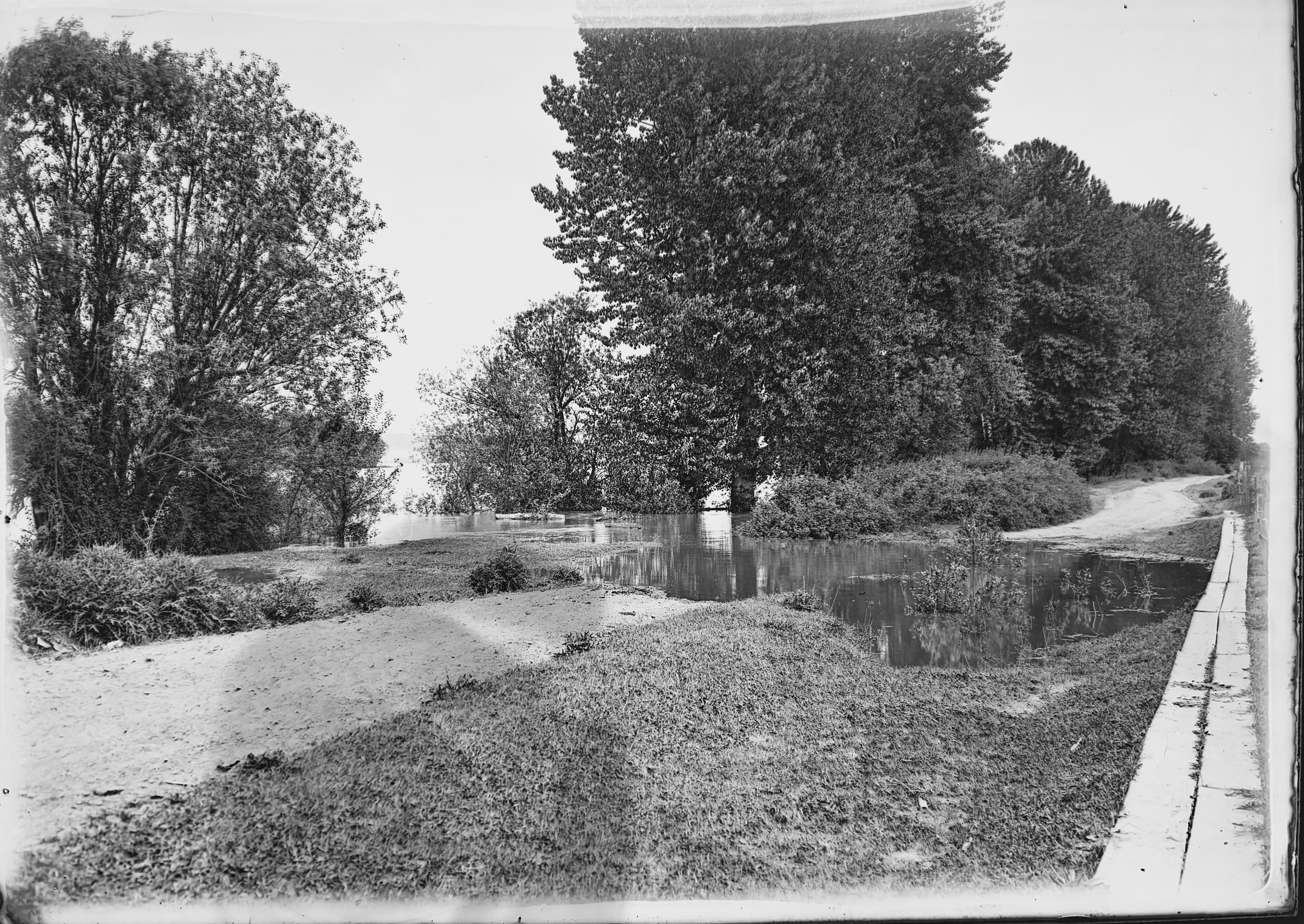
Columbia Slough High Water, courtesy of Portland City Archives. Image A2009.009.2791
We’ve been staring at this photo, like we enjoy doing with all old photos, trying to understand what it has to tell us, where it was taken and its overall context.
We’ve written about the slough here on the blog, also known as the Columbia Bayou on some maps and as “the bottoms” in surveyors notes from the 1850s, and shared some views taken about this time and a bit earlier. In other work, we’ve learned about the conversion of the slough for grazing and agriculture, and later for flood control and irrigation. When this picture was taken, big changes were on the horizon that would eventually lead to a transformation of the Columbia River’s south shore in this area bringing hundreds of thousands of cubic yards of fill, a levee system, construction of the Portland Air Base and later Portland International Airport.
But back in 1913 when this photo was taken there was still living memory of a very different time, of the first people who made their lives and livelihood on these banks, of a river that rose and fell, with waters regularly filling as far south as today’s Columbia Boulevard.
As to where this was taken? Starting with the easy assumptions, we believe it’s looking upstream to the east, the mainstem of the Columbia in the middle distance. The large-format camera used to make this glass negative would have been a heavy thing to lug around, so chances are it’s not too far from where the Public Works Department could drive.
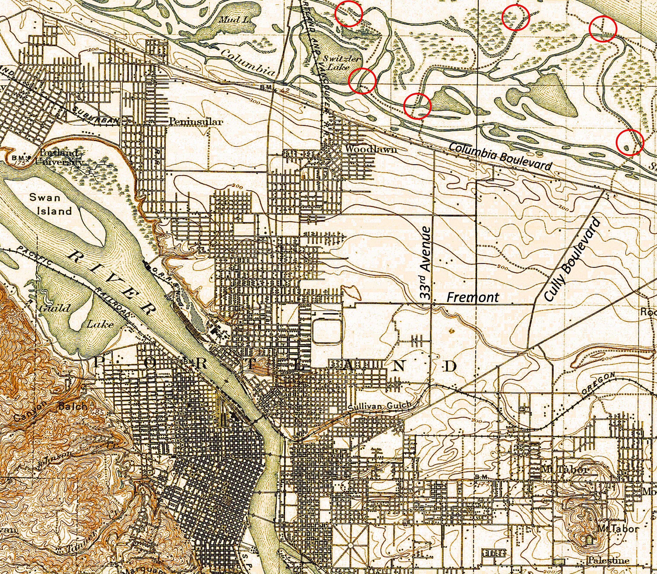
A look at the 1897 USGS Portland quadrangle map above, and the 1915 Hanson and Garrows Map of Portland, suggests it could have been at the far north end of NE 33rd (known in that area as Sunderland Road), or north of Cully Boulevard, both places where small networks of temporary gravel roads wove around slough waters. Check out the map, with some new labels added for orientation and a few possible photo locations circled in red, just for fun. While you’re looking around, appreciate just how complex and amazing the slough was. During high water on the Columbia, all those channels and ponds and the wet meadows in between were submerged.
Back to the 112-year-old photo: it’s a pretty interesting image of an extinct location reminding us of our short time here, and the changes we’ve wrought in just over 100 years.

