Throw together a couple dozen scattered and growing neighborhoods, at least five incorporated towns with their own municipal governments, a public transportation system owned and operated by a handful of different authorities and private companies, a real estate market on fire, and an expanding network of streets and main arterials running across the whole complicated map. Sounds like an administrative headache, doesn’t it?
That was the challenge facing local leaders in 1931 when Portland decided it needed a new addressing system. The old way just wasn’t working: letters, visitors, homebuyers and even deliverymen were getting lost.
By the mid 1920s, Portland’s east side neighborhoods were booming. Research we’ve done into building permit history shows Alameda’s heyday of construction was 1922. In those early years, some homes started out with one address, but had to be renumbered—some several times—as lots were developed and new homes built.

If you look carefully when out walking, you might find clues to our old address system. This artifact was cast into a neighbor’s front steps when the street was East 30th Street North.
By 1926, the city engineer recognized the need to change our address system. Except for the alphabet district in northwest Portland, where streets were (and still are) alphabetical, there was no numerical or organizational logic about how we told each other where we lived or worked. No baseline starting point for address numbers like today’s use of the Willamette River and Burnside. No predictable and sequential set of numbers that go with each block (i.e. the 2400 block of any particular street being 24 blocks north or south of anywhere else). No primary districts (northeast, northwest, north, southwest and southeast). Just cardinal directions and a pack of numbers. By the late 1920s, Portland Postmaster John M. Jones reported that 2,000 pieces of mail were going astray each day because of the confusing and random addressing system.
After all, the fraying system in place had been cobbled together in the early 1890s when the cities of Portland, East Portland and Albina merged. In the intervening years, both the population and the territory of the city more than doubled.
Reflecting on our system’s need for help, one reporter for The Oregonian wrote: “Many a city planner and civic engineer had thrown up his hands or uttered oracular warnings at the antiquated way in which our city was numbered.”
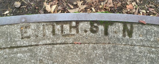
More evidence of Portland’s early addressing system when all east side streets had two cardinal directions. Most of these early cast-in-place curb identifiers have been lost to modernizing curb cuts. Another name frequently cast into our sidewalks is builder Elwood Wiles. Click here for a photo and short biography of Mr. Wiles.
City Commissioner Asbury Lincoln (A.L.) Barbur recognized the problem and assembled a group to look at other cities for examples and to assemble a system that fit Portland’s needs. Barbur, whose name you will recognize from the southwest Portland boulevard named to honor him, was one of Portland’s most civic-minded early leaders. Elected five times to two-year terms as city auditor between 1907-1917, Barbur ran successfully in 1920 for commissioner (his election slogan was “Let the People Rule”). Read the reporting from the day and you’ll find him a pragmatic, smart, get-it-done elected leader who was almost single-handedly responsible for the business model that resulted in the paving of Portland streets, as well as the push to change the address system. Barbur’s street paving model is worthy of its own story: with so many new gravel streets in need of work, Barbur led the city to buy and operate its own paving plant rather than contract it all out, which saved the city millions of dollars, got the job done, and attracted the ire of local contractors who branded him a socialist.
In early 1930, Barbur’s addressing committee looked first at the system in Philadelphia, and then at Milwaukee, Wisconsin for ideas. As they did their scoping work, they also held public meetings in Portland neighborhoods to hear ideas and build support. By December 1930, Barbur’s committee had crafted a plan and received unanimous support from 18 different community organizations.
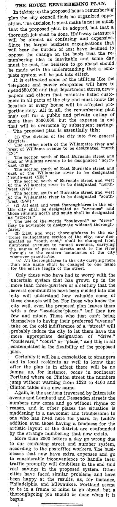
The essential framework was the system we know today: Divide the city into five sectors: NE, NW, SE, SW and North (owing to the bend in the river). Burnside was to be the new baseline north and south; the river was already an effective east-west baseline. Blocks would be divided into sets of 100 numbers. And some substantial renaming would add continuity and order. Here’s an editorial from The Oregonian on May 13, 1931 that endorses specifics of the plan and makes the case for change.
On September 2, 1931, city council unanimously and enthusiastically passed the plan, including $10,000 to pay for ceramic number tiles for every house and building, and it created a workforce of unemployed men to get the job done. Here in Alameda, renumbering and renaming resulted in a numeric transformation, and the changing of at least two street names, Glenn became NE 32nd Place; Laura Avenue became Edgehill.
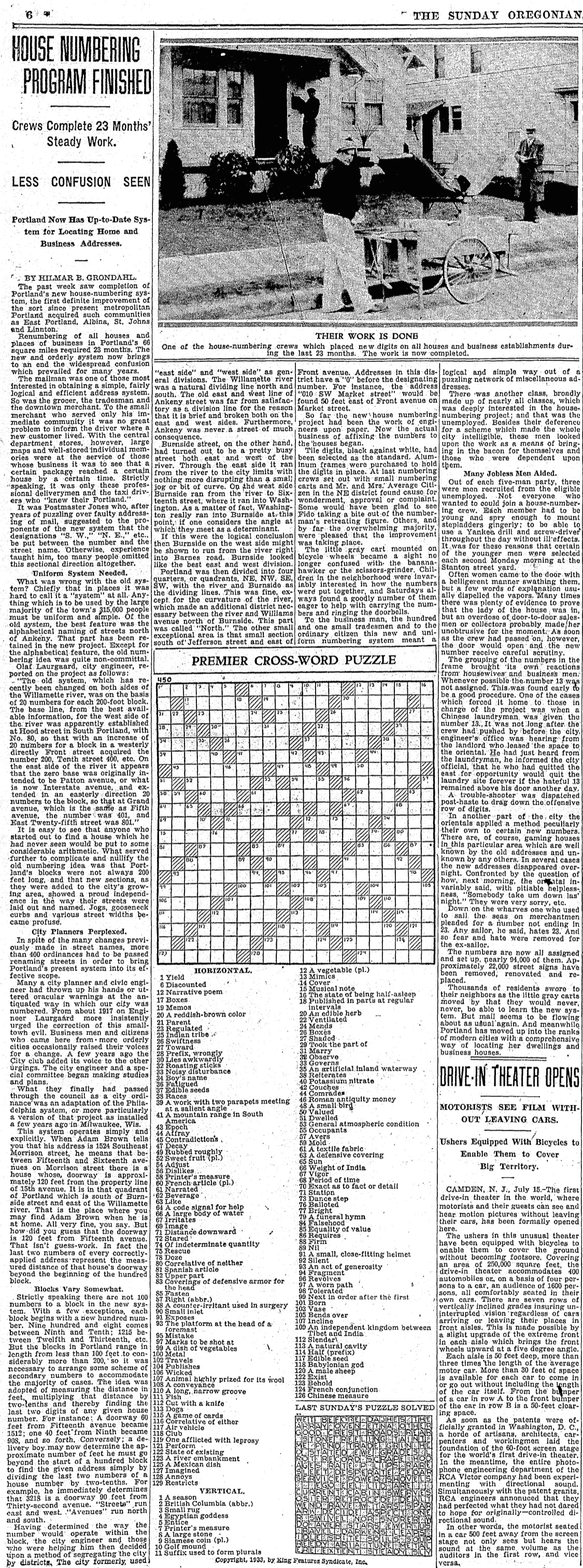
From the July 16, 1933 edition of The Oregonian. Click on the image to read the full story.
From the fall of 1931 through the summer of 1933, crews of workers fanned out across 66 square miles of Portland pulling wheeled carts filled with ceramic numbers, aluminum trays to hold the numbers, and hammers and nails to anchor them to every Portland house or business. It took 23 months. Not everyone was happy: some were superstitious if assigned anything with a 13 in it. Others who operated certain established and illegal businesses out of their homes took down the new numbers so as to not confuse their loyal customers. But most Portlanders embraced the new system and caught on to its logic quickly.
A ringing endorsement from The Oregonian on July 16, 1933, coinciding with completion of the renumbering, summed up how the community responded to the transformation:
“To the business man, the hundred and one small tradesmen and to the ordinary citizen, this new and uniform numbering system meant a logical and simple way out of a puzzling network of miscellaneous addresses.”
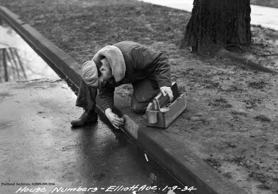
Painting a new address on the curb in Portland’s Eliot neighborhood following the Great Renumbering. Photo courtesy of City of Portland Archives.


Great post. I am off to discover how and when our numbering system here was altered….
Outstanding summation. Thanks!
I am amused that there was no reference to Seattle — I guess Portland didn’t want to pay any attention to the doings of its big sister to the north! Seattle went through several stages of street naming revisions and directional designations.
Good article about an interesting subject, but just a few minor corrections. There was in fact a dividing street between north and south prior to 1931, but it was Ankeny, not Burnside (Ankeny was the border between the original Portland plat and Captain Couch’s claim on the west side of the river). Blocks were numbered in 20’s not 100’s as is the case now. The address system was indeed very confusing, but on the east side only the numbered streets north of Ankeny had to have two compass points, e.g. “East 57th Street North”. East of the river, Glisan was just “East Glisan”, because no part of Glisan was ever south of Ankeny. To add to the confusion, Belmont and Hawthorne needed no compass points at all, because they didn’t exist on the west side and were entirely south of Ankeny. I notice that even the Oregonian article got something wrong, because it has the description of which streets were renamed as “avenues” backwards. And one addition to the story, as of this year (2020) there is a sixth district, “South”, due to another bend in the river; previously these addresses were in SW Portland but had to start with a zero.
I am trying to locate a “Before and After” list of addresses in Portland, especially in North Portland and Southeast Portland. Does anyone know of one? I am trying to figure out where my ancestor’s houses were located but all I have are pre-1930 addresses.
Absolutely. This very handy reference can be found at Portland City Archives. Here’s a link to a very large PDF copy: https://efiles.portlandoregon.gov/Record/2685610/
Pingback: Two Townhomes Join 1925 House – Montavilla News
Pingback: Sunny 82nd Market Closes – Montavilla News
Pingback: Deconstruction of 1900 Era House on NE 75th – Montavilla News
Pingback: Five Frugal Things
Howdy again. What is the URL for the renumbering conversion “old to new”?, thanks Del
pastportland.com is a great tool for translating between old and new addresses in Portland.
Pingback: Lucy was a voter – Pieces & Stems: Family History