Time travel deep dive at NE 42nd and Killingsworth

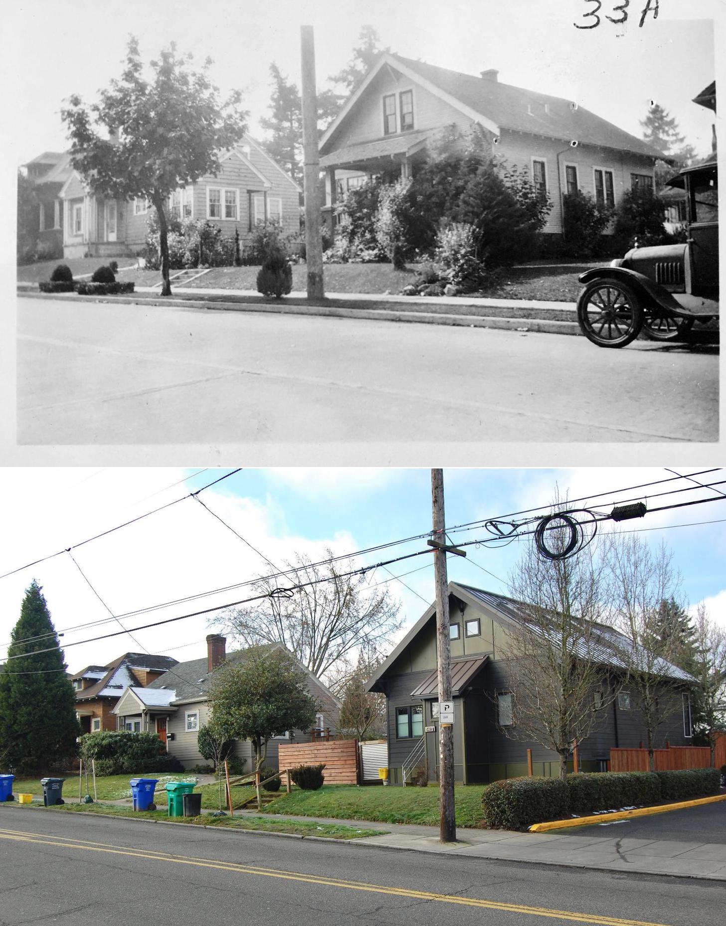
The intersection of NE 42nd and Killingsworth can feel like it exists on the way to somewhere else. But this crossroads has its own rich history that runs deep.

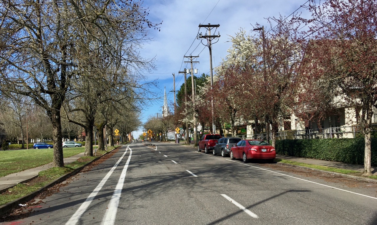
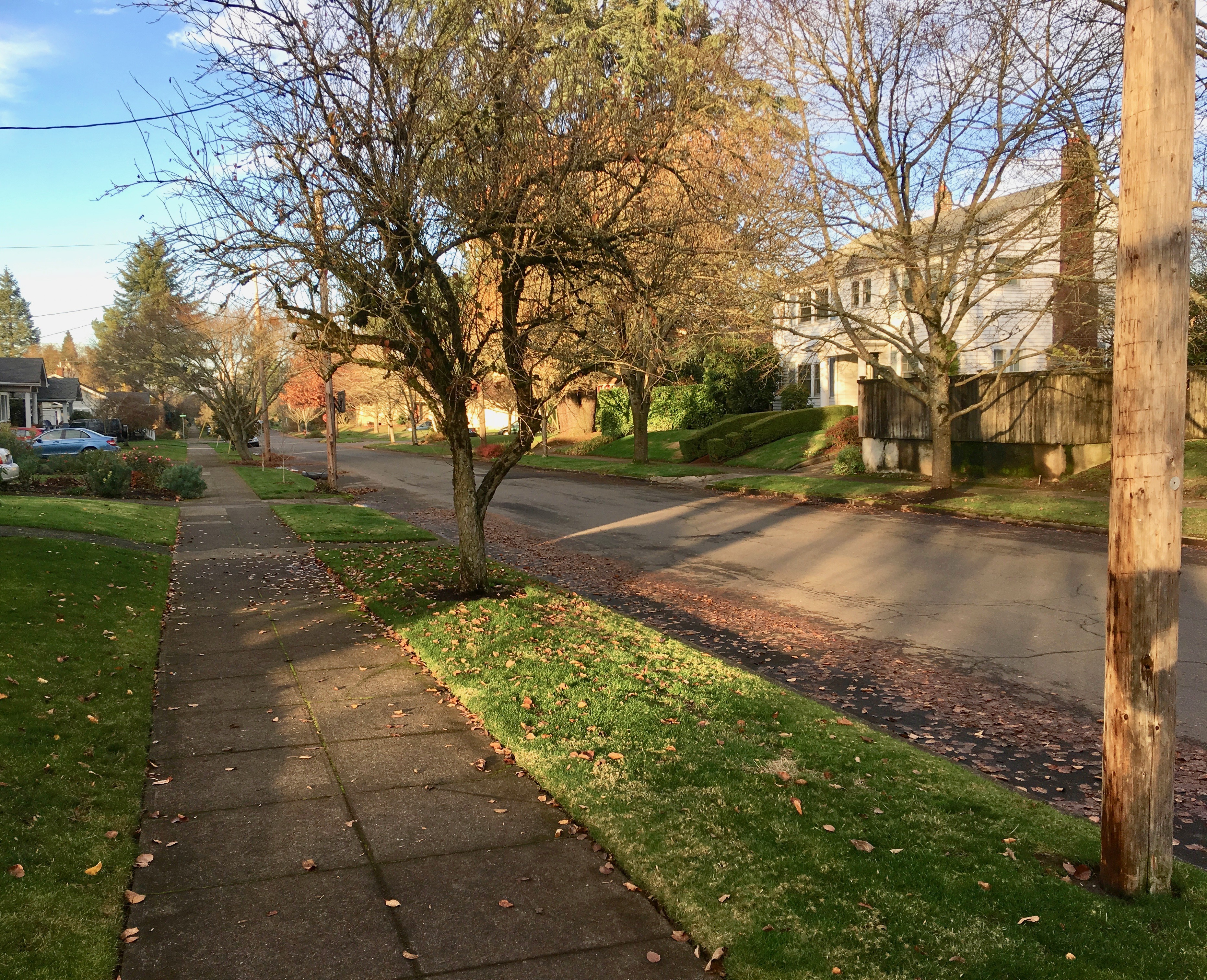
NE 42nd and Killingsworth, looking northeast. Fall 2023, Google streetview.

It’s worth slowing down time a bit to be able to see and explore the chapters here, which run back through commercial retail and early neighborhood development to wide open fields of berries and orchards, further back through the homestead era and even down slope toward the Columbia River and the slough wetlands that have been known and inhabited by Chinookan people since time immemorial.

This is the first of a three-part exploration to spark your imagination about the layers of history here. In this first installment, we’ll overview the arc of the story. In the second installment, we’ll take an illustrated deep dive into the subdivision years between 1900-1940 when everything was changing for the neighborhoods around the crossroads. Our last installment will explore the changing look of the intersection itself from the 1950s-1980s: gas stations and mom-and-pop groceries, greenhouses, a Safeway store, a trailer park, Adams High School and more.

Today, both NE Killingsworth Street and NE 42nd Avenue are well-used surface streets in the Northeast quadrant of Portland. The traffic-controlled intersection where they cross—poised at the northern edge of the 42nd Avenue / western Cully neighborhood commercial area four miles from the downtown core of the city center—features restaurants, bus stops, a convenience store, direct access to a city park and a brand-new workforce training center operated by Portland Community College. In fall 2025, Home Forward will open 84 units of affordable housing here. This is a busy place.

Early slopes above the Columbia Slough

For millennia the uplands south of the Columbia Slough and Columbia River were covered by a mixed forest of Douglas-fir, hemlock, cedar, alder and maple. Periodic fires, windstorms and outbreaks of insects and disease created openings in the forested canopy. The upland plateau that would eventually become the vicinity of today’s NE 42nd and Killingsworth sloped gently down to meet a vast flood plain, which followed an east-west line at the foot of the slope traced by today’s NE Columbia Boulevard.

Situated between the bottom of the slope and the main channel of the Columbia River just to the north was an interconnected flood plain mosaic of wetlands, ponds, marshes and off-channel waterways. Chinookan seasonal gathering places and dwelling places thrived here for thousands of years.

“Interior of Ceremonial Lodge, Columbia River,” an 1846 oil painting by Paul Keane, who traveled among the Chinook villages of the lower Columbia River.

Explorers, trappers and traders passed by on the Columbia River in the early 1800s intersecting the lives of indigenous people who had known this area since time immemorial. Early white traders introduced successive epidemics of disease, disruption and depredation, and by the 1830s the Chinookan people’s settlements in this area and their ways of life had been dramatically changed. By the late 1840s, Oregon Trail settlers arrived in the area; this immediate vicinity was homesteaded by several families practicing a mix of agriculture, trade and subsistence. Forests were removed, roads were constructed, and homes and barns built.

Surveys gridded the land

With the opening of the Oregon Trail in the mid 1840s and arrival of an increasing number of outsiders seeking land for farms and homesteads, the U.S. Government established a systematic process to map and identify lands that had been mostly cleared of indigenous people that could be granted to newcomers. Survey crews got to work here in the Portland area in 1851 establishing the Willamette Meridian, a systematic grid of townships, ranges and sections across the territory and the Western U.S. that promoted the availability of lands.

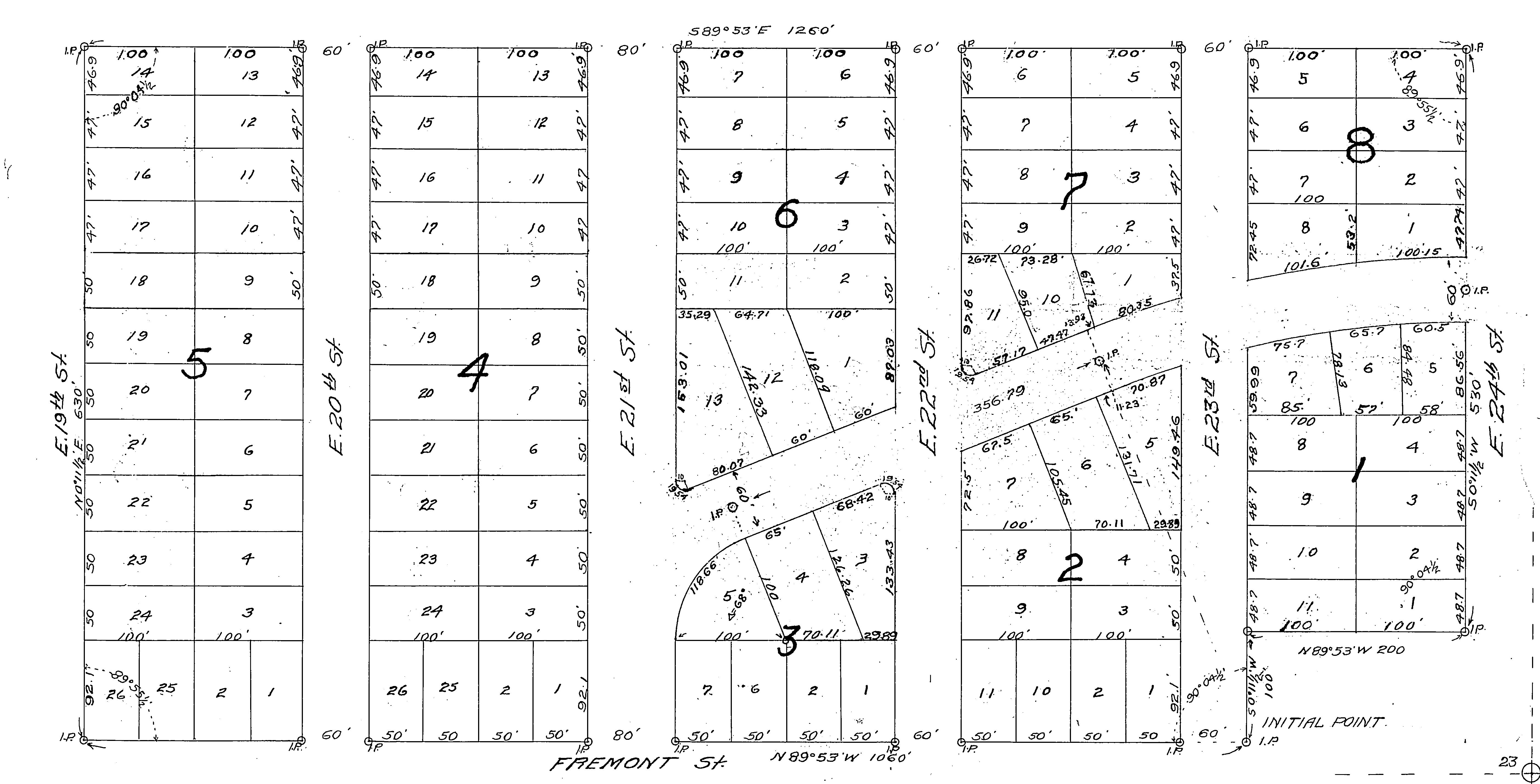
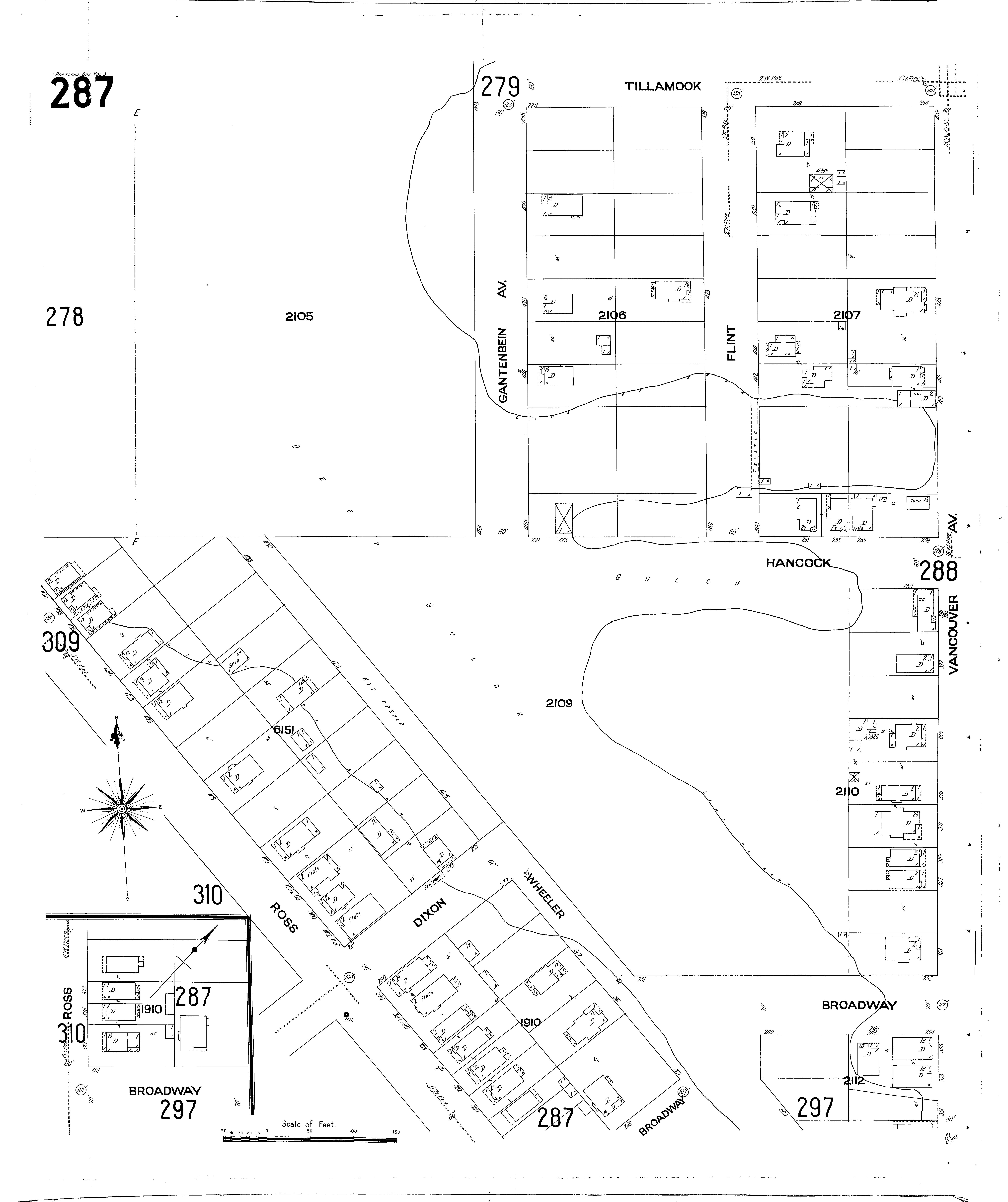
Today’s intersection of NE 42nd and Killingsworth exists at the corner of four sections of the Willamette Meridian: Township 1 North Range 1 East, sections 13 and 24 to the west; Township 1 North, Range 2 East, sections 18 and 19 to the east. Here is a compilation of those two original survey maps (click in for a closer look, they are fascinating). Observations below.

On the left is Township 1 North, Range 1 East. Notable are the early grid of a young Portland in the lower left; the location of past forest fires; the proximity of early trails and the complex waterways that make up the Columbia Bayou to the north. The blue arrow indicates the approximate location of today’s NE 42nd and Killingsworth. On the right is Township 1 North, Range 2 East. Notable here are the “wet prairie” description of the Columbia Slough bottomlands in the vicinity of today’s Portland International Airport; the road running northeast, predecessor of today’s Cully Boulevard; the surveyor’s descriptors—land gently rolling, soil 2nd rate, gravelly. Timber, Fir, Hemlock, Maple—describe vegetation in the area at the time; Rocky Butte shows up as the raised topography in the center of the map.

In October 1851, surveyor Butler Ives and his crew walked all through this area in order to draw these maps, and characterized what they saw like this:

Upland situated in the middle portion of the township is gently rolling and is elevated from 50 to 100 feet above the adjoining bottoms. The soil of the above is nearly uniform and good second rate clay loam and some gravelly in the northeast portion south of the Columbia bottoms.

The bottom lands both of the Willamette and Columbia, is from 5 to 15 feet above low water, the most elevated being along the banks of the rivers and bayous; they are subject to an annual inundation lasting from 1 to 2 months in the summer season, leaving only a few of the higher places dry. They are mostly open grassland. Soil rich alluvial and badly cut up with bayous, stagnant ponds and lakes which render nearly one half of them unfit for a cultivation.

The timber on most of the uplands is heavy and varies from 1 to 2 and in some instances to 250 feet in height. It is principally fir with a little maple, cedar, hemlock and dogwood interspersed.

The undergrowth is vinemaple, maple, brush and is usually thick; there is considerable dead and fallen timber caused by fire which has run through most of this Township.

In the bottoms is ash, willow balm, Gilead, crabapple with oak, and is found skirting the banks of the rivers and bayous. The undergrowth is in thick mixture patches of hardwoods, rose bushes gooseberry bushes and vines. The Columbia bayou is deep in most places and will admit boats drawing several feet of water. The other bayous are generally shallow.

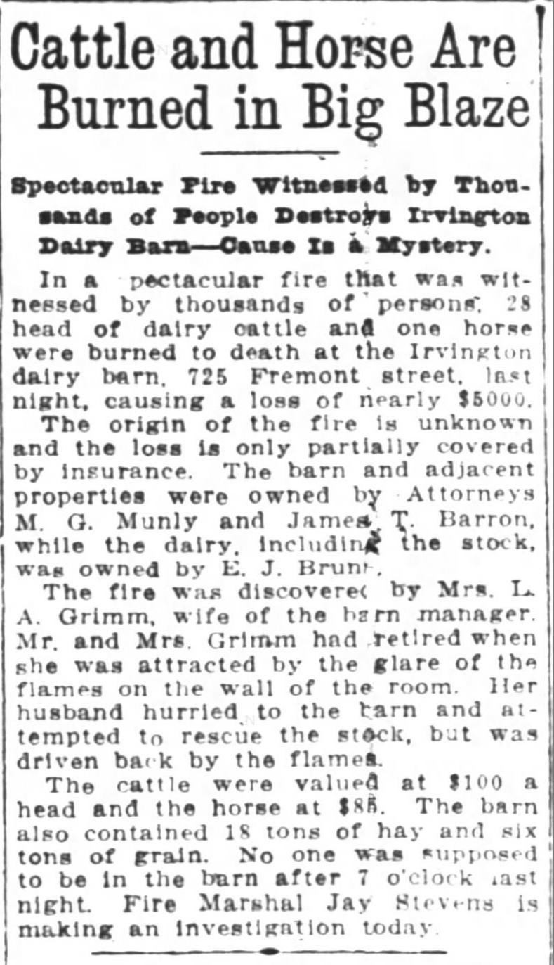
As more people arrived, the surrounding lands were further divided, sold and developed. Wetlands to the north were drained for agriculture. More roads were built and active steamboat commerce developed on the nearby Columbia River. In 1882, a short stretch of dirt road in the growing nearby town of Albina was dedicated as Killingsworth Street, named for prominent real estate developer William Killingsworth. One year later—1883—the Oregon Railway and Navigation Company opened an east-west rail line passing nearby to the south that connected Portland with a growing network of regional and national railways.

A patchwork emerges

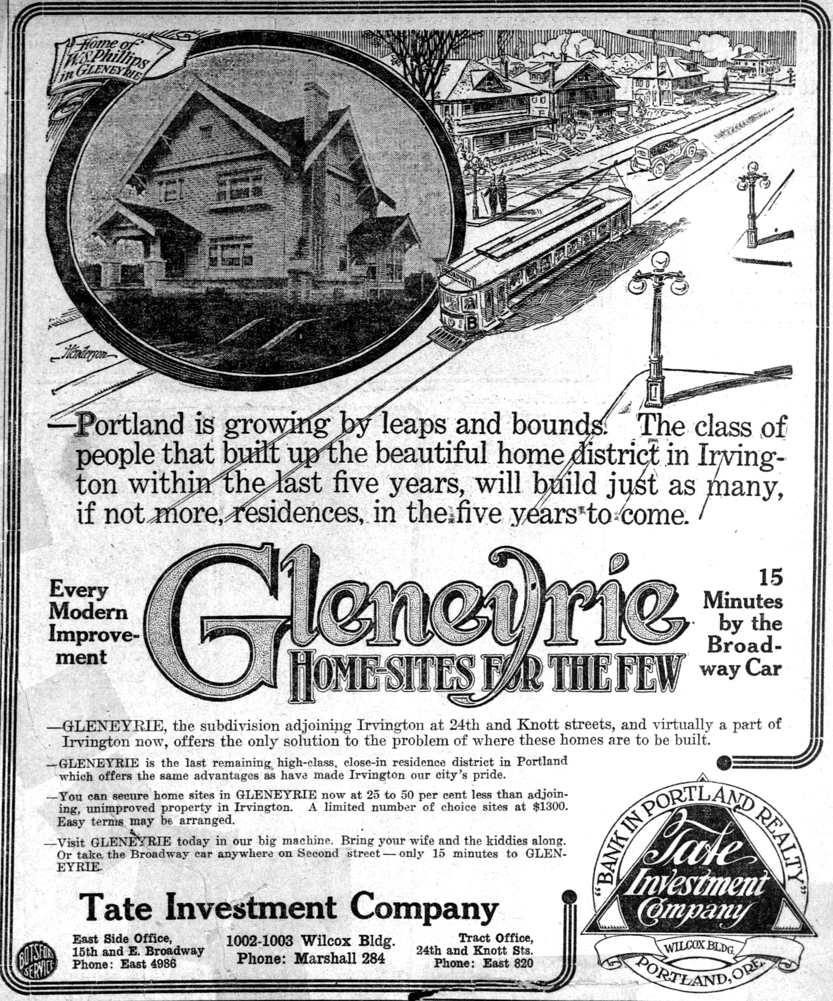
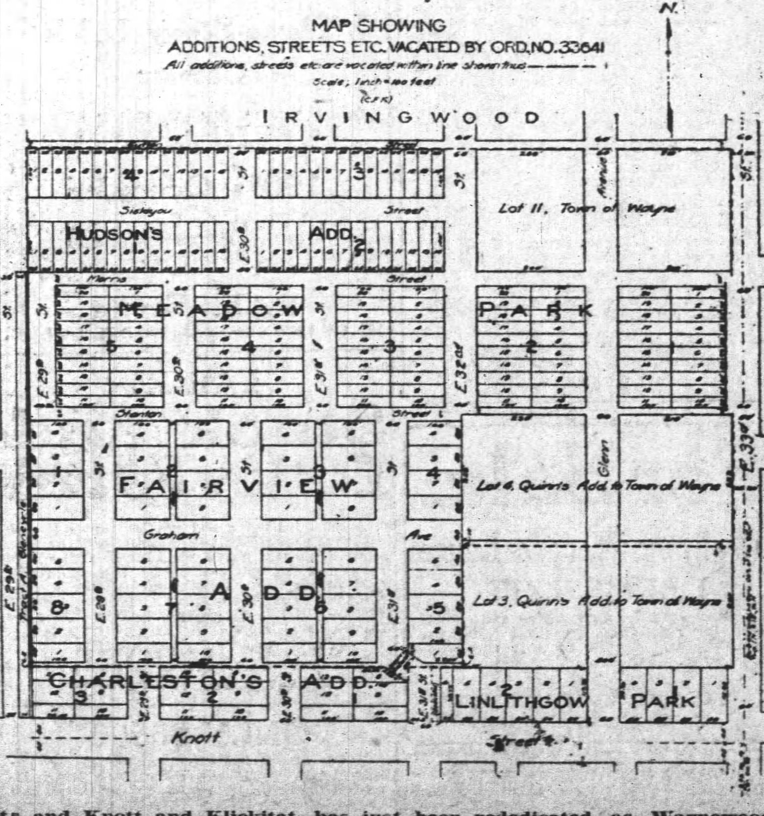
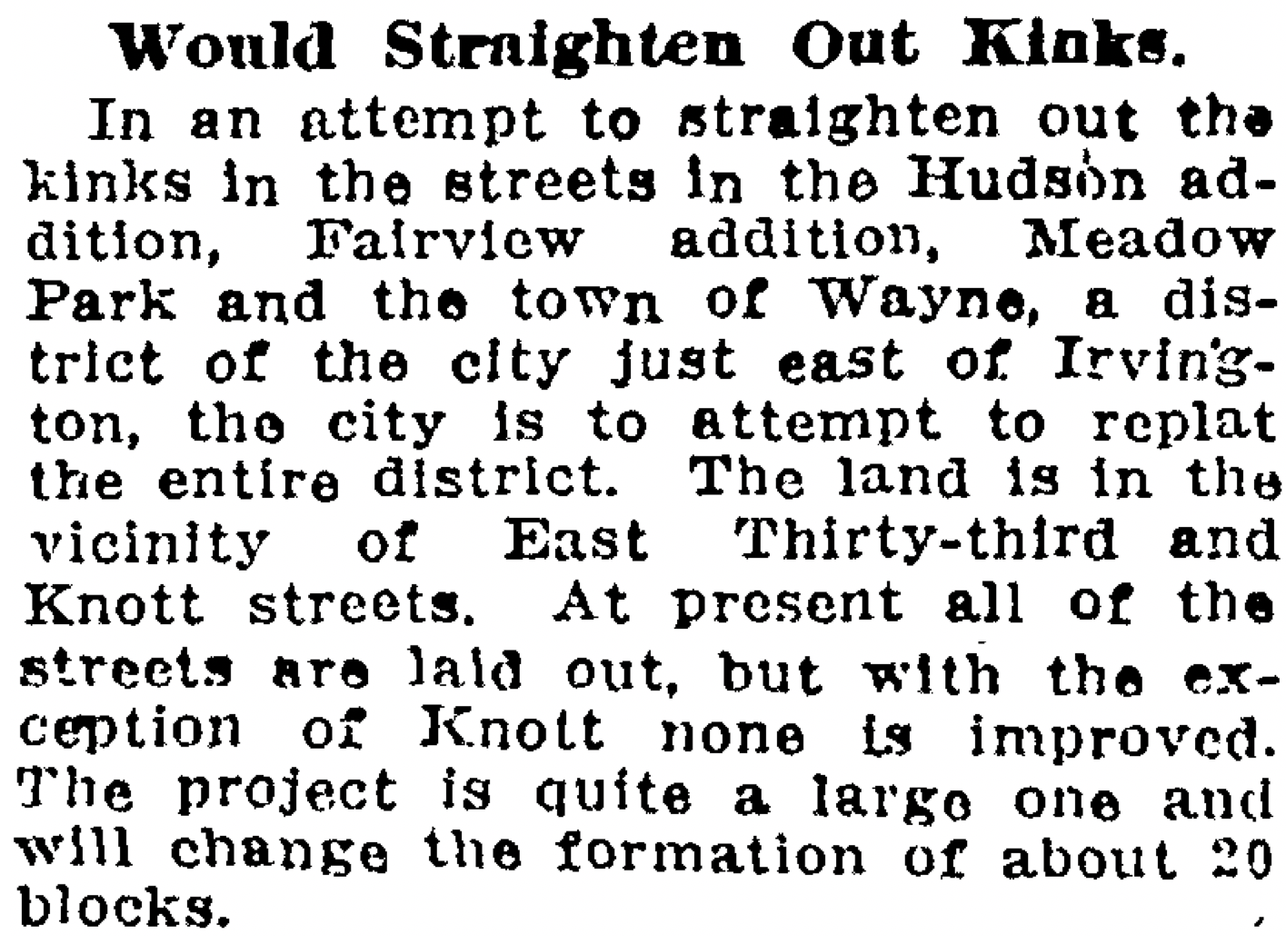
Our crossroads was well outside the eastern boundary of East Portland, which in 1891 consolidated with the towns of Albina and Portland (on the west side of the river) to form the single City of Portland. A rough north-south gravel trace known as the County Road (today’s NE 42nd Avenue) was carved out connecting the east-west predecessor of today’s Fremont Street with the east-west road along the Columbia Slough (today’s Columbia Boulevard). Growing population and commerce continued to boost Portland’s expansion. By the turn of the century, lands that 50 years earlier had been taken from indigenous people and deeded by the federal government to a handful of incoming families were being subdivided and sold into hundreds of parcels.

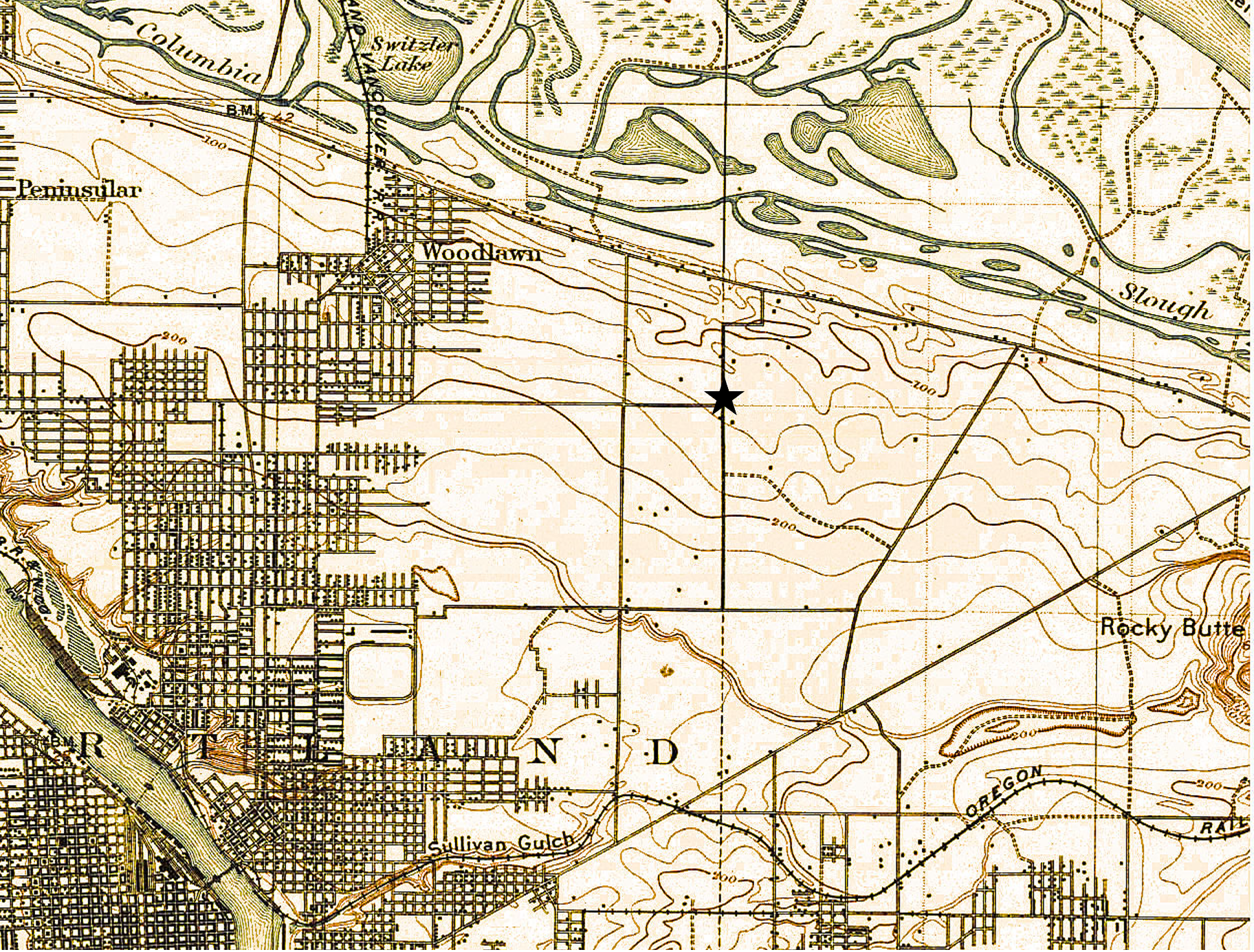
A patchwork of agriculture and development dotted the surrounding landscape with small farmsteads of orchards, berries and vegetables interspersed with homesites. Below is a detail from a USGS 1897 map of the area (star shows location of NE 42nd and Killingsworth). Notable here is that Killingsworth does not go farther east; development does not proceed much farther east than NE 7th; scattered farmsteads occupy the area of today’s neighborhoods; the Irvington race course at NE 7th and Fremont shows up in lower left.

Because of the area’s distance from the downtown core, its location beyond easy access to the streetcar system which promoted development, and its agricultural productivity, the crossroads remained largely rural until the opening of Portland Airbase in 1941, which was then a brand-new facility built on the reclaimed floodplain wetlands just south of the Columbia River.

Post-war boom ignites interest

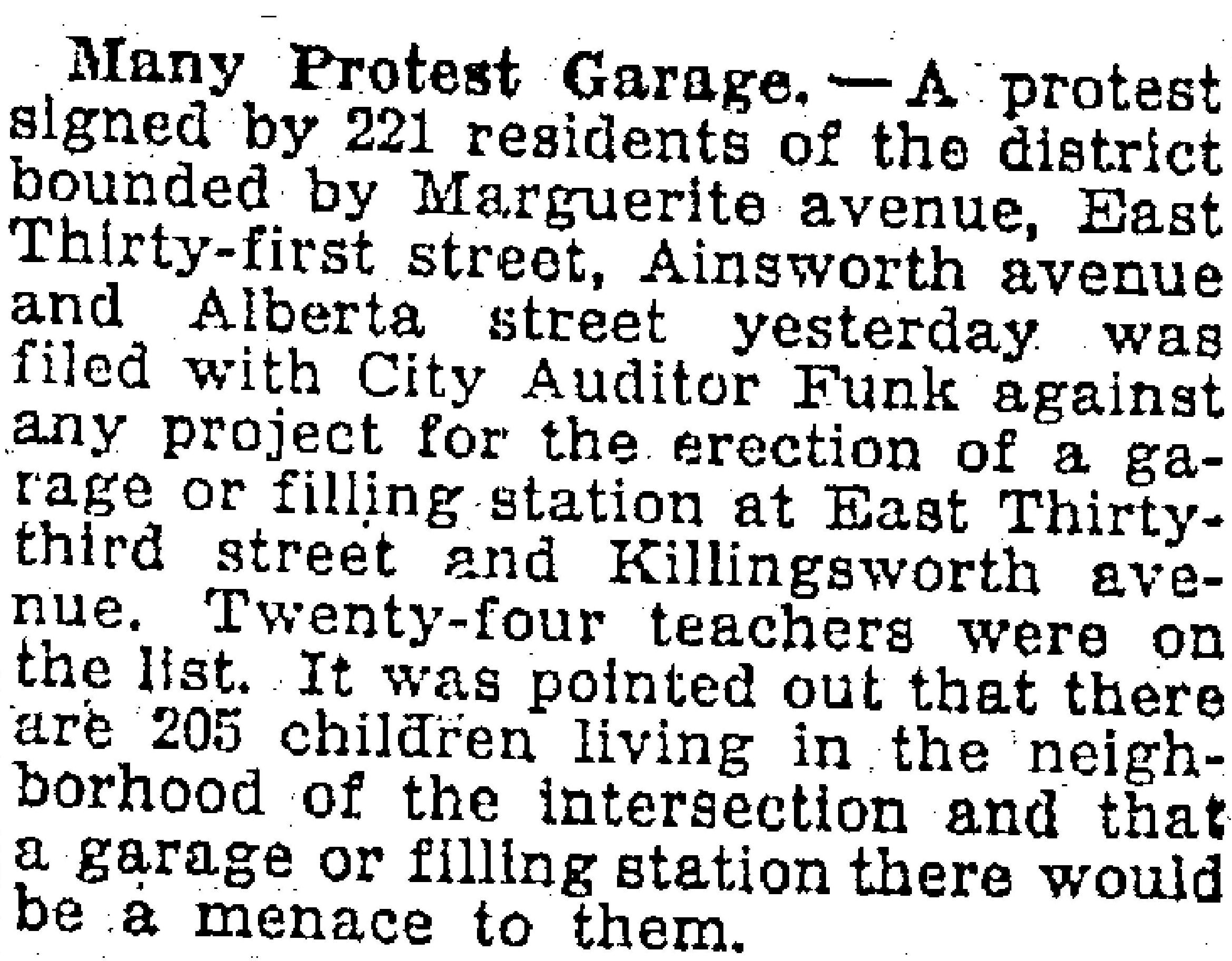
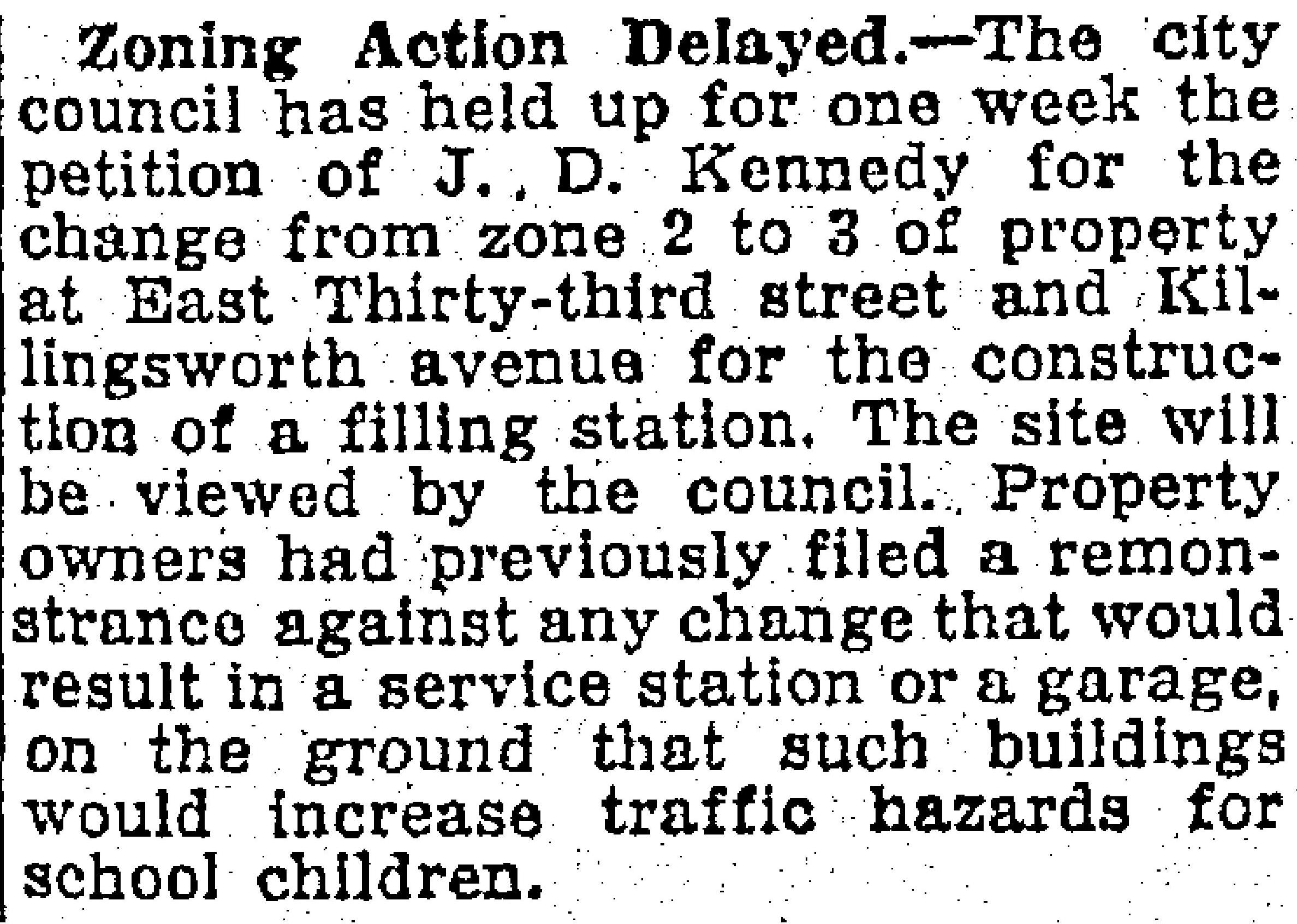
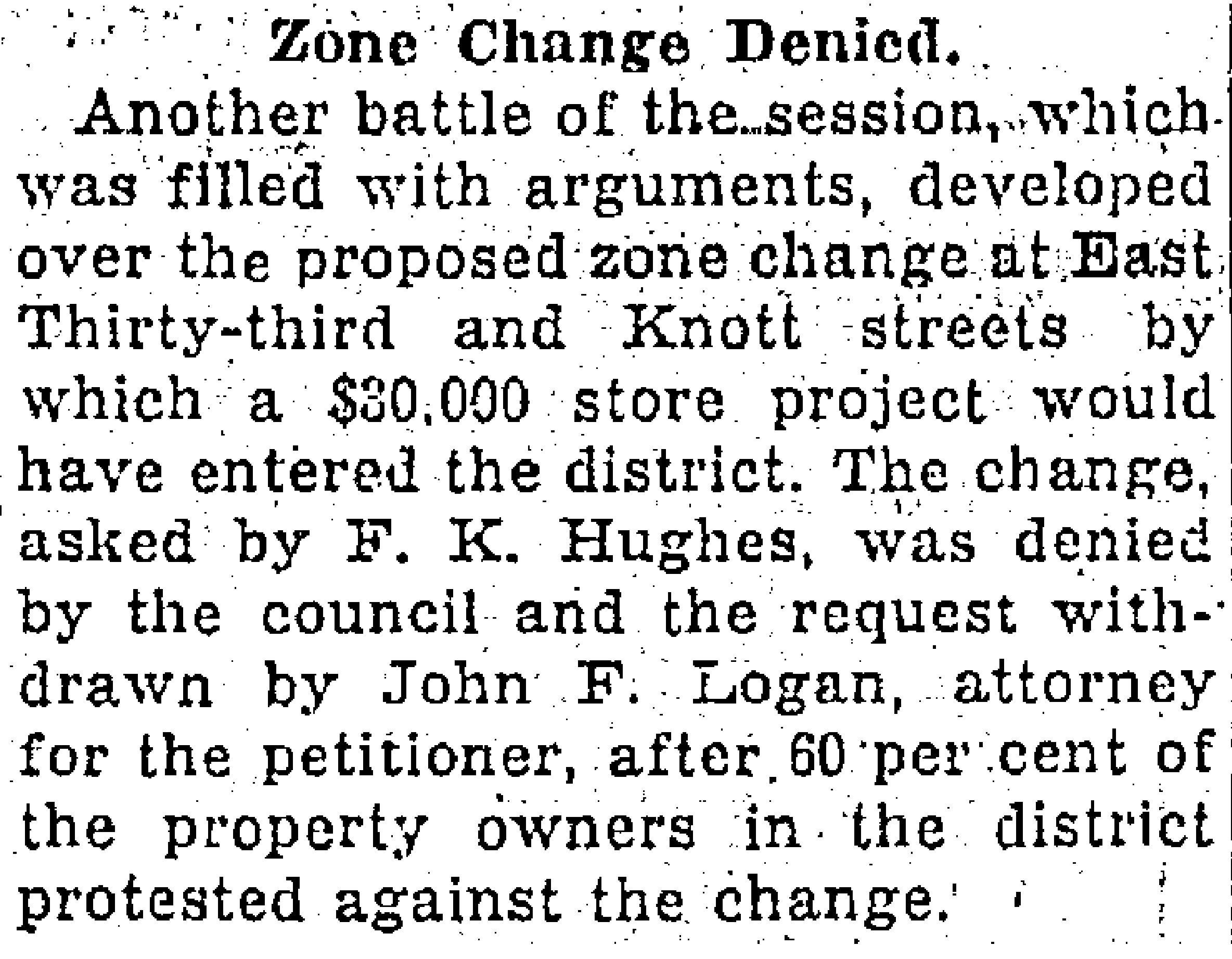
The wartime expansion of manufacturing, residential growth and military operations drew new attention to the area, leading to transportation improvements and northern extension of NE 42nd Avenue with a viaduct over the Columbia River Highway, making it a major throughway from the eastside to the airbase. Residential and commercial development followed. Portland’s post-war housing boom in the 1950s led to further development, including more subdivisions, construction of a busy trailer park at the northeast corner of the intersection, and city acquisition of remaining nearby farm lands into what would become today’s Fernhill Park just to the northwest.

By the 1960s the area had been annexed into Portland proper. A commercial hub had developed at NE 42nd and Killingsworth including large and small grocery stores, service stations, bars, restaurants and light manufacturing. In the mid-1960s, the Portland School Board condemned a portion of the surrounding area to build John Adams High School, in direct opposition to residents’ wishes, razing homes and businesses. The school complex was later transitioned into Whitaker Middle School, and eventually torn down in 2006 due to changing student demographic needs and concerns about radon gas and the presence of unhealthy black mold found throughout the building.

Next: From farm fields to city lots – plats and development arrive

A hidden place called Gleneyrie

Today, we think of the Alameda neighborhood as one contiguous area with well-recognized boundaries: The city’s Office of Neighborhood Involvement identifies Alameda as that area from Prescott on the north to Knott on the south; from NE 21st on the west to NE 33rd on the East. One single named neighborhood today, containing about 2,400 dwellings and more than 5,000 people.

But hiding underneath today’s one single map is a treasure of 23 old maps—subdivision plats—all drawn at different times by different people as they transformed this landscape one small piece at a time from forests and fields to the grid of streets we know today. We’ve been taking a systematic look at these plats, some of which like one particularly chaotic collision just north of Knott, we’ve written about.

Here’s one we’ve been looking into recently: Gleneyrie, a subdivision plat filed in July 1911 by three couples who were the principals of the Tate Investment Company: Thomas and Inez Foster; Jost and Maria Held; and Robert and Nellie Tate. That fall, they placed their first ad for the property, below, which was then still just a concept (click in for a larger view).

From The Oregonian, October 22, 1911

The Tate Company investors purchased their 24 acres of the former Bowering Homestead Donation Land Claim in the years after the 1905 Lewis and Clark Exposition with an eye toward real estate development. The surrounding open fields, orchards and dairy property were rapidly being converted to residential use to keep up with Portland’s booming real estate market and population. And there was much money to be made by investors ready to speculate on a rising market. The Tate Investment Company also developed Dixon Place, another plat just north of Fremont between NE 15th and NE 21st avenues.

Here’s a look at the official Gleneyrie plat, filed with the Multnomah County Surveyor and County Clerk on July 25, 1911: from NE 24th to NE 29th, between Siskiyou and Knott.

One week later, Tate added additional area to Gleneyrie taking in East 26th and 27th north to the existing boundary on the eastern edge of the plat.

The namesake Gleneyrie was a Tudor-style castle in Colorado built in 1871 by William Jackson Palmer, founder of Colorado Springs: big, beautiful, fancy and well-known. And the name sounded good too, which was key. By 1915, Portland developers had filed more than 900 plats—development plans that divide an acreage into a subdivision of lots and streets—many of which were as small as one block or less, and all named by developers searching for an attractive sounding name.

Today’s Alameda neighborhood is made up of 23 separate plats, all filed at different times by different developers who were competing with each other and speculating on market conditions when they bought chunks of what had been old homesteads and farms claimed in the 1850s and 1860s.

In some areas the plats have retained their distinct personality and name. But here in Alameda—named for the 1909 Alameda Park Addition plat filed just to the north—the identity of the individual plats like Gleneyrie eventually dissolved into the commonly used neighborhood name we know today.

But in the Spring of 1913, when having a catchy name might help compete with all the other real estate advertising, the Tate Investment Company pushed out a series of full-page and half-page illustrated ads in The Oregonian and the Oregon Journal to market the attributes of their new subdivision. And they tied their marketing more closely to Irvington—a well established prestigious brand—than to Alameda, which had just been launched (and was trying to coattail on Irvington as well).

From The Oregonian, April 14, 1913

From The Oregonian, April 20, 1913

While all this advertising was underway, work out on the ground of what was Gleneyrie transformed the property from what were rolling fields into a mostly level subdivision. Significant grading work was done on the property to remove hills and fill in swales and ponds. Newspaper accounts from 1913 indicated 50,000 cubic yards of fill was removed: that’s more than 4,000 modern-day dump truck loads.

One of the leading early builders in Gleneyrie was Arnt Anderson, one of the two-dozen-plus builders we’ve written about on The Builders page. Anderson built some amazing homes that have passed the test of time…before he was arrested, convicted and imprisoned for grand larceny.

Today, ask anyone to tell you where Gleneyrie is and you’ll probably get a blank stare. But back in the day, the folks at the Tate Investment Company were trying hard to make it a household name. Literally.

Wondering about the other 22 plats in today’s Alameda? Here’s the full list: Alameda Park, Homedale, Olmsted Park, Irvington, Edgemont, Pearson’s Addition, Town of Wayne, Town of Wayne Replat, Waynewood, Irvingwood, Meadow Park, Dunsmeade, Irvindale, Hillside, George Place, Gile Addition, Bowering Donation Land Claim Tract, Norton’s Subdivision, Stanton Street Addition, Hudson’s Addition and Meadow Park.

Fixing the Perfect Labyrinth

Those nice sweeping bends leading north from Knott Street between NE 29th and 31st in the Alameda neighborhood are not there by accident: they were put there on purpose to solve a very specific problem.

But there was a slow-moving accident that made them necessary and it involved bad the absence of planning, perhaps a measure of greed and too little communication, plus the passage of time. Figuring out this back story has been a bit of a puzzle, which is fine because it represented an historic puzzle on a scale never attempted back in the day, more than 100 years ago.

You know the bends we’re talking about. Take a look:

Google Earth image showing the area bounded by Siskiyou, 29th, 33rd and Knott which posed major challenges to developers in the 19-teens until the city came up with a simple idea but hard-to-achieve plan. Toward the bottom of the photo, note the curved streets leading north off Knott at NE 29th, NE 30th and NE 31st.

Understanding Plats and Subdivisions

To understand what happened here, it helps to know about plats and subdivisions, which are different than actual neighborhood names. Portland is made up of more than 900 plats. A plat is a localized engineering plan and legal survey for development of a subdivision that shows the precise location of streets and lots. Back in the day developers gave these plats names that would catch a prospective home buyer’s eye, or that meant something to the developer.

Today’s Alameda neighborhood, for instance, is made up of 23 separate plats, all filed at different times by different developers who were competing with each other and speculating on market conditions when they bought chunks of what had been old homesteads and farms claimed in the 1850s and 1860s. There was indeed an Alameda Park plat (filed in 1909 by the Alameda Land Company), but it’s only one piece of what the City of Portland today refers to as the Alameda neighborhood. 22 other subdivision plats—with names now lost to time except on property legal descriptions—make up today’s neighborhood.

Here in today’s Alameda we’re made up of the following plats: Alameda Park, Olmsted Park, Meadow Park, Linlithgow Park, Homedale, Irvington, Irvingdale, Irvingwood, Edgemont, Charleston’s Addition, Pearson’s Addition, Stanton Street Addition, Hudson’s Addition, Gile Addition, Town of Wayne, Town of Wayne Replat, Quinn’s addition to Town of Wayne, Waynewood, Dunsmeade, Hillside, George Place, Bowering Donation Land Claim Tract, Norton’s Subdivision, and Gleneyrie. Phew. All filed by different owners/developers with the county surveyor in the 40 years between 1882-1922.

Remembering the deep history of these lands

Going back in time, it’s important to remember that before these lands were claimed as homesteads by the first white Euro-American arrivals, the federal government forcibly dispossessed the area’s indigenous people from these lands. All of us in the Portland area live today on lands ceded to the U.S. by Chinookan tribes and bands; their former home lands since time immemorial. Read more about this deep history here.

This area was part of the City of East Portland until 1891

The east side wasn’t actually Portland until after 1891, it was East Portland, a separate city. Prior to that, we were three separate cities sharing some limited common infrastructure, but with different character and focus: Portland (on the west side of the river), East Portland and Albina.

In 1891—in an attempt to roll together the greater Portland area population into one number that would intimidate rival Seattle which was growing fast—the three towns consolidated into one (46,385 people in Portland + 10,000 people in East Portland + 5,000 people in Albina = 61,385 people total in the Portland “metropolitan” area). Take that, Seattle (total 1890 population: 42,837).

There had been a boomlet of development about the time the transcontinental railroad arrived in Portland in the spring of 1882, when some plats were filed in East Portland including “The Town of Wayne” plat in the heart of today’s Alameda. After the Lewis and Clark Centennial Exposition in 1905, which put Portland on the map, a bunch more plats were filed, and then again during the 1920s, after the pandemic.

But let’s get back to the bends.

Too many disconnected plats – a real estate collision

Think of this accident of time as a kind of real estate development collision. The helter-skelter nature of platting before we became part of Portland—fueled in part by spikes in the real estate market which drove owners to create small, disconnected parcels on paper that were never actually developed—resulted in plats with different types of street and lot layouts. As larger, newer and better-planned subdivisions spread out to divide up more territory, the patchwork northwest corner of 33rd and Knott became a vortex of confusion. The city coined a perfect term for it at the time: misfit platting.

Some plats had alleys, some didn’t. Some had many narrow lots. Some had fewer larger lots. There was only one through street and it had varying widths. Corners didn’t line up. There was no street naming protocol. In short, it was a mess.

But the area was still just multiple hopeful plans on paper—these were open fields well into the late 19-teens, even though more than 45 owners had already bought in—and people continued buying, holding and even trading lots as a speculative investment. Here’s what it looked like by about 1915:

This diagram from the Oregon Journal on May 20, 1918 shows the jumble of plats that used to occupy the area bounded today by NE Siskiyou on the north, Knott on the south, 33rd on the east and 29th on the west. The plats include: Town of Wayne, (1882); Quinn’s Addition to the Town of Wayne, (1886); Hudson’s Addition, (1892); Fairview Addition, (1889); Meadow Park (1890); and Charleston’s Addition, (1895). A careful examination shows that each plat is organized differently. Note that the Fairview Addition even had alleys.

In the early 1910s, with construction and sales well underway in nearby Irvington, Alameda, Beaumont and Rose City Park, developers turned to the next nearby open lands in the pipeline for development and found this total mess.

There was only one real solution that came to mind: Go back to the drawing board and replat the whole area, something never done on this scale (and perhaps never since). But how you do that with specific lots already owned by dozens of hopeful investors in planned subdivisions that had been legally filed and on the books for as long as 30 years?

You see the problem now.

It first surfaced in the newspaper in February 1915:

From The Oregonian, February 12, 1915

The problem percolated among the property owners and the city engineering office for a while until they developed an ambitious plan about how to proceed:

From the Oregon Journal, June 20, 1915

Fisher’s meeting with the property owners went well and all but one got on board. A petition was signed a few months later to send a message of good faith to the city. The last line of the article summed up the problem nicely: the addition is said to be a perfect labyrinth.

From the Oregon Journal, January 9, 1916

The city engineers worked with the Title and Trust Company to do the necessary temporary title transfers to a holding trust that would allow a clean slate and then started drawing different lines, keeping everyone whole, eliminating the labyrinth, adding those curves, and retitling every single lot back out of the temporary trust. The result was a brand-new subdivision called Waynewood, a tip of the hat we suppose to the old Town of Wayne plat and the Irvingwood subdivision just to the north.

The official plat of Waynewood filed with the Multnomah County Surveyor on February 2, 1918 containing the brand-new retitled lots and redrawn streets. In addition to understanding how the curves came to be, the replatting process also explains the misaligned corner at NE 29th and Siskiyou.

A story in the Oregon Journal on May 30, 1920 explained the process and the benefits:

Today all of the energy and consternation that went into that process is completely invisible to us here in their imagined future (at least until now), our only clues the graceful curved streets that lead north from Knott Street. Those curves are reflected south of Knott as well, but they came later when the subdivision known as Dolph Park was platted in 1924, and that’s another story.

If you like neighborhood history puzzles like this as much as we do, check out the Prescott Jog, the Ainsworth Long Block, the Ghost of Crane Street and remembering Laura Hamblet.

Albina’s Williams Avenue, 1909

The loss and complete transformation of what was once a vital Albina main street will always haunt this North Portland neighborhood, in so many different ways. Important chapters of Portland history have played out here, from the early days of being its own city before becoming part of Portland, through waves of immigration, to Civil Rights protests and the vibrancy of African-American owned business, life and culture.

Today, if you don’t know this history, you might drive north on Williams past Emanuel Hospital and not know you are traveling through a kind of sacred ground.

To help us imagine this lost place, here’s a pretty amazing photo from AH photo friend Norm Gholston, and a then-and-now shot we matched up during a recent outing. Norm shared this great old pic recently: it’s the image side of a “real photo” postard, popular in this era. Click to enlarge and take a good look.

Taken from just north of the intersection with Russell Street, the 1909 photo features a look at the Kennard and Adams department store on the left, which carried a little bit of everything. The first intersection in the distance is Knott Street. That’s the Immaculate Heart Church steeple at Williams and Stanton you can see in the distance, the only common denominator that really jumps out at you from the two photos (known back in the day as St. Mary’s Church, not St. Mark’s as the Sanborn implies).

Here’s a composite of several Sanborn maps we put together to be able to visualize where Norm’s 1909 photo was taken. The red box indicates the approximate photo point. Click to enlarge.

Details from Sanborn plates 268, 273 and 274, from 1909.

If you ride, walk or drive this way—or if you didn’t know the history of this amazing stretch of street—take a moment to check out the following  multiple sources of insight about what this neighborhood meant during its heyday, and how its loss has affected the people who knew it:

Historic Black Williams Project

An article about Albina in the Oregon Encyclopedia

A nice rewind that looks back across the years by The Oregonian

NE 33rd and Killingsworth: From rural road to busy intersection

In our ongoing pursuit of insight about the early days of Northeast neighborhoods, we’ve come across a zoning change petition filled with photos and maps from 1929 that allows an interesting glimpse into the evolution of today’s busy intersection at NE 33rd and Killingsworth in the Concordia neighborhood.

We’ll whet your appetite with this 1929 photo of a fine bungalow, owned by Frank and Louella Watson that was located at the northwest corner of NE 33rd and Killingsworth (facing 33rd), on property now occupied by the Mud Bay pet store.

Looking west across NE 33rd at the Watson house, a tidy-looking bungalow surrounded by highly manicured hedges and gardens, that occupied what is now the parking lot for Mud Bay. Photo taken on August 15, 1929. The sidewalk running off into the distance at left parallels Killingsworth. Photo courtesy of Portland City Archives, A2001-062.57.

At the turn of the last century, John D. Kennedy owned much of the land between Killingsworth, Ainsworth, NE 33rd and NE 42nd, which he platted as the Kennedy Addition. By 1910, he was carving up the fields into building lots and a handful of houses were being built. In 1913 he sold the city a four-acre parcel that is now Kennedy School, which opened in 1914. Kennedy knew an emerging neighborhood would need a school and he was, after all, in the business of selling lots for homebuilders.

The Oregonian reported at the time this part of NE 33rd—which was also known as the Sunderland Road north of Prescott—was still unpaved and mostly used for moving cattle and sheep, and that the surrounding area was heavily wooded with only a few scattered houses.

By the mid 1920s, more homes had been built in the area, particularly along NE 33rd. At the southwest corner of 33rd and Killingsworth was a small Red and White Market. At the southeast and northwest corners, bungalows had been built. At the northeast corner of Killingsworth and 33rd pictured below, Kennedy owned an open field that once housed a barn (a kind-of local landmark known as “Kennedy’s Barn”). You can see some of the wood left over after the barn’s demolition.

Looking east across 33rd at the open lot at the northeast corner of 33rd and Killingsworth where Kennedy’s barn once stood, June 15, 1928. The street running off into the distance at right is Killingsworth. Taken from the Watson home pictured above. Photo courtesy of Portland City Archives, A220-062.54. Contemporary photo showing the same view today.

Even though the area still had a strong rural residential feel, Kennedy could already visualize how things would go: the school and homes were ripe for their own commercial district. So, in the summer of 1929 he put the re-zoning wheels into motion to get his parcel ready for commercial development.

Here’s a look at the area from a 1925 aerial photo:

Detail of a 1925 aerial photo. Kennedy School is visible in the upper right corner. Kennedy’s field appears just above the “NG” in the original hand lettering on the photo (now a 76 gas station). The red dashed line indicates the location of present day New Seasons Concordia. Click for larger view. Aerial photo courtesy of City of Portland Archives.

In 1929, Portland’s zoning code was fairly simple: Zone 1 was for single-family residential use; Zone 2 was for multi-family residential use; Zone 3 was for business and manufacturing; and Zone 4 was unrestricted. (Here’s a link to a great history of zoning in Portland).

At the time, the northeast corner of the intersection owned by Kennedy had been zoned for residential use, but he wanted it to be Zone 3 to develop the property for commercial use. In his petition, Kennedy described his vision to build a commercial corner just like the one in Beaumont at 42nd and Fremont (he actually included a photo of that building), or a filling station. Kennedy pledged that if the zone change was allowed, he would personally see to it that “no cheap construction will be permitted,” and that “it will be so kept that it will be an attraction to any business Street intersection or residence district.”

Neighbors weren’t wild about the idea.

On October 12, 1929, adjacent property owners submitted a hand-drawn and color-coded map that recorded exactly how they felt. Owners with properties shaded green wanted the area to stay restricted to residential. Those shaded yellow were in favor of Kennedy’s petition for zone change to commercial. Have a good look and you’ll figure out pretty quickly which properties were owned by Kennedy. It’s also interesting to note the third category (yellowish green), which were neighbors in favor of the Kennedy petition at first but who then changed their minds.

Map drawn by neighbors showing opposition to rezoning of the Kennedy property for commercial use. Click to enlarge. Courtesy of City of Portland Archives, File A2001-062.

Here’s where it gets visually interesting.

Along with their map, neighbors submitted photographs to help the Planning Commission understand the residential character of the neighborhood and the potential impact of a zone change. We paired these with similar views photographed on a snow day in early February 2019.

5434 NE 32nd Place (formerly 1160 E. Glenn Avenue, the Svensen family home). The southeast corner of NE 32nd Place and Killingsworth. Photographed on August 14, 1929. Courtesy Portland City Archives, A2001-062.60.


5506 NE 32nd Place (formerly 1150 E. Glenn Avenue, the Eaton family home). The northeast corner of NE 32nd Place and Killingsworth. Photographed on August 14, 1929. Courtesy Portland City Archives, A2001-062.61. We wonder if the homeowner realizes the house once had an extended front porch and pergola, and a completely different siding material.


5526 and 5606 NE 34th Avenue (formerly 1166 and 1168 E. 34th Avenue, the Nellie White and C.C. Cooper family homes, respectively). Photographed on September 19, 1929. Courtesy Portland City Archives, A2001-062.65.


What was then a newly constructed building at the southwest corner of 33rd and Killingsworth, known as Hollinshead’s Corner, named for the developer who built the building. Looking southwest across Killingsworth. Note the entry archway and façade that is still standing. Photographed on September 30, 1929. Courtesy of Portland City Archives, A2001-062.67.


The market at Hollinshead’s Corner, looking west across 33rd, just south of Killingsworth. The edge of the decorative archway is visible at far right. Photographed on September 30, 1929. Courtesy of Portland City Archives, A2001-0672.66.


5343 NE 33rd and 5407 NE 33rd (formerly 1137 and 1139 E. 33rd Avenue, homes of Mrs. Mercier and H.C. Wright, respectively). Directly across from present day Canon’s Ribs. Photographed on August 30, 1929. Courtesy of Portland City Archives A2001-062.63.


The neighborhood submitted these photos and the map as the battle about Kennedy’s requested zoning change played out in late October 1929:

From The Oregonian, October 29, 1929.

Because of the local turmoil and the fact that any Planning Commission recommendation would have to come before City Council for a vote, the electeds took the item off the agenda for several months, and then wanted to come out and have a look for themselves. Action on Kennedy’s petition dragged into 1930.

From The Oregonian, March 15, 1930.


When City Council visited the site in March 1930, they had in hand the following do-pass recommendation from the Planning Commission:

Inasmuch as the southeast and southwest corners of this intersection have been changed to zone three, the Planning Commission recommends this change be granted providing the petition agrees to set all buildings fifteen feet back from the street lines on both 33rd Street and Killingsworth Avenue. This requirement was agreed to by property owners on the south side of the street when their change was granted.

Following the visit, Commissioner of Public Works A.L. Barbur recorded the following in support of Council’s eventual decision to approve the change.

The members of the Council viewed the site of the proposed change of zone, and after careful consideration of the matter were of the opinion that the zone change should be allowed provided the property was used for either of the purposes outlined by the petitioner in his letter, and a fifteen-foot set back line established.

Neighbors around 33rd and Killingsworth and teachers at Kennedy School couldn’t have been very happy, but the story fades into the background. The Great Depression intervened and the thought of any commercial construction was put on hold. Aerial photos from 1936, 1940 and 1951 show the intersection unchanged, Kennedy’s open field on the northeast corner still very much open. By 1956, filling stations had been built on both northeast and southeast corners, but Watson’s tidy bungalow was still there.

Meanwhile, there was either solidarity or sour grapes when in 1932—two years after the Kennedy petition decision—City Council denied a similar zone change request just a bit farther south on 33rd at Knott Street:

From The Oregonian, July 1, 1932.

Interesting how decisions from long ago do affect the way the landscape has turned out today (and the corollary that our decisions today shape future outcomes). Imagine if these council actions had been just the opposite, with 33rd and Knott transformed into a busy commercial intersection and Killingsworth and 33rd the quieter residential area.

Next up: How other decisions made by John D. Kennedy gave Concordia some of the longest blocks in the area.

Dairy & Orchards in the heart of Alameda | The Homedale Tract

Homedale is the name of the property plat—once part of an orchard and dairy—that occupies the landscape bounded roughly by Fremont and Ridgewood, between NE 19th and NE 24th. Today, it’s considered part of the Alameda neighborhood. Here’s a look at the geography.

Detail from the Homedale Plat, filed in 1921. Click to enlarge.

Think of a plat as a road map filed by developers for organizing property into individual lots and streets (read more about the relationship between plats and neighborhoods here). We all live somewhere in a plat and each has its own unique story, players and moment in history. We’ve created a category here on the blog (The Plats) to hold our ongoing exploration of these stories.

While today it’s an orderly grid of streets and homes dating from 1922, less than 100 years ago the sloping landscape just below Alameda ridge that you see here was an important part of Portland’s eastside agriculture. We’ve come across several interesting descriptions that will feed your curiosity and the way you think about this landscape. Read on, from local resident Rod Paulson written in January 1976:

“Before 1921 and 1922 when city lots were staked out, much of this was an apple orchard, the remnants of which can still be seen in some back yards. The trees grew right down to the edge of the Fremont Street [side]walk and there were several old buildings on the place, residential and otherwise, including a large farmhouse painted light brown which was located close to Fremont in the vicinity of 21st Avenue. This house dated back to the 1890s or before and people lived there in apparent comfort in a rural setting, yet in the midst of modern houses that [were being built] in all directions.”

“There was another farmhouse set back a considerable distance from the street more or less in the eastern part of the orchard, and a barn was situated opposite the end of 23rd Avenue.”

We’ve wondered about this: are isolated apple trees from the early orchard days still out there scattered across this part of the neighborhood? Can any readers confirm? In a happy coincidence, the Sabin Community Association has planted a small orchard of young trees near NE 19th and Mason, on ground that probably once was part of the old orchard:

The once and future orchard, near NE 19th and Mason, December 2018.

Owners Michael G. Munley and James T. Barron bought the future Homedale property in 1905 for $6,500 and kept it in agricultural use with an eye to eventual development, but market conditions didn’t make that worthwhile until the 1920s. Not coincidentally, Munley was son-in-law of E.Z. Ferguson, president of the Alameda Land Company which owned land just up the hill. Barron was a Ferguson business partner.

The Irvington Dairy operated from a barn situated at the northeast corner of NE 21st and Fremont from the 1890s until 1916 when a catastrophic fire destroyed much of the herd and the barn.

From the Oregon Journal, January 11, 1916. The address given–725 Fremont–is from Portland’s old addressing system and translates into the NE corner of 21st and Fremont. We did not find a follow-up news story about the fire investigation. The house remembered by Rod Paulson was home to dairy manager Grimm and his family.

Location of the former Irvington Dairy barn at NE 21st and Fremont, looking northeast, December 2018.

Between the terrible fire and an early 1920s resurgence in Portland’s real estate values, the time was nearing when Munley and Barron would execute the land use change and end the property’s agricultural past. In 1919, the Grimms and dairyman E.J. Bruns were selling off the last of the Munley herd:

From The Oregonian, March 30, 1919

A nearby dairy existed just to the east as well: the Pearson Place, the cow pasture where Alameda School was eventually built. The Pearson family operated their dairy there during this same time period and it too was subdivided into residential lots about the same time. You can read more about the Pearson Dairy and its time-traveling tree here (and we recommend putting on your walking shoes and your imagination to walk the perimeter of the farm).

Six years after the big fire at NE 21st and Fremont, Munley and Barron were underway with their plan to develop the property:

From The Oregonian, March 12, 1922

By the fall of 1922, the streets of Homedale had been carved into the south-facing slopes and the first homes had been built. Real estate ads even mentioned without explaining why that most lots had a fruit tree (but no mention of cows).

Interesting to note that prior to 1922, Regents Drive did not go all the way through to NE 21st because the orchard and open fields were in the way. Regents came down the hill and tee’d into NE 24th before heading south. Think of that next time you drive down Regents headed for NE 21st: the former orchard and pasture land you’re driving through.

If you’ve read this far, you deserve the reward of one of our all-time favorite news stories from that time illustrating the consequence of this early day change of land use from agriculture to residential (a subject that bears exploration in future posts). Dixon Place is the next subdivision to the west just a few blocks over, between Fremont to Shaver and from NE 15th to NE 19th, part of today’s Sabin neighborhood. What a great headline:

From The Oregonian, May 3, 1923

Dairies like the one at NE 21st and Fremont–and many more small dairies around town–occupied a unique niche in time as Portland grew between 1890 and the 19-teens. As population and growth exploded and property became more valuable for housing, the departure of the dairies was a bellwether of change. More from the front lines of subdivision-dairy conflict here. It’s a fascinating story.

Before Concordia there was Irvington Park, and an even deeper history

We’ve had the opportunity recently to look into the origins of what is known today as the Concordia neighborhood, and even though it had different names way back when, no big surprise that today’s neighborhood draws its name from nearby Concordia University.

Opened in 1907 on six acres of land that was then at the edge of Portland city limits, Concordia College was a simple two-story wood frame building home to the Oregon and Washington District of the Evangelical Norwegian Synod. Operating primarily as a high school program for young men until the 1950s, Concordia gradually evolved into a junior college, added a co-ed mission and additional facilities in the 1950s, and became a full-fledged four-year college in 1977.

Here’s an article from The Oregonian on December 15, 1907 that provides some context and mentions a few early references that AH readers will recognize. Have a look (click to enlarge).

We’ve written about that stop at the end of the Alberta carline mentioned above, which was the corner of NE 30th and Ainsworth. Check out our post and a 1944 photo of the streetcar parked there.

So ok, no big surprise about the Concordia name we know today. But peel back a layer of history to reveal earlier names, and it gets interesting.

Back then, if you lived in the area north of Killingsworth and south of Dekum between 20th and 33rd, you would have told someone you lived in Irvington Park (not to be confused with Irvington), or maybe the Town of Creighton, or the Heidelberg Addition, or even Foxchase, all place names making up today’s Concordia neighborhood that stem from the title of survey plats filed by the real estate operators who gridded out the fields and forests on these gentle south slopes above the Columbia River.

The Town of Creighton (like the Town of Wayne adjacent to Alameda) wasn’t actually a town, more like the idea of a town, hatched by property speculators in 1883, drawn out as a kind of map and filed with the Multnomah County surveyor. Remember back then this neck of the woods was well outside the city limits. The Town of Creighton plat is unrecognizable today: its tentatively drawn tree-related street names didn’t carry through time: Maple, Walnut, Beech, Locust, Birch. Creighton’s only legacy is the location of boundary lines on today’s map: north of Killingsworth, east of 25th, south of Rosa Parks and west of 33rd.

Take a look below at the Irvington Park plat, filed in 1890 and trading on the name of Irvington, a subdivision south of Fremont (the same one we know today). Note that in this view of the Irvington Park plat, west is up. You’ll see some familiar names, and some that didn’t make it through the years, Click to enlarge, it’s a big file:

Maybe you’ve figured out that “Riggen Street” is today’s Holman, and that “North Street” is Rosa Parks Way. 33rd on this plat is actually today’s 32nd place and 34th is 33rd. Details, details.

One of the interesting aspects of Irvington Park was how aggressively real estate man F. B. Holbrook marketed it during its early years, and how he coat-tailed on Irvington, located more than a mile south as a crow flies, which he had no actual business relationship with. Have a look at this ad, which ran in The Oregonian on July 10, 1907:

And here’s another gem, from September 16, 1907.

Yes, there were lots of trees: a nice way of saying this subdivision was way the heck out there.

Trading on the name of someone else’s success wasn’t a new idea. Alameda Park developers did the same with their own outrageous 1910 brochure, plus when Alameda was plumbed for sewers back in 1910, they even attempted to freeload (so to speak) on Irvington’s existing sewer system.

Even The Oregonian got into the act of promoting Irvington Park. Here’s a piece from July 23, 1913.

There’s a fascinating history to the Irvington Park lands that runs deeper, to 1866 when 49 acres were transferred from the United States government to Henry McIntire as part of a bounty land claim deed that was a reward for McIntire’s military service. The lands changed hands quickly after that, owned briefly by a private individual, then by Willamette University, and then by the Salem Flouring Mills. During the early 1880s the lands were even owned by William H. and Jennie Creighton (of “Town of Creighton” fame) before they defaulted on a mortgage payment to the Salem Flouring Mills. Mr. Creighton started out as a produce and shipping broker and proceeded into real estate speculation, as it seemed every Portland businessman did in those days.

By the early 1890s, the lands were in the hands of an unimaginatively named group called the Investment Company, owned by big-time Portland developers including William M. Ladd (who incidentally was a principal in the Salem Flouring Mills) and Edward Quackenbush. Selling lots in Irvington Park was just one of their many enterprises.

And deeper yet: elderly residents of Irvington Park we have interviewed report that when the ground was first disturbed to make streets and lots almost 100 years ago, Native American objects and artifacts were frequently found, which makes sense given the proximity to the Columbia Slough and Columbia River. These lands, like every inch we live on today, are part of the ceded lands of the Confederated Tribes of the Grand Ronde. Unfavorable treaty agreements in the 1850s removed indigenous people from these original homelands and then systematically broke the lands up to development through actions like the Donation Land Claim Act and related bounty land claim provisions. Any stone tools or arrowheads found today should rightly be returned to the Confederated Tribes of the Grand Ronde.

Over time, as Concordia College’s physical presence began to expand, the underlying plat names in the adjacent neighborhood fell out of usage in favor of what was becoming a local landmark, as in “we live over near Concordia,” and the previous deep history was forgotten. The mid-1970s marks the first official reference to the Concordia neighborhood that we could find either in daily news reporting or in city reference documents.

Read more about the “finest corner in Concordia,” a summer’s evening trip from 1915 to NE 30th and Ainsworth.

Alameda sewer geek-out

We’ve been spending some time at the City of Portland Archives lately, which is something we recommend. The staff there are always helpful, knowledgeable, patient and friendly too. One of the nice things about visiting is that you might run into something you didn’t know you needed to know, and that might just amaze you when you really think about it. Like this:

Courtesy City of Portland Archives file AP/25016, January 5, 1934.

The same view, looking north on NE 24th at Alameda, in December 2017.

On a recent visit, we bumped into some old city documents and photographs that provide a major archival document and engineering geek-out for us and possibly for one or two AH other readers: 110-year-old sewer plans for Alameda and repair photos from the 1930s.

OK, we know this isn’t going to interest everyone, but the drawings below pertain to the very earliest construction activity in our neighborhood. When you really look at them—and realize this universe of sloping interconnected pipes was carefully thought up and then dug deep into the ground and placed by hand—you have to appreciate the early planners and builders. Have a look (click to enlarge) and then we’ll analyze what we see.

Courtesy City of Portland Archives, record number M/13197.

What we’re looking at here are elevation drawings that show a cross-section of Alameda streets and slopes and how the sewer system relates to the grid above the surface. The measurement between the dashed line (which is ground level shown as feet above sea level, 243′ at the top of the ridge) and pipe placement shows how deep these pipes are. Pretty deep in some places. The red numbers indicate the number of feet between the indicated junctions. The percentage numbers indicate the slope of each line (up to 22 percent slope coming off the ridge). The whole idea here is to have positive drainage through the entire system (thank you, gravity). The label “SP” indicates the diameter of the pipe used. Pipe dimensions start smaller to the north and get larger as the sewers run south, a function of the growing number of connections into the main line as the sewers head for the main trunk collector sewer which is under Sullivan’s Gulch. There are many nuances to be seen here. Interested in learning more about the history of sewers (not a question that gets asked very often, I’d say)? I’ve probably lost you by here, but just in case, check this out.

This sewer system was one of the first construction items completed when Alameda was built. Grading for the streets, curbs and sidewalk construction followed. If you’ve seen the ubiquitous “Elwood Wiles” stamp on our sidewalks and wondered who he was, check out this earlier post. Among many other things, Wiles was a former Alameda resident (maybe you’ve walked by his house on Bryce just east of Regents).

Evidently, aside from the engineering challenge of getting sewage safely and predictably down from Alameda Ridge, construction of that first sewer system posed financial and legal challenges as well. The Alameda Land Company wanted to be able to hook its sewer system into the existing Irvington sewer system, which made sense since it was all downhill on its way to Sullivan’s Gulch (where today’s I-84 runs) which was home to the major sewer line that drained into the Willamette River. (Read more about how the eastside gulches drained sewage directly into the Willamette River and were eventually filled in. But that’s a different topic…let’s stay on track here).

Irvington and Alameda were in competition for real estate sales and there was no love lost between the two development companies. Irvington was not about to foot the bill for construction of a sewer system just to have it be used for free by neighbors up the hill. A restraining order was filed by Irvington against the Alameda Land Company in 1910 and eventually the city had to step in and referee exactly how system development charges were going to be apportioned. Ultimately, Alamedans paid for construction of their own sewer system, a portion of the costs for their sewer that drained into Irvington, and their share of the costs when the city constructed the main collector sewer in Sullivan’s Gulch in 1911. Interesting to note that over the years the usually friendly Irvington-Alameda rivalry took on a life of its own beyond sewer lawsuits, which you can read more about here and here.

During our recent visit to City Archives we also learned that Alameda’s sewer system did not stand the test of time. Things started falling apart in the 1930s. We came across photos and an engineering report from 1934 that details the very expensive reconstruction of more than 1,700 feet of sewer all along NE 24th from north of Prescott to south of Alameda. Here’s another view of that work, looking north on 24th. The house near the center of the frame is on the northwest corner of 24th and Prescott.

Courtesy City of Portland Archives, file AP/20614, January 5, 1934.

Similar view in December 2017

This was a costly job: $13,622.57 which employed a small army of 48 laborers for two months and required trenching in some places 30 feet below the surface of the street. The construction report placed blame for the work squarely on methods used by the Alameda Land Company when they were hurrying their system into the ground back in 1911:

City of Portland Civil Works Administration Report 35-26W-76, March 20, 1934.

Back in 1911, using the drawings referenced here, workers dug deep trenches under what would become Alameda’s streets. At the bottom of these trenches, they used heavy wooden timbers to build long three-sided “box tunnels” without tops. Into these continuous long narrow boxes they placed fill dirt and sewer pipe. Using this common method, they were supposed to completely fill around the pipe with sand and dirt then close off the top of the box with a heavy wood cover before filling the trenches back in to street level. But that didn’t happen.

Eventually the unsupported weight of sand and gravel settling in from above crushed the box and the sewer pipe. The surface of NE 24th also dropped as all the soil below street level began to work its way lower and lower into the collapsed box tunnel. The result: a cave-in at the surface of the street, crushed sewer pipes below and one heck of an expensive mess.

Fortunately, for City Engineer L.G. Apperson, the city had the original drawings on hand and knew where to start looking to solve the problem.

Never underestimate the value of a good archive!

In praise of alleys

Here’s something you probably have not spent much time thinking about: Northeast Portland alleys.

It’s OK that you haven’t been thinking about them—it’s hard to know exactly where they are, some neighborhoods have them and some don’t. And even where they do exist, they might be hidden behind a wall of blackberry bushes, or garbage cans, or yard debris.

But now it’s time to think about alleys and to go out of your way a bit to appreciate and understand their history, demise and possibility. Along the way, we should also examine the question of why one neighborhood has them and another doesn’t. Mull that over a bit while we explore this topic.

First, an important fact about Portland alleys: virtually all of them are on the eastside.

Downtown Portland, known for its small and walkable 200’ x 200’ blocks, has never had alleys, to the chagrin over time of some business owners and public works officials who have complained that our downtown grid makes deliveries and trash removal too complicated and public. If our city blocks had alleys, they’ve argued, those essential but less desirable functions could take place out of view, giving the front of the business more leeway and prominence.

Here’s a great map that shows the extent and location of Portland’s alleys. Have a good look at it then come back here and we’ll continue our exploration.

There is at least one common denominator in this map’s seemingly random purple grid segments: they exist in neighborhoods platted before 1909. In Portland, as in so many other US cities, alleys were a utilitarian feature designed before the age of automobiles. The barn out back that might have housed a horse or wagon also contained garbage and other chaos that you didn’t want to have out front. But when the car came along—a symbol of convenience, independence and even status—garages began their migration from out back to the front of the house.

After about 1910, land development companies platting Portland’s eastside neighborhoods responded to this shift by dropping alleys and back garages from their plans. Not incidentally, this allowed houses to be a bit larger and to shift back farther from the street allowing for front yards and landscaping, as well as driveways and garages.

Alameda and its neighborhoods immediately to the north are a perfect illustration. Vernon, Elberta (not a typo) and Lester Park—the subdivisions just to the north across Prescott—were platted between 1903 and 1908 and they have alleys and 40′ x 100′ lots. Here in Alameda, platted in 1909 and built starting in 1910, there are no alleys, but 50′ x 100′ lots. North of Prescott, smaller houses crowd the street and yards are small. South of Prescott in Alameda, houses are larger and set back farther. No alleys. (Check out our Maps page and scroll down to find the original plats for Vernon, Elberta, Lester Park and Alameda Park.)

Yes, there are other contributing factors at play: Alameda has the ridge, which breaks the rectangular grid pattern. Plus, Edward Zest Ferguson and his Alameda Land Company wanted Alameda to be an upscale addition of larger homes, as opposed to the more compact homes and lots in subdivisions to the north. Irvington, for instance, platted even earlier than all of us above the ridge, does not have alleys. This was a function of the size and siting of much larger and costly homes on relatively constrained lot sizes. It’s hard to have both large homes and alleys given our compact grid.

The presence or absence of alleys was central to the question of site and building design, real estate value, and marketing potential at the turn of the last century. Throw in the advent of automobiles and you’ve crossed a tipping point away from alleys in the minds of early property developers. Why bother with alleys anymore?

So, there’s our answer to why some eastside neighborhoods have them and some don’t: it’s largely related to timing (pre- and post-1909 as the key date), with the advent of the car looming large, and a few other considerations like targeted market sector and house size. Bottom line is that after 1909, no more new alleys were built on Portland’s eastside.

Here in Northeast Portland you’ll find two types of alleys: the obvious ones that are a long straight laneway right up the middle of the block adjacent to back yards and paralleling the length of the fronted street (typically the numbered street). You’ll find these between Prescott and Alberta, from 24th to 33rd. Another form you’ll find is the tee alley, on either side of Ainsworth between NE 23rd and NE 33rd. This form provides a shorter cross alley (like the top of a letter T) that bisects the long laneway. These are interesting to explore and are in pretty good shape.

Once you start walking our alleys, you begin to see clues to the past and to future potential, and you can see how different neighborhoods have responded to their alleys. While we haven’t walked every Portland alley, we’ve explored a lot of them, and offer these observations as an enticement.

This alley is just off Alberta between NE 29th and NE 30th. Looking a bit like a gallery, the pools of light here illuminate boards that advertise the adjacent T.C. O’Leary’s Irish Pub. It’s an enticing sight.

___

Most of the alleys between Prescott and Alberta from NE 24th to NE 33rd look something like this one: muddy ruts, grass, brush ready to grow over.

___

Here’s one just north of Alberta between NE 27th and NE 28th. The entrance is crowded with garbage cans and recycling bins but adventure up a bit and you see a kind of graffiti gallery.

___

Here’s one that has grown over. Looks like that laurel bush has eaten the garage too.

___

The Piedmont neighborhood has great alleys that run south from Rosa Parks to Killingsworth between MLK and N. Commercial. Lots going on here: powerline corridor, pavement and some interesting ADUs.

___

We came across quite a few alleys that had an entry threshold like this one with the gridded pattern scored into the sidewalk. This signaled the alley opening to passing pedestrians.

___

Some alleys like this one in Portsmouth have become debris dumping zones for neighbors, with piles of clippings, dirt and other debris forming impassable mounds. No more cars up this alley.

___

This Portsmouth alley is so well used and traffic-friendly that residents have built a driveway off the alley that seems like a primary entrance to their house. No need for a front yard here.

In recent years, there has been a resurgence of interest in alleys as public spaces that connect neighbors and neighborhoods. In many ways they are a hidden resource, public spaces in out of the way places. A few years back a consortium of city planners and urban design professionals launched the Portland Alley Project, which led to several alley maintenance and recovery projects. Here’s another great blog by San Francisco urban designer David Winslow with passages from his book Living Alleys: A new view of small streets.

Check these out, look at the map and then go for a walk. Get out there into this ready-made local trail system where you can slow things down and experience a completely different neighborhood than the one you think you know.

A Concordia alley

Filling the eastside gulches: “The last stand of the frontier in Portland”

Yes, we’re diverging a bit from old houses, but our recent foray into Portland’s lower northeast side has been interesting, plus at least a couple of our readers asked a good question: so when did that happen?

We know from our recent look at the 1909 Sanborn maps that the western edge of Portland’s eastside represented a major challenge to turn-of-the-last-century developers and engineers. Everywhere the land met the waters of the Willamette and its tributaries–and in the upslope transition to the relative plateau we consider today’s eastside–the land was marked by gulches, gullies, ridgelines, swamps, seeps and seasonal creeks.

Sanborn maps from 1909 referred to these areas simply as “deep gulch” which was less a geographic place name than a kind of short-hand for you’re gonna have some work to do if you want to build here. Sanborn didn’t show topographic lines, locate waterways or note other natural features. Just white space implying terra incognita. Interesting that for a fire insurance map, they didn’t consider the fire hazard coming up out of the gulch: lots of summer news stories from those early days of gulches on fire and nearby homes being threatened.

So if you’re like us, you want to know a little more about the extent and location of these places. Click around in the Sanborns below to look at some of the deep gulches in Eliot and Lower Albina. You’ll recognize the street names: some of them still don’t go through today because of old fashioned topography, and of course there are two major sports arenas, a hospital and a major interstate highway that have reshaped the landscape too. Still, have a look to set the table for the story of development that follows and the memories of a little boy who grew up playing in the gulches. And if you’re interested in learning more about Portland’s “hidden hydrology,” take a look at this cool set of maps we came across while looking around.

img6

Here’s the area around today’s Portland Public Schools building off Dixon in Sanborn Plate 287 from Volume 3 in 1909. If you venture around this vicinity today as we did recently, you’ll see the line of bank hasn’t moved a whole lot, but the bottom of the gulch has clearly been filled. For a comprehensive discussion of the development of this area, check out Roy Roos’s excellent book The History of Albina.

img6

In Plate 297 above, you see a channel toward the bottom of the map at the “intersection” (we use this term loosely because these were little more than gravel traces, not engineered roads at the time) of Wheeler and Broadway, and an east-west hollow up toward the top all along Weidler, where Sanborn notes that either the street or future buildings, or both, were planned to be built on posts. Bring on the engineers!

Let’s hear from Edward W. Coles, who grew up on Hancock Street, one block from this terra incognita, at today’s 77 NE Hancock. Coles was an adventurous schoolboy at the turn of the last century. His explorations and memories are collected in a self-published volume called These Were My Days. In just over 90 pages, he brings Portland day-to-day life of the 1900s into very clear focus. It’s great reading: a time capsule, really, that we’ll draw on again down the line. Here he introduces us to one of the most memorable afternoons of his entire life, which happened in Montgomery Gulch at the foot of Hancock Street.

One of my most unusual experiences happened when I was in my early teens. Ecology was not a concern in those days. They threw most anything down the hill into Montgomery Gulch. [My friend] Orlo and I would go down after school looking for anything we could use. Once, there was a piece of galvanized pipe 2 feet in diameter and 15 feet long which was lying on the side of the hill. He dared me to slide down the inside.

I put both arms against my sides and slid down. The only trouble was that the lower end had dug in the dirt and I couldn’t get out. I hollered and Orlo tried to move the pipe but it was too heavy. Then he got frightened and left, leaving me stuck in the pipe. I thought he was going for help. I wondered what would happen to me: maybe I would starve or maybe the rats would crawl into the pipe when they saw I was helpless. I screamed but my voice only echoed against the pipe. I was frantic, and I was sure that my days were numbered.

In the meantime, Orlo went to his home. Eventually my mother called me for dinner. No Edward. She had all the neighbors hunting, but no luck. Orlo had never said anything to anybody; he was too frightened. They called the police, but no luck. Then, one lady said that she saw me with Orlo early in the afternoon and that Orlo must know something. Finally the policeman frightened Orlo so badly that he confessed where I was. By that time it was getting dusk, and four or five men went down to the Gulch and pulled me out. I had been in the pipe for over two hours; I was almost out of my mind. I never thought I would get out of there alive. I was in bed for two days and had nightmares for months.

About that time they decided to put Montgomery Gulch to some good use, for valuable industrial property. They used hydraulic mining equipment: a giant hose and nozzle and lots of water at high pressure. A drain was made to the Willamette River, but after several weeks they had dead carp. The odor was awful. However, they eventually got it all washed down and smooth, all near the railroad and the river.”

Montgomery Gulch was a geographic place–you can see it there in Sanborn 287–and it was perceived as a major impediment to development. Named for James B. Montgomery (1832-1900), a railroad and real estate business leader and Oregon legislator who was a force behind the development of Lower Albina. Here’s a story from The Oregonian on November 13, 1914 describing ongoing challenges with filling Montgomery Gulch (note the salute to young Coles and his playmates down in the third paragraph):

img6

While these rough places on the bluffs may have meant adventure (and a scary afternoon) for young Coles, real estate developers had bigger issues. For them, the transportation and infrastructure challenges meant property with less value, and obstacles for higher value properties they were trying to sell. Gulches elsewhere in Portland were being converted to sewers draining directly into the Willamette. Some were open garbage dumps. Others were bridged by long trestles for roadways or rails. Whatever the strategy, a growing Portland needed more flat land and was ready to do whatever it took to solve the gulch problem. Here’s a quote from The Oregonian on March 3, 1905 that summed up the sentiment of the day:

“Around Vancouver Avenue and Weidler and Victoria streets is a deep gulch that runs down from Irvington. Into the gulch is dumped debris of all kinds. A row of buildings backing upon the gulch are said to be without proper sewerage. Complaints and remonstrances to the authorities have availed naught, say the neighbors.”

And a letter to the editor from November 6, 1912:

“Why could not all the refuse be dumped in some deep gulch and then have a crew of men grading on the mountain side closeby and dumping their earth on the garbage? Earth will purify any putrefaction it comes in contact with. Signed, O. Hempstead”

To the question of differential property values of gulch vs. non-gulch—and who pays the cost of improving infrastructure—some developers wanted to put the entire cost only on those owners whose sloped property was in need of improvement. Many on the eastside argued to spread the cost across all owners who would benefit.

Ultimately, as Portland’s population grew and property values increased, the city figured out how to contract the substantial grading and fill work. Fill was brought in from elsewhere on the eastside, and the city undertook a major project of widening and lighting Northeast Broadway to coincide with opening of the Broadway Bridge on April 22, 1913. Here’s an article from June 30, 1912 about big changes to the gulches, the streetcar line, and to Broadway itself:

6-30-1912 Fills Planned

By the time the Broadway Bridge opened, most of the curbs and streets were in place up here in Alameda. Sewer lines were in and streetcar lines and local businesses were starting to bloom. The grid was in place, the gulches filled, and the first steps were taken on the uncertain path to the future.