We’ve been spending some time at the City of Portland Archives lately, which is something we recommend. The staff there are always helpful, knowledgeable, patient and friendly too. One of the nice things about visiting is that you might run into something you didn’t know you needed to know, and that might just amaze you when you really think about it. Like this:
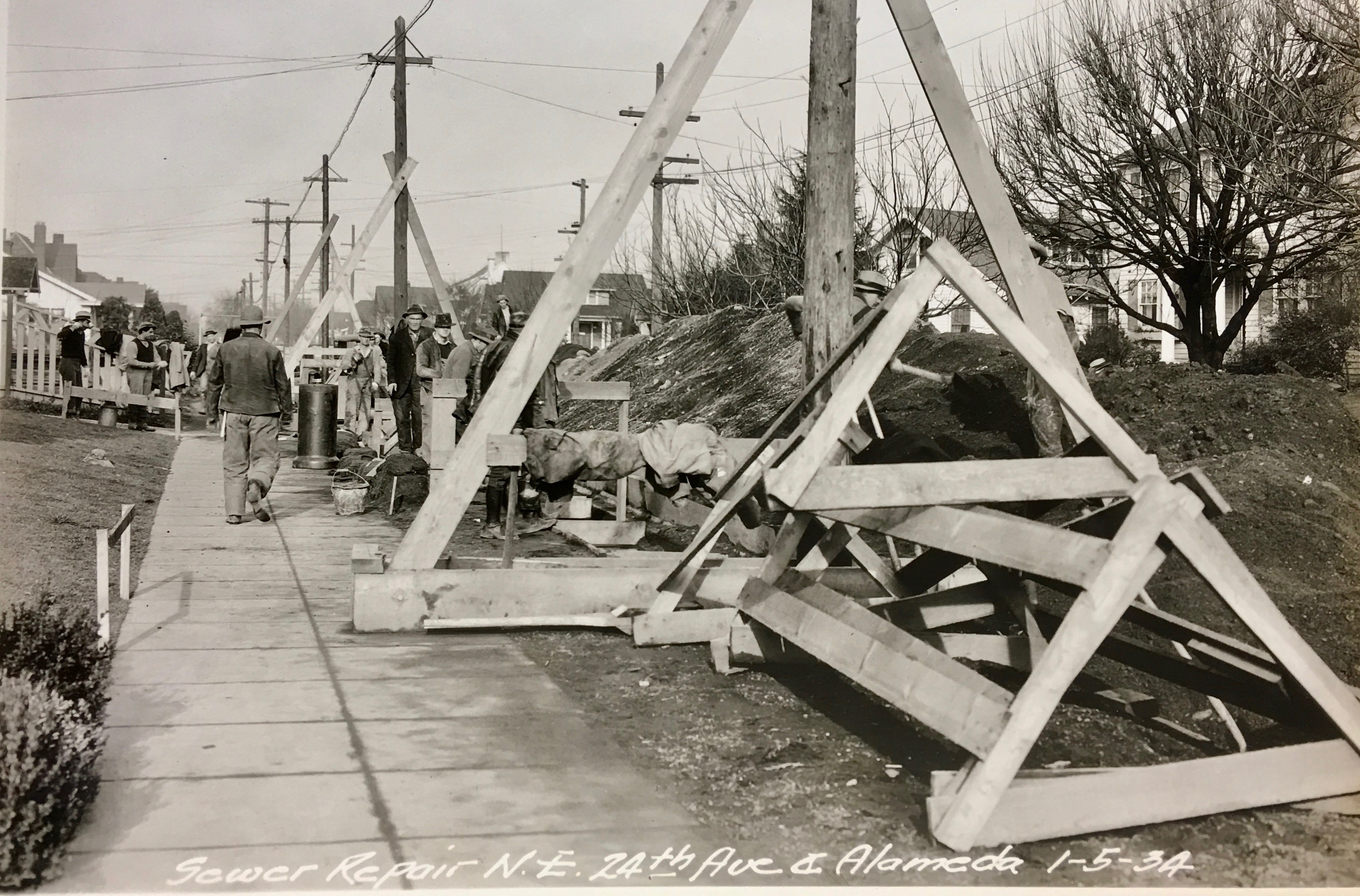
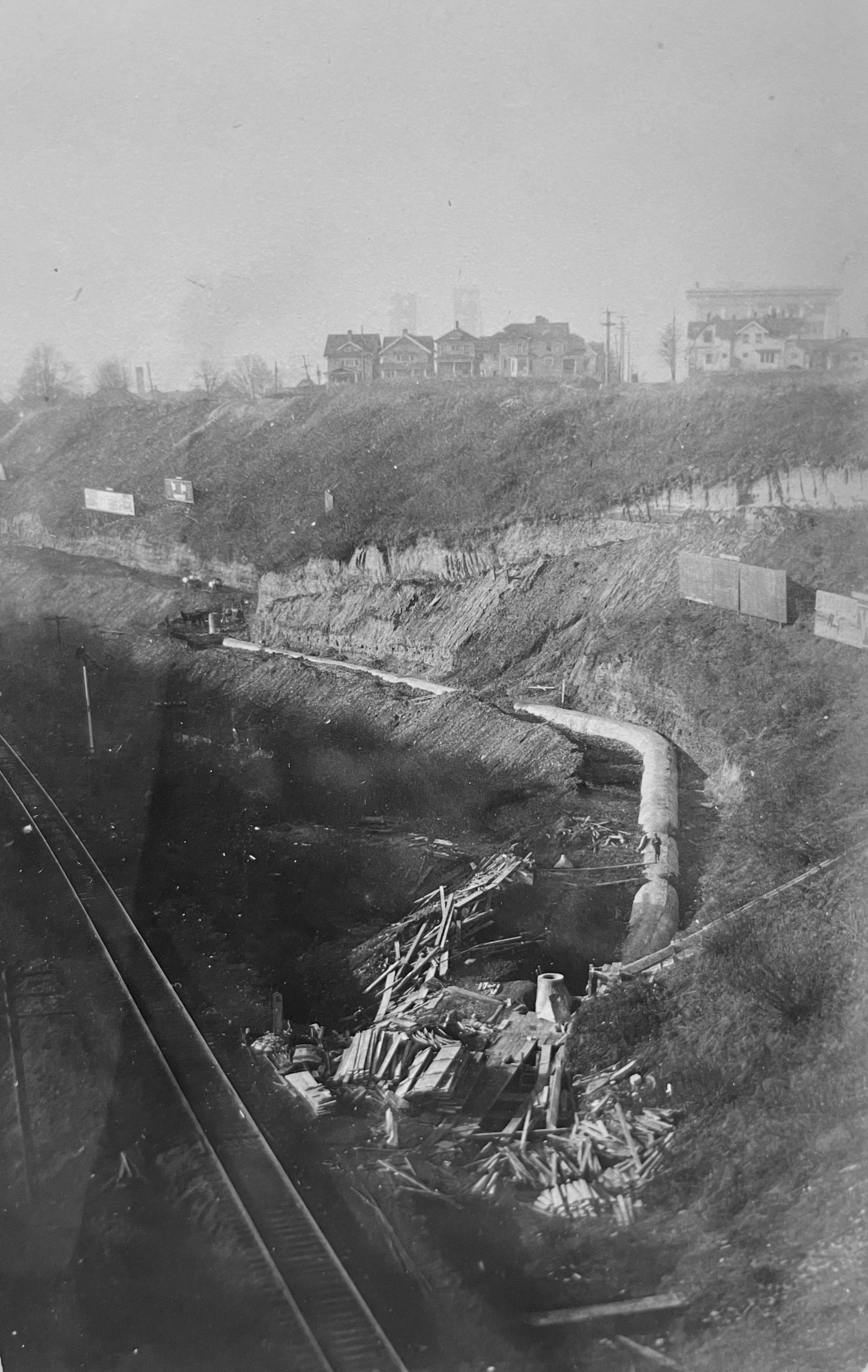
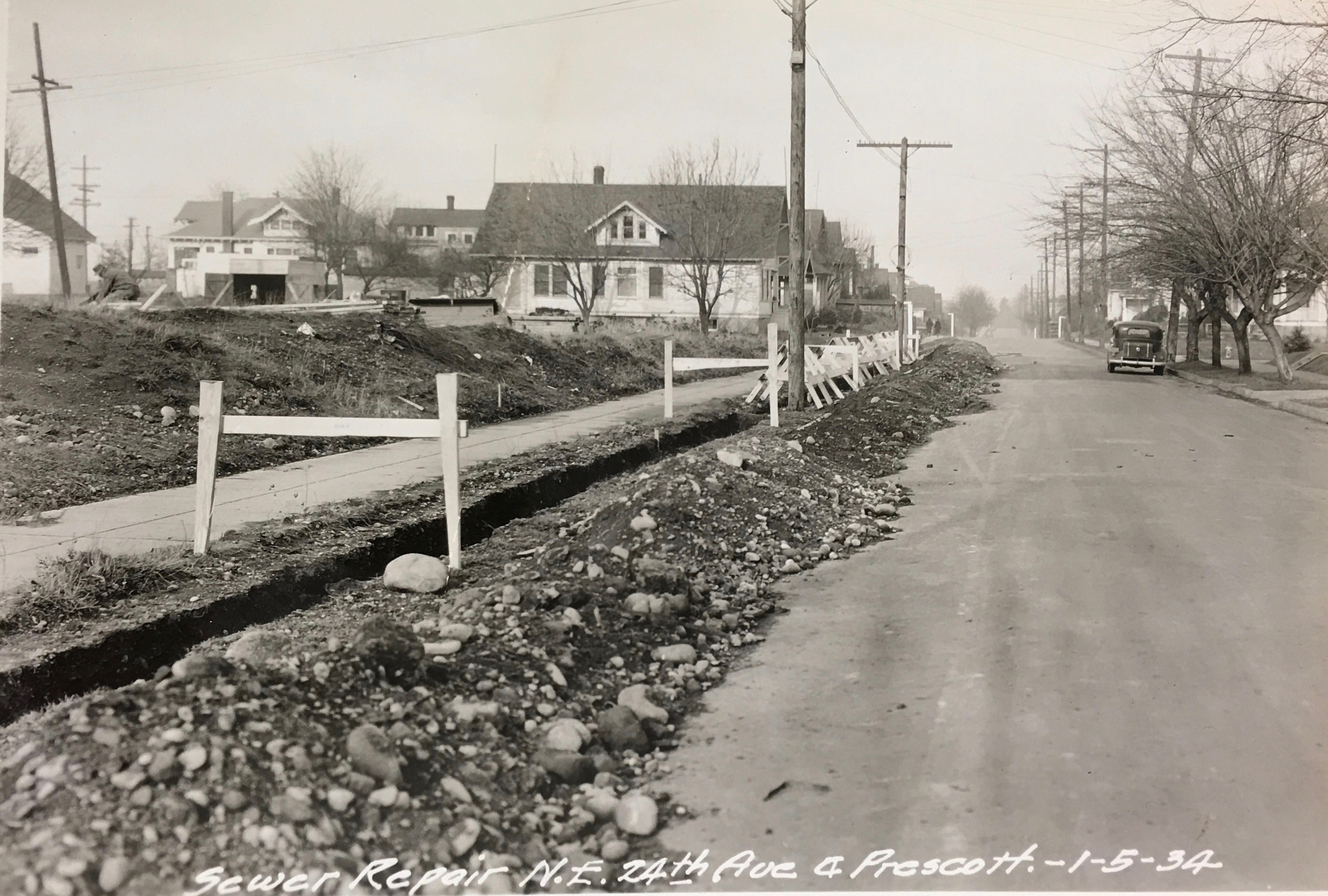
Courtesy City of Portland Archives file AP/25016, January 5, 1934.
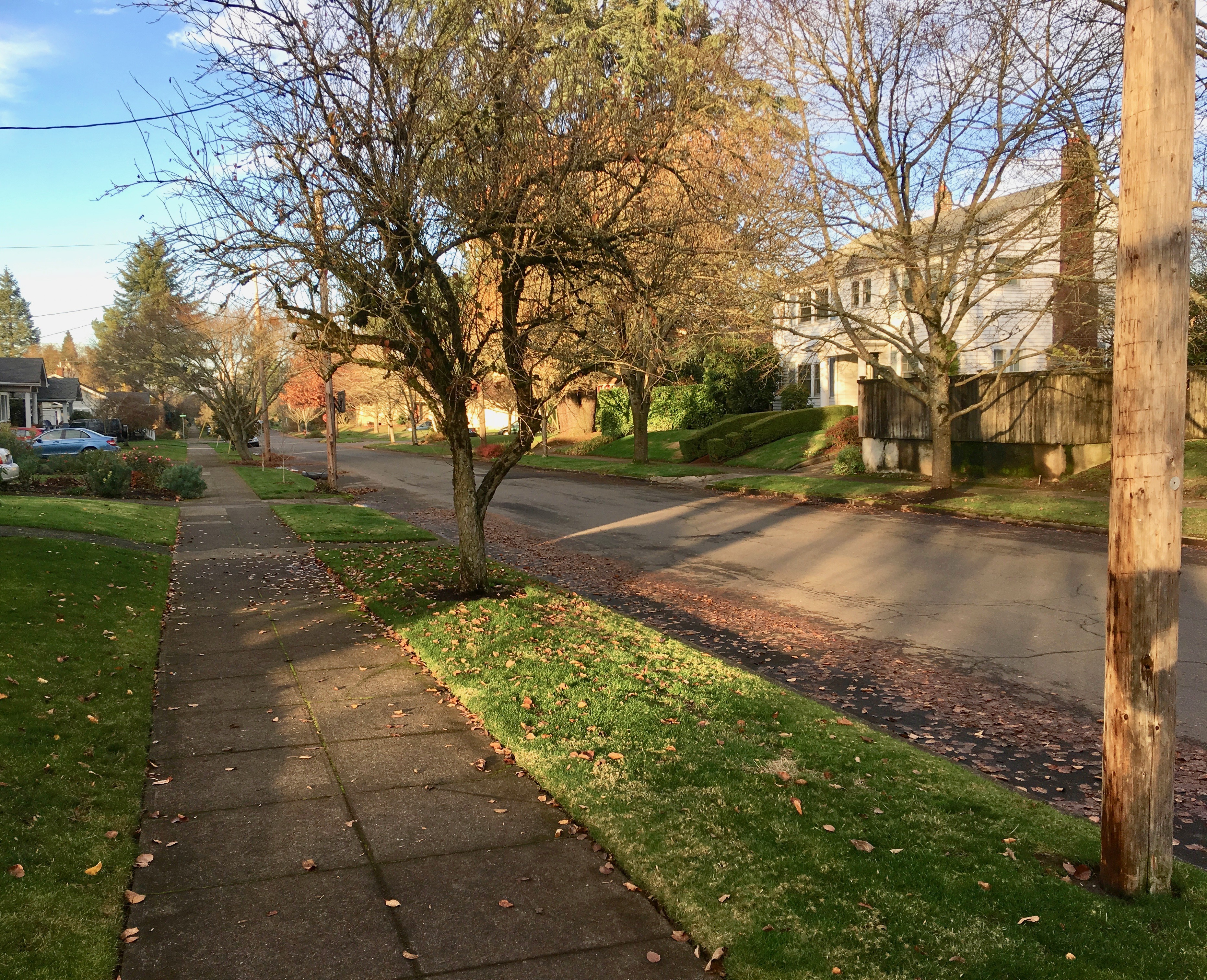
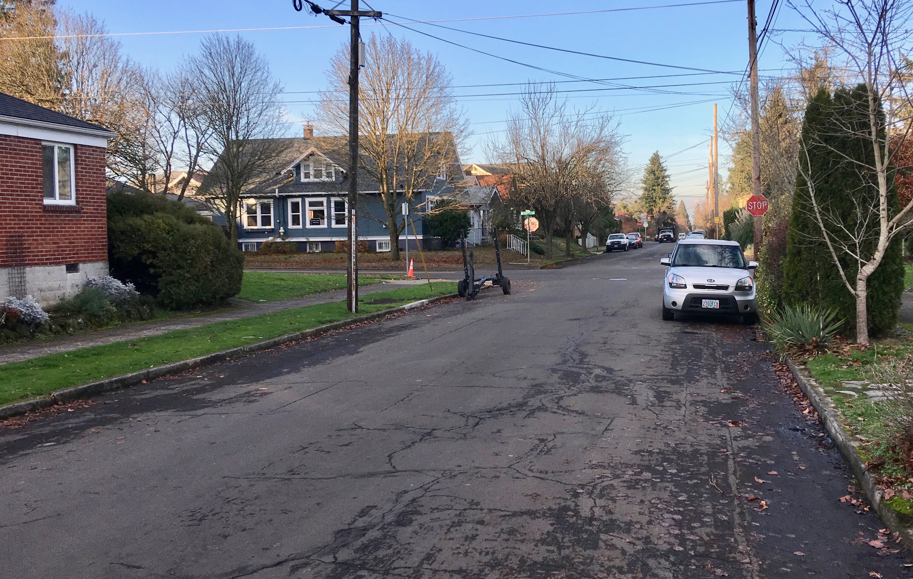
The same view, looking north on NE 24th at Alameda, in December 2017.
On a recent visit, we bumped into some old city documents and photographs that provide a major archival document and engineering geek-out for us and possibly for one or two AH other readers: 110-year-old sewer plans for Alameda and repair photos from the 1930s.
OK, we know this isn’t going to interest everyone, but the drawings below pertain to the very earliest construction activity in our neighborhood. When you really look at them—and realize this universe of sloping interconnected pipes was carefully thought up and then dug deep into the ground and placed by hand—you have to appreciate the early planners and builders. Have a look (click to enlarge) and then we’ll analyze what we see.
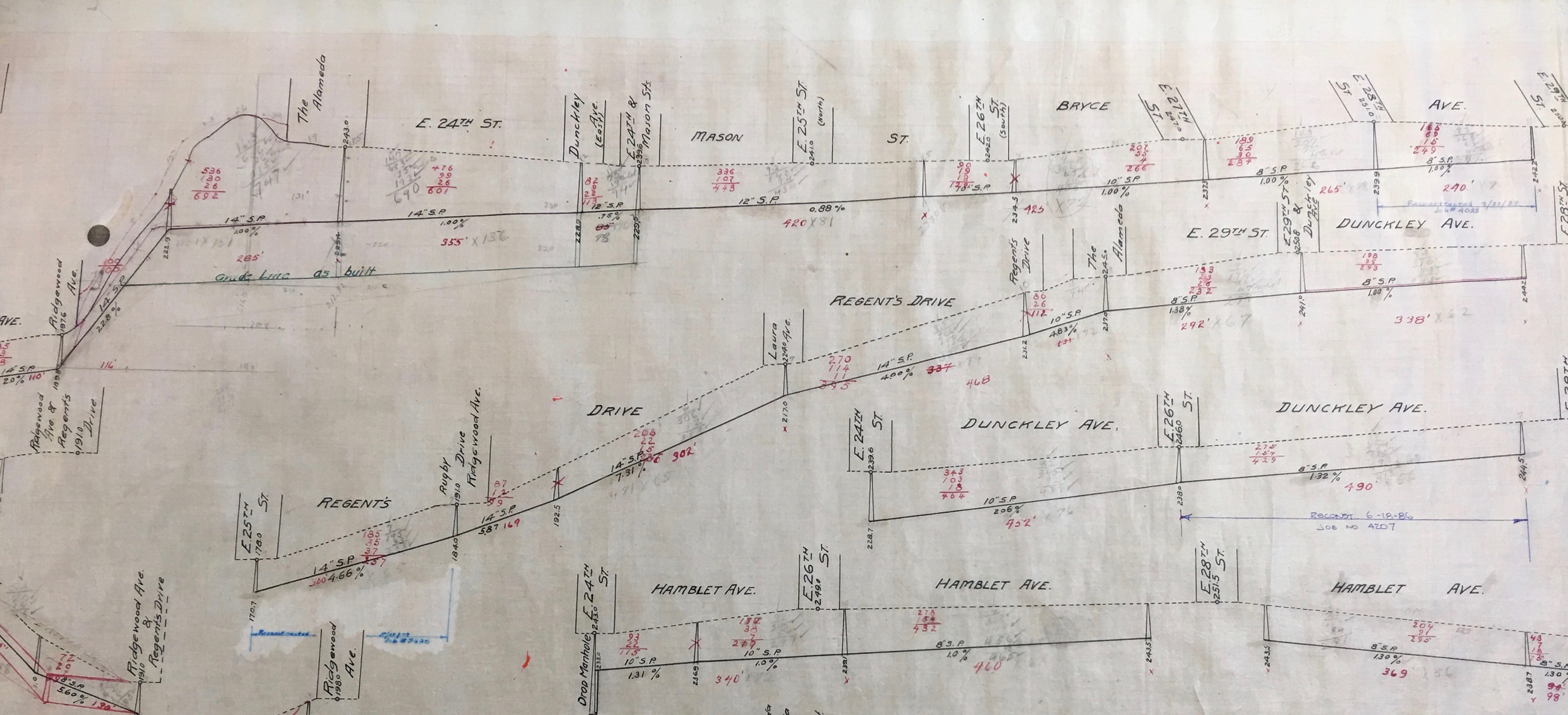
Courtesy City of Portland Archives, record number M/13197.
What we’re looking at here are elevation drawings that show a cross-section of Alameda streets and slopes and how the sewer system relates to the grid above the surface. The measurement between the dashed line (which is ground level shown as feet above sea level, 243′ at the top of the ridge) and pipe placement shows how deep these pipes are. Pretty deep in some places. The red numbers indicate the number of feet between the indicated junctions. The percentage numbers indicate the slope of each line (up to 22 percent slope coming off the ridge). The whole idea here is to have positive drainage through the entire system (thank you, gravity). The label “SP” indicates the diameter of the pipe used. Pipe dimensions start smaller to the north and get larger as the sewers run south, a function of the growing number of connections into the main line as the sewers head for the main trunk collector sewer which is under Sullivan’s Gulch. There are many nuances to be seen here. Interested in learning more about the history of sewers (not a question that gets asked very often, I’d say)? I’ve probably lost you by here, but just in case, check this out.
This sewer system was one of the first construction items completed when Alameda was built. Grading for the streets, curbs and sidewalk construction followed. If you’ve seen the ubiquitous “Elwood Wiles” stamp on our sidewalks and wondered who he was, check out this earlier post. Among many other things, Wiles was a former Alameda resident (maybe you’ve walked by his house on Bryce just east of Regents).
Evidently, aside from the engineering challenge of getting sewage safely and predictably down from Alameda Ridge, construction of that first sewer system posed financial and legal challenges as well. The Alameda Land Company wanted to be able to hook its sewer system into the existing Irvington sewer system, which made sense since it was all downhill on its way to Sullivan’s Gulch (where today’s I-84 runs) which was home to the major sewer line that drained into the Willamette River. (Read more about how the eastside gulches drained sewage directly into the Willamette River and were eventually filled in. But that’s a different topic…let’s stay on track here).
Irvington and Alameda were in competition for real estate sales and there was no love lost between the two development companies. Irvington was not about to foot the bill for construction of a sewer system just to have it be used for free by neighbors up the hill. A restraining order was filed by Irvington against the Alameda Land Company in 1910 and eventually the city had to step in and referee exactly how system development charges were going to be apportioned. Ultimately, Alamedans paid for construction of their own sewer system, a portion of the costs for their sewer that drained into Irvington, and their share of the costs when the city constructed the main collector sewer in Sullivan’s Gulch in 1911. Interesting to note that over the years the usually friendly Irvington-Alameda rivalry took on a life of its own beyond sewer lawsuits, which you can read more about here and here.
During our recent visit to City Archives we also learned that Alameda’s sewer system did not stand the test of time. Things started falling apart in the 1930s. We came across photos and an engineering report from 1934 that details the very expensive reconstruction of more than 1,700 feet of sewer all along NE 24th from north of Prescott to south of Alameda. Here’s another view of that work, looking north on 24th. The house near the center of the frame is on the northwest corner of 24th and Prescott.
Courtesy City of Portland Archives, file AP/20614, January 5, 1934.
Similar view in December 2017
This was a costly job: $13,622.57 which employed a small army of 48 laborers for two months and required trenching in some places 30 feet below the surface of the street. The construction report placed blame for the work squarely on methods used by the Alameda Land Company when they were hurrying their system into the ground back in 1911:
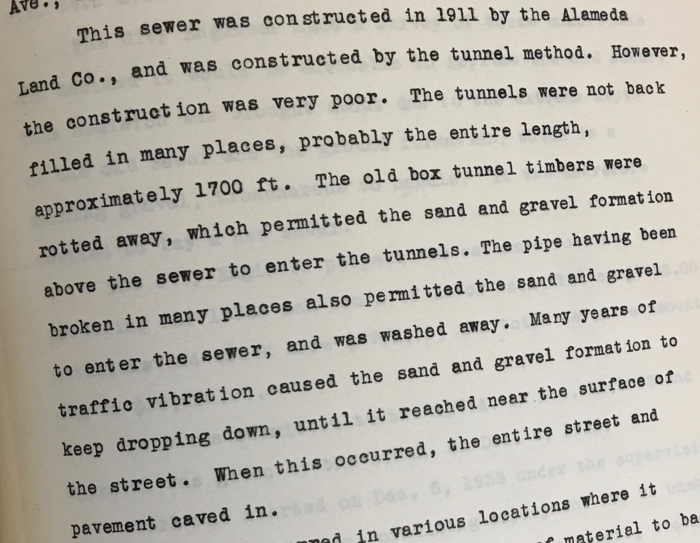
City of Portland Civil Works Administration Report 35-26W-76, March 20, 1934.
Back in 1911, using the drawings referenced here, workers dug deep trenches under what would become Alameda’s streets. At the bottom of these trenches, they used heavy wooden timbers to build long three-sided “box tunnels” without tops. Into these continuous long narrow boxes they placed fill dirt and sewer pipe. Using this common method, they were supposed to completely fill around the pipe with sand and dirt then close off the top of the box with a heavy wood cover before filling the trenches back in to street level. But that didn’t happen.
Eventually the unsupported weight of sand and gravel settling in from above crushed the box and the sewer pipe. The surface of NE 24th also dropped as all the soil below street level began to work its way lower and lower into the collapsed box tunnel. The result: a cave-in at the surface of the street, crushed sewer pipes below and one heck of an expensive mess.
Fortunately, for City Engineer L.G. Apperson, the city had the original drawings on hand and knew where to start looking to solve the problem.
Never underestimate the value of a good archive!