It’s been a busy winter preparing history studies for properties all over Portland, working on the historic newspaper project and some other deep dives, and making presentations on local history topics. It’s what we love to do, so we’re happily busy. But all that work has borrowed time from the blog, which has been on the quiet side lately.
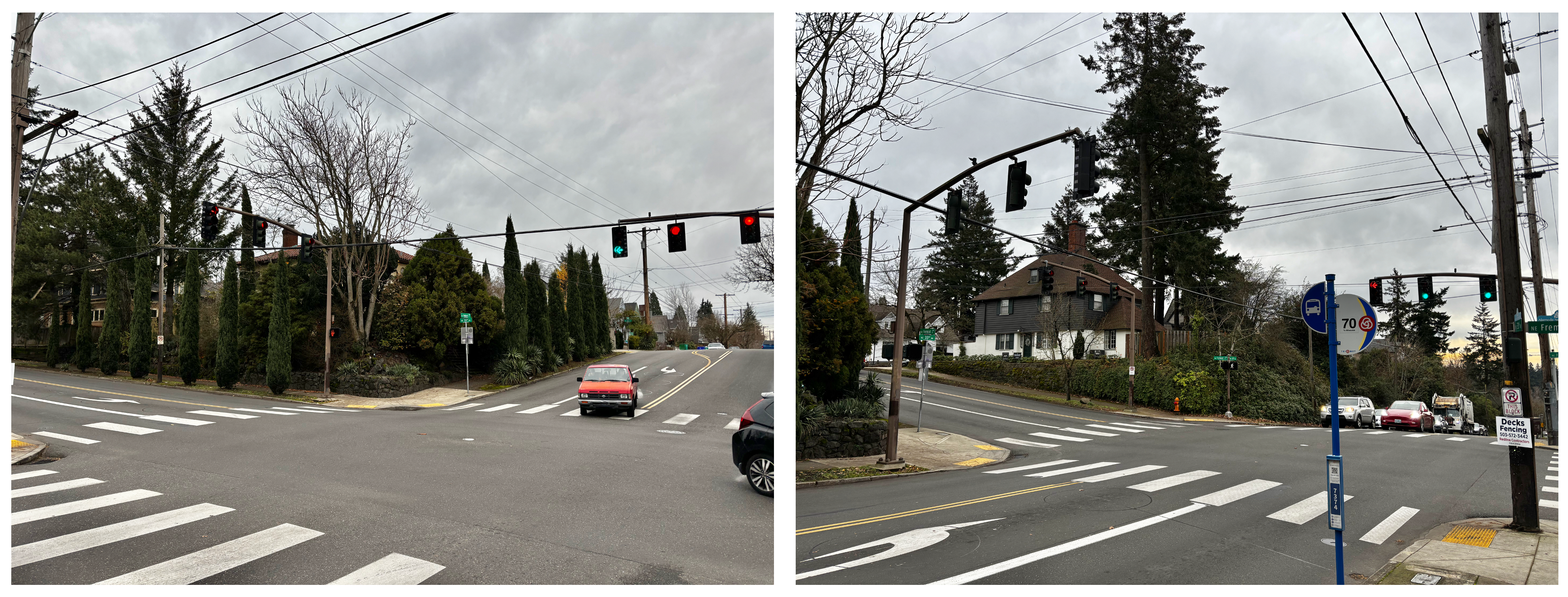
Let’s break the quiet with an interesting photograph related to other photos and stories we’ve shared here. Check it out: NE 42nd and Fremont in the Beaumont neighborhood, on Thursday, July 27th, 1933. Click in for a good look and then we’ll discuss.
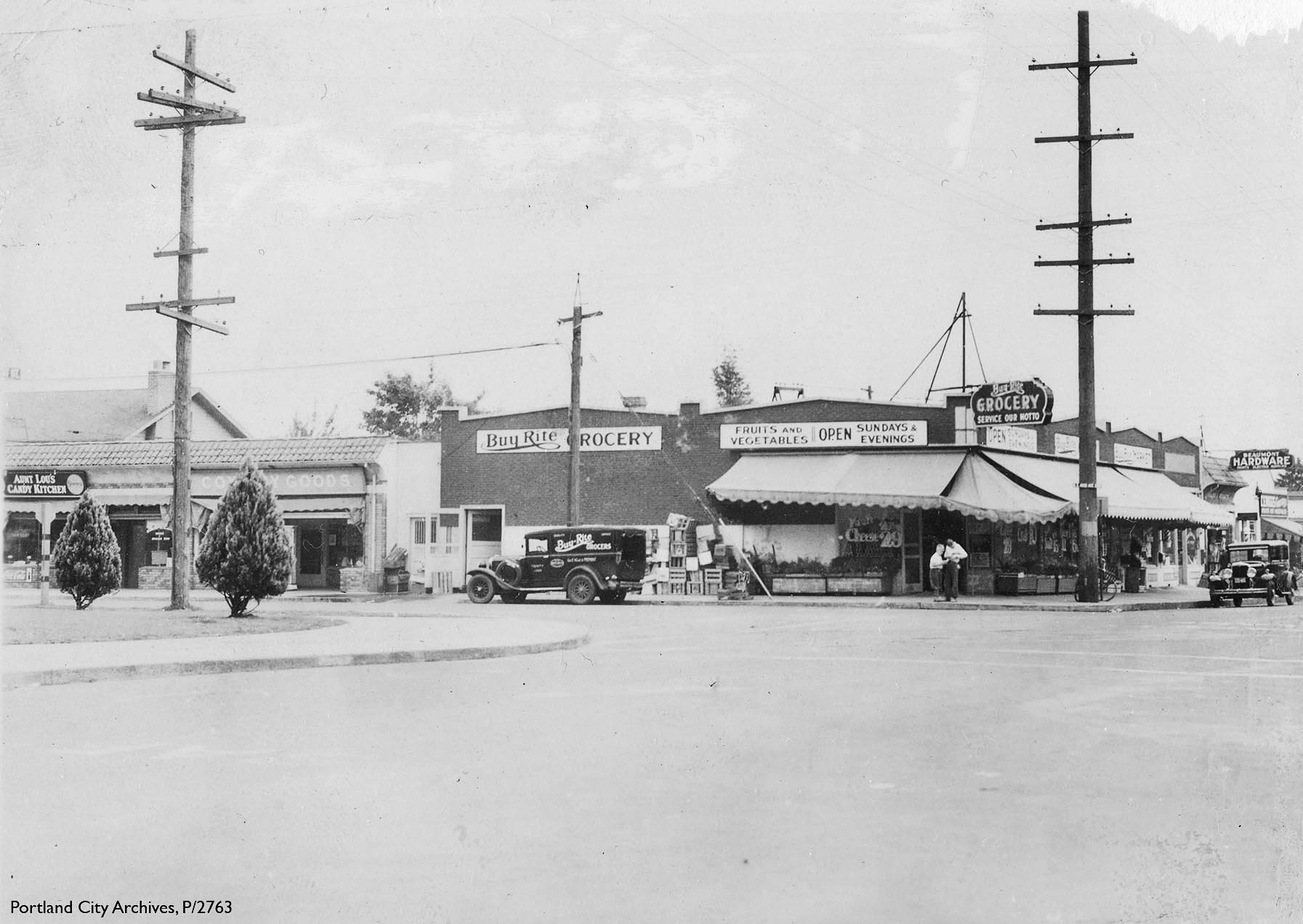
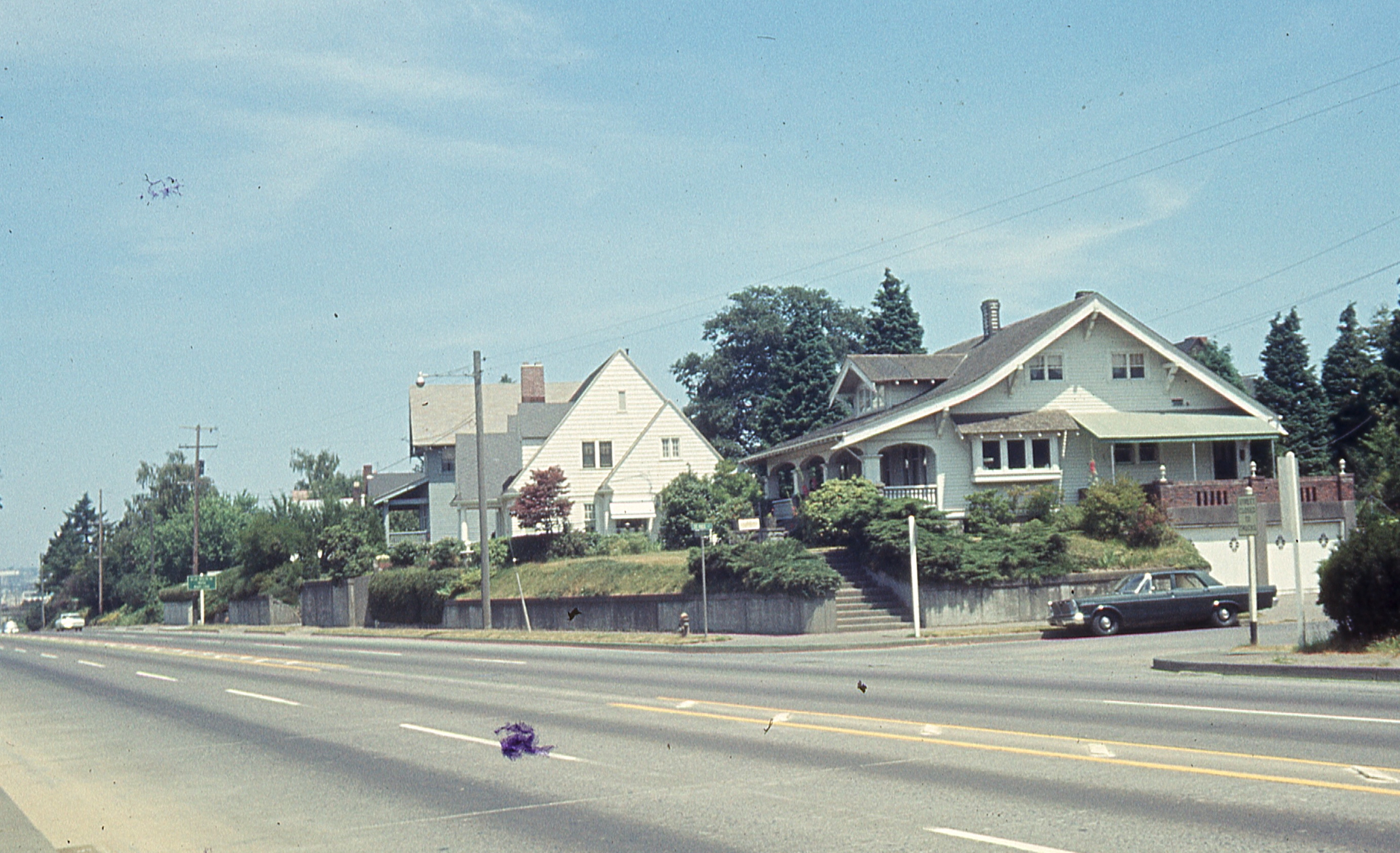
July 27, 1933, NE 42nd and Fremont. Courtesy of Portland City Archives P/2763
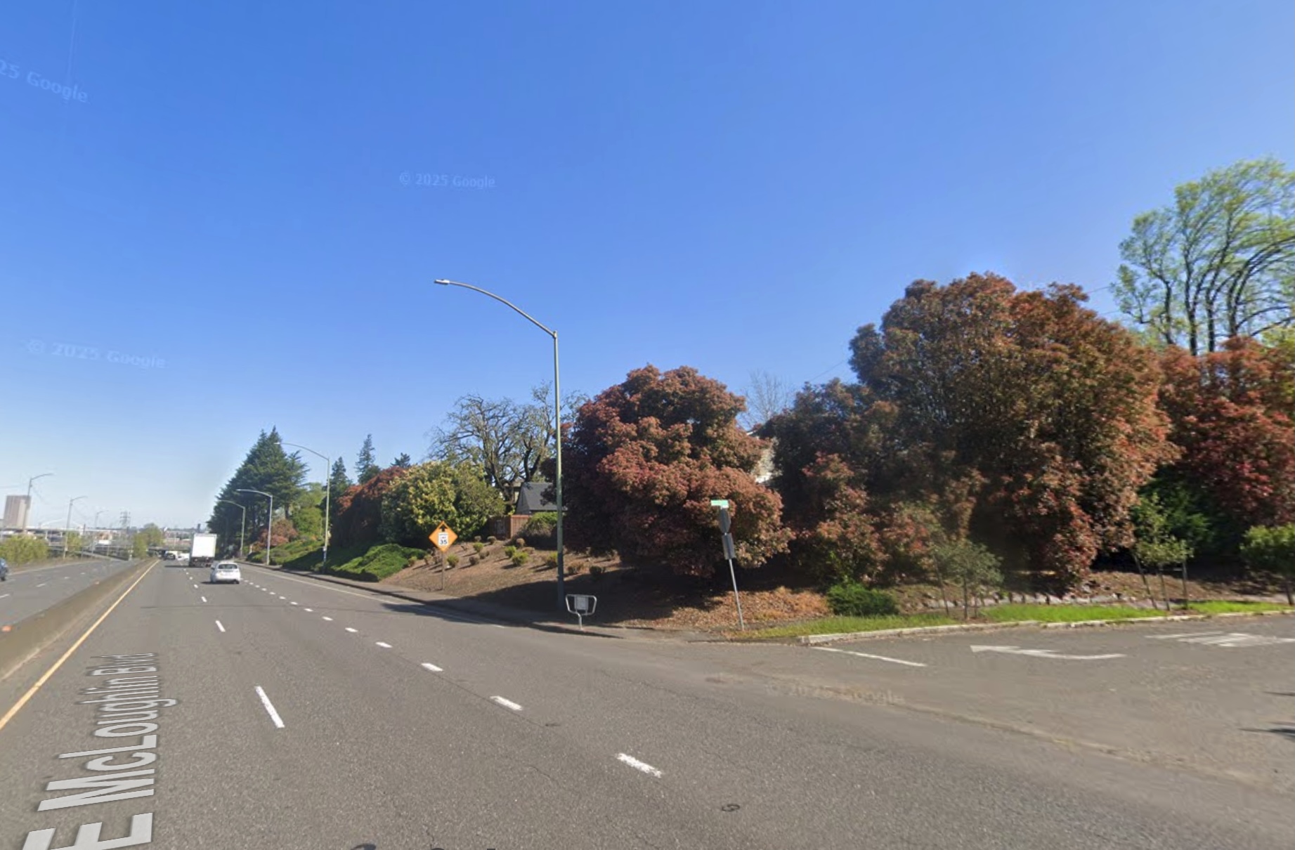
First things first: the view is looking to the east-northeast from Fremont Street showing the northeast corner of the intersection with NE 42nd Avenue. Below is a contemporary photo that will help you place this view (note the corner of Beaumont School in the far left):
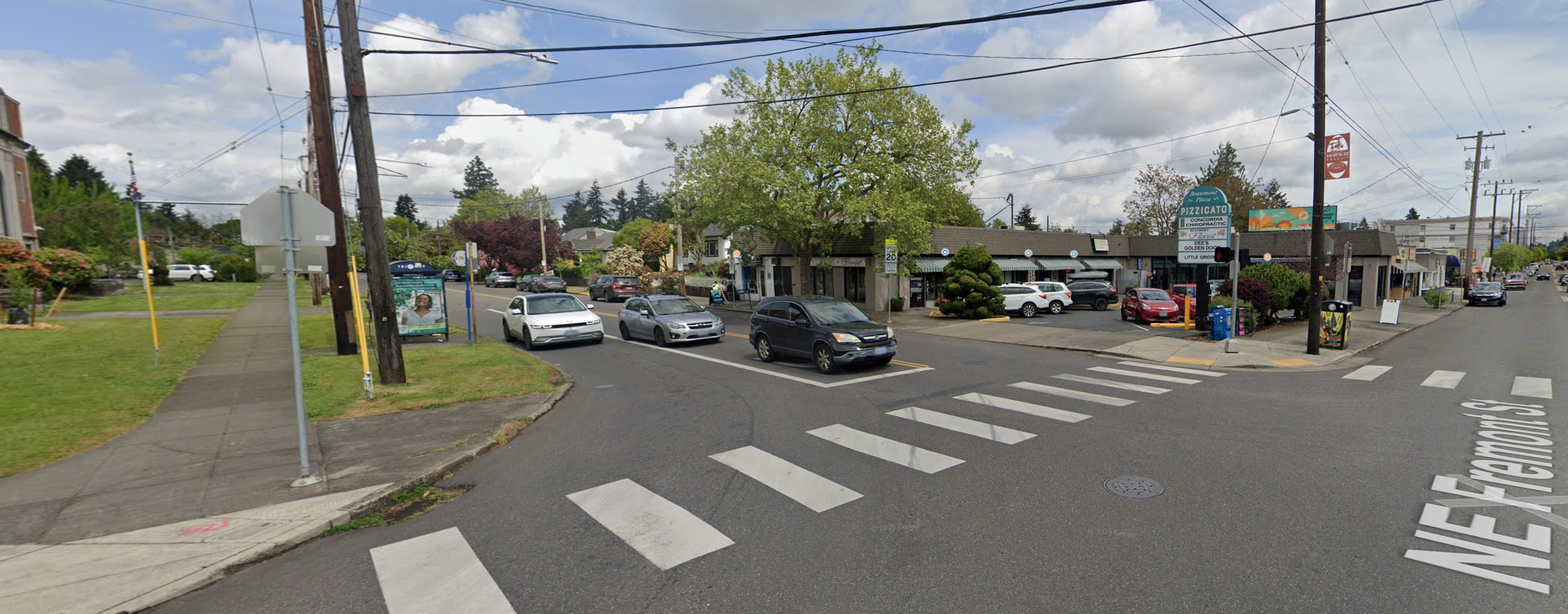
Google Streetview – April 2025
Let’s take inventory of the 1933 buildings and businesses we see in that old photo, working left to right:
Aunt Lou’s Candy Kitchen, a candy store, perfectly situated across the street from Beaumont School. Today, the space is occupied by Little Griddle, 3520 NE 42nd Avenue. Aunt Lou’s was owned and operated by Lou and Jesse Opdyke, who also owned candy stores downtown and at SE 36th and Division. The storefront just to the south was vacant in July 1933, but had been Alameda Shade Shop, a maker of light shades.
Cox’s Dry Goods, run by Horace Cox in a portion of the space that up until recently was occupied by Beaumont Florist, 3512 NE 42nd Avenue. The rest of that building no longer exists.
Buy Rite Grocery, 4201 NE Fremont, occupied the entire northeast corner of the intersection facing both 42nd and Fremont. Much of the footprint of this building today is a parking lot serving Beaumont Plaza which contains the former florist space, a chiropractor, a hair salon and Pizzicato.
Owned and operated by Henry Witt, Buy Rite was the first grocery in the neighborhood, pre-dating the Beaumont Market by about 10 years, and it was the anchor Beaumont business. Back in 1933, Henry Witt and Buy Rite wanted to make sure you knew they are open for business on Sundays and evenings, and that service is their motto. The two boys out front appear to be focused on a recent purchase. The store’s delivery bike leans up against the power pole, which looks to occupy the same place on the sidewalk as it did way back when. The delivery truck ready at the curb.
Here’s what the Fremont side of Buy Rite looked like in a 1927 photograph shared by former Beaumont neighbor Paul Kirkland, looking west-northwest (yes, that’s the brand-new Beaumont School in the distance). Sure looks like the same delivery truck parked out front. Streets haven’t been paved yet:
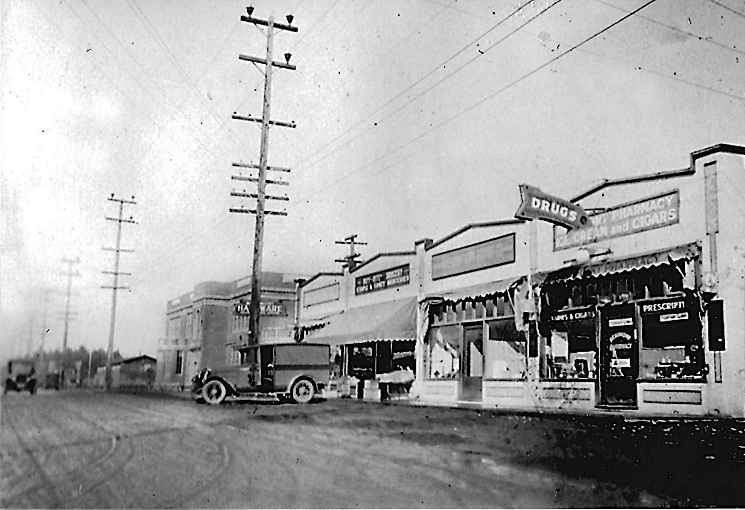
You can read more about the 1927 Beaumont photos and memories Paul shared with us back in 2015.
Back to our 1933 photo: A bit farther east on Fremont you can see the sign for the original Beaumont Hardware, which in 1933 was at 4217 NE Fremont, about a half block west from the Beaumont Hardware we know today.
When you really stare at this photo and think about it, certain questions come to mind. Like: what were you supposed to do as a driver when you approached? Our hunch is that NE 42nd had the right-of-way, so if headed north or south, you just swung through the jig-jog there. In the contemporary view you can see how the signals and their wiring dominate the intersection today. Of interest: in the 1933 photo, the streets had only relatively recently been paved.
If old views of this intersection look vaguely familiar, it’s because we’ve written about them before and shared photos and insights about Beaumont market across the street.
Want to read more about Beaumont-Wilshire? Here’s a category of more than 30 B-W posts we’ve written going back to 2007. Check it out. By the way, categories are a great way to find your way around the more than 350 posts and pages here on the blog: you can find the drag-down menu on the far right side of the page below the Top 30 list. One of our favorite categories: Photo detective.
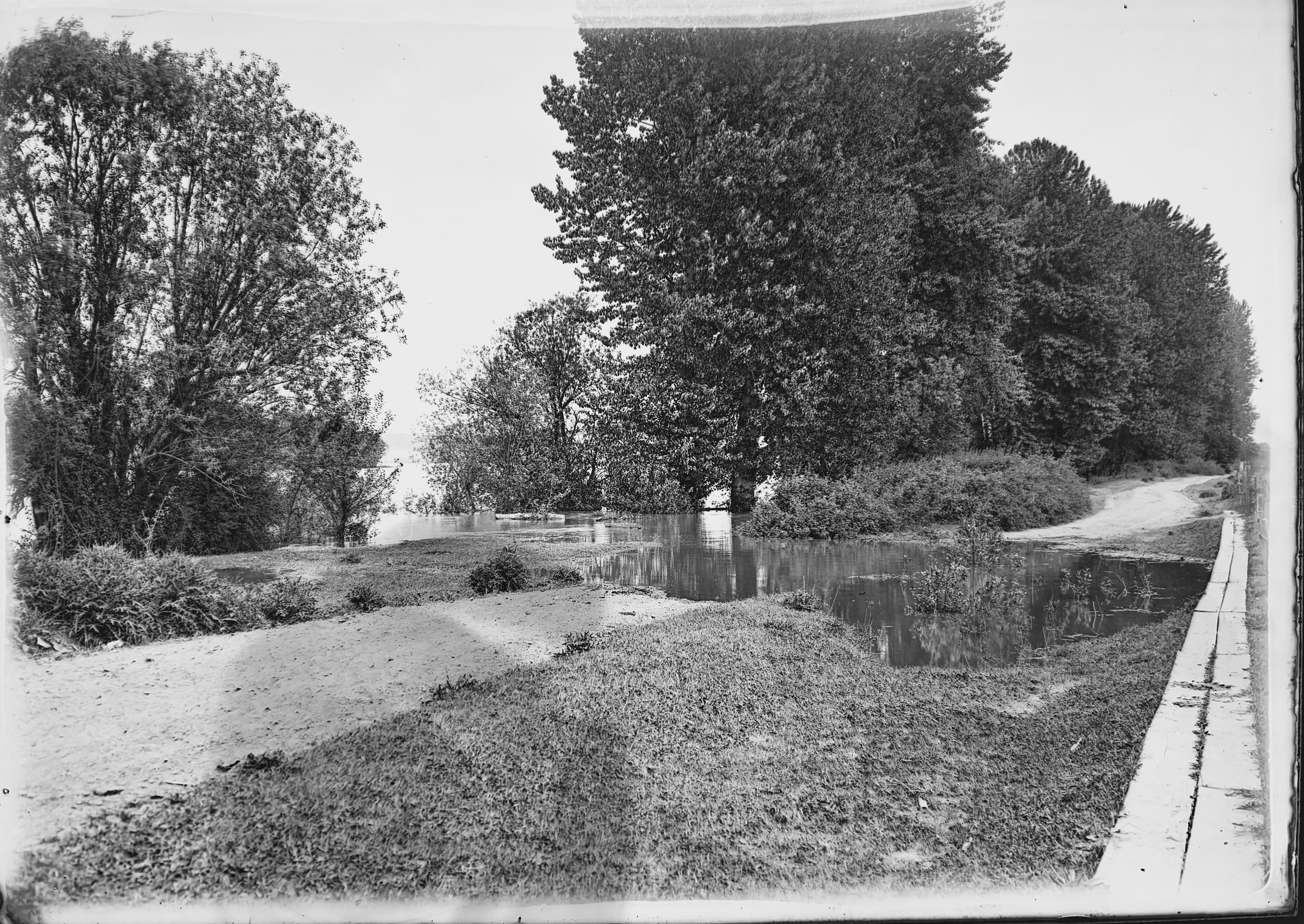
Coming soon: A batch of new/old photos help us visualize the watery world of Bundy’s Baths on the east bank of the Willamette River near the northern tip of Ross Island.


