Like a mosaic of fine old tiles, hundreds of subdivision plats rest atop Portland’s neighborhood landscape, creating a base-layer of orderly streets and lots beneath the places we know today. Drawn up over the last 140 years by different developers, each plat has a name: some are catchy, some are descriptive, a few remain in common use to describe the places we know. Most have been lost to time.
Neighborhood names are administratively determined by the Portland Bureau of Planning and Sustainability, which has plotted them on this handy map.
Plat or subdivision names are filed on the date of platting with the Multnomah County Surveyor and are boundaries of surveyed property tied to the legal description of the land. There are more than 900 individual plats in Portland.
Here’s a good example of a plat that has nothing to do with the name of any neighborhood. It’s Homedale, and it spans today’s Sabin and Alameda neighborhoods. Try telling someone you live in Homedale (or any of the other 21 named plats in our neighborhood) and you’re likely to get a blank stare.
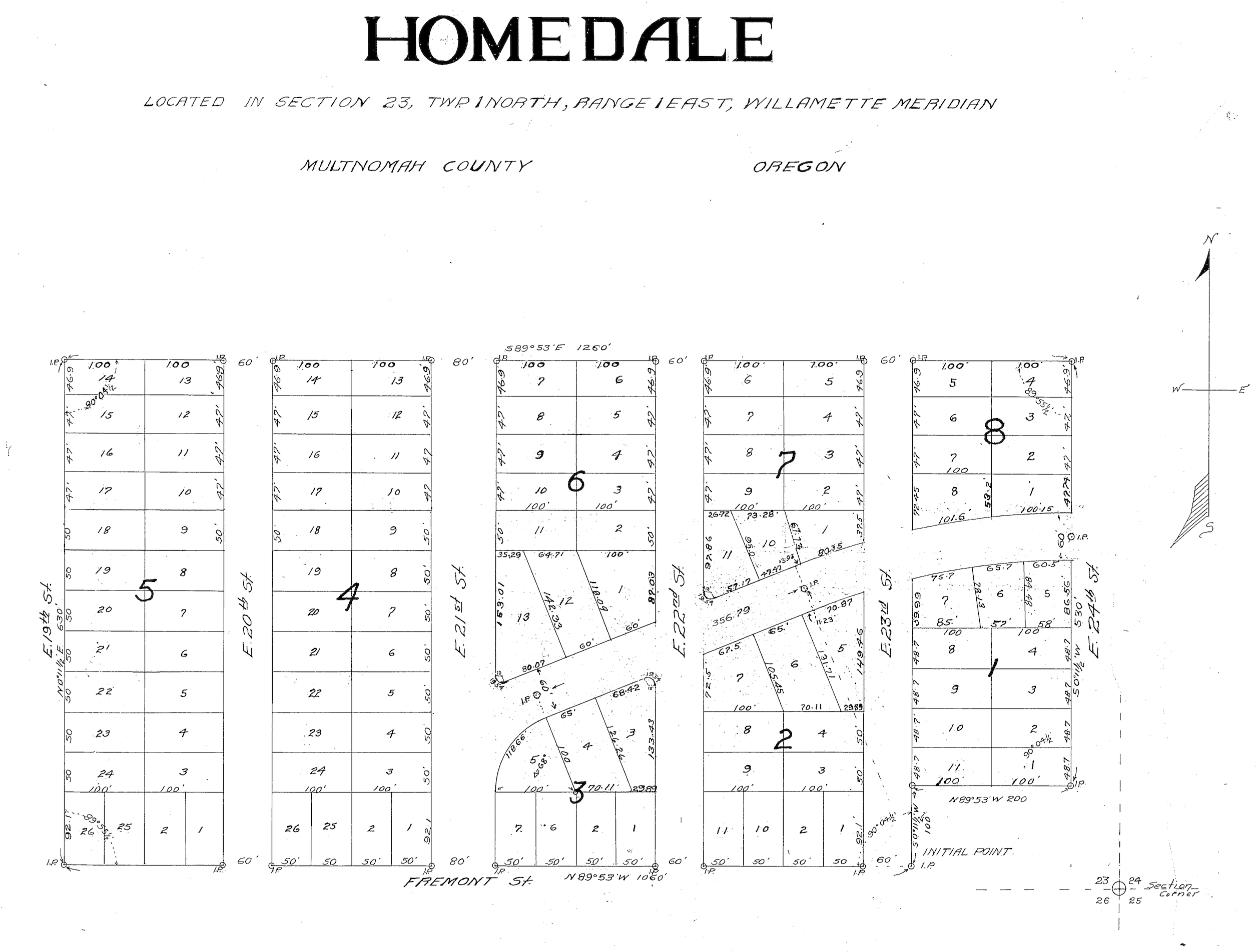
Within the confines of what the city thinks of as today’s Alameda Neighborhood are at least 21 plats of all sizes, from the Alameda Park plat, to the Homedale plat (1922), to the Town of Wayne plat (1882). Probably the only one that will ring a bell for most residents is Alameda Park, the namesake for what is today’s larger Alameda Neighborhood.
And just to make life a little more confusing, the Alameda Park plat exists within both the Alameda Neighborhood and the Sabin Neighborhood (late 20th century neighborhood administrative boundaries).
Here’s the full list of plats inside today’s Alameda neighborhood boundaries: Alameda Park, Homedale, Olmsted Park, Irvington, Edgemont, Pearson’s Addition, Town of Wayne, Town of Wayne Replat, Waynewood, Irvingwood, Meadow Park, Dunsmeade, Irvindale, Hillside, George Place, Bowering Donation Land Claim Tract, Norton’s Subdivision, Stanton Street Addition, Gleneyrie, Hudson’s Addition and Meadow Park.
With more than 20 plats in just one “neighborhood” alone, no wonder the city has chosen to lump geographical areas into single neighborhood names. No plats were moved, changed or amended to coincide with our neighborhood’s name. Rather, the place name we all know today — and it’s corresponding map — was determined decades after the ink was dry on the subdivision (plat) names.
Here’s a link to plat maps for Alameda and several surrounding areas.
Just for fun, dig out the thick pack of papers you signed at closing, or look at your property tax statement: you’ll find the name of the plat that includes the block and lot where you live. Just remember: this name exists separate from the name of our neighborhood.

