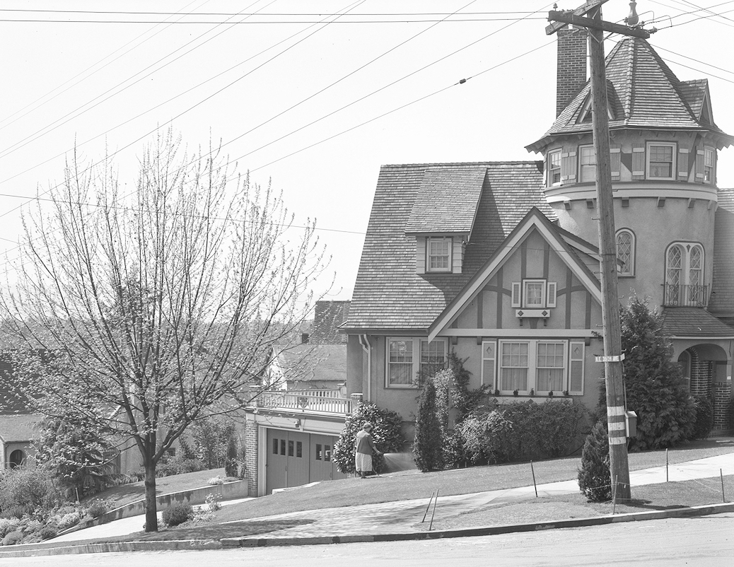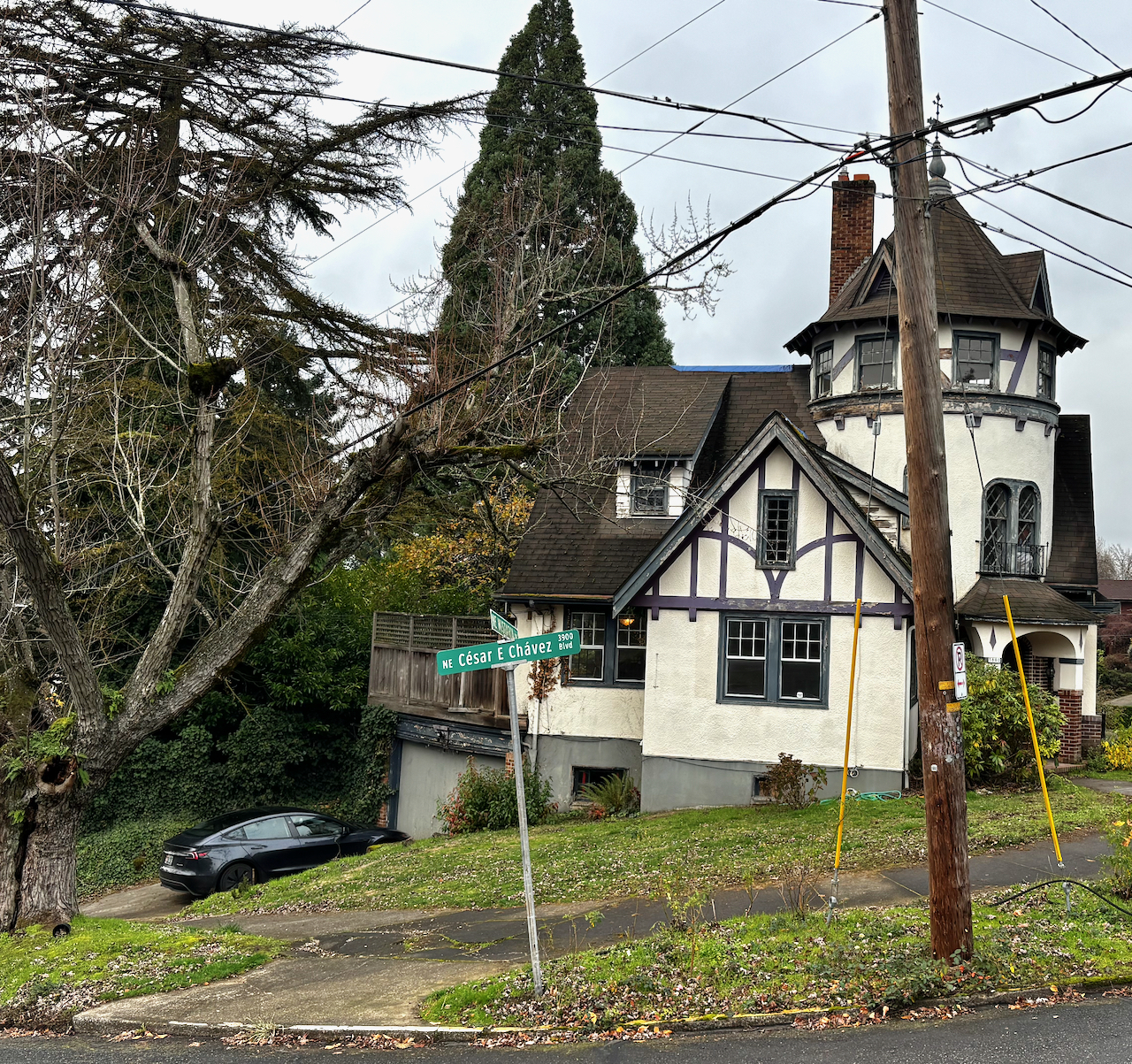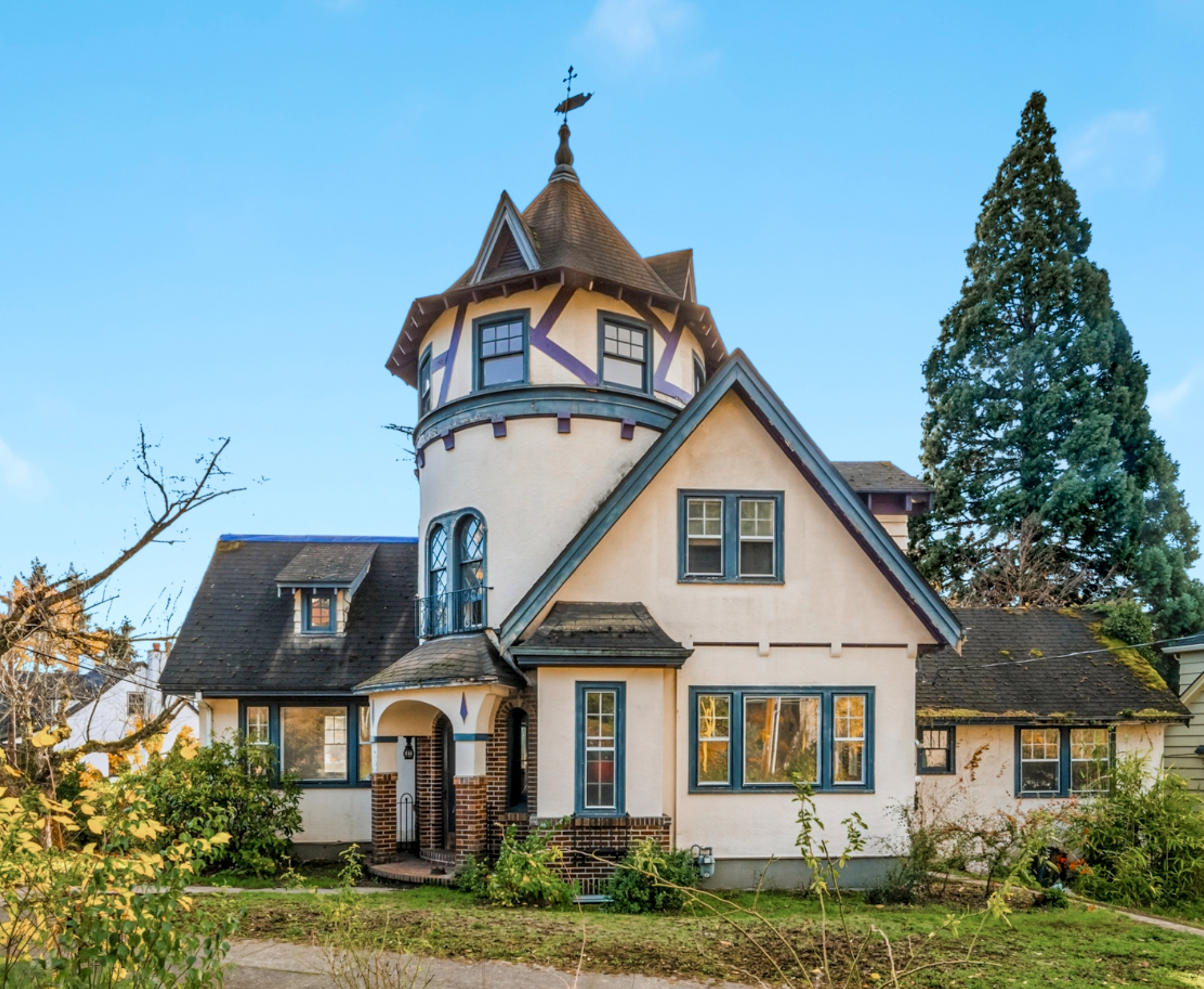
The turret house at 3880 NE Wistaria, built in 1928, has been through hard times the last 30 years. A Portland brother and sister duo who restore old homes purchased the house in February 2026 and are underway with restoration.
New owners of the turret house at 3880 NE Wistaria have begun restoration work on the unique and visible 1928 home, tackling the biggest challenge first: decades of unaddressed water damage to the garage, porch and southern exterior wall.
Siblings Amber Chang and Kyle Lindros have restored other homes and have a track record for attention to historic detail and quality work. But they’ve never seen anything quite like the amount of restoration work that needs to be done here, or the unique architectural and historical aspects of the house. See our post from earlier this year about the history of the house.
The brother-and-sister team—who grew up in Eugene—acquired the house in February 2026. They bring a relevant mix of skills and experience to the challenge: Amber is an interior designer who has worked on houses across the Portland area, lives nearby in her own 100-year-old home, and has a special appreciation for homes with a story. Kyle’s degree is in construction engineering management from Oregon State University. He has a decade of experience in heavy civil engineering work.
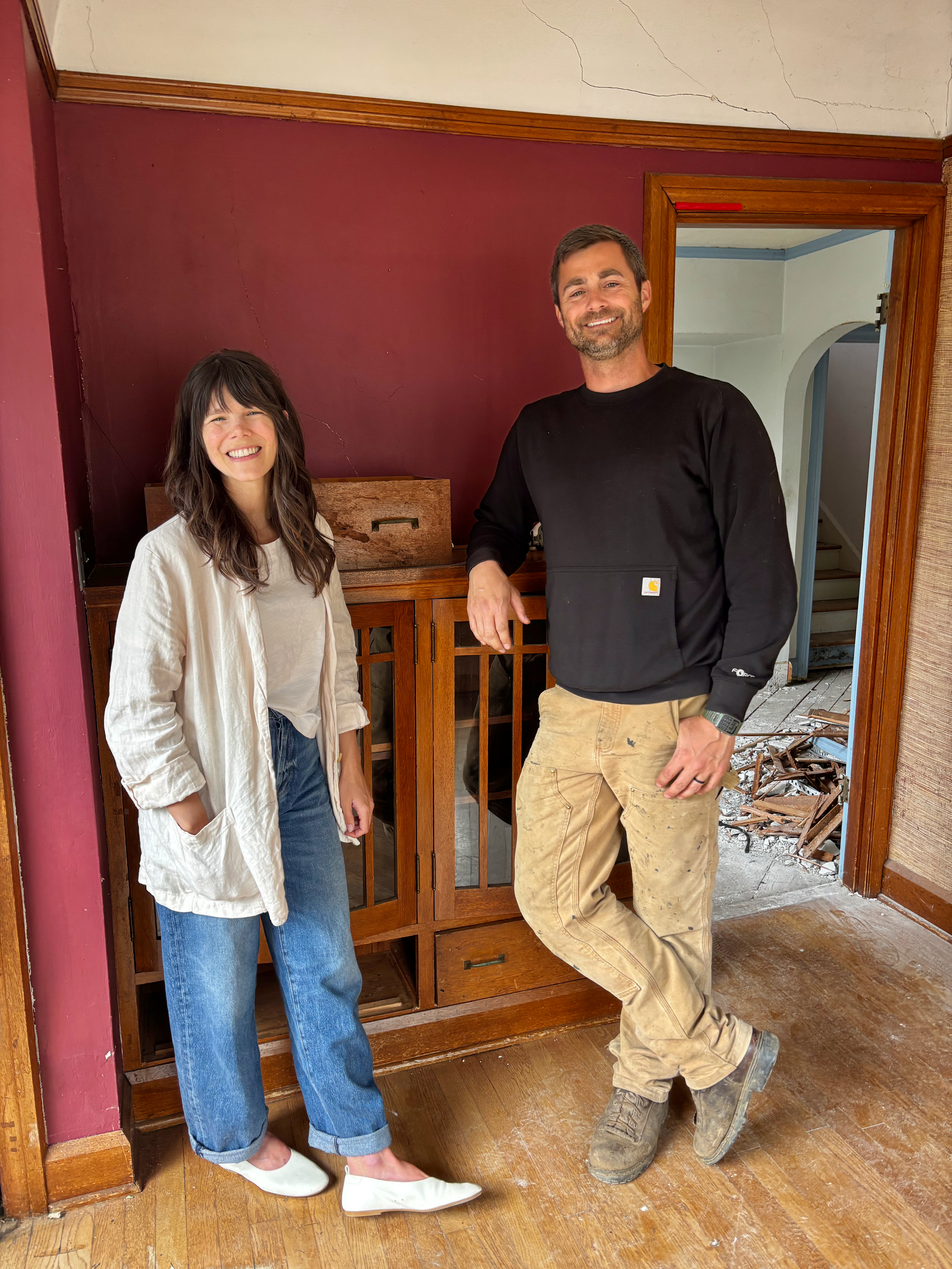
Siblings Amber Chang and Kyle Lindros are the new owners of 3880 NE Wistaria and are underway with work to restore and adapt the home. Here they are standing in the dining room: the built-in cabinet behind them is a keeper.
Together, they plan to restore the turret house and to celebrate its unique history and architecture.
According to Kyle, the top priority has been the not very glamorous but crucial work of mold remediation, asbestos removal, sewer line replacement, water line replacement, hazard tree removal and underground storage tank decommissioning.
This spring, the focus has also been on assessing the work to be done, organizing the permitting and work planning, stabilizing the structure, and considering how best to adapt the 100-year-old home to family life in the 21st Century.
Much of the significant damage to the house has been caused by gutters and roof systems that have failed allowing water into places it shouldn’t go: roofs, ceilings, floors and walls. The garage wall on the south side of the house has completely failed because it has been saturated with 30 years of misdirected runoff. Parts of the garage outside wall have been held in place only by the root systems of nearby trees that have taken advantage of the water source.
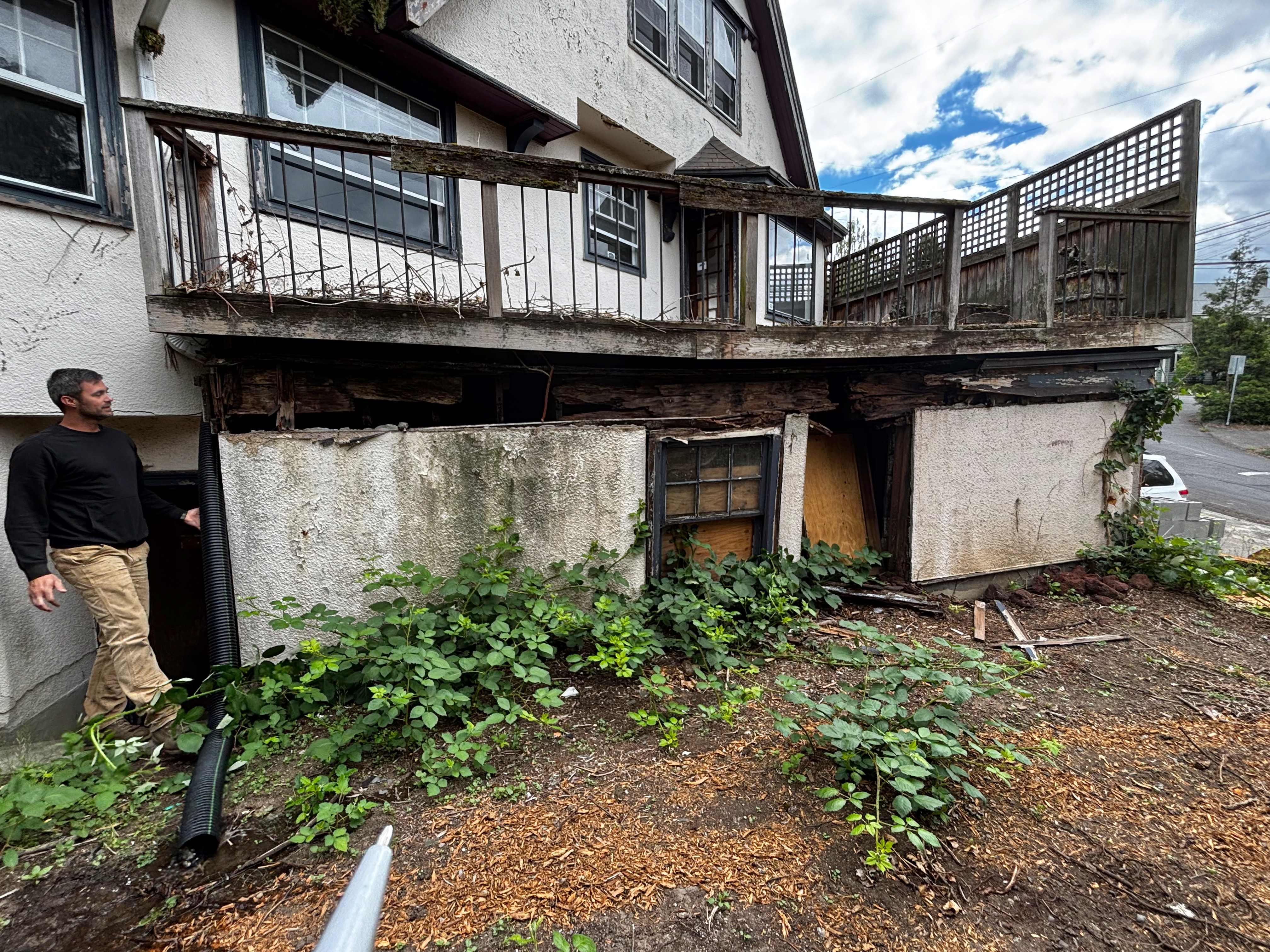
The south wall of the garage and the back deck sag and crumble under 30 years of rain runoff. The header above the window is rotten and has become insinuated by roots of the nearby trees.
Once the water flow has been staunched and managed, a next focus will be on making some changes to the interior traffic flow, including relocating the kitchen and dining room, establishing the primary bedroom on the first floor, adding a double door to the back deck and back yard, and simplifying the basement floor plan by relocating the furnace, modifying the traffic flow, and adding a bathroom.
Windows and doors throughout the house also need attention. Thieves broke in this winter and removed most of the original glass doorknobs and other signature hardware. An early challenge: finding similar replacement hardware. Kyle has already made a spreadsheet identifying every door and missing doorknob, and has been busy locating vintage replacements.
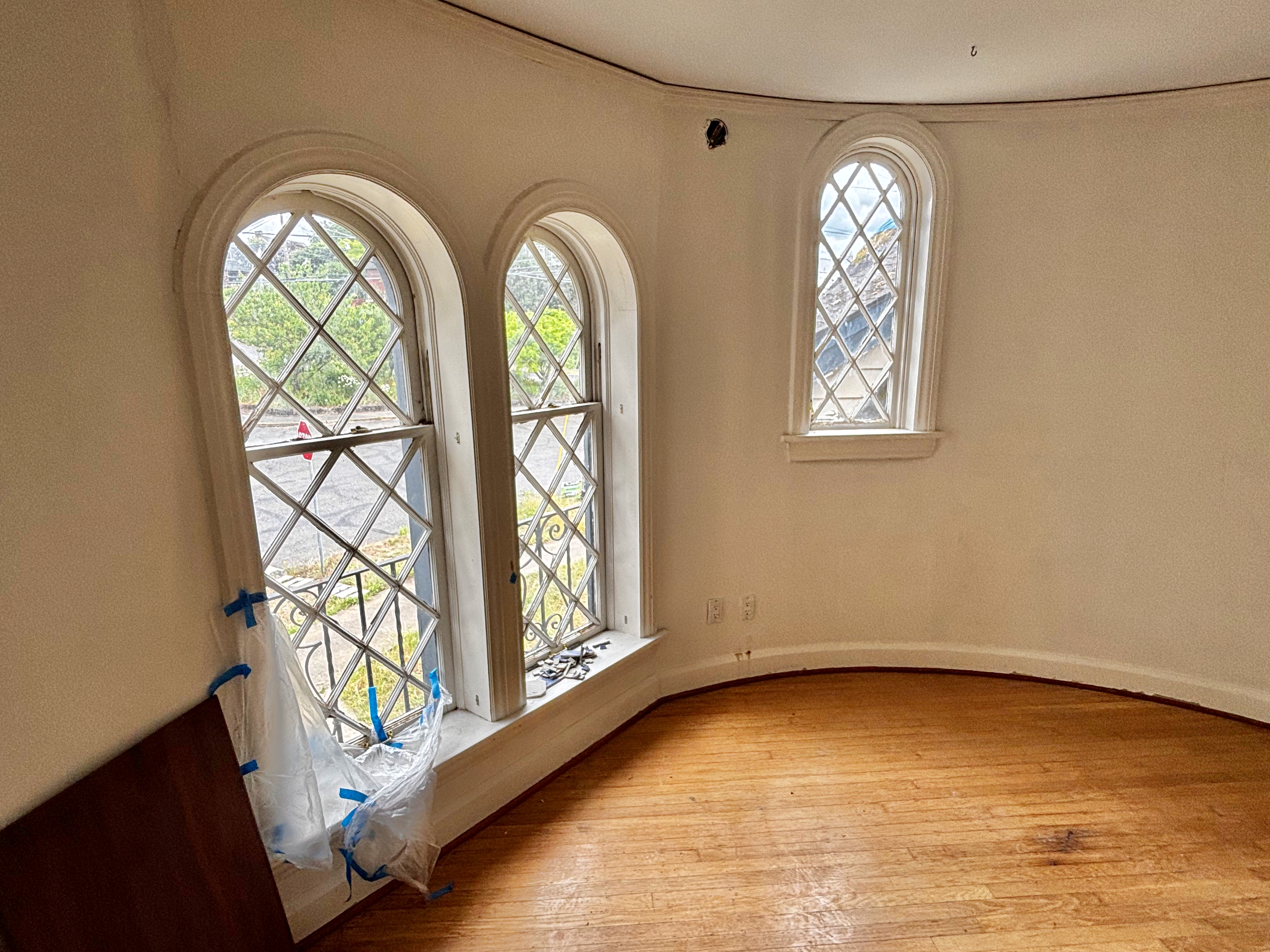
Windows throughout the house, including these in the second-floor turret room, are on the list to receive TLC. Restoring the original windows is a priority.
Outside, Amber and Kyle are working with a landscape designer to re-establish a back deck, fenced back yard and landscaping that creates private outdoor spaces and further restores a sense of home, allowing for a better integration of indoor and outdoor spaces.
Their timeframe is ambitious: Amber and Kyle hope to complete their work and have the house on the market by mid-2027. But they are also realistic, based on experience, and by wanting to do things right:
“Completing a great renovation that honors the home, the neighborhood, and the people who will live there is far more important than completing the project on any specific date,” says Kyle.
What first attracted the sibling duo to the turret house?
“We’re drawn to houses that have been through some trouble,” says Amber. “In a way, the house actually becomes the client. The challenge is: how do we take a house like this that has had things happen to it, and make it desirable again, without losing the soul of the house? We love having a puzzle like that to solve.”
More to follow as the work progresses.
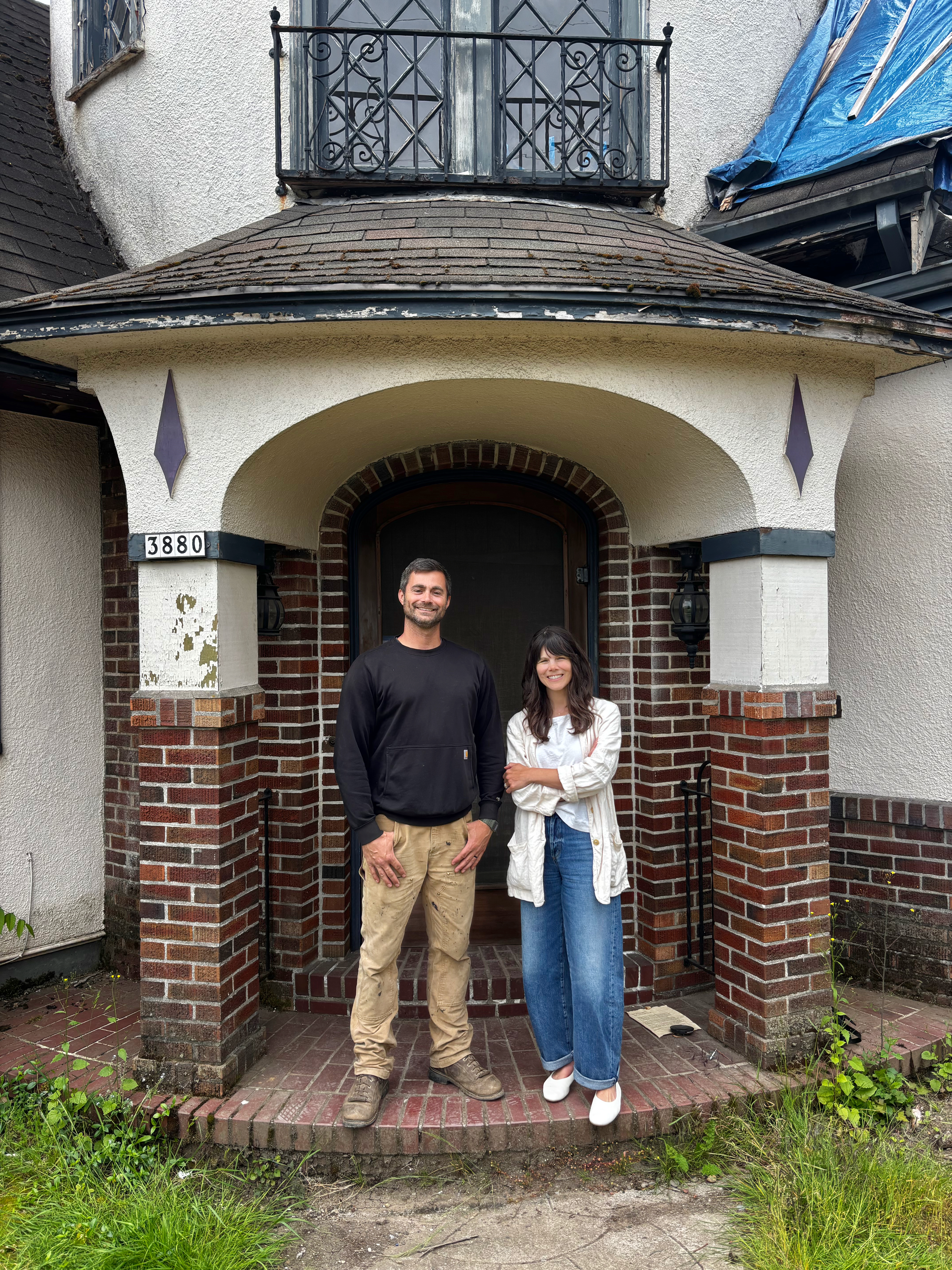
Kyle Lindros and Amber Chang at 3880 NE Wistaria in June 2026.