What started out as a monumental effort to map fire risk in neighborhoods built from combustible materials has become a trove of information for old house researchers. The Sanborn Company started out in the 1860s mapping neighborhoods and buildings to help give fire insurance underwriters information upon which to write their insurance policies. The maps show in impressive detail the construction materials of every structure in a neighborhood, the heat source of institutional buildings, the location and size of water mains, and basic construction information (as in, where was the front porch?), etc.
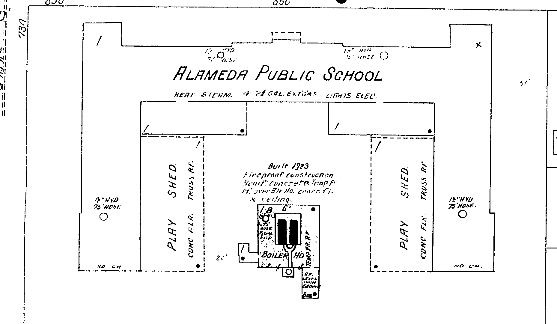
The outline of Alameda School, 1924, showing the location of the boiler and incinerator, and standpipes for water. Detail from Sanborn Plate 613, Volume 6.
The scope of the mapping effort is almost unbelievable: 12,000 U.S. towns and cities were mapped, most of them several times, by an army of surveyor / mapmakers. With this information, volumes of maps were drawn up and published producing a durable snapshot in time of neighborhood development. And all of this in the era before digitial mapping techniques.
Writer and public historian Kim Keister writes: “Stated simply, the Sanborn maps survive as a guide to American urbanization that is unrivaled by other cartography and, for that matter, by few documentary resources of any kind.”
A quick spin through a few of the maps from Alameda, made in 1924, provides some interesting insight. Remember, this is before the address change of the 1930s, so the numbers you see won’t make sense today. You can click on any of these images for a closer look at the map selection.
Below, just look at how few homes there were in this part of the neighborhood. In some cases, streets weren’t even in yet. The northern part of the neighborhood — the Alameda Park Addition shown on the plat map here on the blog — was developed first, when the areas south of Alameda Elementary School were just open fields.
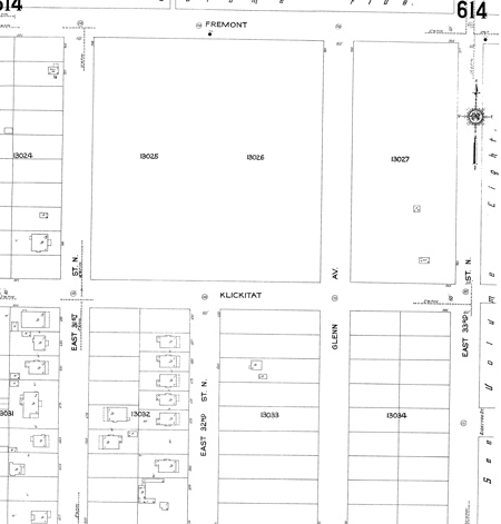
Detail from Plate 614, Volume 6.
From time to time you come across a building that must have pre-dated the grid of the neighborhood, like this one below where the building is sitting at odd angles to the street. Sometimes, you’ll find barns and outbuildings showing as well.

Detail from Plate 626, Volume 6
Check out this spot up at Alberta and NE 26th: my guess is that a lot of the wood and supplies to build our houses came out of here. Today it is a parking lot:
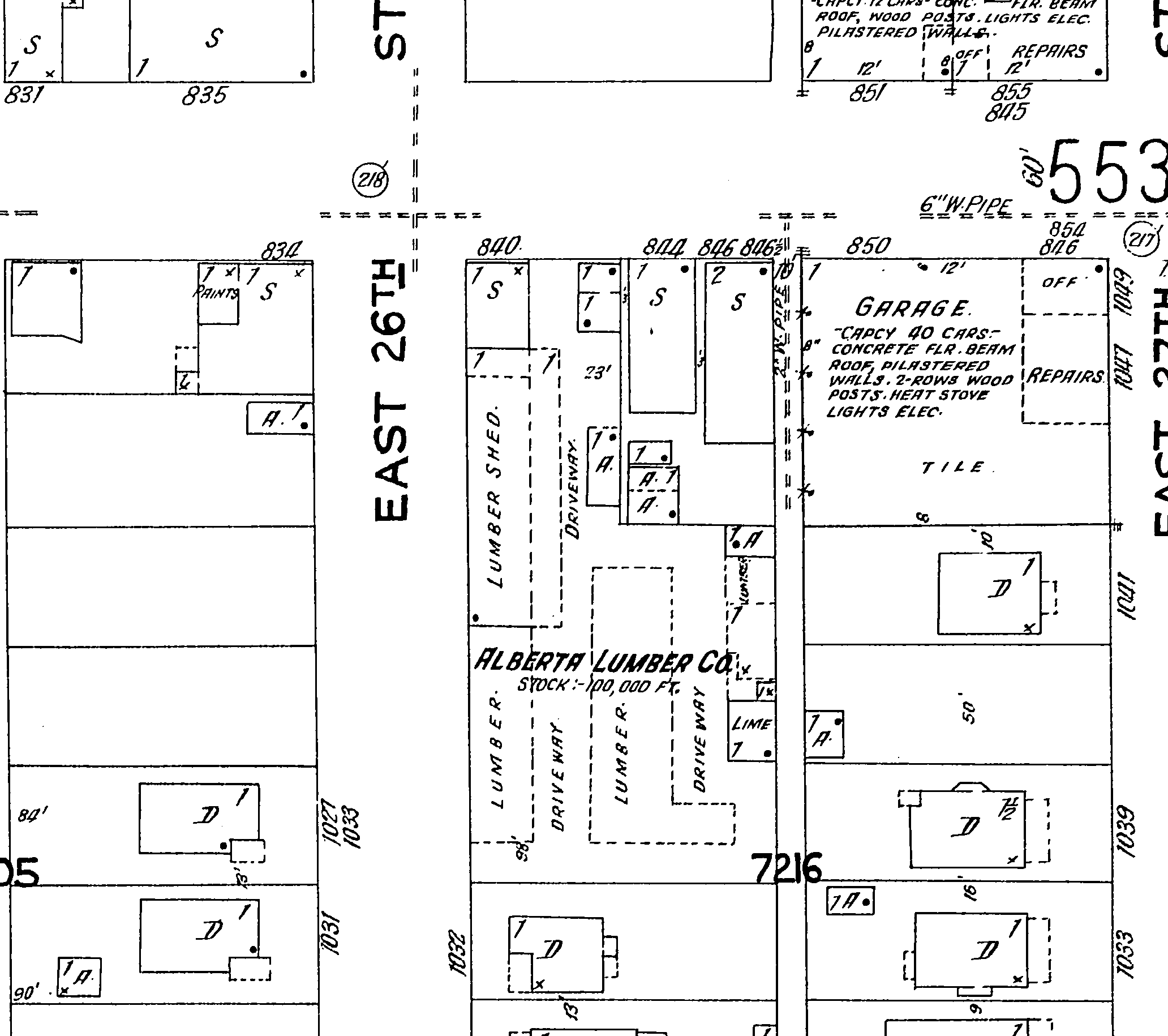
Detail from Plate 552, Volume 5.
Here’s a snapshot of the Alameda business district, which housed a dry goods store, a shoe repair, and a drug store. More on that in future posts. That’s Fremont running left and right, and NE 24th running up and down.
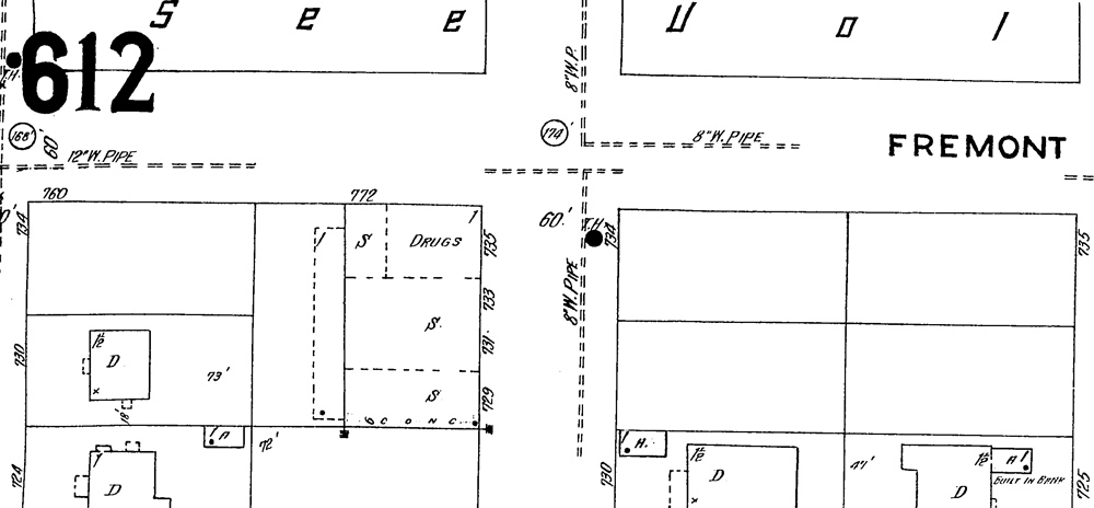
Detail from Plate 612, Volume 6
Small versions of these maps are available on-line through Multnomah County Library, which also has a hard copy of the original maps (so does the Oregon Historical Society). They are amazing and colorful documents to behold. If you have the time and interest, they’re well worth a look. I’ve printed out copies and assembled them together to give a full map of the neighborhood, circa 1924. An interesting snapshot. Click here for a link to the Library’s Sanborn database. If you click over to the Library site to look at the Alameda-related Sanborns, have your library card number ready, and look for the Portland, Oregon Sanborns from 1924. We are in both Volume 5 and Volume 6.

