In our ongoing pursuit of insight about the early days of Northeast neighborhoods, we’ve come across a zoning change petition filled with photos and maps from 1929 that allows an interesting glimpse into the evolution of today’s busy intersection at NE 33rd and Killingsworth in the Concordia neighborhood.
We’ll whet your appetite with this 1929 photo of a fine bungalow, owned by Frank and Louella Watson that was located at the northwest corner of NE 33rd and Killingsworth (facing 33rd), on property now occupied by the Mud Bay pet store.

Looking west across NE 33rd at the Watson house, a tidy-looking bungalow surrounded by highly manicured hedges and gardens, that occupied what is now the parking lot for Mud Bay. Photo taken on August 15, 1929. The sidewalk running off into the distance at left parallels Killingsworth. Photo courtesy of Portland City Archives, A2001-062.57.
At the turn of the last century, John D. Kennedy owned much of the land between Killingsworth, Ainsworth, NE 33rd and NE 42nd, which he platted as the Kennedy Addition. By 1910, he was carving up the fields into building lots and a handful of houses were being built. In 1913 he sold the city a four-acre parcel that is now Kennedy School, which opened in 1914. Kennedy knew an emerging neighborhood would need a school and he was, after all, in the business of selling lots for homebuilders.
The Oregonian reported at the time this part of NE 33rd—which was also known as the Sunderland Road north of Prescott—was still unpaved and mostly used for moving cattle and sheep, and that the surrounding area was heavily wooded with only a few scattered houses.
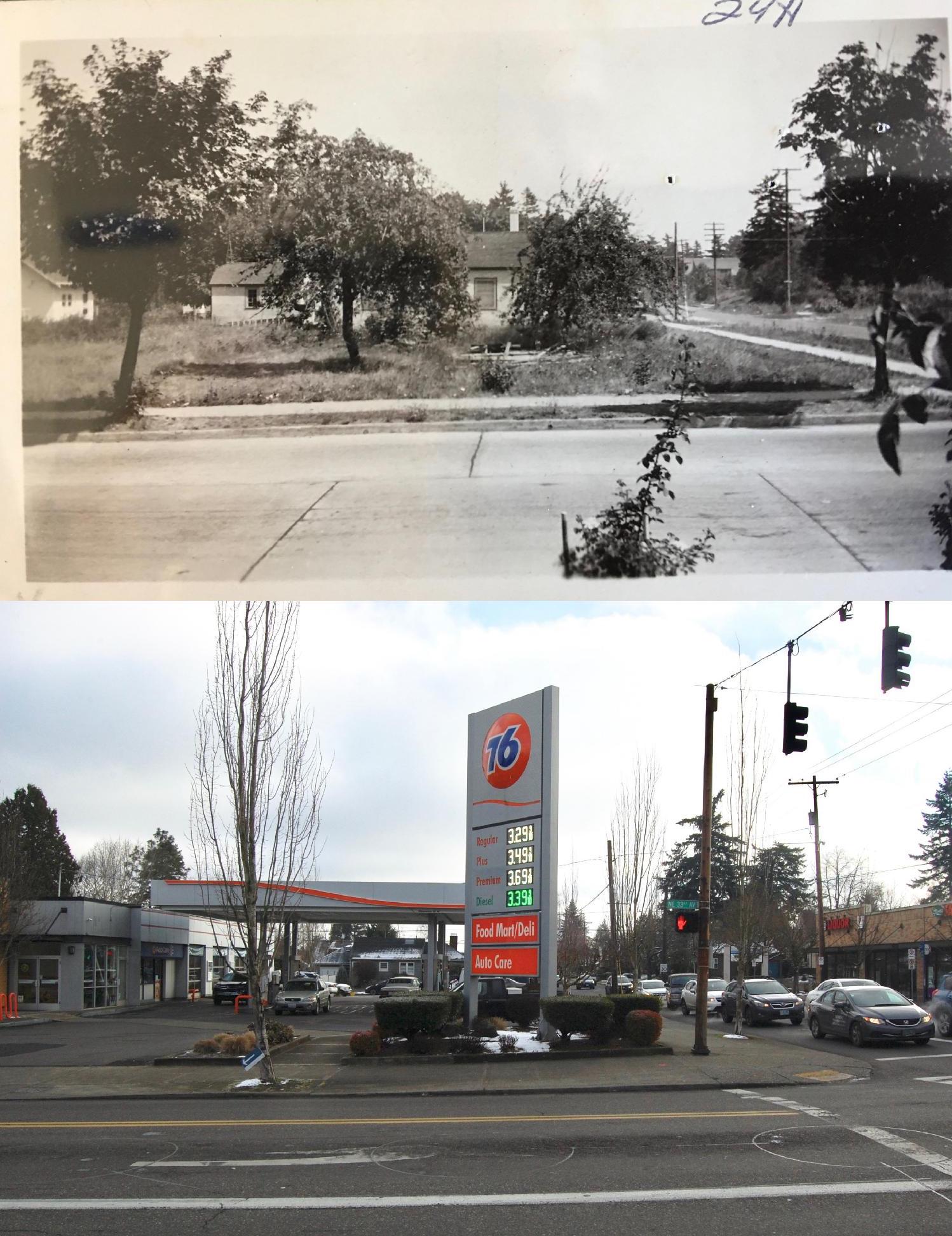
By the mid 1920s, more homes had been built in the area, particularly along NE 33rd. At the southwest corner of 33rd and Killingsworth was a small Red and White Market. At the southeast and northwest corners, bungalows had been built. At the northeast corner of Killingsworth and 33rd pictured below, Kennedy owned an open field that once housed a barn (a kind-of local landmark known as “Kennedy’s Barn”). You can see some of the wood left over after the barn’s demolition.
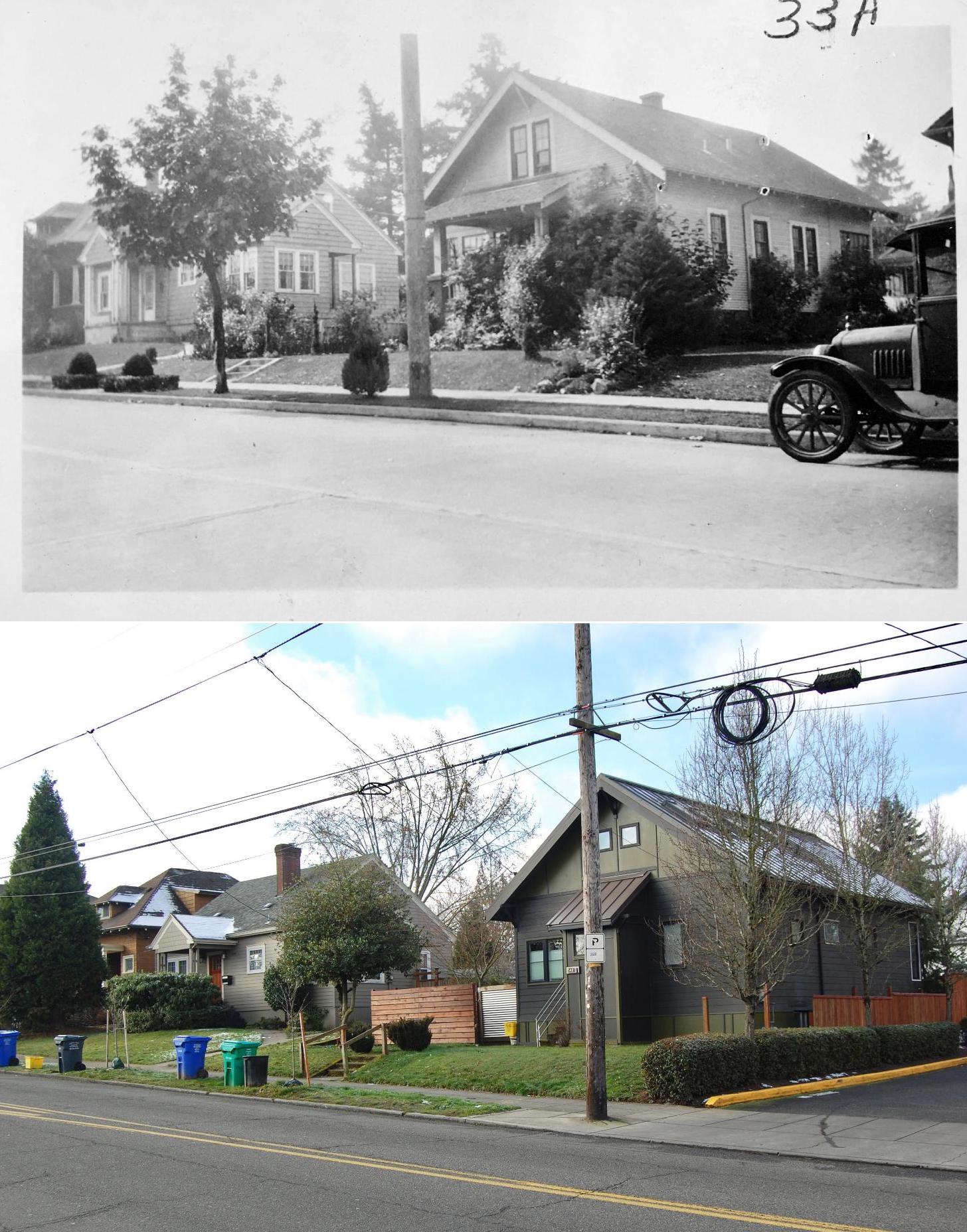
 Looking east across 33rd at the open lot at the northeast corner of 33rd and Killingsworth where Kennedy’s barn once stood, June 15, 1928. The street running off into the distance at right is Killingsworth. Taken from the Watson home pictured above. Photo courtesy of Portland City Archives, A220-062.54. Contemporary photo showing the same view today.
Even though the area still had a strong rural residential feel, Kennedy could already visualize how things would go: the school and homes were ripe for their own commercial district. So, in the summer of 1929 he put the re-zoning wheels into motion to get his parcel ready for commercial development.
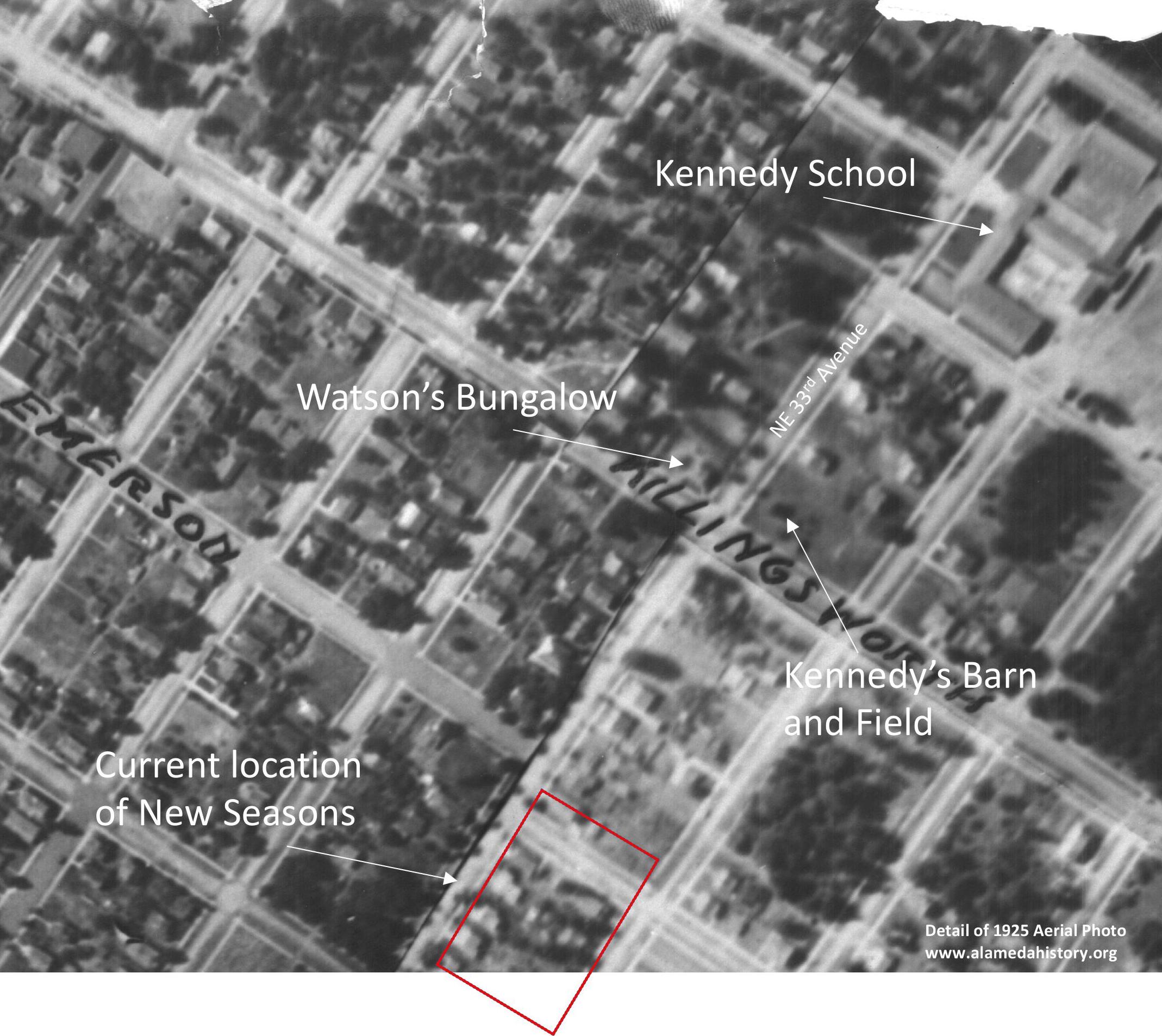
Here’s a look at the area from a 1925 aerial photo:

Detail of a 1925 aerial photo. Kennedy School is visible in the upper right corner. Kennedy’s field appears just above the “NG” in the original hand lettering on the photo (now a 76 gas station). The red dashed line indicates the location of present day New Seasons Concordia. Click for larger view. Aerial photo courtesy of City of Portland Archives.
In 1929, Portland’s zoning code was fairly simple: Zone 1 was for single-family residential use; Zone 2 was for multi-family residential use; Zone 3 was for business and manufacturing; and Zone 4 was unrestricted. (Here’s a link to a great history of zoning in Portland).
At the time, the northeast corner of the intersection owned by Kennedy had been zoned for residential use, but he wanted it to be Zone 3 to develop the property for commercial use. In his petition, Kennedy described his vision to build a commercial corner just like the one in Beaumont at 42nd and Fremont (he actually included a photo of that building), or a filling station. Kennedy pledged that if the zone change was allowed, he would personally see to it that “no cheap construction will be permitted,” and that “it will be so kept that it will be an attraction to any business Street intersection or residence district.”
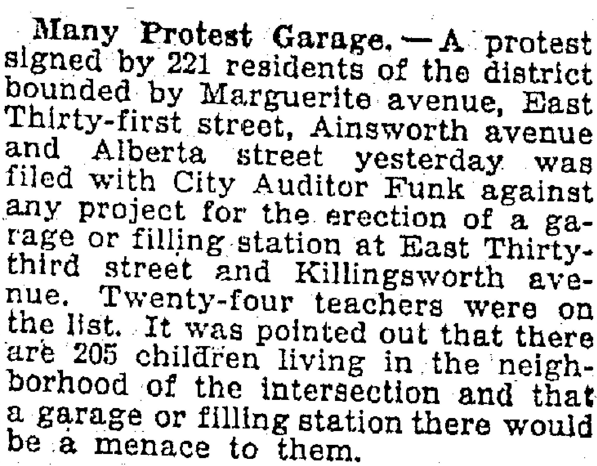
Neighbors weren’t wild about the idea.
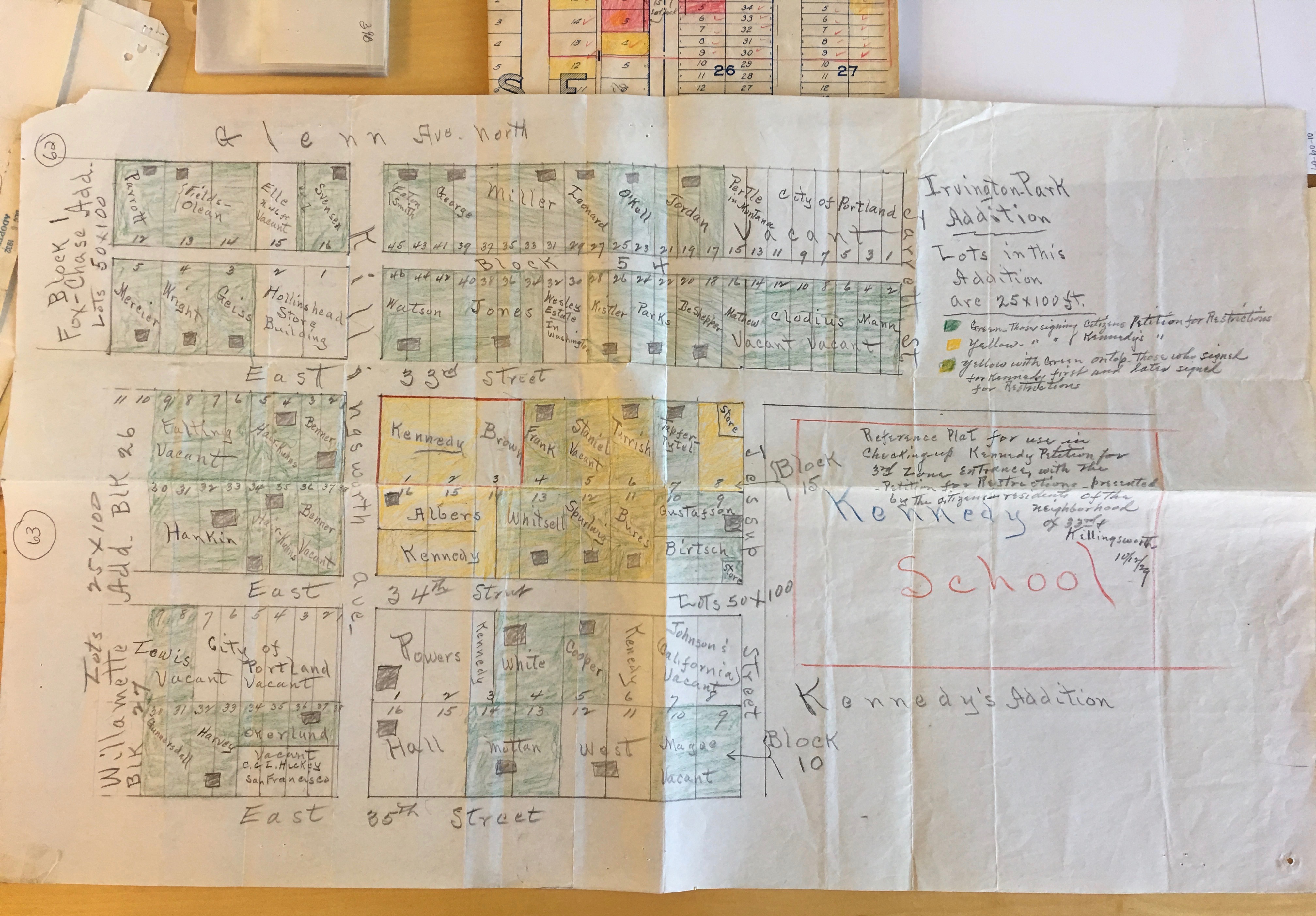
On October 12, 1929, adjacent property owners submitted a hand-drawn and color-coded map that recorded exactly how they felt. Owners with properties shaded green wanted the area to stay restricted to residential. Those shaded yellow were in favor of Kennedy’s petition for zone change to commercial. Have a good look and you’ll figure out pretty quickly which properties were owned by Kennedy. It’s also interesting to note the third category (yellowish green), which were neighbors in favor of the Kennedy petition at first but who then changed their minds.

Map drawn by neighbors showing opposition to rezoning of the Kennedy property for commercial use. Click to enlarge. Courtesy of City of Portland Archives, File A2001-062.
Here’s where it gets visually interesting.
Along with their map, neighbors submitted photographs to help the Planning Commission understand the residential character of the neighborhood and the potential impact of a zone change. We paired these with similar views photographed on a snow day in early February 2019.

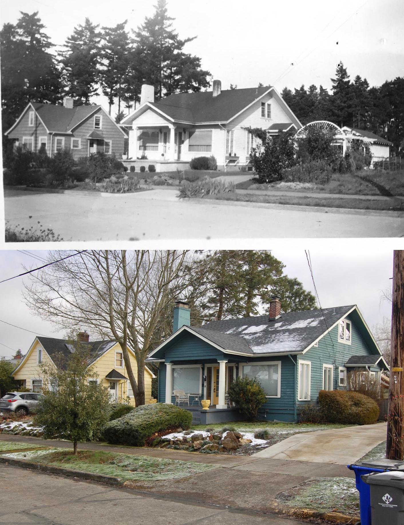
5434 NE 32nd Place (formerly 1160 E. Glenn Avenue, the Svensen family home). The southeast corner of NE 32nd Place and Killingsworth. Photographed on August 14, 1929. Courtesy Portland City Archives, A2001-062.60.

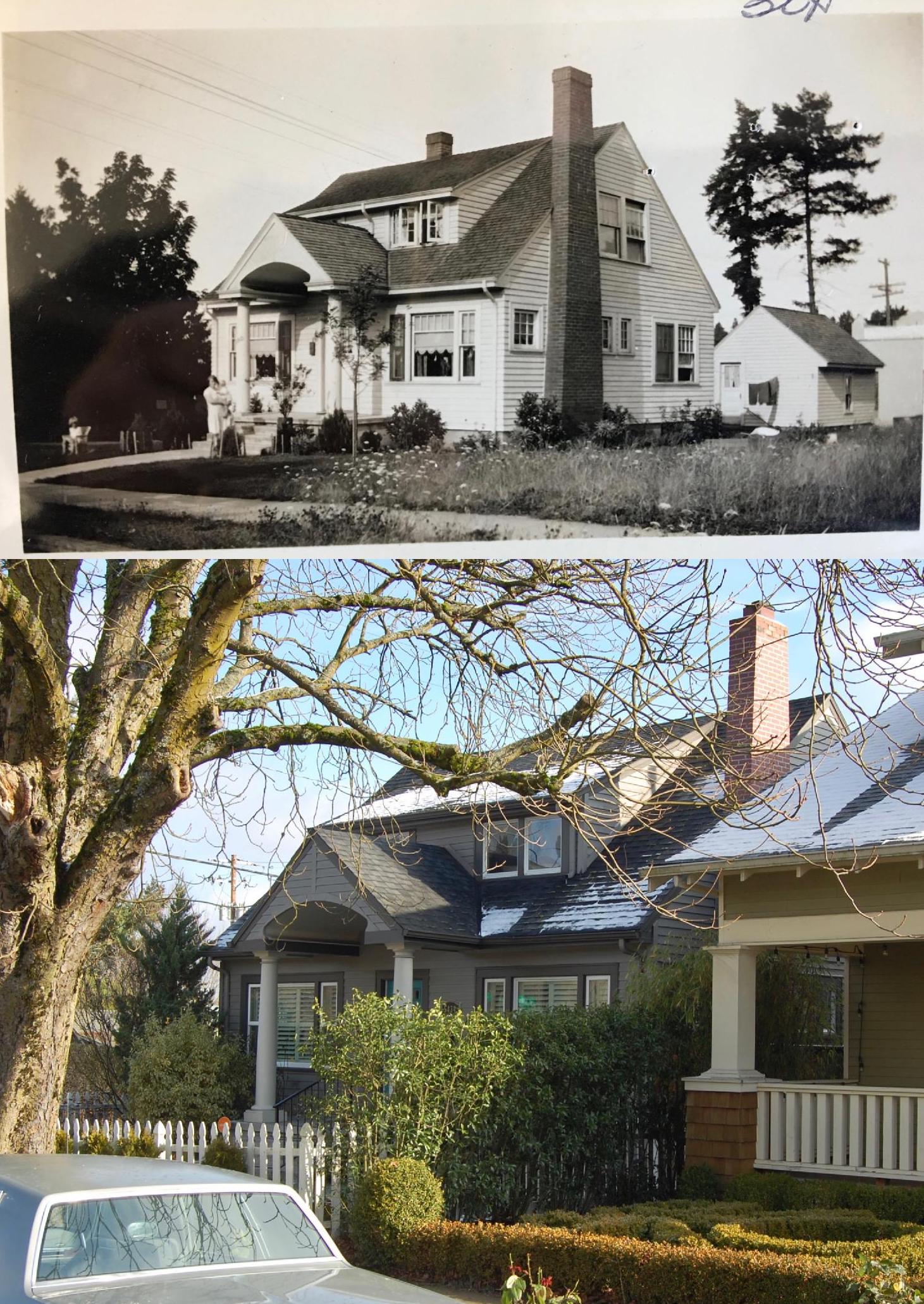
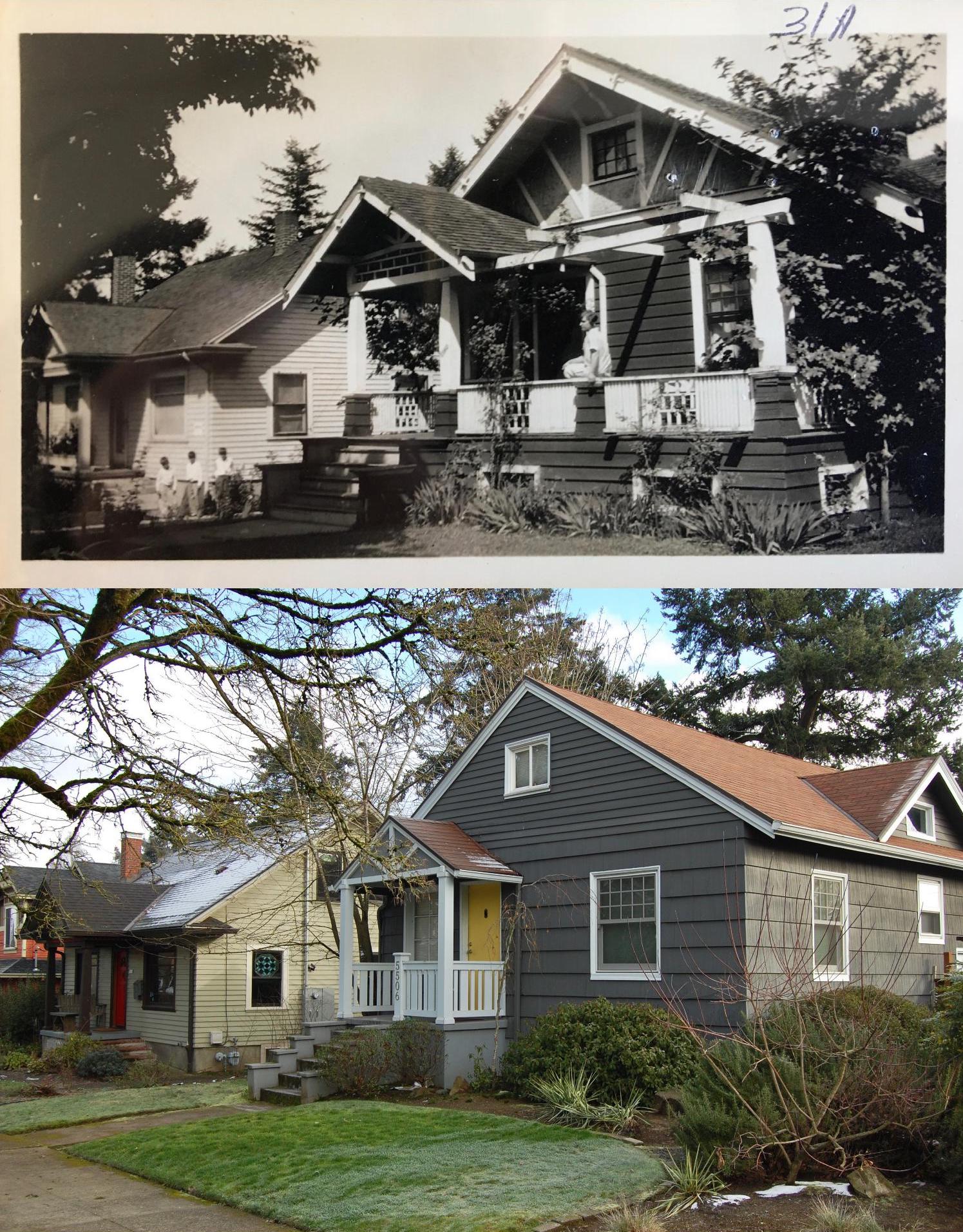
5506 NE 32nd Place (formerly 1150 E. Glenn Avenue, the Eaton family home). The northeast corner of NE 32nd Place and Killingsworth. Photographed on August 14, 1929. Courtesy Portland City Archives, A2001-062.61. We wonder if the homeowner realizes the house once had an extended front porch and pergola, and a completely different siding material.
 5526 and 5606 NE 34th Avenue (formerly 1166 and 1168 E. 34th Avenue, the Nellie White and C.C. Cooper family homes, respectively). Photographed on September 19, 1929. Courtesy Portland City Archives, A2001-062.65.

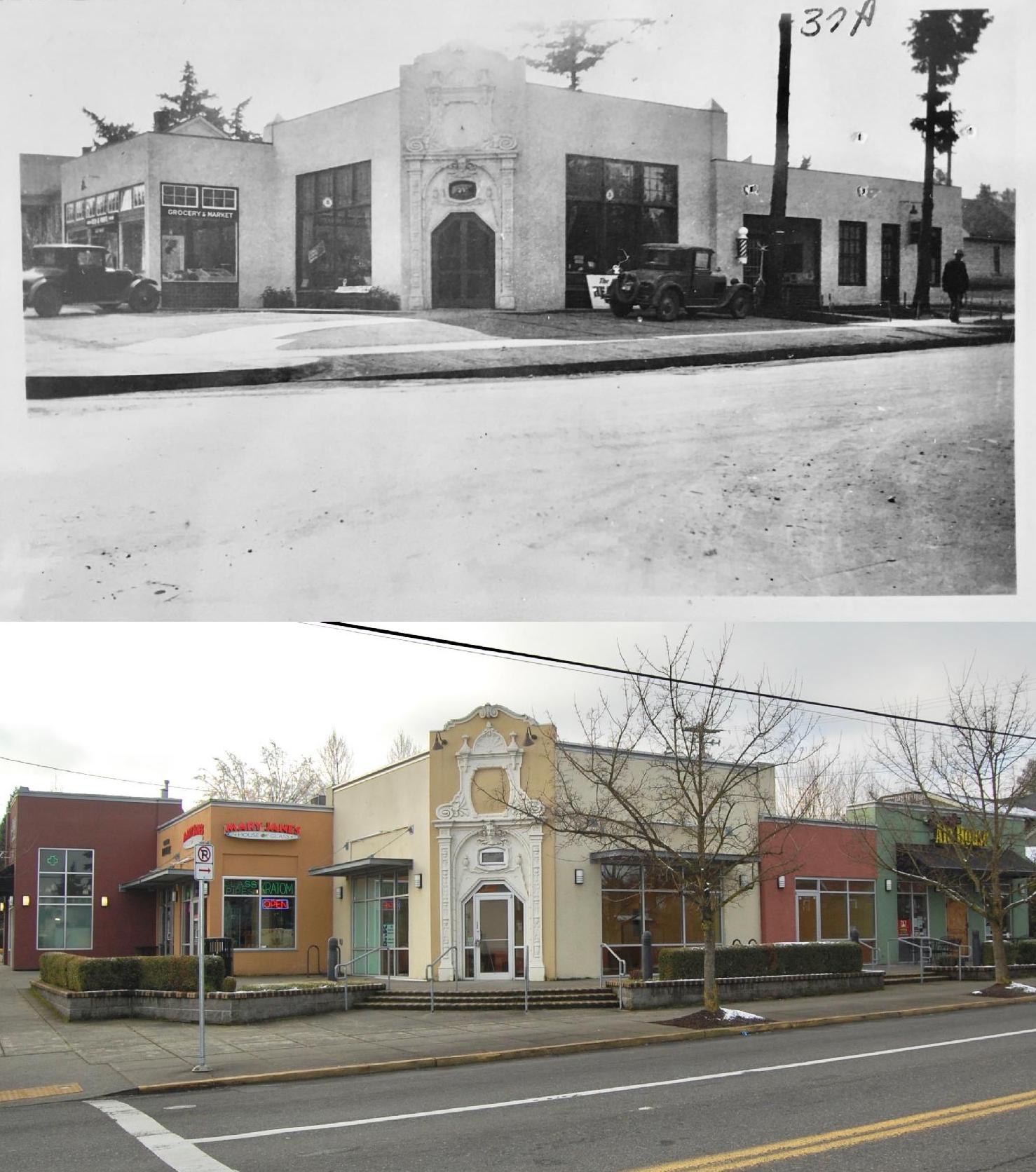
What was then a newly constructed building at the southwest corner of 33rd and Killingsworth, known as Hollinshead’s Corner, named for the developer who built the building. Looking southwest across Killingsworth. Note the entry archway and façade that is still standing. Photographed on September 30, 1929. Courtesy of Portland City Archives, A2001-062.67.
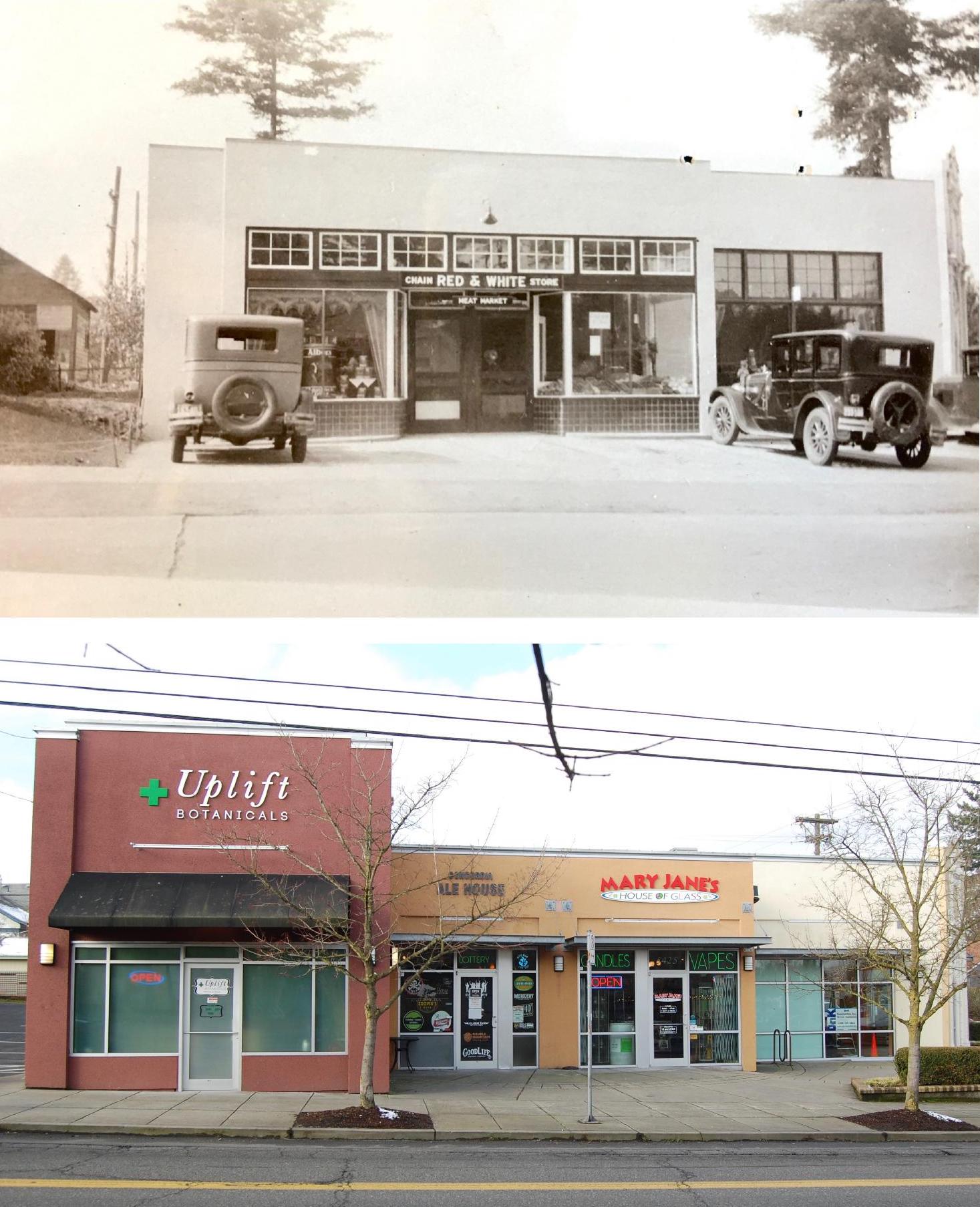
 The market at Hollinshead’s Corner, looking west across 33rd, just south of Killingsworth. The edge of the decorative archway is visible at far right. Photographed on September 30, 1929. Courtesy of Portland City Archives, A2001-0672.66.
 5343 NE 33rd and 5407 NE 33rd (formerly 1137 and 1139 E. 33rd Avenue, homes of Mrs. Mercier and H.C. Wright, respectively). Directly across from present day Canon’s Ribs. Photographed on August 30, 1929. Courtesy of Portland City Archives A2001-062.63.
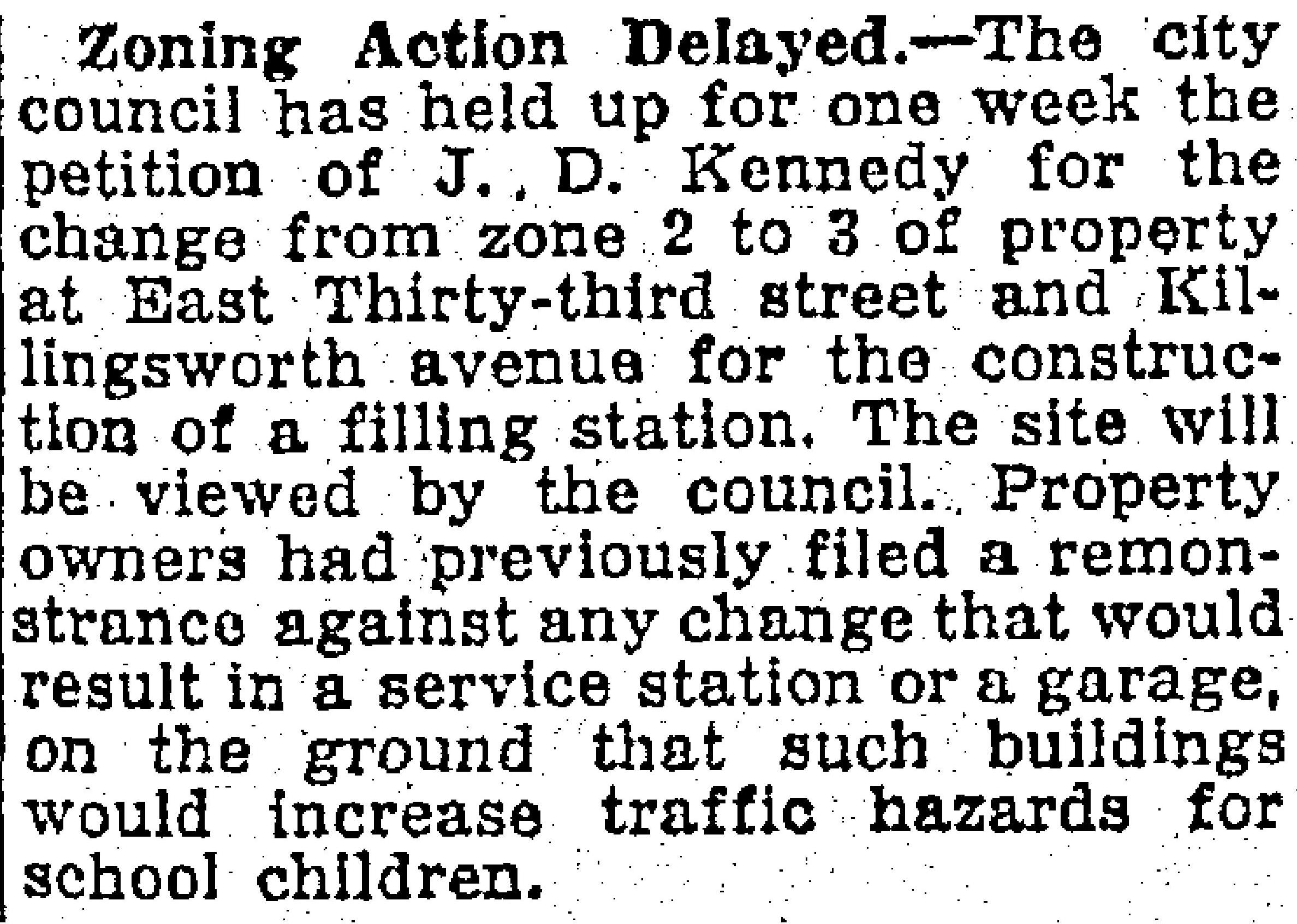
The neighborhood submitted these photos and the map as the battle about Kennedy’s requested zoning change played out in late October 1929:

From The Oregonian, October 29, 1929.
Because of the local turmoil and the fact that any Planning Commission recommendation would have to come before City Council for a vote, the electeds took the item off the agenda for several months, and then wanted to come out and have a look for themselves. Action on Kennedy’s petition dragged into 1930.

From The Oregonian, March 15, 1930.
When City Council visited the site in March 1930, they had in hand the following do-pass recommendation from the Planning Commission:
Inasmuch as the southeast and southwest corners of this intersection have been changed to zone three, the Planning Commission recommends this change be granted providing the petition agrees to set all buildings fifteen feet back from the street lines on both 33rd Street and Killingsworth Avenue. This requirement was agreed to by property owners on the south side of the street when their change was granted.
Following the visit, Commissioner of Public Works A.L. Barbur recorded the following in support of Council’s eventual decision to approve the change.
The members of the Council viewed the site of the proposed change of zone, and after careful consideration of the matter were of the opinion that the zone change should be allowed provided the property was used for either of the purposes outlined by the petitioner in his letter, and a fifteen-foot set back line established.
Neighbors around 33rd and Killingsworth and teachers at Kennedy School couldn’t have been very happy, but the story fades into the background. The Great Depression intervened and the thought of any commercial construction was put on hold. Aerial photos from 1936, 1940 and 1951 show the intersection unchanged, Kennedy’s open field on the northeast corner still very much open. By 1956, filling stations had been built on both northeast and southeast corners, but Watson’s tidy bungalow was still there.
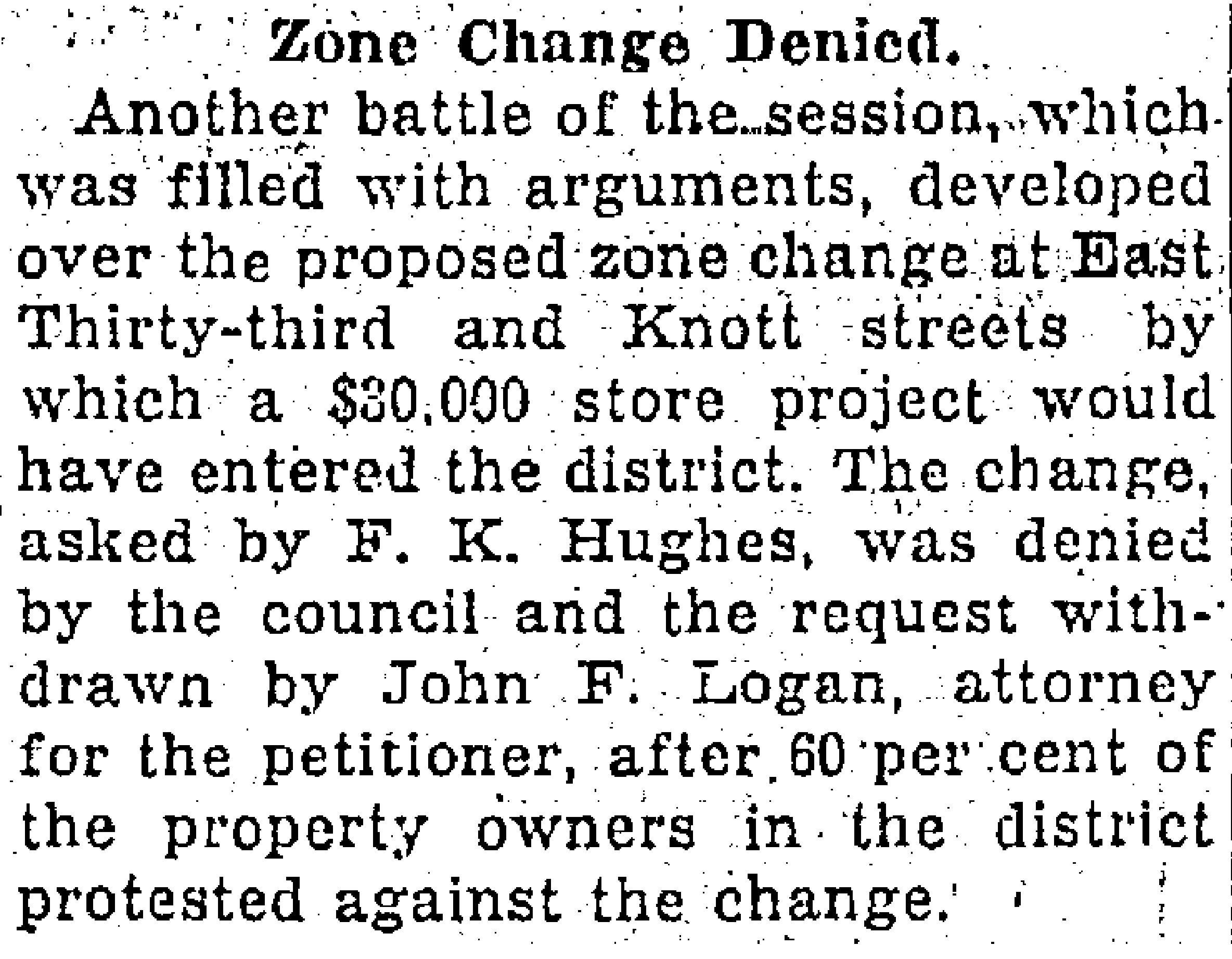
Meanwhile, there was either solidarity or sour grapes when in 1932—two years after the Kennedy petition decision—City Council denied a similar zone change request just a bit farther south on 33rd at Knott Street:

From The Oregonian, July 1, 1932.
Interesting how decisions from long ago do affect the way the landscape has turned out today (and the corollary that our decisions today shape future outcomes). Imagine if these council actions had been just the opposite, with 33rd and Knott transformed into a busy commercial intersection and Killingsworth and 33rd the quieter residential area.
Next up: How other decisions made by John D. Kennedy gave Concordia some of the longest blocks in the area.