Adaptive Reuse on NE Prescott: From Food King to Evolve Collaborative

The former Prescott Fountain Building at 2903 NE Prescott has had many lives in its nearly 100 years: grocery store, soda fountain, butcher shop, antique store, barber shop, radio store, bakery, convenience store.

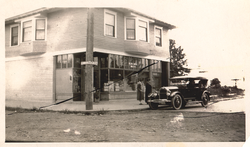
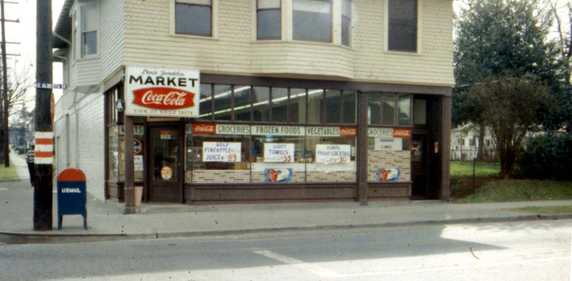
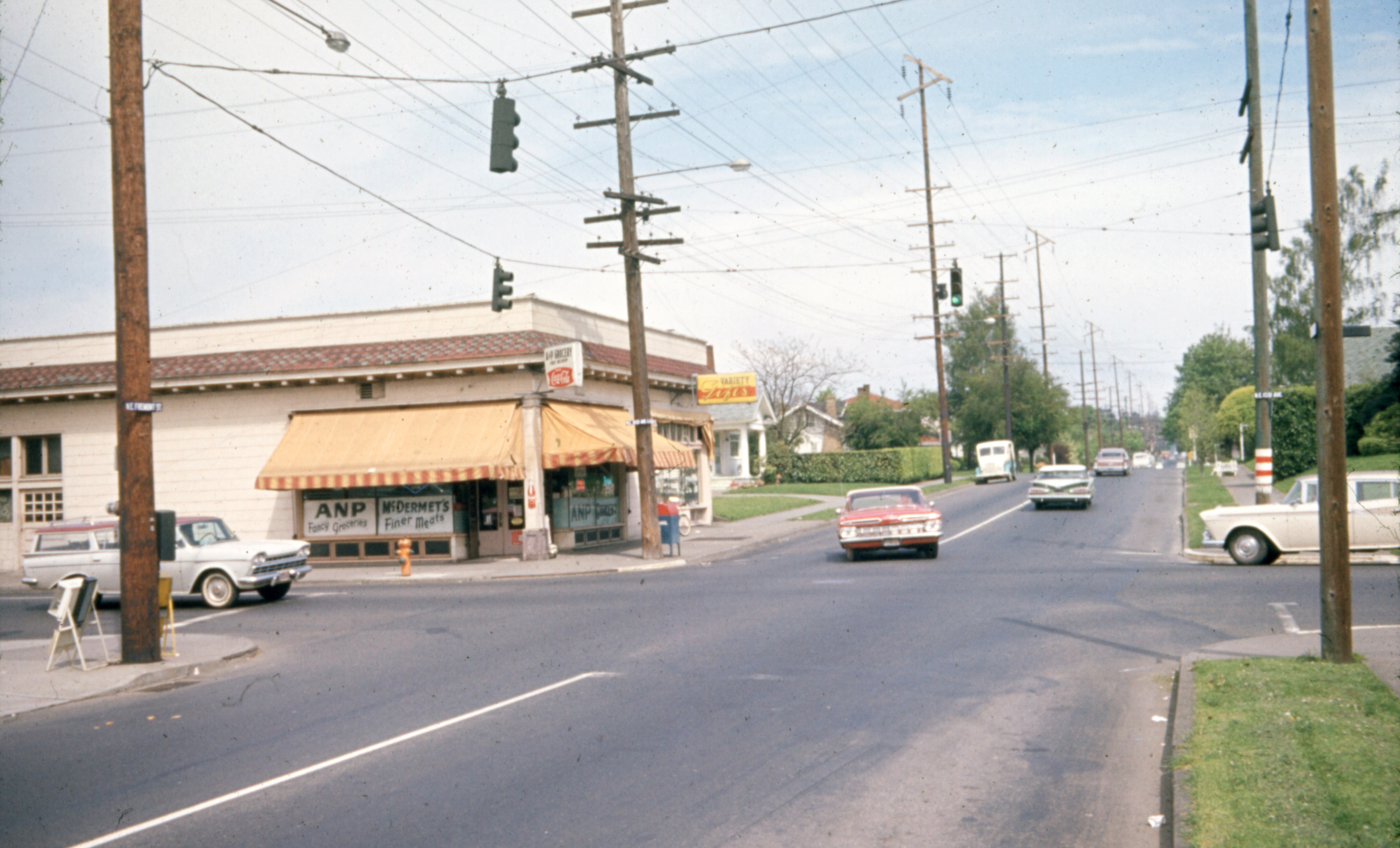
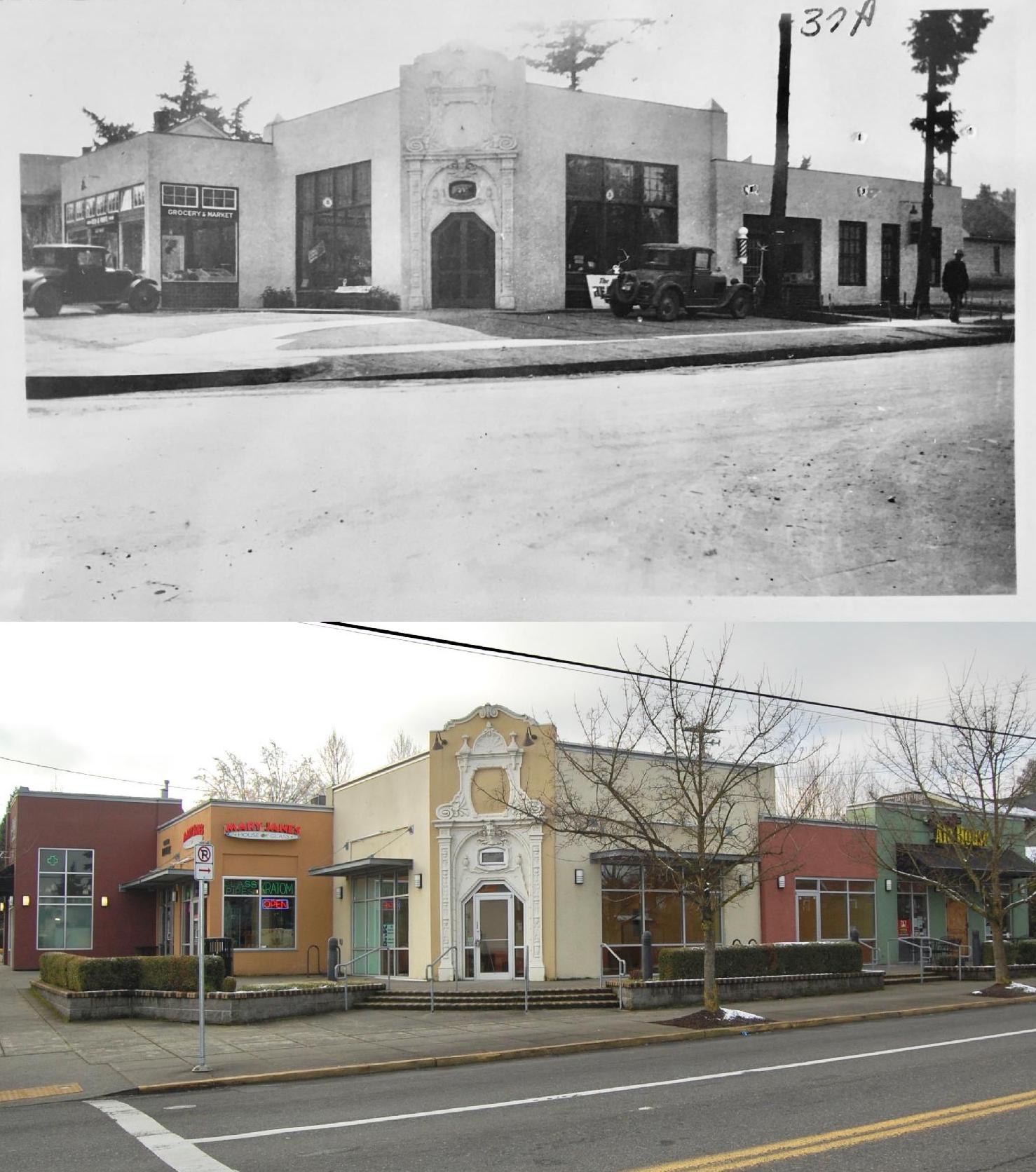
A 1955 photo looking northeast at the corner of NE 29th and Prescott. Photo courtesy of Historic Photo Archive.

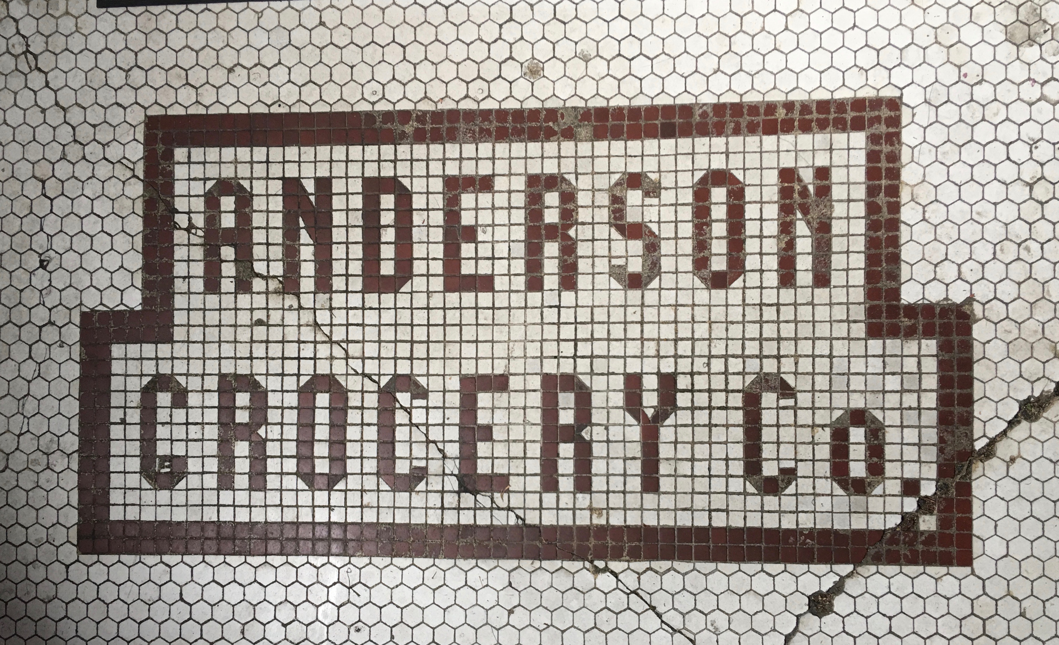
Built for $6,000 in 1922 by grocer Thomas H. Cowley, an immigrant from the Isle of Man, the building has been a time traveler, reconditioned and repurposed many times over. Originally a grocery store and meat market, the building sold in 1927 and new owner Martha Sylvester reconditioned it to fill six different retail spaces within the 7,000-square foot building.

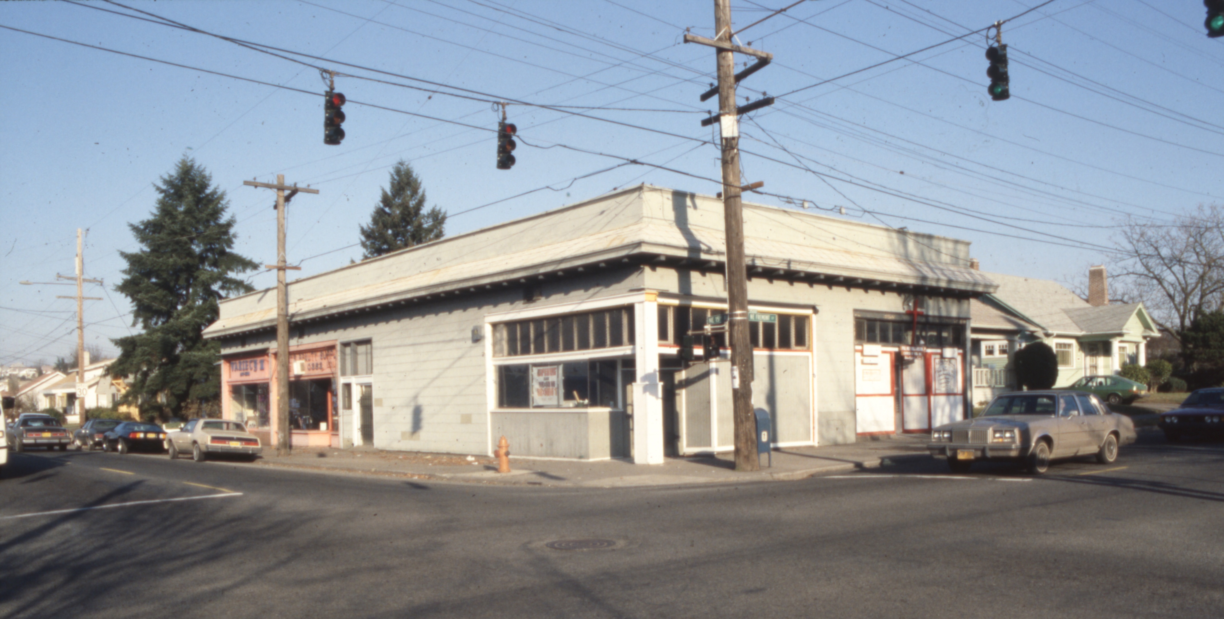
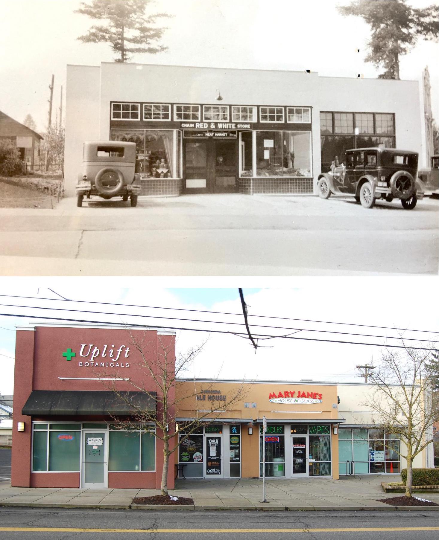
A 2009 photo taken from the same angle shows the former Food King Market in operation before it closed in 2020.

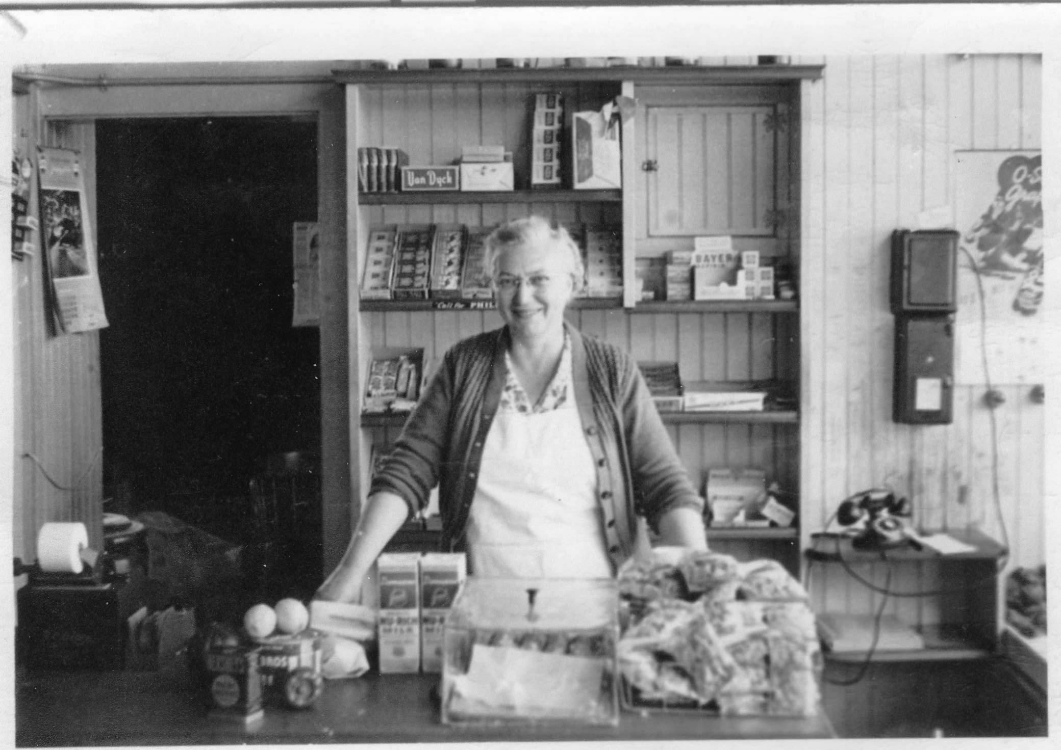
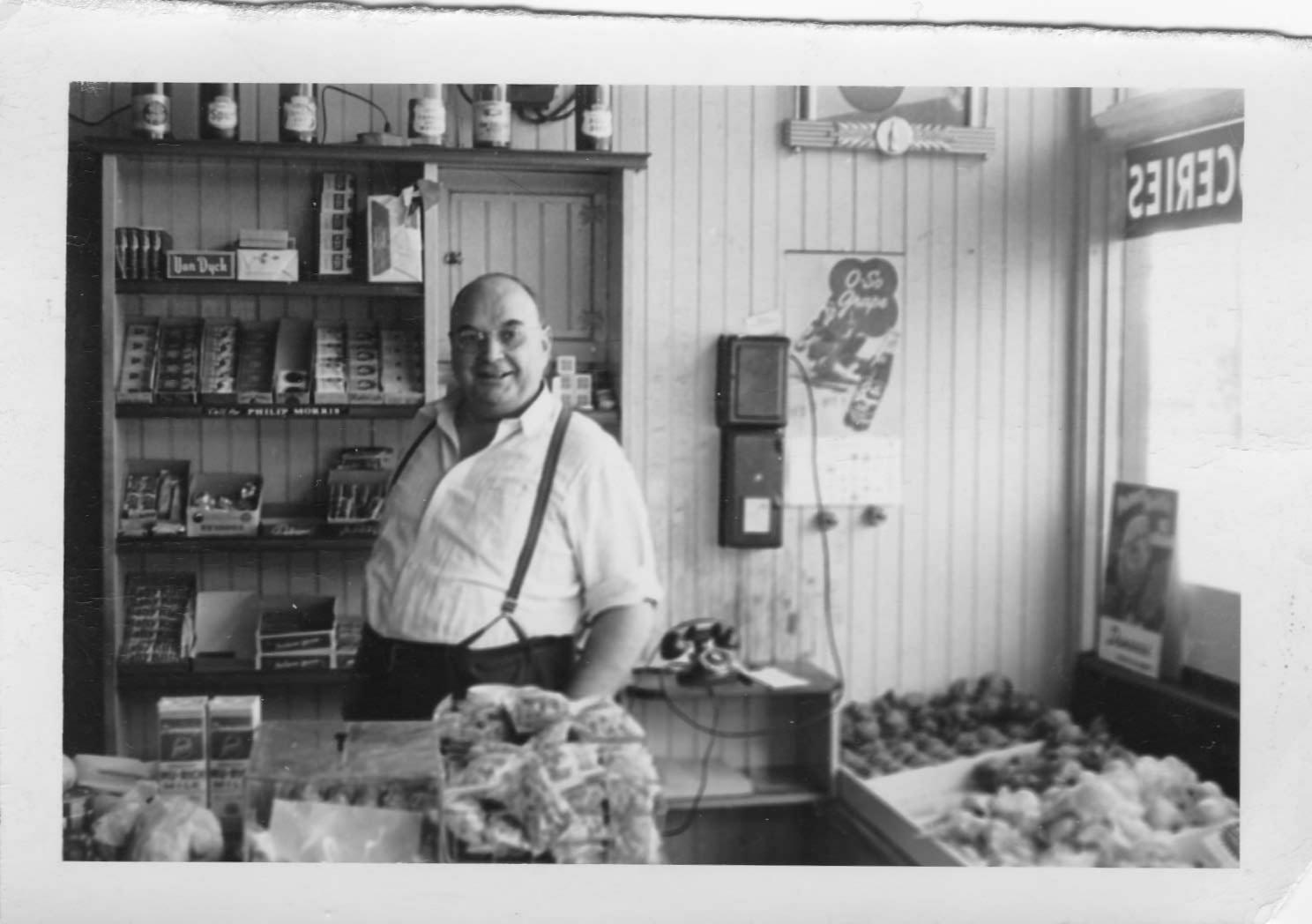
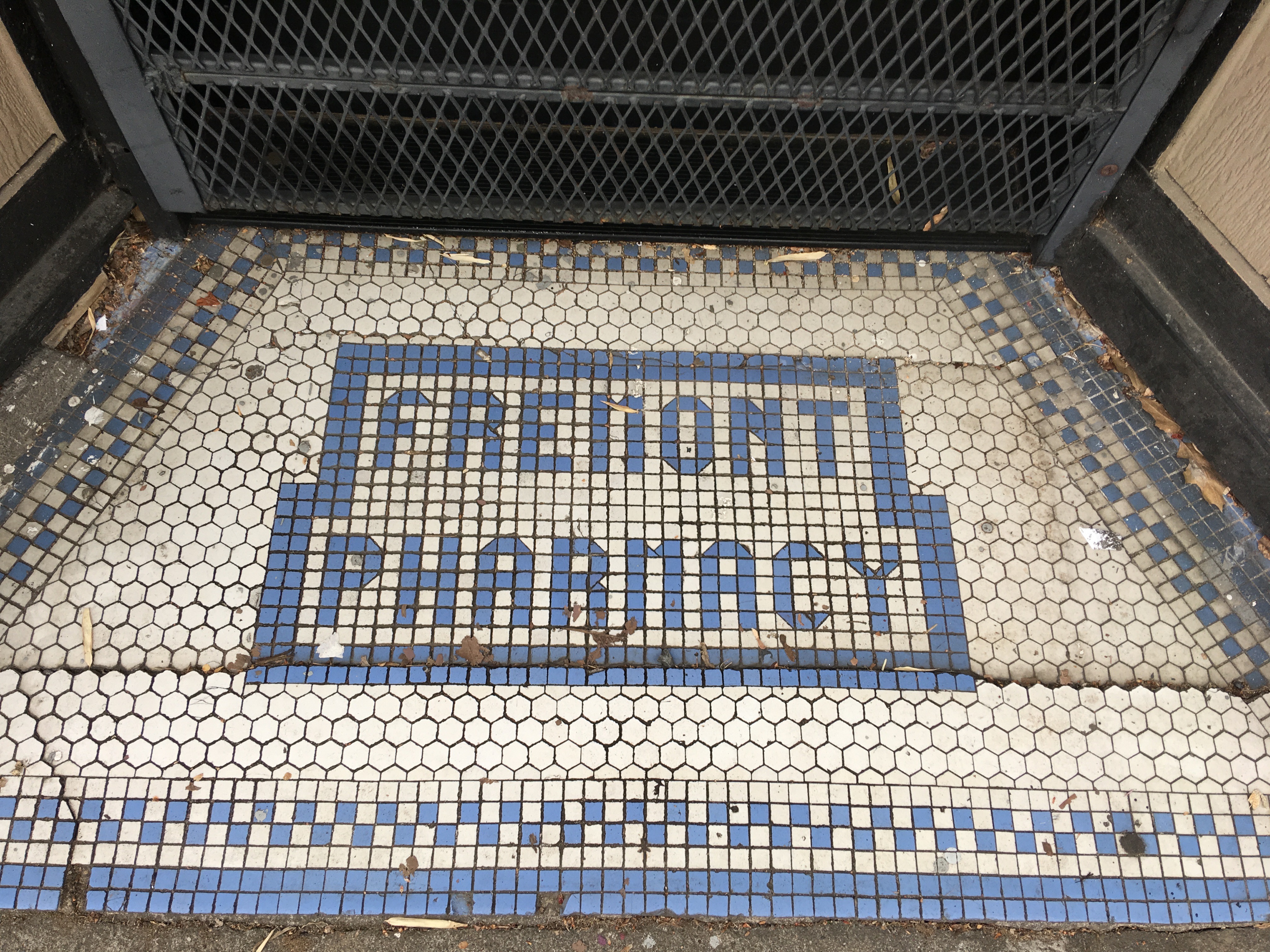
Today, most neighbors remember it as Food King Market, a handy place to pick up a gallon of milk or a missing ingredient without having to make the full trip to the big store a few miles away. Older residents will remember it simply as “Hunderups,” or the Prescott Fountain, where you could run a tab and get an ice-cold bottle of Coke.

As a retail location, it’s always been like that: providing convenience, a local touch and a sense of identity to its surrounding residential neighborhood. Former Food King owners David and Kaybee Lee—who opened Food King in the building in 1989—were likely to welcome you in with a smile. Over the years, those of us who lived nearby appreciated the Food King for its convenience, even as we noticed the building was showing its century of wear and tear.

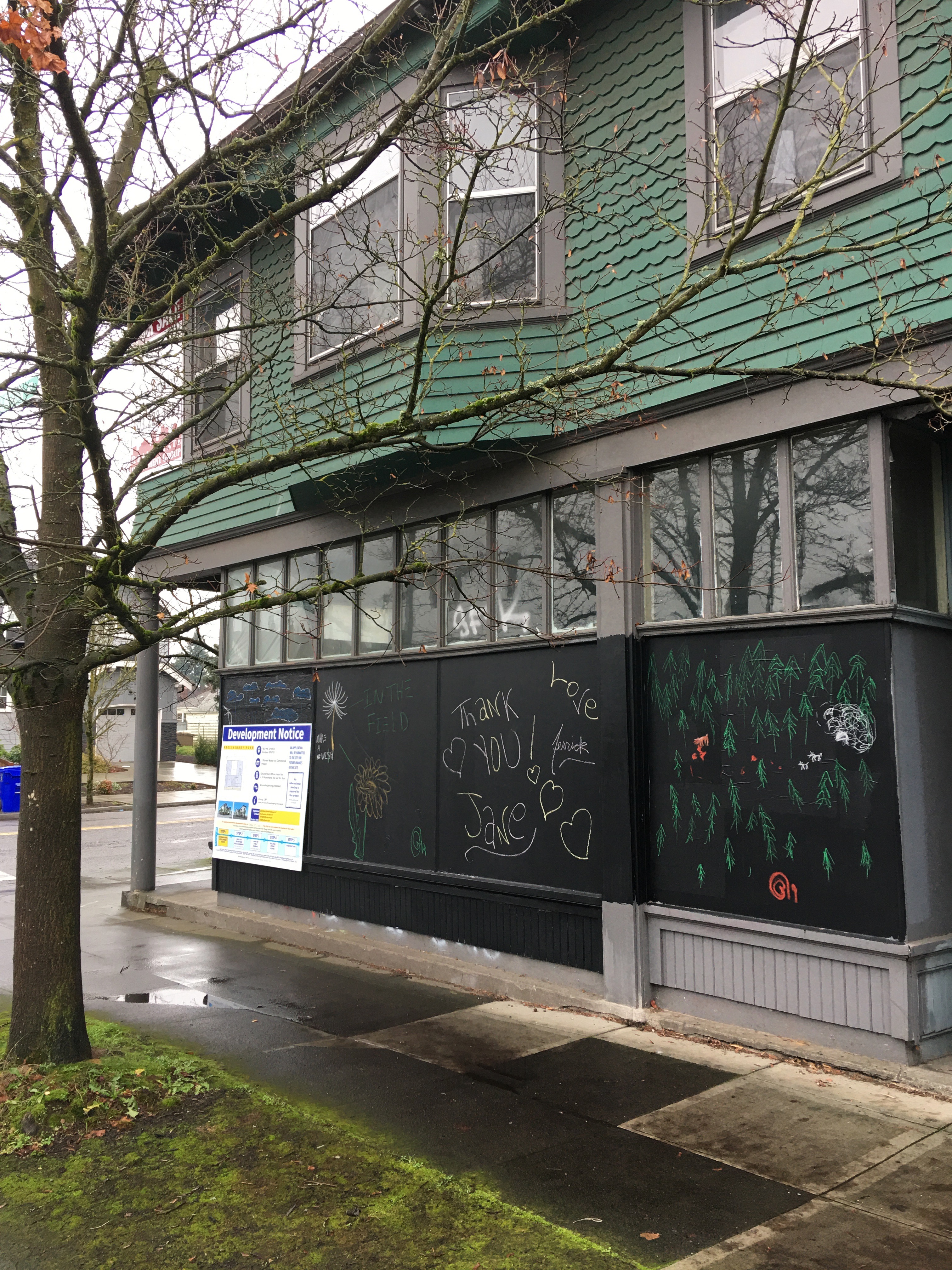
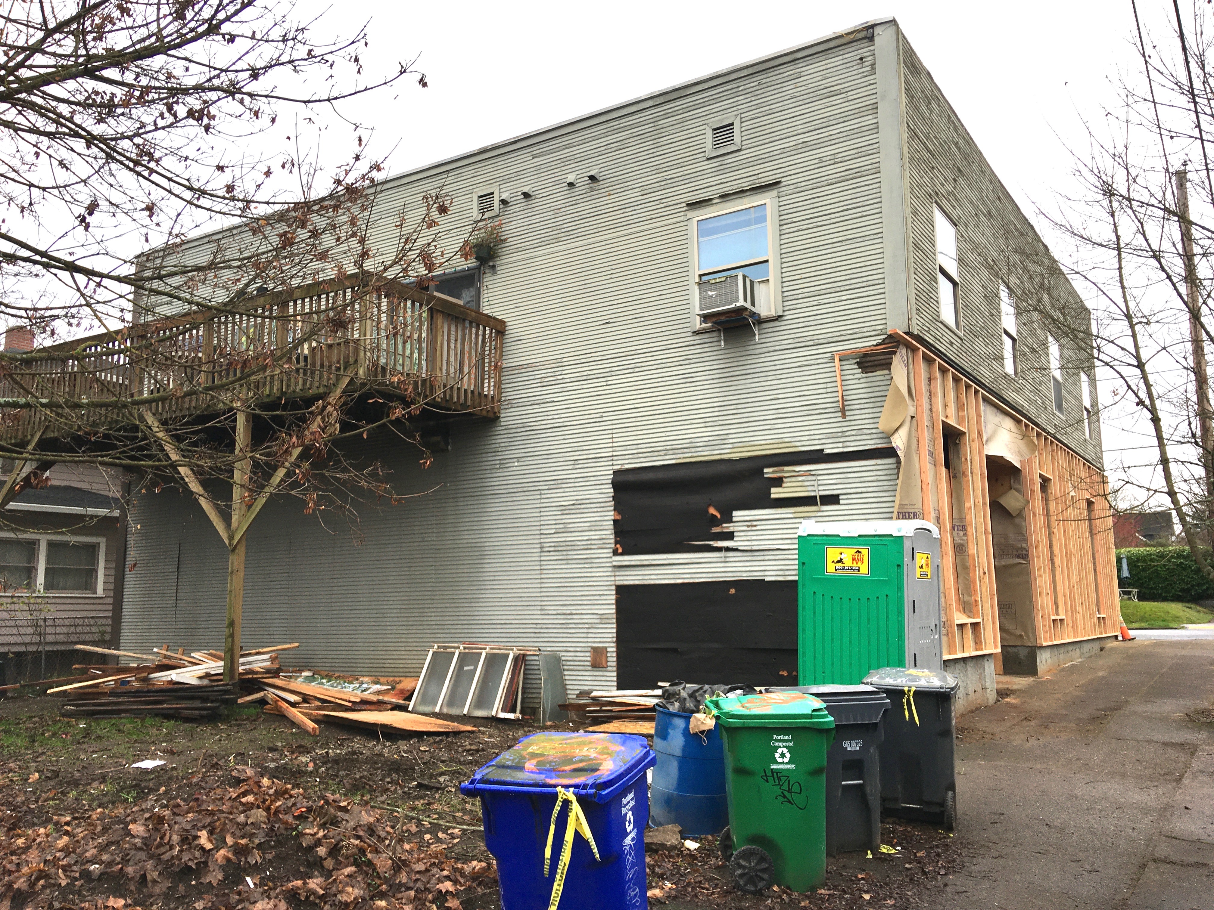
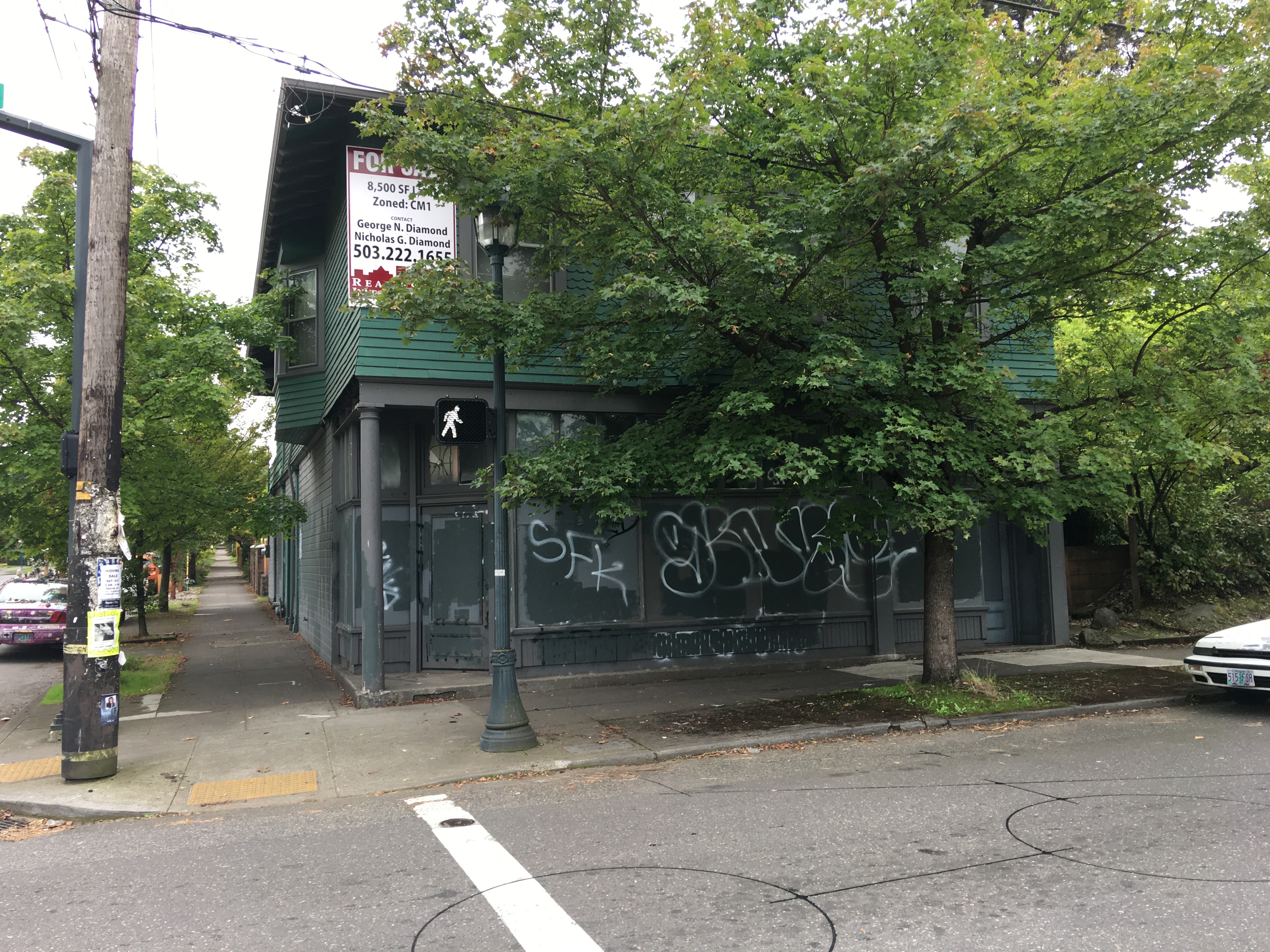
In 2018, after 30 years running the store, the Lees decided it was too hard to compete with grocery stores that seemed to be moving ever closer to the neighborhood. For them, it was time to sell the business and the building, which they did in 2020 just before the pandemic hit. For the last 20 months, it’s been a sad sight, vacant, tagged with graffiti.

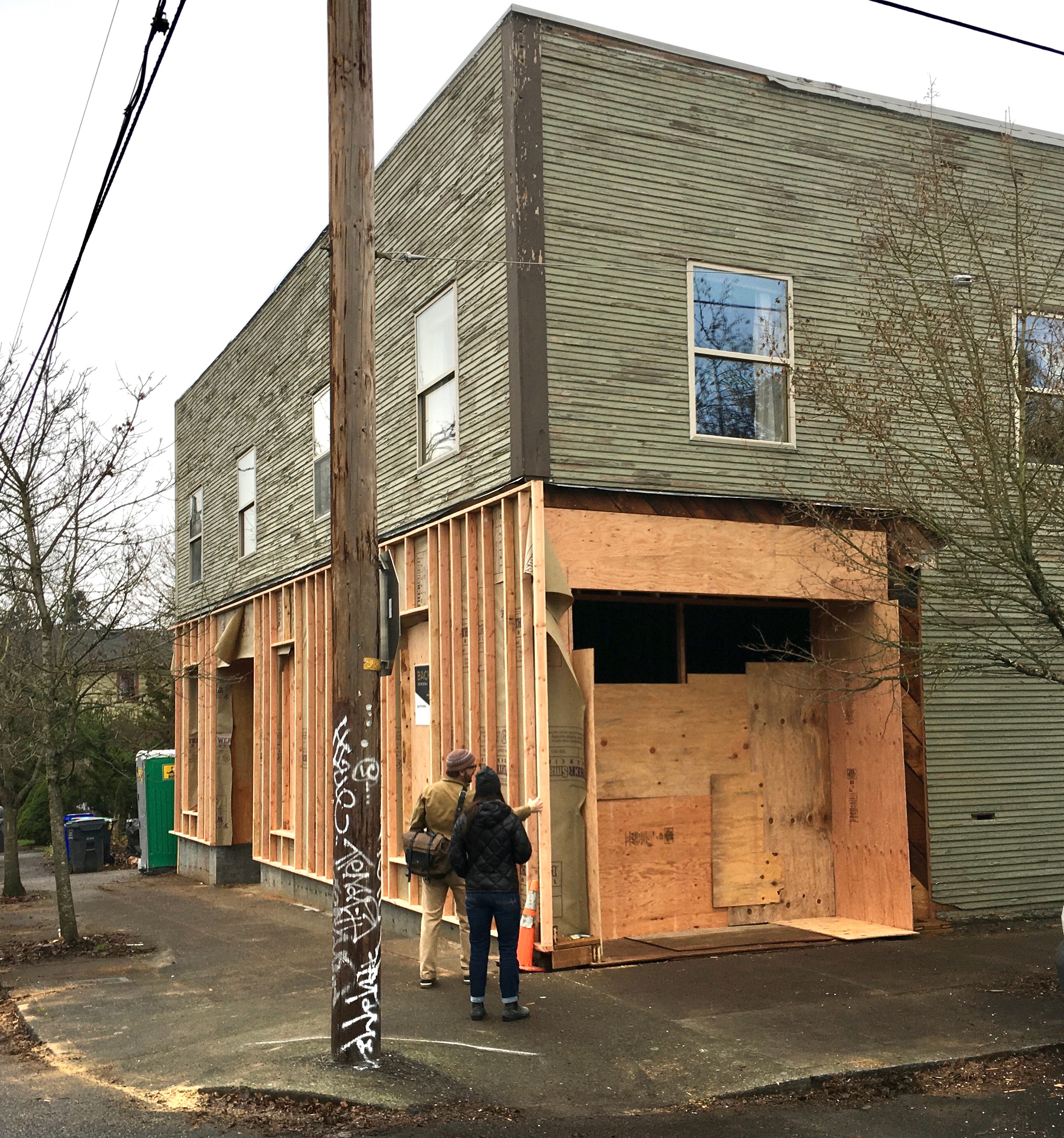
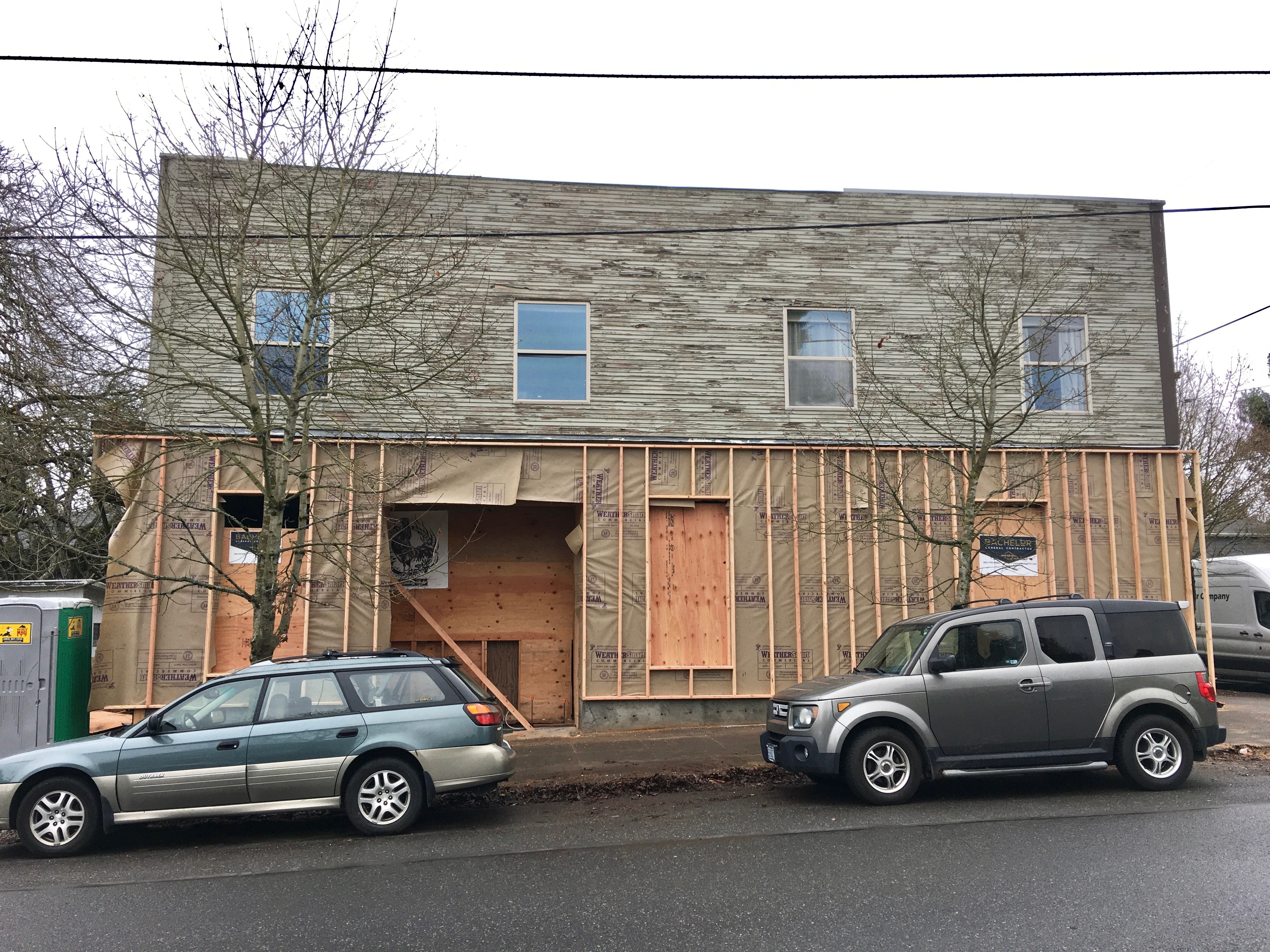
Recent construction activity at the site has piqued neighborhood interest as the building appears to be coming back to life. We’ve been glad to see it hasn’t been a tear down, and we’ve wondered what’s next. The transition to its next chapter is an interesting neighborhood story.

Prescott Fountain Building, 2903 NE Prescott, on December 1, 2021.

Christian Freissler, who lives just up the street and was a frequent shopper at Food King, was in for a convenient gallon of milk one day before the for sale sign went up, when he overheard the Lees talking about closing up shop and selling the building. Freissler is one of three founders of Evolve Collaborative, a Northeast Portland-based product design agency founded in 2014. He and his partners had been thinking about buying a building as headquarters for their 15-person design firm. After Freissler’s visit with the Lees, the seed was planted.

Evolve has moved office several times during its seven years of operation, occupying different rented spaces, but Freissler and partners felt owning a building would be an important investment in creating a secure and sustainable future for the business. When he began to consider the possibilities of the Prescott Fountain building, he and his team got excited.

“Living in the neighborhood, I’m quite sensitive to developers coming in, erasing buildings and putting up multi-story buildings,” said Freissler. “I’m proud of the fact that we’re going to keep the building and renovate it.”

Evolve hired architects Doug Skidmore and Heidi Beebe of Beebe Skidmore Architects. Skidmore describes the project like this: “We’re changing the function of a former mercantile building into creative office space and doing it in a way that is compatible with the neighborhood. It’s an exciting project in part because it is surrounded on all sides by residential neighborhoods.”

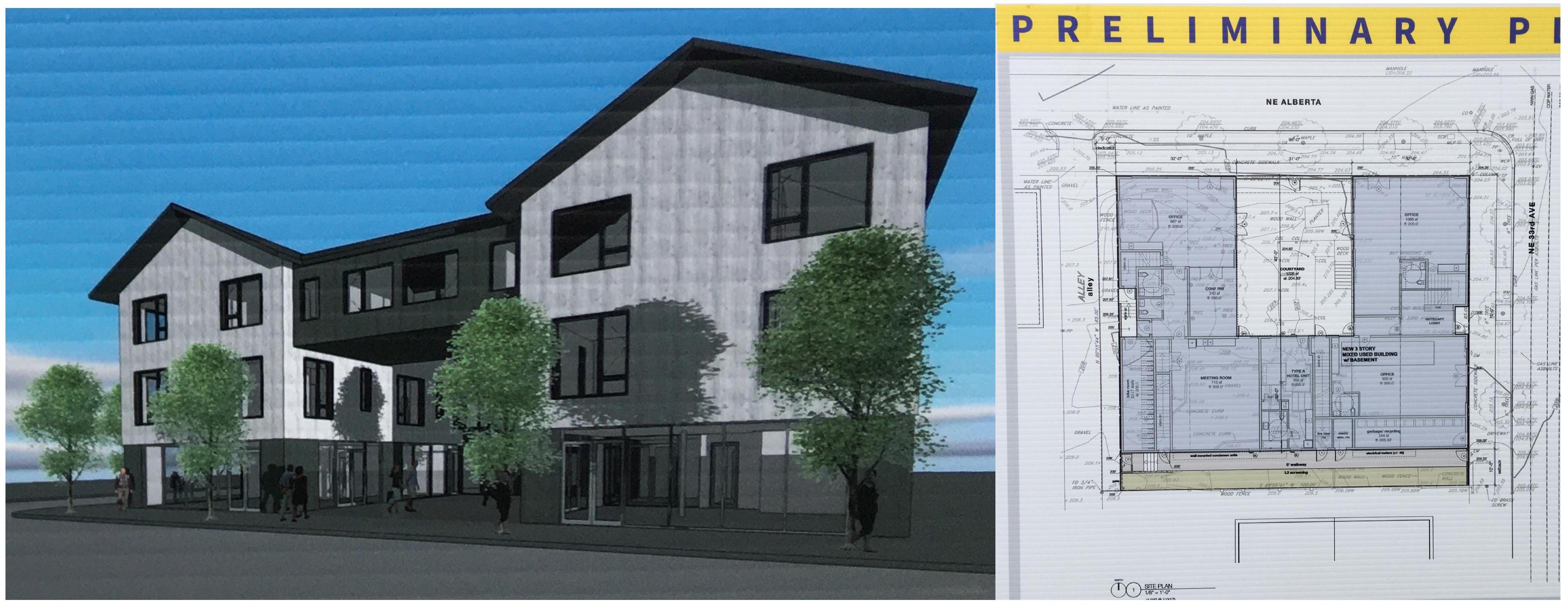
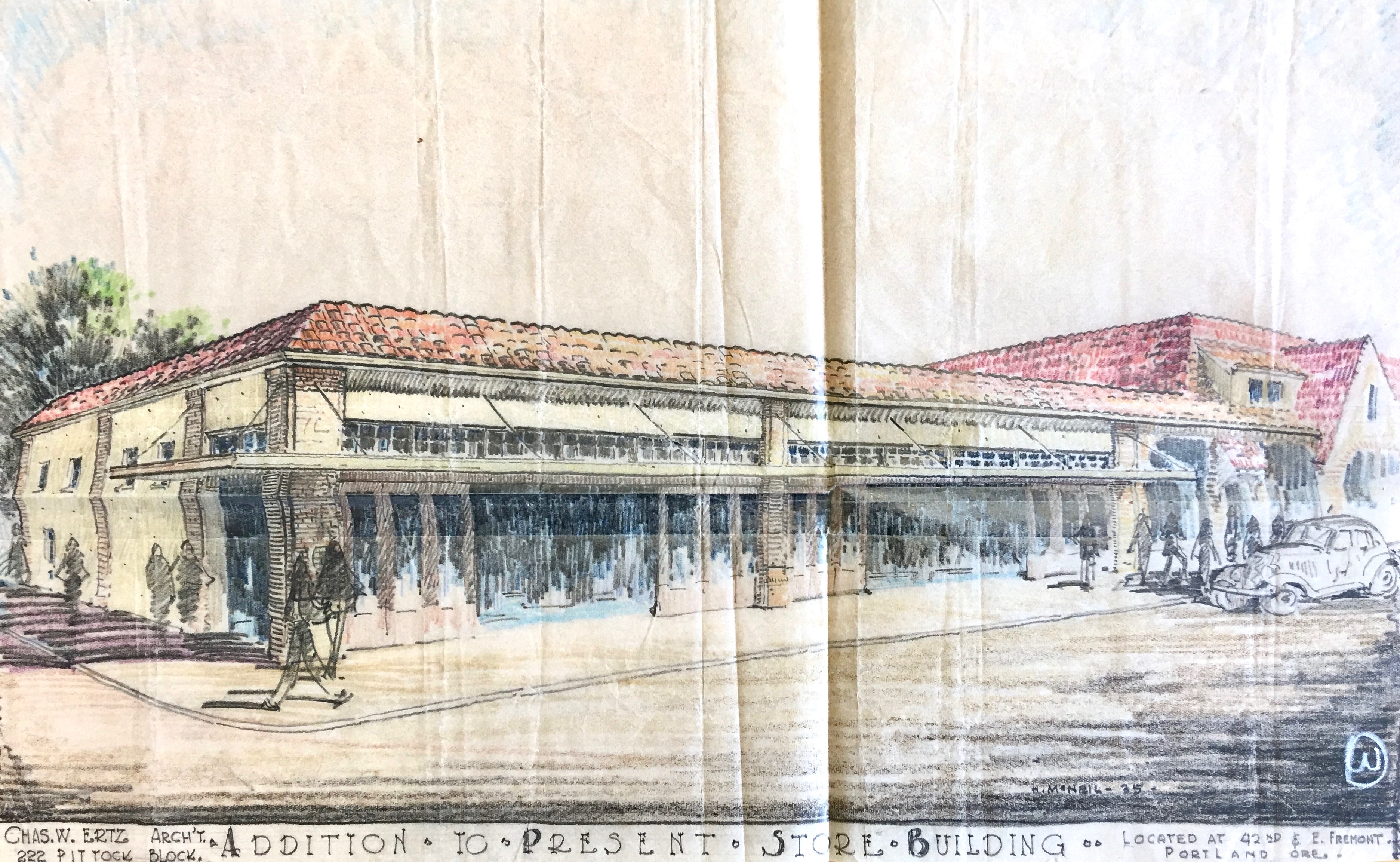
Architect’s rendering of the south side of the building facing NE Prescott Avenue. Courtesy Beebe Skidmore Architects.

Windows dominate the Prescott Street side of the building—reminiscent of a schoolhouse—and the historic awning-style roofline of the original building will remain, complete with the ornate brackets (though the tiles are gone). Three forward-facing larger windows are embedded above in that awning roofline: two facing Prescott and one facing NE 29th, pulling light into the interior space. Inside, exposed original roof trusses and structural members show the building at work. Exterior materials will be stucco and wood combined with the existing masonry.

The main entry to the building will be about where the door to the market was on Prescott. Once inside, there will be a common area, and then two spaces: a larger one to the right that will be home to Evolve on the east side of the building, and a second smaller space on the west side of the building in the area where the old Prescott Fountain was located. Freissler, Skidmore and team are still thinking about how that space will function, but Freissler has been imagining a gallery or some other community space.

The renovation conforms with zoning that favors low-density commercial use compatible with adjacent residential life, limiting each tenant to 5,000 square feet. “The idea is to not have a business that is any larger than a regular house lot,” said Skidmore. “It’s a way of scaling down and keeping the business size compatible with the neighborhood.”

Evolve hopes to be in its new quarters next spring.

Old Building + New Purpose: Good Tidings Church is now Steeplejack Brewing Company

The scaffolds and fences have come down from around the former First Universalist Church of Good Tidings / Metropolitan Community Church at NE 24th and Broadway, and soon the doors will open on the restored and repurposed 112-year-old church building.

The former First Universalist Church of Good Tidings was built in 1909 and has recently been restored and repurposed. It opens to the public soon. Photographed July 2021.

We wrote about the project here last November: neighborhood residents Brody Day and Dustin Harder have been adapting the old church into the new Steeplejack Brewing Company. The two acquired the building in April 2019 from the Metropolitan Community Church which was downsizing to a building in Southeast Portland following 42 years in the space. At the time, another offer was on the table from a local developer who wanted to demolish the church and build a five-story condominium on the site. After a meeting with the pastor and the congregation—and assurance that Harder and Day were planning to keep the building intact—they successfully closed the deal.

Steeplejack opens quietly to the public starting on Friday, July 23rd from 3:00-10:00 p.m. with a grand opening scheduled for Saturday, July 31st, when regular hours begin from 7:00 a.m.-10:00 p.m.

The old church has the distinction of being one of a few buildings in Portland dedicated by U.S. Presidents. William Howard Taft sealed up a small time capsule and set the cornerstone during the building’s opening on October 4, 1909. Day and Harder have the original box (it had been opened some years ago) and plan to set a new cornerstone, sealing in the old box, at 2:00 p.m. on Saturday, July 31st. Next week, they’ll be accepting very small time-travel items that might go into the box.

We had a chance to visit the newly-completed restoration as part of Steeplejack’s soft opening this week and offer these glimpses of the “new” old space:

The front door and location of the historic cornerstone and time capsule, which will be placed on Saturday. July 31 at 2:00 p.m. The original cornerstone was set by U.S. President William Howard Taft on October 4, 1909.
The west face of the building. Note the heart shape in the large stained-glass window, and then have a look on the wall inside (below) as the sun shines through.
An interior scene. Tables built with original structural wood reclaimed during the restoration.

Lead paint sinks Billy Rowe’s wall mural

We’ve heard from the property owner working on restoration of the former Billy Rowe’s Tavern building (recently known as Bernie’s Southern Bistro) at the southeast corner of NE 29th and Alberta.

Unfortunately, the mural on the west wall must go.

We’ve been watching this week as an amazing wall-size advertisement from the 1940s has resurfaced during restoration, and as we’ve learned more about Billy Rowe.

O’Cardinal Properties—the current building owner—was as amazed with the find as the neighborhood was, and intrigued with the possibility of incorporating the original material of the painted wall into the renovated space. But testing for lead late last week returned results that have ruled that out.

“We love the signs and would like to preserve it,” wrote O’Cardinal’s Property Manager Monica Geller in a weekend e-mail exchange.

“However, last week we got the paint tested for lead and it came back with extreme lead paint ratings that will not allow us to retain the mural as is, even with a strong clear coat intended to contain the lead paint.”

Geller and her colleagues are disappointed, especially given their interest and track record of adaptively re-using and renovating older buildings. In southeast Portland at SE 14th and Stark, O’Cardinal updated the 1929 Luxury Bread Building, carrying forward aspects of its history—including old siding, photos of the old bakery operation and family photos and stories from the former owners. Here’s a photo from inside Luxury Bread showing how O’Cardinal used a former painted mural there:

Repurposed wall siding inside the Luxury Bread Building recently restored by O’Cardinal Properties, 1403 SE Stark. Due to high levels of lead found in the Billy Rowe’s mural, something like this is not possible, according to O’Cardinal.

“We have a plan to take a hi-res photo and reproduce the image to use on the building to retain some of the heritage, “Geller continued.

“I know it is going to be hard for the neighborhood to see the boards come down,” she acknowledged, “but there is no feasible way for us to keep the mural in place, so it will be removed.”

More Time Travel on Alberta Street

It’s time for another Alberta Street merchant portrait to add to the growing collection. Meet the crew from Anderson’s Grocery Store Number 5 at 676 Alberta Street, about 1930. That’s 1816 NE Alberta today (thanks to the Great Renumbering). Sent by AH photo friend Norm Gholston, this one is definitely worth a close look so click in for a good look around.

Here’s a challenge: Think you can identify all of the produce on display?

Anderson’s Store, 676 Alberta Street, about 1930. Courtesy of Norm Gholston.

1816 NE Alberta Street, April 2020

At its peak, Anderson’s Grocery was a 39-store chain of “cash stores” (all on Portland’s eastside) built by Carl G. Anderson starting in 1905, so called because there was no book of credit kept; business was “cash on the counter” only. This particular store was Anderson’s fifth and was well established by the time this photo was taken in the early 1930s. On the back of this photo are cryptic notes explaining that the young man in the middle was the person managing the store: James Franklin Frost.

Jim Frost was born in Selma, Oregon in 1905, married Emma Doering from Saskatchewan in 1927, worked for Anderson’s in the 1930s, enlisted in the service in 1943 and returned from the war to run Frost’s Grocery on the southeast corner of NE 30th and Killingsworth. He and Emma lived within walking distance of Anderson’s, and they ran small neighborhood mom and pop grocery stores all their lives.

We’re still working on the identity of the other two gentlemen—the butcher on the left and Frost’s stock clerk partner on the right. All of them in shirts and ties and shiny shoes, how about that?

Grocer Carl Anderson was a bit of an empire builder, and definitely thought of himself that way. This business profile, written not long after the photograph was taken, provides further insight into Anderson’s humble beginnings and rise to grocery stardom.

From The Oregonian, May 4, 1935

In the year after this story, Anderson opened a grocery in a new building at the heart of the Beaumont business district which we know today as Beaumont Market.

For the record, there was also an Anderson’s Grocery at NE 15th and Fremont, but that’s a different Anderson and a story for another day…

Another neighborhood goodbye: Food King Market

We know change is the only real constant in our neighborhood life, but it seems we’ve been saying goodbye to businesses and buildings more frequently than usual these days.

Today is the last day of business for Food King Market, located at 2909 NE Prescott. The building has recently sold and the family that has met the neighborhood’s convenience store needs for the last 20-plus years is closing up shop. There most certainly is a story here about owners David and Kaybee and their own history in the place and where their path leads from here. The neighborhood will miss them and the convenience of having a small market nearby for last-minute needs.

For the building, it’s unclear where the path will lead. The new owner is in conversation with the city regarding permitting and here’s what the official status of remodeling plans says:

“Remodel and change the use of the existing structure (which is now consisting of three units: a grocery store, a residence, and a current vacant unit), to either 100% office or a combination of office and retail sales and service. Also proposed is to convert approximately 500-800 sq ft of existing footprint into covered or partially-covered outdoor areas.”

The silver lining at this point for the neighborhood appears that this is not a multi-story Airbnb hotel or condominium. It seems the new owners are considering repurposing aspects of the original building.

Which leads us to this photo, which accompanied this post we wrote 11 years ago describing the history of the stores that have operated on the site, and shared memories of some of the “kids” who dropped by for iced cokes on credit.

1955, looking northeast from the corner of NE 29th and Prescott. Photo courtesy of Tom Robinson.

Thanks David and Kaybee. We’ll miss being able to zip over for the missing ingredient at the last moment, and we wish you well. And we’ll continue to follow remodel plans for this building which has been a neighborhood institution of sorts for almost 100 years.

Where there’s a will, there’s a way

We’ve been watching two commercial corners just a few blocks apart that share similar histories but are on very different pathways to the future.

We’ve written here about the Logan Grocery, the mom-and-pop grocery store that for more than 100 years has anchored the southwest corner of NE 33rd and Alberta and is now slated for demolition. Here’s a look just as a refresher:

NE 33rd and Alberta, December 2019

In the last week or so, a sign has been posted on the building showing a rendering of the future, which includes demolition of the historic building and then construction of a three-story mixed-use commercial building including a 19-apartment hotel (which we think probably means Airbnb-like short-term rentals) and no on-site parking. Yes, you read that right. Take a look (click to enlarge).

Interviewed in late September, developer Bob Bochsler of Box Real Estate Holdings explained that he wanted to consider ways to utilize the existing building, but that concerns associated with the cost of reinforcing the old foundation drove the demolition decision, nixing any kind of adaptive reuse that would allow the existing building to be repurposed for a new future.

Note that no informational meeting is required for this significant change, though there is contact information and a cryptic note that the project might be amended.

~

Meanwhile, A few blocks over, at the northeast corner of 30th and Emerson, a similar but very different story is unfolding. Here, a 107-year-old wood-frame mixed-use commercial building that was once also a grocery store (and many other things) is being restored and repurposed as the home of a medical practice and neighborhood coffee shop. Take a look:

Dr. Thomas Grace and Rachel Buckwalter inspect the southwest corner of their future place of business. Clinic entry to the right, coffee shop entry to the far left. December 2019.


West side, coffee shop to the left, clinic to the right. Apartments upstairs. December 2019.

There’s lots more to learn about this old building, constructed in 1912, which once housed two businesses on the first floor facing NE 30th, and two apartments upstairs. Back in the day it was a grocery store. It’s been Cecilia’s Drapery Shop, Jack Emerald’s Barber Shop, The Quaint Shop (an art supply business), a men’s clothing shop, a dry goods store and many other things.

Here it is in the 1924 Sanborn Fire Insurance map, showing it’s pre-address-change addresses of 1122 and 1124 East 30th Street North (downstairs) and 1122 ½ (upstairs). Look in the lower right-hand corner. S=shop. D=dwelling. A=automobile or garage.

Detail from Sanborn Fire Insurance Map Plate 535, 1924.

Dr. Thomas Grace and Rachel Buckwalter bought the two-story building this last year and have been busy getting it ready for its next chapter, which begins this coming spring. The couple own and operate Natural Pain Solutions, a chiropractic practice focused on non-surgical spinal decompression, integrated care and treatment for pain. When it opens in spring, the practice will be Move Better Chiropractic.

Their former clinic had been located in the Macadam Center building which was destroyed by fire in January 2018. After the fire, Thomas and Rachel—who are Vernon neighborhood residents—were on the lookout for a new venue. When Rachel saw the for sale sign on the building last spring, she called on a whim, walked through later that day and fell in love with the building. Thomas saw it the next day and they knew renovating the space would work for them. Within weeks, they had started talking with architects.

Since then, there have been plenty of conversations with engineers, estimators, architects and contractors to determine the feasibility of adapting the building to meet their needs, but in their minds demolition was not a solution.

Yes, the foundation is 107 years old and like all old foundations in the neighborhood has its issues and needs. But instead of considering that a deal breaker, a partial new foundation wall has been added, seismic stabilization work has been done, and additional structural timber has been added.

The renovation design concept—by Portland firm Works Progress Architecture—starts with the structural work and completely renovates the interior space, fitting it inside the existing exterior building envelope, offering a contrast between old and new. The clinic and a new coffee shop will occupy the first floor, with glass roll-up garage doors in the coffee shop on the north face of the building opening onto an open outdoor patio and hanging-around space. Friends of Grace and Buckwalter own and operate Full City Rooster (a craft coffee roaster in Dallas, Texas) and will be helping Grace establish the coffee shop in the renovated building.

North side where the roll-up garage door will open into the patio/open space. December 2019.

Upstairs, the existing apartments are being renovated. In the future, Grace and Buckwalter hope to convert the two existing apartments into four studio apartments.

A repurposed small building in the open lot to the north will hold Buckwalter’s new business, “Moss,” which will feature an unusual mix of garden-related items and specialty intimate clothing for women.

The couple—who live a few blocks away in a 1912 bungalow with their four children—appreciate living and working in vintage spaces. The building is not far from the busy Foxchase corner of NE 30th and Killingsworth, and just a few blocks north of Alberta. Being on Trimet Bus 72 is also a plus (they’ve added a get-out-of-the-rain portico to the west face of the building for riders).

So, why did they decide not to go for the demolition option and to invest in making an old building work?

“We like the building and we think it will look beautiful with a couple upgrades and modifications,” said Grace. “We see this location as a natural transition between Killingsworth and Alberta Street, and hope to be a connection point in the community. We hope that the outdoor space will serve as a public area and place of informal gathering.”

Where there’s a will, there’s a way.

109-year old store on Alberta Street slated for demolition

Big changes are underway at the southwest corner of NE 33rd and Alberta. The 109-year old grocery store building–built when there were more horses than cars in Portland and before streets in this area were paved–is slated for demolition and will be replaced by a three-story, mixed use condominium / office building. Public notices have recently been posted on the property by the City of Portland alerting its status as being in a 120-day demolition delay.

This photo from the 1920s shows the Logan Grocery, a view looking southwest from the corner of NE 33rd and Alberta. NE 33rd Avenue, then known as the “county road,” was not yet paved. Photo courtesy of Bob Wilson.


A similar angle, September 26, 2019


Looking north along the NE 33rd Avenue side of the store, September 26, 2019 


The public notice posted on the property, September 265, 2019.

Developer Bob Bochsler of Box Real Estate Holdings in Portland expects demolition to take place in 2020 with construction to follow. While drawings for the new structure are not yet complete, Bochsler envisions a building with a pitched roof and an inner courtyard facing NE Alberta. “I want it to be in keeping with Pacific Northwest style,” said Bochsler.

When he first approached the project, Bochsler said he wanted to consider ways to utilize the existing building, but costs associated with reinforcing the foundation made adaptive reuse not cost effective.

The property is ranked in the City of Portland’s Historic Resource Inventory, recognizing its significance for potential historic register designation. However, because past owners have never listed the property in the National Register of Historic Places, it can be torn down after a brief delay.

Operated from the 19-teens until the 1940s as “Logan’s Grocery,” the building cycled through multiple owners in the 1950s-1970s, known as Zwhalen’s Market and then as Romoli’s. From the late 1970s until recently, the building contained the studio and residence of Portland artist Jay Backstrand.

The building in March 1962, as Ernie Zwhalen’s Market. Photo courtesy of City of Portland Archives, image A2011-013.


Concordia resident Bob Wilson, grandson of second-generation former storekeepers Anna and Earl Logan, has fond memories of the store from its heyday, and shared photos of the Logans behind the counter of their store taken in the 1940s.

Anna Logan and Earl Logan pictured inside their store at NE 33rd and Alberta during the 1940s. Courtesy of Bob Wilson.

In a recent e-mail, Wilson shared these memories:

“When I was a small child, my grandparents lived in the house just south of the store. My grandmother would fix lunch every day for my grandfather Earl and bring it over to him. Earl was the storekeeper. Anna was the butcher for the store. As a small boy it was so much fun to be with my grandparents, and then to go over to their store and see all of the people who dropped by.”

We welcome photos, memories and stories about the life of this building and its corner over the years, and will continue to follow plans for demolition and construction.

Read more here on the blog about the storefronts of NE Alberta, nearby mom-and-pop grocery stores, and some of our photo detective work identifying other old Alberta Street businesses.

Remember the ANP Market at 15th and Fremont?

We’ve been focusing this spring on NE 15th and Fremont, which has seen significant change during the last 100 years, including zone changes, multiple demolitions and major commercial construction, and the coming and the going of the Irvington Streetcar.

Throughout all this change, there’s been one steady witness at the northeast corner of the intersection that has seen it all: the former Anderson’s Grocery Company building, 1501 NE Fremont. Today it’s Daddy Mojo’s Cafe, and it’s had a long and interesting history. Here are two views about 20 years apart that will help turn back the clock.

Looking east on Fremont at NE 15th, May 1963. Taken as part of a petition for a zoning change that would eventually remake this intersection. Courtesy of City of Portland (OR) Archives, (ZC 4309). A2011-013. Click to enlarge the photo…there’s lots of detail there.


A similar view from 1985. In this photo, the ANP Market was in the process of becoming Roxanne’s, and the Fremont Pharmacy was the Full Holy Ghost Mission Church of God, Inc. Courtesy of City of Portland (OR) Archives, A2008-008.2113.


Contemporary view, April 2019.


Built in 1923 by Andrew W. Anderson, this Mom-and-Pop corner grocery fed the neighborhood for many years, first as Anderson’s Grocery Company and then as the ANP Market. In the 1970s it served as a district office for the Multnomah County Juvenile Court.


Today’s sushi restaurant next door was Fremont Pharmacy from 1923 well into the early 1960s when it became a variety store. During the early pharmacy years, the business also doubled as the designated public polling place for the neighborhood in the mid-1920s.

We’re digging deep into the various chapters of this building’s stories (Anderson’s Grocery Co., the ANP Market, the district office Roxanne’s, Mojos and everything in between) and welcome memories and stories from AH readers. Drop us a note with your recollections (doug@alamedahistory.org) and we’ll share what we learn.

Beaumont Market Corner: Two buildings as one

On a recent visit to City Archives, we turned up a great old photo of a local landmark you’ll recognize, and some amazing drawings that allow for Beaumont neighborhood time travel and trivia. Let’s start with the photo (from 1929) and its companion view today:

Looking south at NE 41st and Fremont. Top, September 1929. Courtesy of City of Portland Archives, A2001-062.46. Bottom, same view in March 2019.

This building was designed and built by Shipley & Snashall, a partnership between two carpenters operating from 1922 until 1931. George Shipley and Valentine G. Snashall specialized in design and construction of eastside retail spaces, though they built several residences as well.

Their most well-known work is the building that in 2019 houses Peet’s Coffee and several other shops at the northwest corner of NE 15th and Broadway—you can see clear family resemblances—which was added to the National Register of Historic Places in 1992. Shipley & Snashall completed the Beaumont building—which in our opinion is also likely register-worthy—in September 1928.

Our other recent archive discovery relates to the Beaumont Market building due east of the Shipley & Snashall building and which most people assume is all part of the same structure. Amaze your friends and neighbors with local trivia by explaining how the market building was actually built seven years after the signature buildings at the corner.

In January 1935, before being issued a building permit, architect Charles Ertz had to demonstrate how his adjacent market building would meet a contingency in zoning requirements at the intersection and be “in harmony” with the older buildings. So he submitted these colored-pencil renderings on onion-skin paper, which just about left us speechless when we found them recently. Click into these for a good look:


Here’s the related correspondence: a “do pass” recommendation from the Commissioner of Public Works and lead building official giving City Council a thumbs up to proceed, which they did unanimously.

Courtesy City of Portland Archives, reference A2001-062

Like many of us, you may have thought all those storefronts at NE 42nd and Fremont were one single building. Now we know. Tip of the hat to the architect!

If you haven’t already seen them, a ways back we shared a half-dozen or so photos of Beaumont from the 1920s along with a deep dive into the retail history of the intersection. Be sure to check them out here, here and here. And our short biography of architect Charles Ertz.


NE 33rd and Killingsworth: From rural road to busy intersection

In our ongoing pursuit of insight about the early days of Northeast neighborhoods, we’ve come across a zoning change petition filled with photos and maps from 1929 that allows an interesting glimpse into the evolution of today’s busy intersection at NE 33rd and Killingsworth in the Concordia neighborhood.

We’ll whet your appetite with this 1929 photo of a fine bungalow, owned by Frank and Louella Watson that was located at the northwest corner of NE 33rd and Killingsworth (facing 33rd), on property now occupied by the Mud Bay pet store.

Looking west across NE 33rd at the Watson house, a tidy-looking bungalow surrounded by highly manicured hedges and gardens, that occupied what is now the parking lot for Mud Bay. Photo taken on August 15, 1929. The sidewalk running off into the distance at left parallels Killingsworth. Photo courtesy of Portland City Archives, A2001-062.57.

At the turn of the last century, John D. Kennedy owned much of the land between Killingsworth, Ainsworth, NE 33rd and NE 42nd, which he platted as the Kennedy Addition. By 1910, he was carving up the fields into building lots and a handful of houses were being built. In 1913 he sold the city a four-acre parcel that is now Kennedy School, which opened in 1914. Kennedy knew an emerging neighborhood would need a school and he was, after all, in the business of selling lots for homebuilders.

The Oregonian reported at the time this part of NE 33rd—which was also known as the Sunderland Road north of Prescott—was still unpaved and mostly used for moving cattle and sheep, and that the surrounding area was heavily wooded with only a few scattered houses.

By the mid 1920s, more homes had been built in the area, particularly along NE 33rd. At the southwest corner of 33rd and Killingsworth was a small Red and White Market. At the southeast and northwest corners, bungalows had been built. At the northeast corner of Killingsworth and 33rd pictured below, Kennedy owned an open field that once housed a barn (a kind-of local landmark known as “Kennedy’s Barn”). You can see some of the wood left over after the barn’s demolition.

Looking east across 33rd at the open lot at the northeast corner of 33rd and Killingsworth where Kennedy’s barn once stood, June 15, 1928. The street running off into the distance at right is Killingsworth. Taken from the Watson home pictured above. Photo courtesy of Portland City Archives, A220-062.54. Contemporary photo showing the same view today.

Even though the area still had a strong rural residential feel, Kennedy could already visualize how things would go: the school and homes were ripe for their own commercial district. So, in the summer of 1929 he put the re-zoning wheels into motion to get his parcel ready for commercial development.

Here’s a look at the area from a 1925 aerial photo:

Detail of a 1925 aerial photo. Kennedy School is visible in the upper right corner. Kennedy’s field appears just above the “NG” in the original hand lettering on the photo (now a 76 gas station). The red dashed line indicates the location of present day New Seasons Concordia. Click for larger view. Aerial photo courtesy of City of Portland Archives.

In 1929, Portland’s zoning code was fairly simple: Zone 1 was for single-family residential use; Zone 2 was for multi-family residential use; Zone 3 was for business and manufacturing; and Zone 4 was unrestricted. (Here’s a link to a great history of zoning in Portland).

At the time, the northeast corner of the intersection owned by Kennedy had been zoned for residential use, but he wanted it to be Zone 3 to develop the property for commercial use. In his petition, Kennedy described his vision to build a commercial corner just like the one in Beaumont at 42nd and Fremont (he actually included a photo of that building), or a filling station. Kennedy pledged that if the zone change was allowed, he would personally see to it that “no cheap construction will be permitted,” and that “it will be so kept that it will be an attraction to any business Street intersection or residence district.”

Neighbors weren’t wild about the idea.

On October 12, 1929, adjacent property owners submitted a hand-drawn and color-coded map that recorded exactly how they felt. Owners with properties shaded green wanted the area to stay restricted to residential. Those shaded yellow were in favor of Kennedy’s petition for zone change to commercial. Have a good look and you’ll figure out pretty quickly which properties were owned by Kennedy. It’s also interesting to note the third category (yellowish green), which were neighbors in favor of the Kennedy petition at first but who then changed their minds.

Map drawn by neighbors showing opposition to rezoning of the Kennedy property for commercial use. Click to enlarge. Courtesy of City of Portland Archives, File A2001-062.

Here’s where it gets visually interesting.

Along with their map, neighbors submitted photographs to help the Planning Commission understand the residential character of the neighborhood and the potential impact of a zone change. We paired these with similar views photographed on a snow day in early February 2019.

5434 NE 32nd Place (formerly 1160 E. Glenn Avenue, the Svensen family home). The southeast corner of NE 32nd Place and Killingsworth. Photographed on August 14, 1929. Courtesy Portland City Archives, A2001-062.60.


5506 NE 32nd Place (formerly 1150 E. Glenn Avenue, the Eaton family home). The northeast corner of NE 32nd Place and Killingsworth. Photographed on August 14, 1929. Courtesy Portland City Archives, A2001-062.61. We wonder if the homeowner realizes the house once had an extended front porch and pergola, and a completely different siding material.


5526 and 5606 NE 34th Avenue (formerly 1166 and 1168 E. 34th Avenue, the Nellie White and C.C. Cooper family homes, respectively). Photographed on September 19, 1929. Courtesy Portland City Archives, A2001-062.65.


What was then a newly constructed building at the southwest corner of 33rd and Killingsworth, known as Hollinshead’s Corner, named for the developer who built the building. Looking southwest across Killingsworth. Note the entry archway and façade that is still standing. Photographed on September 30, 1929. Courtesy of Portland City Archives, A2001-062.67.


The market at Hollinshead’s Corner, looking west across 33rd, just south of Killingsworth. The edge of the decorative archway is visible at far right. Photographed on September 30, 1929. Courtesy of Portland City Archives, A2001-0672.66.


5343 NE 33rd and 5407 NE 33rd (formerly 1137 and 1139 E. 33rd Avenue, homes of Mrs. Mercier and H.C. Wright, respectively). Directly across from present day Canon’s Ribs. Photographed on August 30, 1929. Courtesy of Portland City Archives A2001-062.63.


The neighborhood submitted these photos and the map as the battle about Kennedy’s requested zoning change played out in late October 1929:

From The Oregonian, October 29, 1929.

Because of the local turmoil and the fact that any Planning Commission recommendation would have to come before City Council for a vote, the electeds took the item off the agenda for several months, and then wanted to come out and have a look for themselves. Action on Kennedy’s petition dragged into 1930.

From The Oregonian, March 15, 1930.


When City Council visited the site in March 1930, they had in hand the following do-pass recommendation from the Planning Commission:

Inasmuch as the southeast and southwest corners of this intersection have been changed to zone three, the Planning Commission recommends this change be granted providing the petition agrees to set all buildings fifteen feet back from the street lines on both 33rd Street and Killingsworth Avenue. This requirement was agreed to by property owners on the south side of the street when their change was granted.

Following the visit, Commissioner of Public Works A.L. Barbur recorded the following in support of Council’s eventual decision to approve the change.

The members of the Council viewed the site of the proposed change of zone, and after careful consideration of the matter were of the opinion that the zone change should be allowed provided the property was used for either of the purposes outlined by the petitioner in his letter, and a fifteen-foot set back line established.

Neighbors around 33rd and Killingsworth and teachers at Kennedy School couldn’t have been very happy, but the story fades into the background. The Great Depression intervened and the thought of any commercial construction was put on hold. Aerial photos from 1936, 1940 and 1951 show the intersection unchanged, Kennedy’s open field on the northeast corner still very much open. By 1956, filling stations had been built on both northeast and southeast corners, but Watson’s tidy bungalow was still there.

Meanwhile, there was either solidarity or sour grapes when in 1932—two years after the Kennedy petition decision—City Council denied a similar zone change request just a bit farther south on 33rd at Knott Street:

From The Oregonian, July 1, 1932.

Interesting how decisions from long ago do affect the way the landscape has turned out today (and the corollary that our decisions today shape future outcomes). Imagine if these council actions had been just the opposite, with 33rd and Knott transformed into a busy commercial intersection and Killingsworth and 33rd the quieter residential area.

Next up: How other decisions made by John D. Kennedy gave Concordia some of the longest blocks in the area.

%d bloggers like this: