Time to make art – Engage in The Change

A few months back we participated in Concordia Conversations, a program about how change has affected Northeast Portland neighborhoods. It was a helpful and provocative gathering involving multiple generations, cultures and perspectives. Our message—as you might guess—was that this has always been a place of change.

Program host, neighbor and artist Jordana Leeb shared a great 25-minute documentary about how recent changes have affected her part of the Concordia neighborhood, which we recommend (you can watch it here).

Continuing to build on the theme this summer, Jordana is curating a community art show called “Engage in the Change.” For now, it will be virtual but later this summer and fall (think Phase 2 opening) she’s hoping to exhibit the art somewhere in the neighborhood.

She’s asking for creativity from you and your family members–art, poetry, music–to explore the topic of neighborhood change. And there’s a chance you might even win some $ for your submittal.

Here are the guidelines:

  • Artwork can include visual art of any kind, written poetry, spoken word, video or music. Cash prizes are available (and there’s a category with a $100 prize for artists under age 18).
  • Art should explore what community means; how our community has changed; how neighborhoods bring us together (or keep us apart); changes you have seen and how they have affected you; what makes us resilient.
  • Deadline for submittal is August 15, 2020.

Here’s a link for more information about this community art show. Plenty of time yet for your creativity, and it would be great to see a bunch of submissions from young people!

Seeking Dekum Court Memories

Do you have a memory or photo from Dekum Court or know someone who does? I’d like to hear from you.

For a time during the early 1940s, the Concordia neighborhood was home to one of the first wartime housing projects in Portland: the Dekum Court Project, an 85-unit complex of housing for non-commissioned officers and their families stationed at the Portland Air Base.

A newspaper photo of living quarters at Dekum Court from The Oregonian, November 8, 1942.

From 1942-1945, 300 military family members of all ages lived in 53 buildings which covered a 15-acre site located between NE 24th and NE 27th avenues, from Dekum and Lombard.

Here’s a map and a site plan to help you visualize:


Courtesy City of Portland Archives, A2001-025

It’s a fascinating and rich story: development of the site for wartime housing; subsequent repurposing as public housing managed by the Housing Authority of Portland; and later partial redevelopment as a ranch-house-subdivision. The original wartime housing quarters are now gone. But there must be stories and memories that remain.

I’m in the research phase of learning more about Dekum Court and would like to hear from anyone who has memories or photos to share. Please drop me a note (doug@alamedahistory.org).

Stay tuned, we’ll come back to Dekum Court in the months ahead with the full story of its development and early life.

Another View | 30th and Emerson

Recently we’ve written about the adaptive reuse of a former neighborhood grocery store located at the northeast corner of NE 30th and Emerson. Its rebirth as a health clinic and neighborhood coffee shop is as inspiring as another story is disappointing: the impending loss of the Logan Grocery at NE 33rd and Alberta.

Today’s post provides a 40-year look back at NE 30th and Emerson and is the fruit of time spent at one of our favorite places, Portland City Archives, where we’ve been recently working on several research projects (the Vernon water tank is in the pipeline, so to speak, and we’ve found some great photos of that giant coming soon).

While searching for views of some former local grocery stores we’re tracking, we came across this gem from 1980. Click in for a good look.

Looking northeast at the corner of NE 30th and Emerson, 1980. Courtesy of Portland City Archives, image A2011-028 APF/15624. A quick look back through newspapers and directories from the 1980s confirms that Premier Real Estate Services, owned by Wayne Jacox, operated from this storefront.

Here’s a similar view today:

NE 30th and Emerson, January 2019.

No telling when the thin clapboard siding went on (or the T-111 siding came off) and the transom windows were removed. Upstairs windows haven’t changed, nor has the utility pole out front with the stop sign on it. The corner entry is gone, as is the 30th Street entry to the upstairs apartment. Gas meters are still in the same place as 1980. And from the 1980 picture, you can see the two distinct storefronts from the way-back past that align with what the 1924 Sanborn map shows at 1122 and 1124 East 30th Street North.

Definitely worth 1,000 words. Thanks City Archives!


Concordia Conversations: January 12th

Here’s an upcoming free neighborhood event that will bridge past, present and future that might be of interest to AH readers:

“Concordia Conversations,” on the afternoon of Sunday, January 12th, will bring together a panel of neighbors to reflect on the drivers of change in Northeast Portland and to view a short film titled “Diary of a Street,” by Portland artist and neighbor Jordana Leeb. The program will be held at the Cerimon House (5131 NE 23rd) from 3:00-5:30 p.m. on Sunday January 12th.

Panelists include: Bob Boyer, long-time Concordia resident, former State Senator and Northeast Coalition of Neighborhoods chair; Chris Guinn III, owner of Dwell Realty and Elevated Coffee; P. Elise Scolnick, current Board Vice-President for Alberta Main Street and long-time resident; and Diane Linn, Executive Director of Proud Ground, a Portland-based community land trust.

We’ll be there too with a brief program looking back at the early years of neighborhood history.

The program is free, though an RSVP is requested. For more information: tinyurl.com/concordiaconversations

Where there’s a will, there’s a way

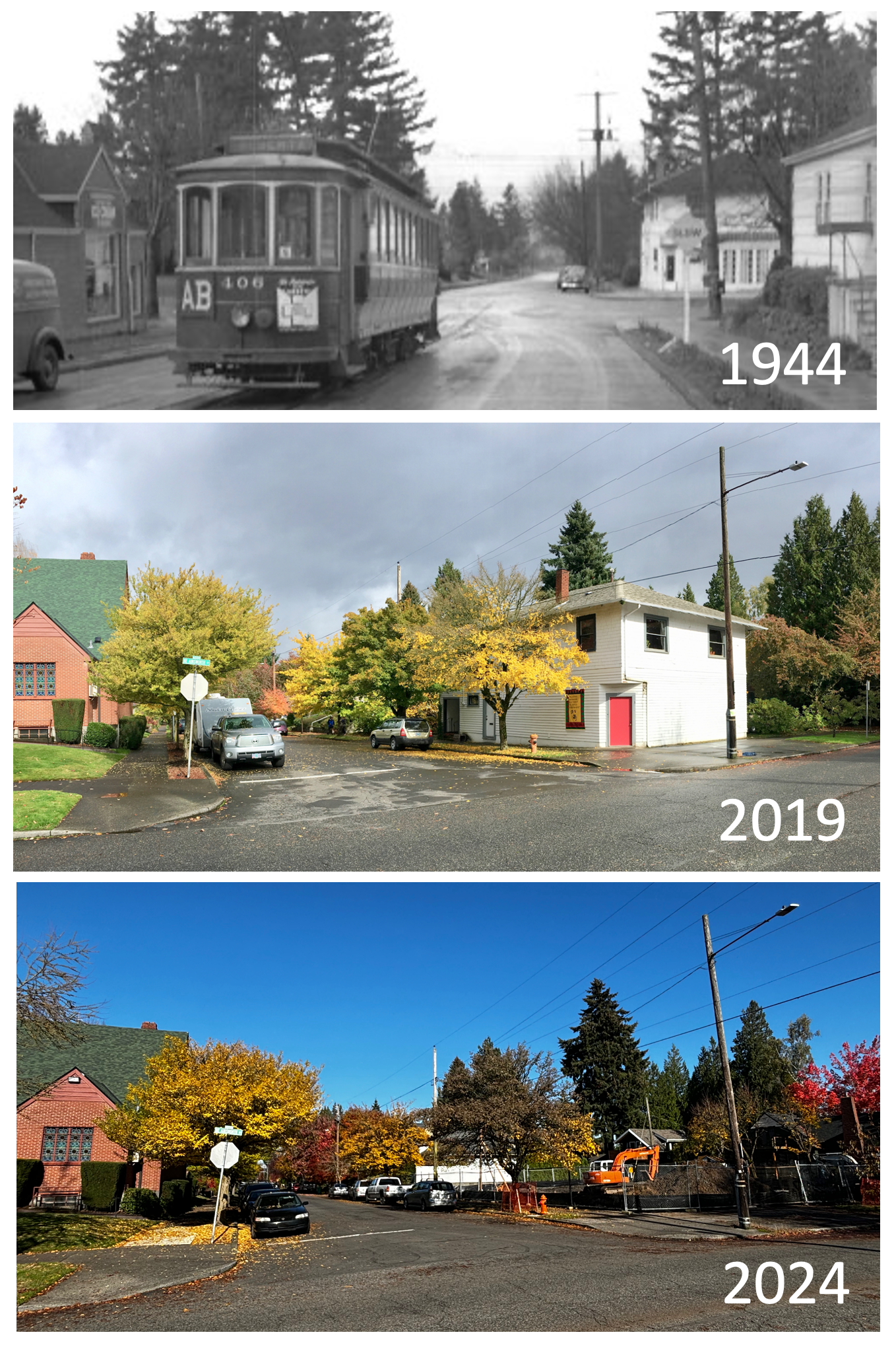
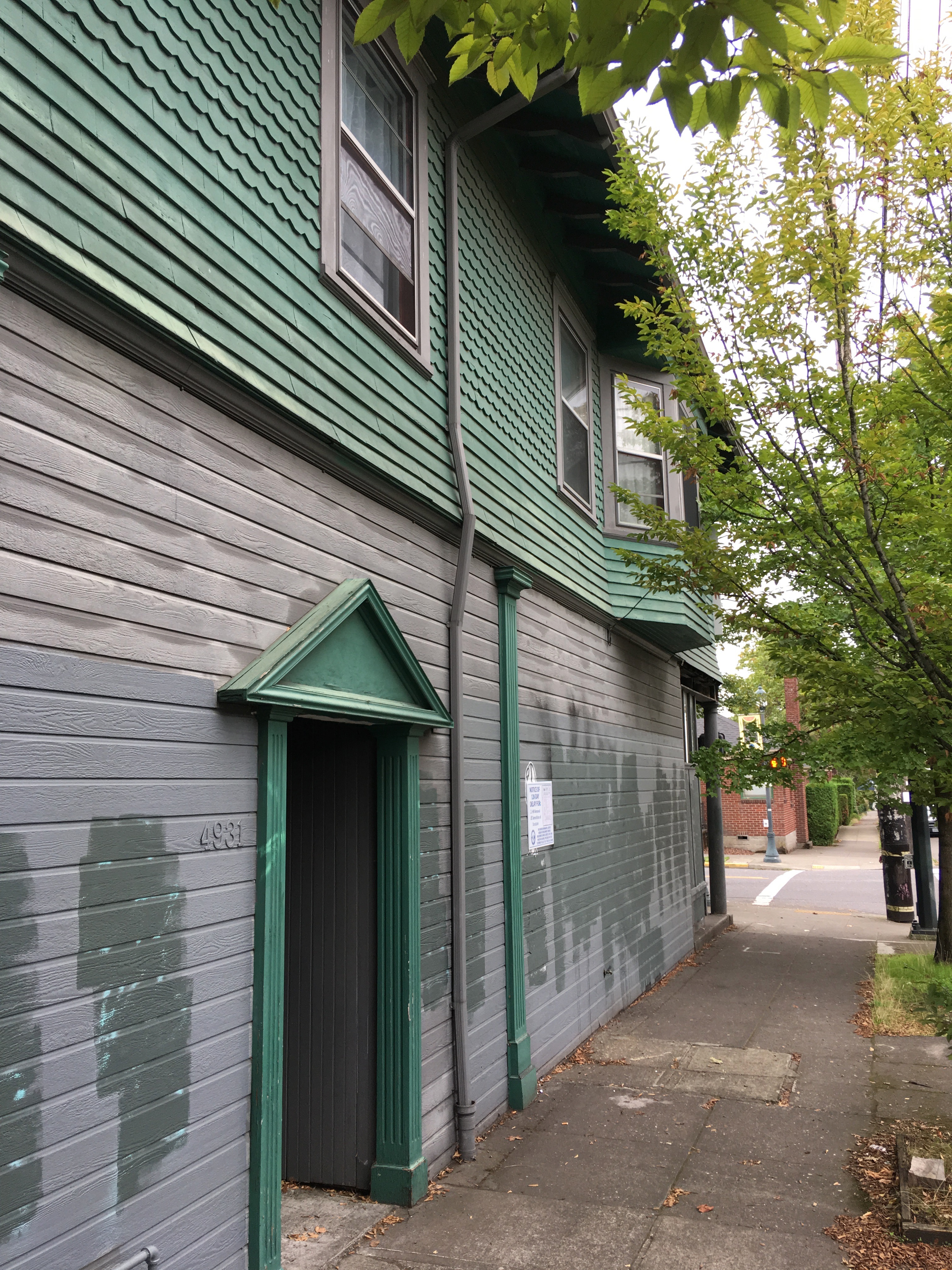
We’ve been watching two commercial corners just a few blocks apart that share similar histories but are on very different pathways to the future.

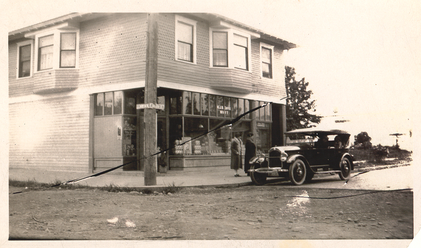
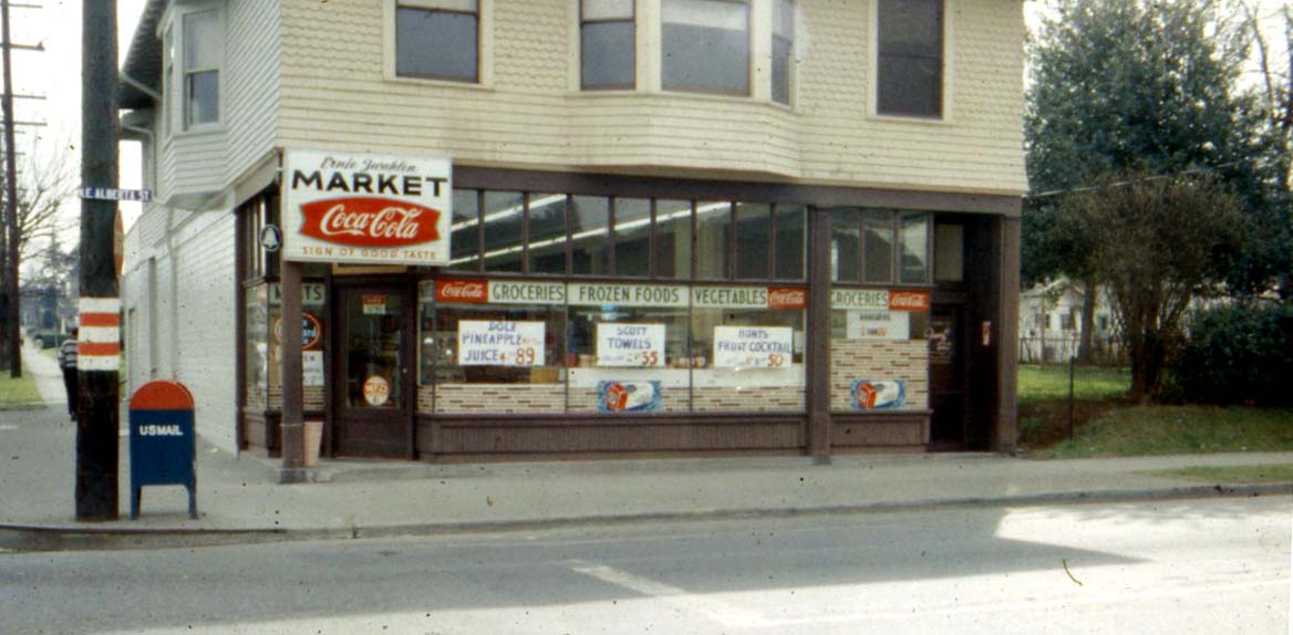
We’ve written here about the Logan Grocery, the mom-and-pop grocery store that for more than 100 years has anchored the southwest corner of NE 33rd and Alberta and is now slated for demolition. Here’s a look just as a refresher:

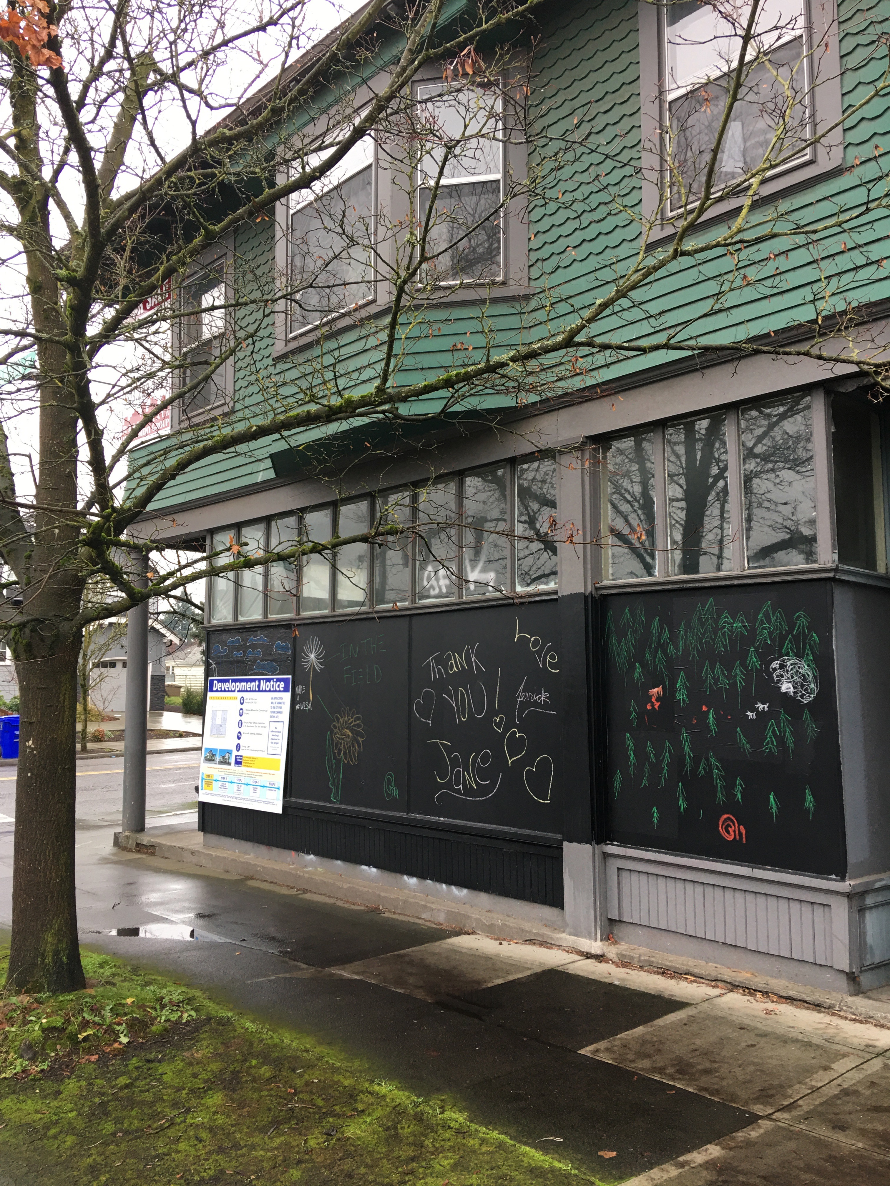
NE 33rd and Alberta, December 2019

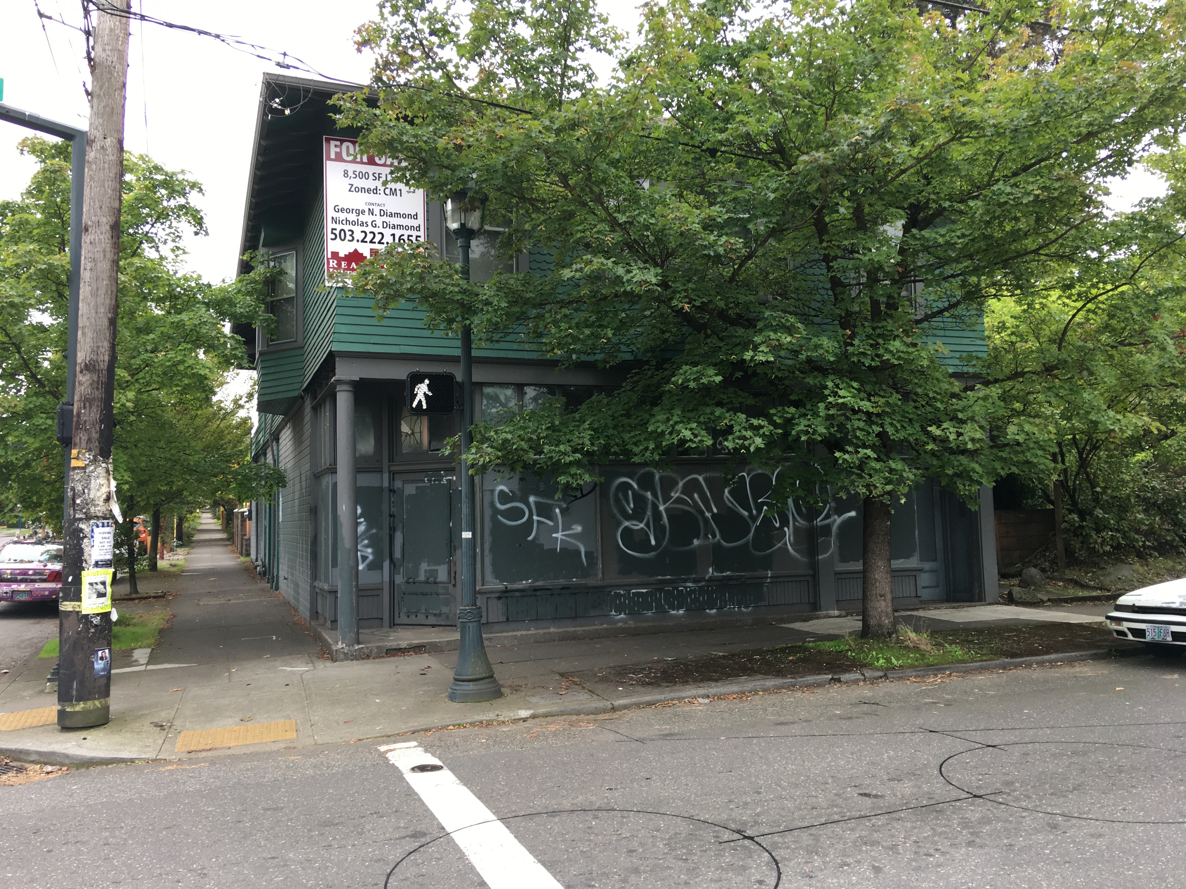
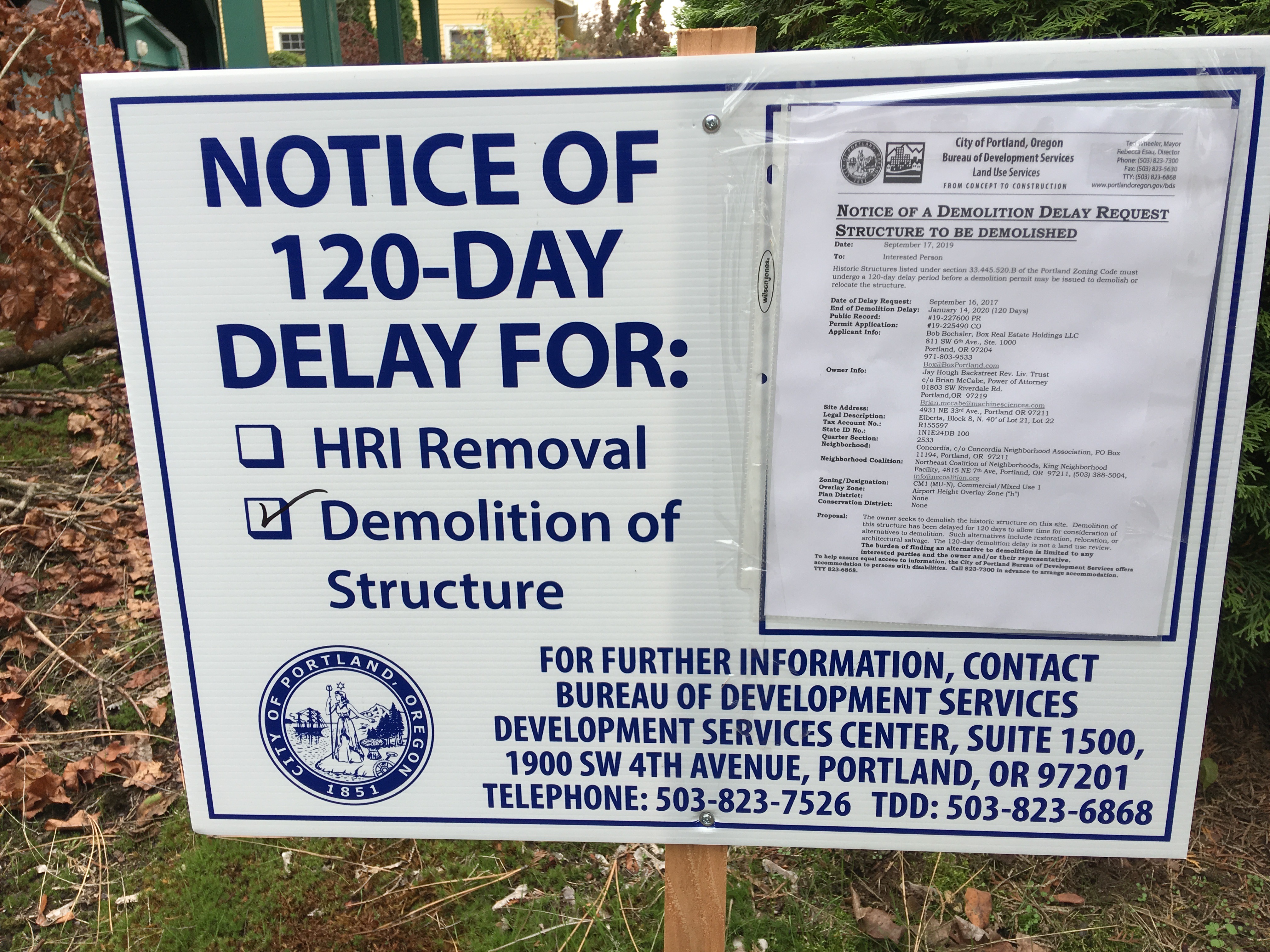
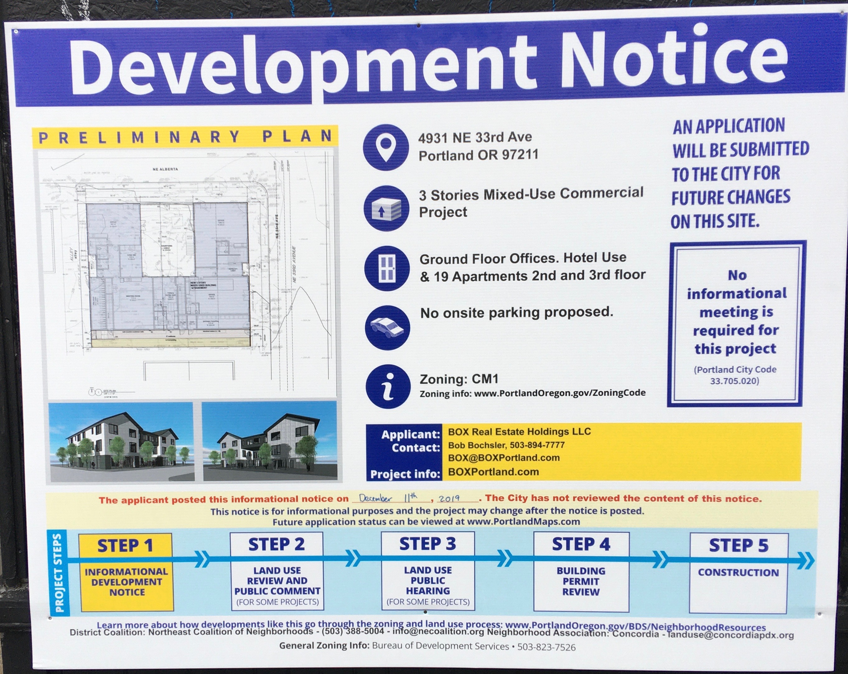
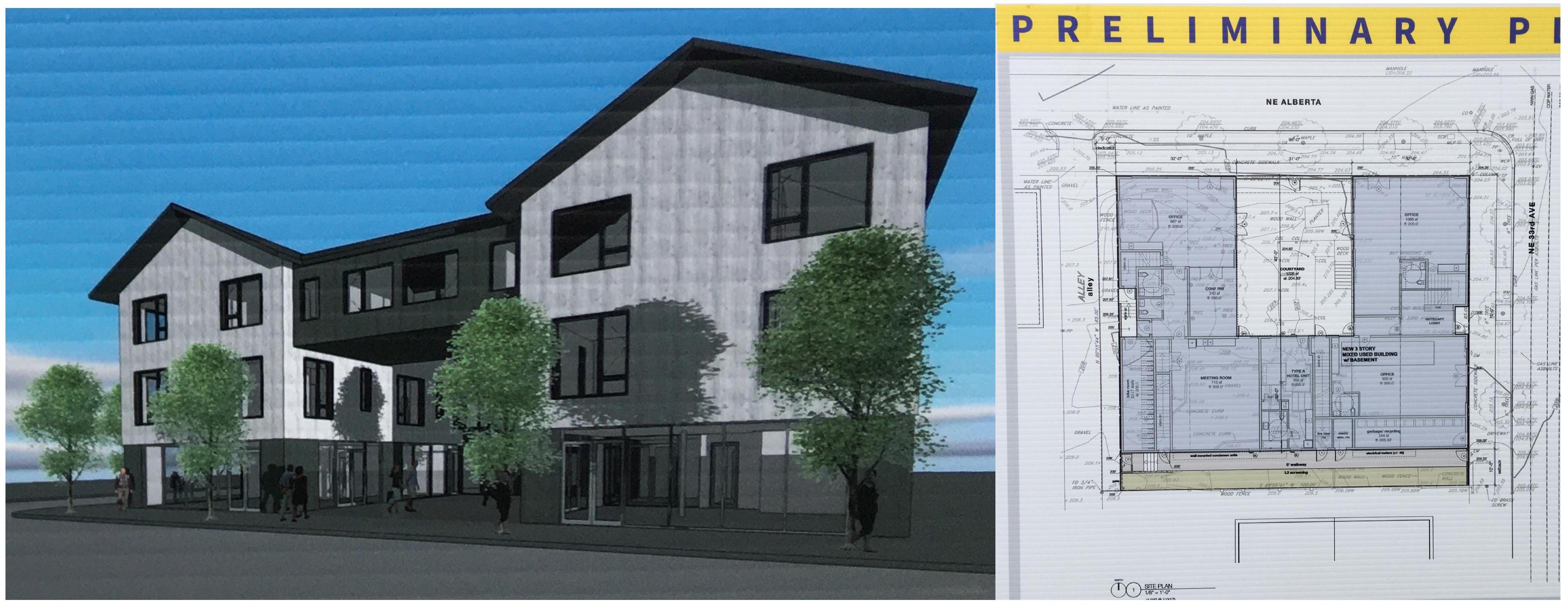
In the last week or so, a sign has been posted on the building showing a rendering of the future, which includes demolition of the historic building and then construction of a three-story mixed-use commercial building including a 19-apartment hotel (which we think probably means Airbnb-like short-term rentals) and no on-site parking. Yes, you read that right. Take a look (click to enlarge).

Interviewed in late September, developer Bob Bochsler of Box Real Estate Holdings explained that he wanted to consider ways to utilize the existing building, but that concerns associated with the cost of reinforcing the old foundation drove the demolition decision, nixing any kind of adaptive reuse that would allow the existing building to be repurposed for a new future.

Note that no informational meeting is required for this significant change, though there is contact information and a cryptic note that the project might be amended.

~

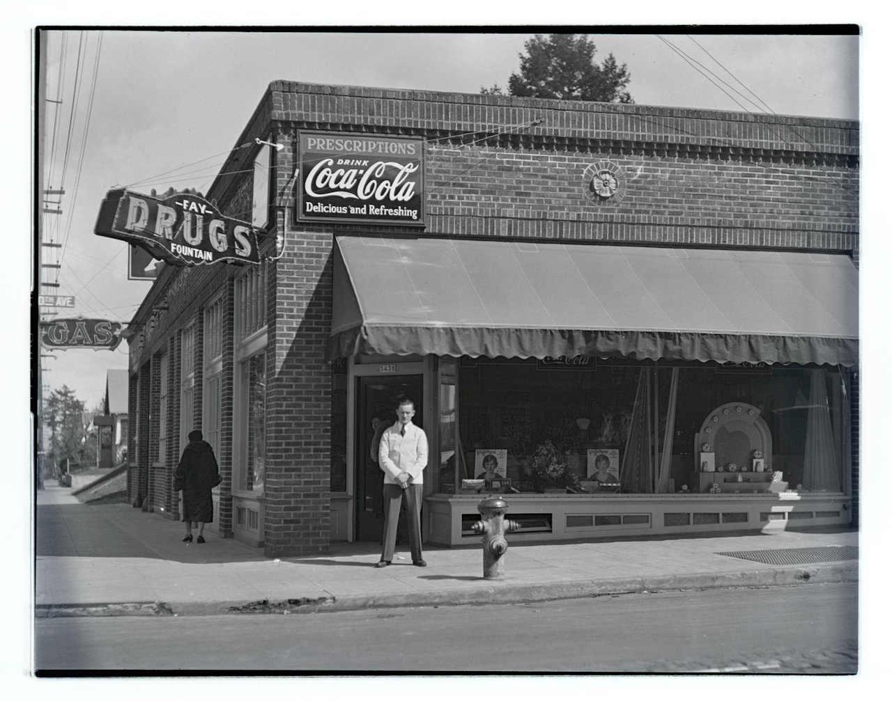
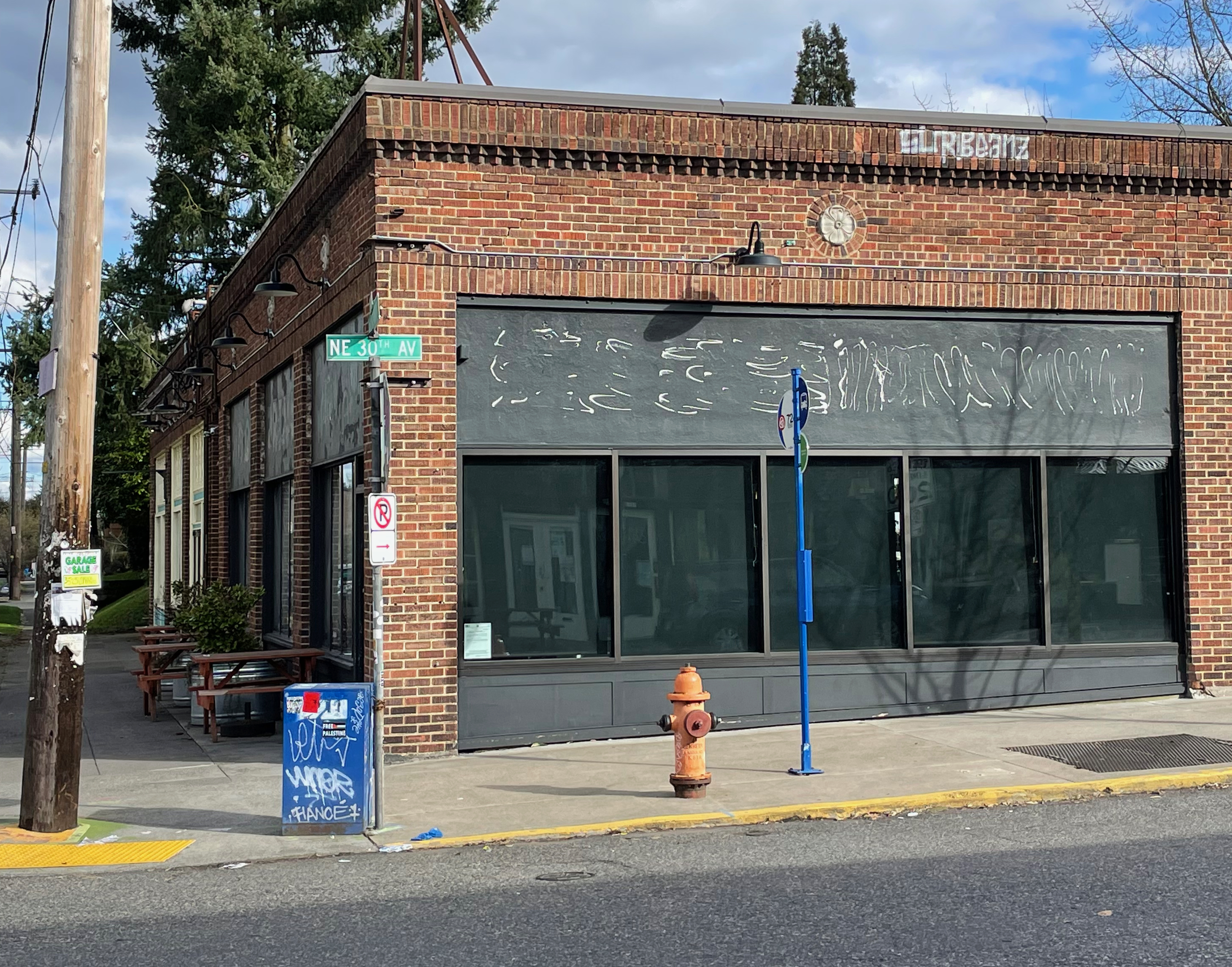
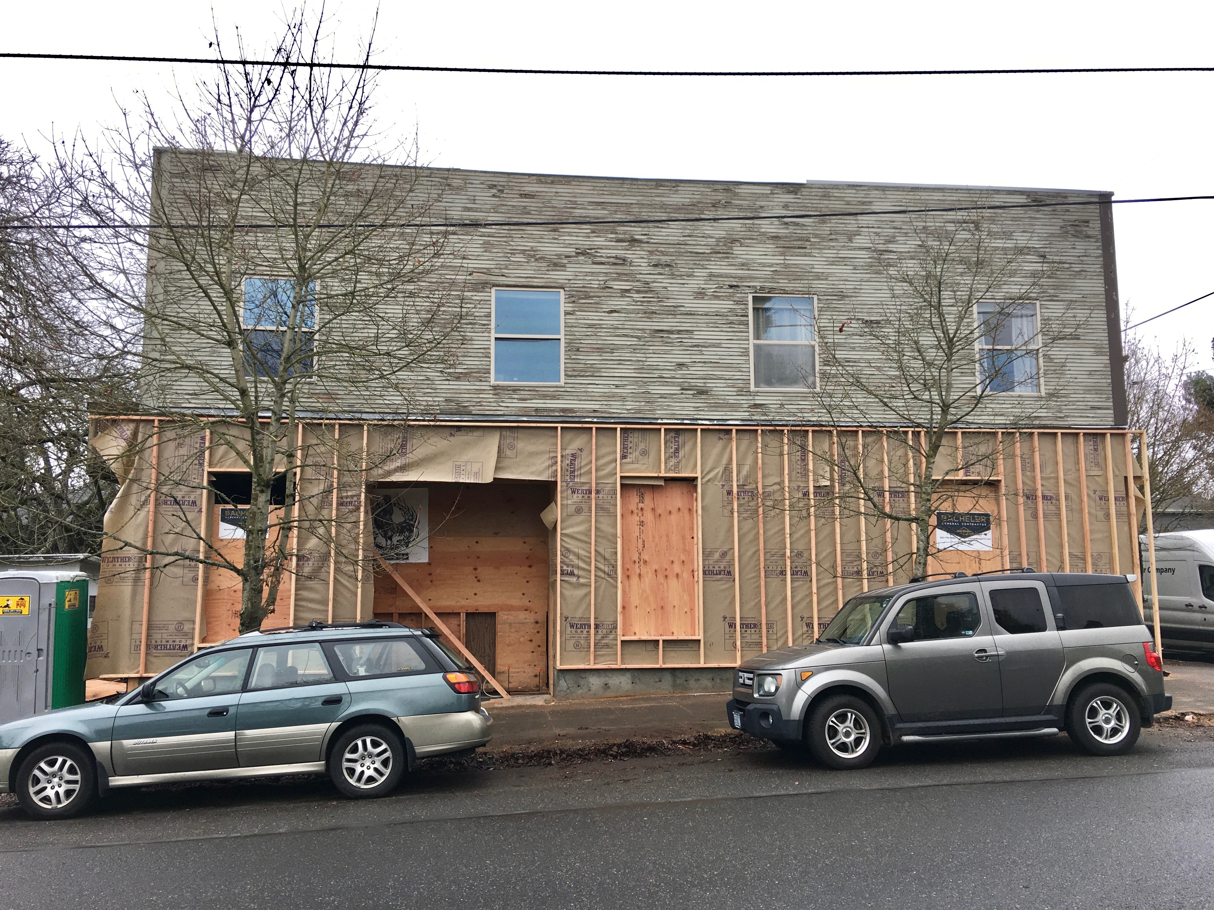
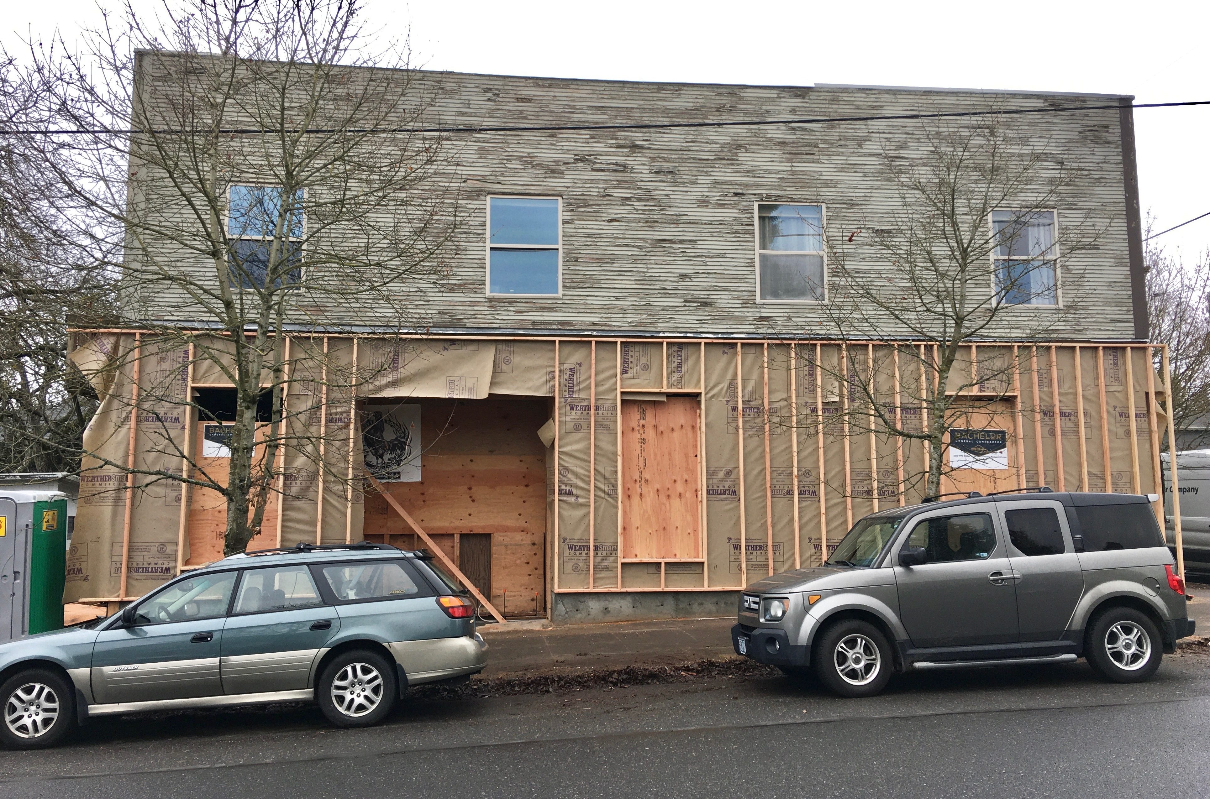
Meanwhile, A few blocks over, at the northeast corner of 30th and Emerson, a similar but very different story is unfolding. Here, a 107-year-old wood-frame mixed-use commercial building that was once also a grocery store (and many other things) is being restored and repurposed as the home of a medical practice and neighborhood coffee shop. Take a look:

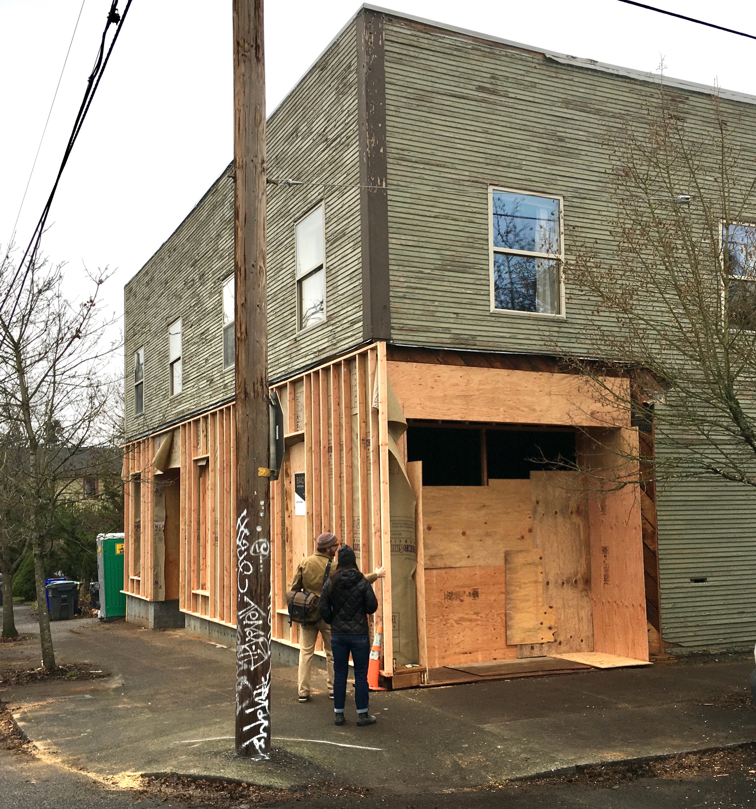
Dr. Thomas Grace and Rachel Buckwalter inspect the southwest corner of their future place of business. Clinic entry to the right, coffee shop entry to the far left. December 2019.


West side, coffee shop to the left, clinic to the right. Apartments upstairs. December 2019.

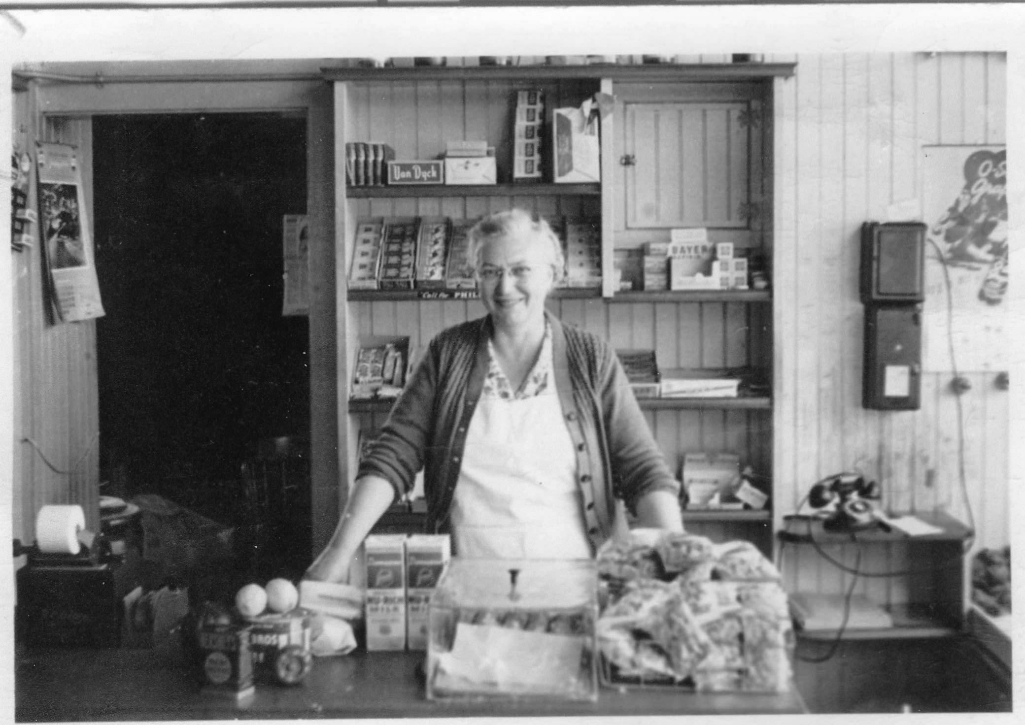
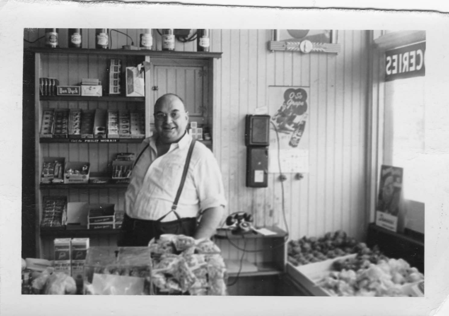
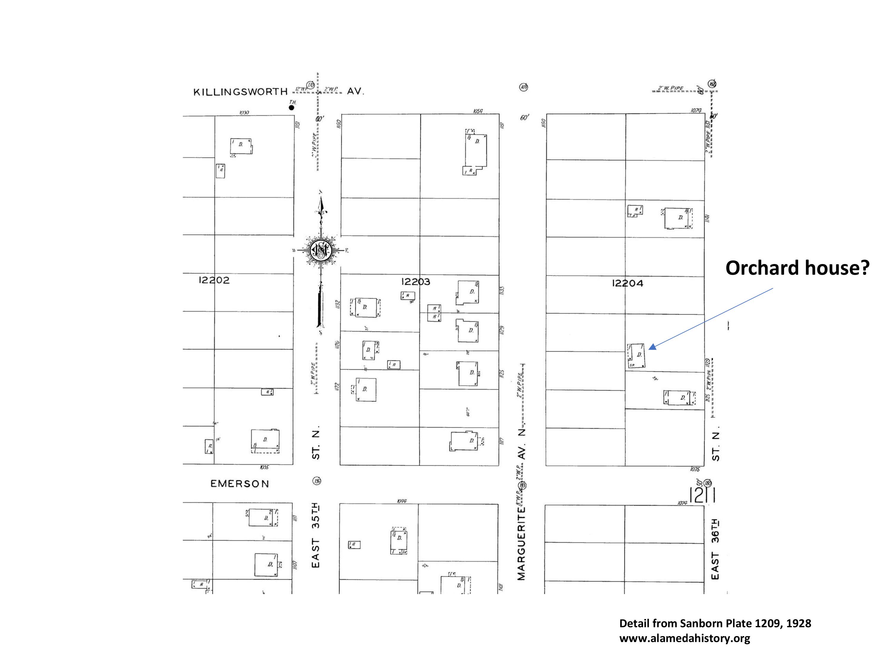
There’s lots more to learn about this old building, constructed in 1912, which once housed two businesses on the first floor facing NE 30th, and two apartments upstairs. Back in the day it was a grocery store. It’s been Cecilia’s Drapery Shop, Jack Emerald’s Barber Shop, The Quaint Shop (an art supply business), a men’s clothing shop, a dry goods store and many other things.

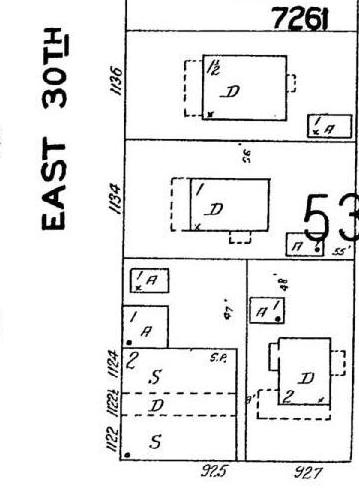
Here it is in the 1924 Sanborn Fire Insurance map, showing it’s pre-address-change addresses of 1122 and 1124 East 30th Street North (downstairs) and 1122 ½ (upstairs). Look in the lower right-hand corner. S=shop. D=dwelling. A=automobile or garage.

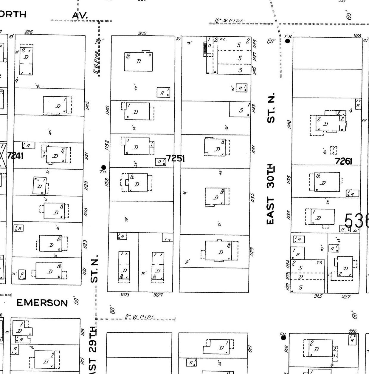
Detail from Sanborn Fire Insurance Map Plate 535, 1924.

Dr. Thomas Grace and Rachel Buckwalter bought the two-story building this last year and have been busy getting it ready for its next chapter, which begins this coming spring. The couple own and operate Natural Pain Solutions, a chiropractic practice focused on non-surgical spinal decompression, integrated care and treatment for pain. When it opens in spring, the practice will be Move Better Chiropractic.

Their former clinic had been located in the Macadam Center building which was destroyed by fire in January 2018. After the fire, Thomas and Rachel—who are Vernon neighborhood residents—were on the lookout for a new venue. When Rachel saw the for sale sign on the building last spring, she called on a whim, walked through later that day and fell in love with the building. Thomas saw it the next day and they knew renovating the space would work for them. Within weeks, they had started talking with architects.

Since then, there have been plenty of conversations with engineers, estimators, architects and contractors to determine the feasibility of adapting the building to meet their needs, but in their minds demolition was not a solution.

Yes, the foundation is 107 years old and like all old foundations in the neighborhood has its issues and needs. But instead of considering that a deal breaker, a partial new foundation wall has been added, seismic stabilization work has been done, and additional structural timber has been added.

The renovation design concept—by Portland firm Works Progress Architecture—starts with the structural work and completely renovates the interior space, fitting it inside the existing exterior building envelope, offering a contrast between old and new. The clinic and a new coffee shop will occupy the first floor, with glass roll-up garage doors in the coffee shop on the north face of the building opening onto an open outdoor patio and hanging-around space. Friends of Grace and Buckwalter own and operate Full City Rooster (a craft coffee roaster in Dallas, Texas) and will be helping Grace establish the coffee shop in the renovated building.

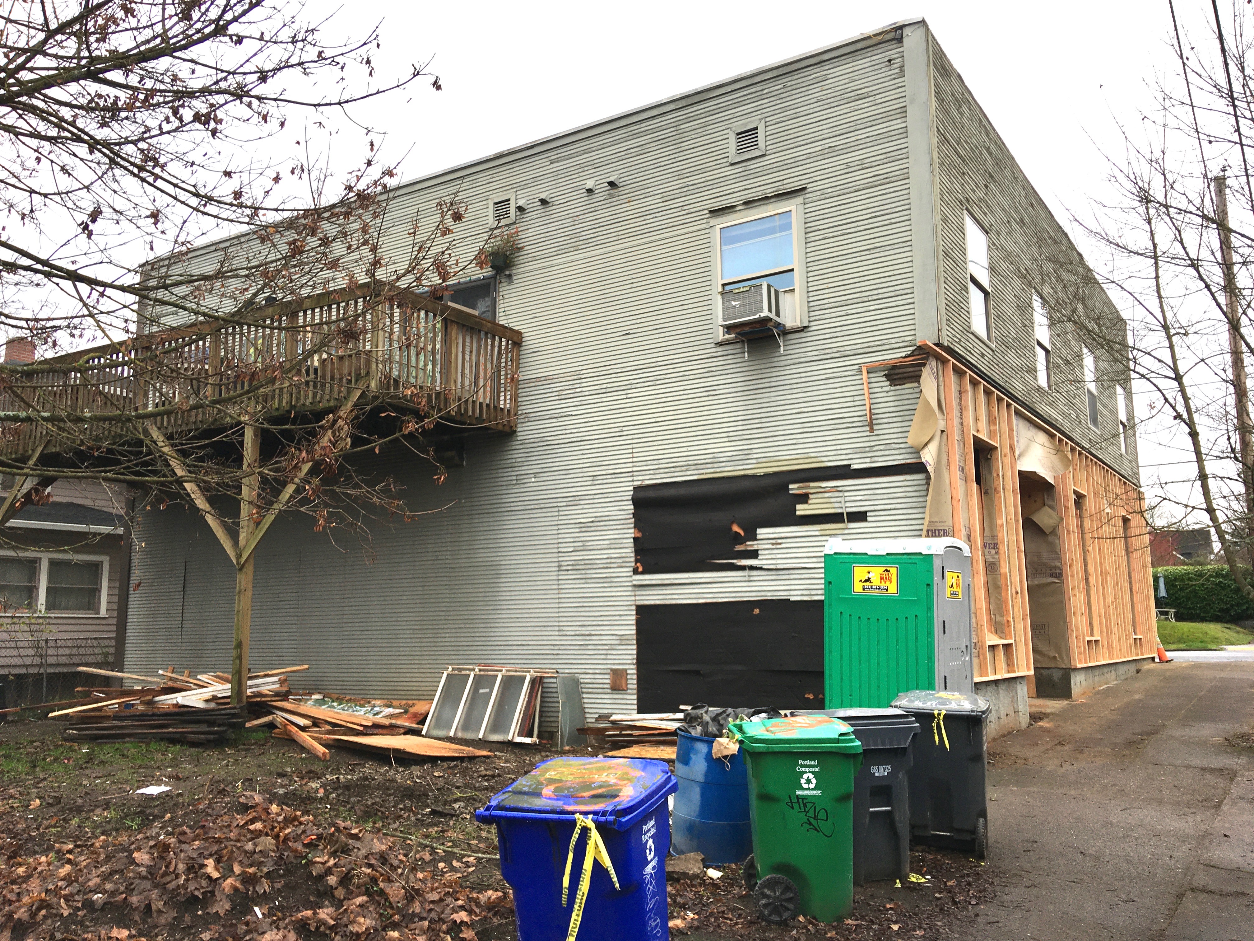
North side where the roll-up garage door will open into the patio/open space. December 2019.

Upstairs, the existing apartments are being renovated. In the future, Grace and Buckwalter hope to convert the two existing apartments into four studio apartments.

A repurposed small building in the open lot to the north will hold Buckwalter’s new business, “Moss,” which will feature an unusual mix of garden-related items and specialty intimate clothing for women.

The couple—who live a few blocks away in a 1912 bungalow with their four children—appreciate living and working in vintage spaces. The building is not far from the busy Foxchase corner of NE 30th and Killingsworth, and just a few blocks north of Alberta. Being on Trimet Bus 72 is also a plus (they’ve added a get-out-of-the-rain portico to the west face of the building for riders).

So, why did they decide not to go for the demolition option and to invest in making an old building work?

“We like the building and we think it will look beautiful with a couple upgrades and modifications,” said Grace. “We see this location as a natural transition between Killingsworth and Alberta Street, and hope to be a connection point in the community. We hope that the outdoor space will serve as a public area and place of informal gathering.”

Where there’s a will, there’s a way.

The Finest Corner in Concordia

We’ve just finished researching a home in the Irvington Park addition, one of the many underlying plats that make up today’s Concordia Neighborhood. It’s been a fascinating look back at what was once the far edge of Portland. Not Irvington, mind you, but Irvington Park: the 175-acre parcel bounded by NE 25th, NE 33rd, Rosa Parks and Killingsworth, first platted back in 1890.

We’ve written about this neck of the woods before, and it keeps drawing us back. Partly because we like to take the dog out on walks in the alleys that criss-cross the neighborhood, but also because we can imagine these lands as the forests they once were, sloping down to the Columbia Slough.

Addison Bennett, a long-time reporter for The Oregonian, visited Irvington Park in July 1915, when things began to finally gel for the young neighborhood. He had been one of the first newspaper reporters to write about the area 25 years earlier, so he knew the wild landscape in its pre-development days.

The narrative of Bennett’s 1915 trip to Irvington Park is worth a read: He called the corner of NE 30th and Ainsworth the finest corner in the entire addition, and for good reason. In part, it was the end of the Alberta Streetcar line. But apparently it was also the heart of community spirit.

NE 30th and Ainsworth, looking north. October 2019.

If you have time, read the whole article (at the bottom of this post), but here’s the part that jumps out at us, and something we like to imagine every time we walk through that intersection:

“One Tuesday night I went out to find just at the end of the streetcar track on the northeast corner of East Thirtieth and Ainsworth Avenue, in a lovely grove of pines, cedars and dogwoods, a great dancing floor, with rows of seats within and surrounding it, the trees a-sparkle with electric lights, a piano and trap-drum playing a twostep and about 40 couples upon the floor while seated around were perhaps 200 happy people of all ages from the wee infant to the aged men and women.

“A dozen or more automobiles waited on the adjacent streets; in some of them passengers were reclining and listening to the music and the glad voices of the dancers and the audience. It was a lovely summer night with just breath enough in the air to soften the heat—and in the heavens, overlooking and apparently guarding all, a full moon looked down upon the happy scene, which was really a picture taken from some story of a fairy land.”

The old frame structure standing on the northeast corner today dates to 1923, a few years after the days of the big dance platform and the dogwoods. That time traveler of a building started out as Hinrich’s Grocery—one of the neighborhood’s many mom and pop stores—and once had large windows facing Ainsworth, which you can see in this photo from 1944 looking north of the Alberta Streetcar parked at that intersection.

Looking north at NE 30th and Ainsworth, 1944. Courtesy City of Portland Archives, image a2009-009-4152.

Here’s Bennett’s full story from 1915 about Irvington Park (click to enlarge). Enjoy.

From The Oregonian, July 25, 1915

109-year old store on Alberta Street slated for demolition

Big changes are underway at the southwest corner of NE 33rd and Alberta. The 109-year old grocery store building–built when there were more horses than cars in Portland and before streets in this area were paved–is slated for demolition and will be replaced by a three-story, mixed use condominium / office building. Public notices have recently been posted on the property by the City of Portland alerting its status as being in a 120-day demolition delay.

This photo from the 1920s shows the Logan Grocery, a view looking southwest from the corner of NE 33rd and Alberta. NE 33rd Avenue, then known as the “county road,” was not yet paved. Photo courtesy of Bob Wilson.


A similar angle, September 26, 2019


Looking north along the NE 33rd Avenue side of the store, September 26, 2019 


The public notice posted on the property, September 265, 2019.

Developer Bob Bochsler of Box Real Estate Holdings in Portland expects demolition to take place in 2020 with construction to follow. While drawings for the new structure are not yet complete, Bochsler envisions a building with a pitched roof and an inner courtyard facing NE Alberta. “I want it to be in keeping with Pacific Northwest style,” said Bochsler.

When he first approached the project, Bochsler said he wanted to consider ways to utilize the existing building, but costs associated with reinforcing the foundation made adaptive reuse not cost effective.

The property is ranked in the City of Portland’s Historic Resource Inventory, recognizing its significance for potential historic register designation. However, because past owners have never listed the property in the National Register of Historic Places, it can be torn down after a brief delay.

Operated from the 19-teens until the 1940s as “Logan’s Grocery,” the building cycled through multiple owners in the 1950s-1970s, known as Zwhalen’s Market and then as Romoli’s. From the late 1970s until recently, the building contained the studio and residence of Portland artist Jay Backstrand.

The building in March 1962, as Ernie Zwhalen’s Market. Photo courtesy of City of Portland Archives, image A2011-013.


Concordia resident Bob Wilson, grandson of second-generation former storekeepers Anna and Earl Logan, has fond memories of the store from its heyday, and shared photos of the Logans behind the counter of their store taken in the 1940s.

Anna Logan and Earl Logan pictured inside their store at NE 33rd and Alberta during the 1940s. Courtesy of Bob Wilson.

In a recent e-mail, Wilson shared these memories:

“When I was a small child, my grandparents lived in the house just south of the store. My grandmother would fix lunch every day for my grandfather Earl and bring it over to him. Earl was the storekeeper. Anna was the butcher for the store. As a small boy it was so much fun to be with my grandparents, and then to go over to their store and see all of the people who dropped by.”

We welcome photos, memories and stories about the life of this building and its corner over the years, and will continue to follow plans for demolition and construction.

Read more here on the blog about the storefronts of NE Alberta, nearby mom-and-pop grocery stores, and some of our photo detective work identifying other old Alberta Street businesses.

Of Special Memories and Orchard Houses

We’ve been fortunate recently to spend some time with Jeanne Allen, a 98-year-old neighbor whose sharp and clear memory reaches well back into her childhood days here in the neighborhood. Jeanne has shared her memories about everything from the old St. Charles Church at NE 33rd and Webster Street, to exploring the brushy trails in the vacant lot at 24th and Fremont where Alameda Dental is now, to earning her girl scout campfire badge in the wilds of the 33rd Street Woods (today’s Wilshire Park, which is way more tame now than the wilderness it used to be).

One of our favorite images from her memory is the nighttime landscape from the darkened second floor room of a house where she grew up on NE 24th Avenue. At night, Jeanne recalls the Broadway Streetcar making its way north, the electrical pick-up mechanism skating along the overhead wires powering the streetcar’s forward motion. As it passed her house, electrical sparks off the wires just outside the window made a dance of shadow and light inside her bedroom, searing into her memory, vivid a lifetime later.

As we talked about change during a recent drive through the neighborhood, Jeanne told us about just how different things were around here in the early years. Pointing out a small home toward the back of one lot, she said something that caught our attention:

“I sure hate to see the orchard houses going away.”

Wait. What’s an orchard house? We’ve never heard that term. We want to know more.

When Jeanne and her husband Bob built their home in Concordia back in 1950, they were surrounded by orchards of cherries, apricots, pears and apples, planted in the early 1900s. 42nd Avenue—like its parallel twin to the west 33rd Avenue—was simply known as the “County Road” and doubled as Portland city limits. Most of the streets in the surrounding area between Prescott, Killingsworth, 42nd and 33rd weren’t paved. Some hadn’t even been constructed.

Jeanne remembers simple small buildings (she didn’t call them shacks, but that’s a term that comes to mind) scattered out among the orchards that served as temporary quarters for those tending the orchards during the year and harvesting during the fall. She and her family always called these little places “orchard houses,” which was a commonly known term and function during those years.

Orchard houses took a simple form: shed-roofed front and back porch; entry door in the middle and a backdoor lined up out the back; a bedroom and window on one side, an open living space on the other, maybe a counter for food preparation; often oriented in an unusual way on the lot, either toward the back or sitting at an angle.

Here’s one that Jeanne knows for certain was an orchard house (she remembers the actual nearby orchard). Plumbing was added to the house in 1924; it was described then as an old one-story frame residence.

An orchard house, seen on a walk through the neighborhood. The rear addition was added in later years. This home has been thoughtfully updated and maintained.

Jeanne’s description got us thinking about houses we’ve seen in the neighborhood, and about evidence of orchard houses appearing in old aerial photos we’ve been looking at, and in 1928 Sanborn maps of the area. Here, take a look at these two Sanborn plates (click for a larger view).


Do you know of any orchard houses? There are likely just a small handful left and we’d like to document them and explore their stories. If you have one in mind (or think you know a candidate), send us a photo or address and we’ll see what we can learn.

Thanks Jeanne!

Remembering the landmark at 33rd and Webster | Old St. Charles Church

For more than 40 years, a dignified and simple clapboard-sided wood frame church presided over the corner of NE 33rd Avenue and Webster, serving as a local landmark for its parishioners and for the neighborhood that was steadily growing up around it.

Old St. Charles Church, March 1931. Looking southeast at the corner of NE 33rd and Webster. Note that 33rd (at right) is paved, Webster (to the left) is not paved. Photo courtesy of the Archdiocese of Portland in Oregon Archives. 

The original St. Charles Catholic Church has been gone now for almost 70 years and recollections about its life and times are slipping close to the edge of living memory. The parish relocated to its current home on NE 42nd in 1950 and demolished the original building. But when you know where it once stood and its place in the evolution of the Concordia, Vernon, Cully and Beaumont-Wilshire area, you’ll want to keep it alive in your own imagination and sense of place.

Let’s put the ghost of this old building on the map: Webster is the east-west street intersecting NE 33rd Avenue just north of Alberta and just south of today’s New Seasons Concordia grocery store. The church was sited with its long side adjacent to Webster, and front doors and stairs facing 33rd, right at the corner.

Detail of 1940 aerial photo showing location of original St. Charles Church at the southeast corner of NE 33rd Avenue and Webster Street. Photo courtesy of University of Oregon Map and Aerial Photography Library.

In February 2019, construction is underway on the site: a three-story 12-plex apartment building, which is being built pretty much in the footprint of where the church stood from 1916 until its demolition in 1950. In fact, while excavating recently for new footings, workers came across parts of the foundation and basement slab of the old church.

Looking southeast at the corner of NE 33rd and Webster, February 2019 (above). The same view in much earlier years (below), photo courtesy of St. Charles Parish Archive Committee.


Below is the Sanborn Fire Insurance Map plate from 1924 that will give you a good snapshot of where the building stood (upper left hand corner), and just how sparsely built up the surrounding area was then (click to enlarge the view). Read more and see other old photos in this recent post about the intersection of 33rd and Killingsworth, this post about Ainsworth and 33rd, and this post about the old fire station one block south at Alberta Court and 33rd.


Knowing what you know now about the prominent role local property owner John D. Kennedy played in shaping the area from 1900-1930 (his early influence can’t be overstated), you won’t be surprised to learn the church building and the entire St. Charles Catholic Parish trace its founding back to him. Parish historians Jeanne Allen and Joseph Schiwek Jr. both credit Kennedy with encouraging then Archbishop Alexander Christie to found St. Charles Parish in the first place, sometime in late 1913. Kennedy did all he could (including providing property for a public school) to create a community from the surrounding rural landscape.

In March 1915, the Catholic Sentinel newspaper characterized the area and its scattered population like this:

“This parish, which is in sparsely settled territory in the northeast portion of the city is made up of earnest workers.”

Said a little less carefully, everyone knew this area was out in the middle of nowhere in comparison to the rest of Portland proper, and that most of the people who lived here were immigrants and first-generation citizens from Italy, Ireland and Germany.

The newly founded St. Charles Parish congregation of 25 families held its first mass on February 3, 1914, in a grocery store built and owned by Henry Hall near the corner of NE Alberta and 32nd Place. Here’s a look at that old store, which stands today. It’s one of the older buildings on Alberta Street, by the way, dating to 1911. The congregation held mass there every Sunday from February 1914 until the completed church was dedicated and opened on October 1, 1916.

3266 NE Alberta (formerly 986 East Alberta before Portland’s addressing system was changed in 1931), originally known as the Hall building and later as Herliska Grocery. Photographed in February 2019. High mass was said here every Sunday between 1914-1916. The building is one of the oldest in this section of NE Alberta.

News stories during that interim reported on the new building’s planning and construction, sharing details from Portland architects Houghtaling and Dougan about the 40’ x 80’ wood frame building with its full concrete basement hall (think potluck dinners and parish events), including this rendering (we particularly like the clouds):

From The Oregonian, June 4, 1916

The church steeple, rising some 50 feet above the street, didn’t turn out quite like the rendering: an octagonal tower with cross was built instead of the traditional peaked steeple. Here’s another view, from sometime in the 1940s.

Photo courtesy of St. Charles Parish Archive Committee

The dedication was covered by The Oregonian, the Oregon Journal and the Catholic Sentinel. All three newspapers noted the church building was just the first phase of construction that would eventually include a parish school and a rectory.

By 1918, with help from John D. Kennedy, the parish bought the two lots immediately to the south with the future in mind: one was vacant and the other held a house that became the rectory. A growing number of young people in the St. Charles parish—many of whom traveled to St. Andrews at NE 9th and Alberta and some to The Madeleine at 24th and Klickitat—had hopes of a school closer to home and the congregation was doing everything it could to save and raise money.

These photos show the rectory (inset) and its location two lots south of the church. You can see the northwest corner of the rectory at far right in the larger photo. From The Catholic Sentinel, March 4, 1939. The rectory was moved to the new site on NE 42nd in 1950, and destroyed by fire in 1978.

But in 1924, the parish experienced a major setback when an overnight fire on June 27th did significant damage to the church building, altar, pews, statues and paintings that added up to almost $3,500: a major loss that would not soon be overcome.

The origin of the fire was disputed at first (fire investigators not really wanting to talk about arson) but then emerged in the stranger-than-fiction tale of Portland firefighter Chester Buchtel. A capable firefighter from an established Portland pioneer family, Buchtel admitted to setting at least 16 fires in 1923-1924–destroying Temple Beth Israel and the German Lutheran Church, both downtown, the St. Charles Church, lumber mills, garages and barns city wide–and causing more than $1 million in damage.

Repairs were made and the building was rededicated on November 23, 1924, but the wind was out of the sails for any school development fund, which continued to be the case through the Great Depression years and beyond.

Parish historian Schiwek picks up the story in the mid 1940s at the end of World War 2, from his book, Building a House Where Love Can Dwell: Celebrating the first 100 years of the St. Charles Borromeo Parish, 1914-2014:

“There were now thousands of GIs coming home to start life afresh with new homes and new families. Such was the case in Northeast Portland. Many new houses were built as families moved into the parish, with the result that by 1950, the old church, that was only capable of seating 300 persons, was fast becoming obsolete. Moreover, demand for a school was increasing and there was no land available at the existing site to build one. There were over 300 Catholic children in the parish at this time and at least half of them were attending neighboring parish schools that were themselves overcrowded and the rest were in public schools without any religious education.”

In the spring of 1950, Archbishop Edward Howard made a change in parish leadership. By that summer, the parish had obtained a site and was into construction on the St. Charles school and campus that exists today 12 blocks east at NE 42nd and Emerson. The old rectory was jacked up from the lot south of the old church and trucked to the new site in a careful two-day moving process.

The final mass at the old church was held on October 15, 1950. A photograph was taken from the church balcony to document the end of an era. And on October 22, the new St. Charles was dedicated with mass held in temporary quarters on the new site until the new church building could be completed in 1954.

Photo courtesy of St. Charles Parish Archive Committee

Long-time parishioner Jeanne Allen remembers that while there was excitement about the move to a new site and anticipation about the brand-new school and fresh start as a community, leaving the old building was hard on some of the established families who had known it all their lives. So many family events—baptisms, weddings, funerals and every Sunday in between—took place there at the corner of NE 33rd and Webster.

“There was something very comforting about the inside of the old church,” she recalled recently. “It was simple, dignified, spiritual.”

With the parish installed in its new quarters, the old church was demolished, likely sometime in 1950. No parish records remain about the demolition and property sale, nothing in the newspapers and no one we’ve spoken to remembers those final actions.

Photo courtesy of St. Charles Parish Archive Committee

Figuring out the Ainsworth long block

While walking in the neighborhood—the best way to observe history in action—we’ve wondered about the very long block between Ainsworth and Simpson, bounded by NE 33rd and NE 37th. Maybe you’ve wondered too: the north-south streets of 34th, 35th and 36th don’t go through, leaving unusually deep and narrow lots. These kinds of things—like the strange zig-zag on Prescott we call the Prescott Street Jog—make us ask: What’s the story behind that?

Here, take a look. It’s the block just west of Fernhill Park:

That’s one long block. A Google image looking northwest at the long block (outlined in green). Note that none of the numbered cross streets, from 33rd to 37th, cross this long block. How come?

The long, narrow configuration of this block stems from decisions made more than 100 years ago by John D. Kennedy, the man who once owned much of the property between Killingsworth, Ainsworth, NE 33rd and NE 42nd, and for whom Kennedy School was named.

We met John D. Kennedy in our recent post about his 1929 zone change petition to turn nearby residential land at 33rd and Killingsworth into commercial property.

Born in County Limerick, Ireland in 1852, Kennedy immigrated to Oregon in 1866, finding his way to Baker City where he worked in and then owned a dry goods store. After coming to Portland about 1881, Kennedy bought this property—then outside the city limits and far from anything that even looked like development—which was originally part of the 1855 Isaac Rennison Donation Land Claim.

John D. Kennedy, about 1920. Photo originally from the Ryerson Collection, borrowed here from McMenamin’s Kennedy School.

Kennedy was an early-in speculator, perhaps 15 years ahead of his time and the market. Northeast Portland’s ripeness for real estate didn’t really take place until the years after the 1905 Lewis and Clark Exposition when it seemed anyone who could was buying property or building houses.

But Kennedy had platted these lands as the Kennedy Addition back in 1890, a grid of 15 square blocks with more than 200 lots. Here’s his original plat:


Kennedy Addition plat filed with the Multnomah County Surveyor’s Office, 1890. The grid survived, even if the street names didn’t. Translation: County Road = NE 33rd; Cleveland Street = NE 34th; Harrison Street = NE 35th; Morton Street (which was built as Marguerite Avenue)= NE 35th Place; Thurman Street = NE 36th; Blaine Street = NE 37th Avenue; Cypress Avenue = Jessup Street; Myrtle Avenue = Simpson Street. Barkholtz was an inholding property owner who wasn’t Kennedy but who went along with the plat. Interesting to note that in later years, that is the one area of the long block where a cul de sac was built.

Two years later in 1892, he platted Kennedy’s Second Addition, adjacent to the east, with more street names that didn’t make it to today (Morrow, Gilliam, Hughes and Francis). His Second Addition contained plans for another 120 homes. Speculators filed several other nearby plats about that time, including Foxchase, Irvington Park, the Willamette Addition and Railroad Heights, but they were also just lines on paper. There was no market yet for residential development.

In 1906, Kennedy filed a petition with the city to “vacate” five of the blocks in his addition. The process of vacation officially eliminates platted streets (even if they don’t yet exist), and the 1906 action—approved by City Council in ordinances 15761 and 15762—essentially erased all of the north-south streets (then called Cleveland, Harrison, Morton, Thurman and Blaine, see above) in the block between Ainsworth and Simpson, from 33rd east to 37th.


From The Oregonian, May 10, 1906

Kennedy’s stated rationale was to sell the larger chunk of land as acreage for farm fields, which is what surrounded his property at the time. It seems he was eager to sell the property and was essentially repackaging it for what was at that moment the most active part of the market (even though Northeast Portland was on the cusp of a homebuilding explosion). Not long after the City Council action, Kennedy did just that:

Classified advertisement for the vacated property, from The Oregonian, October 21, 1906

In the years that followed as urbanization spread, neighborhoods were built to the north, south and west, and Kennedy’s smart and early real estate speculation paid off. But the 12-acre parcel, with no north-south through streets due to his 1906 decision to vacate streets from the property, stayed as one big block in farm use.

After Portland voters passed a $500,000 park acquisition bond measure in 1919, Kennedy courted the city with the long block tract—a perfect park size at 12 acres—suggesting it would make a great place for playgrounds, picnic tables and ball diamonds. This was long before Fernhill Park or Wilshire Park (which have their own interesting stories well worth reading), and concurrent with consideration of Alberta Park, which was ultimately selected over Kennedy’s tract for purchase and development. Think about that: what if today’s Alberta Park had become neighborhood streets as planned, and Kennedy’s long block was a park? Hmm.

Here’s an aerial photo of the area from 1936 that shows the long block with a few homes, the oldest dating back to 1909…purchased from Kennedy after the 1906 ordinance passed creating the 12-acre parcel. One home, on the Simpson Street side, actually pre-dates Kennedy’s 1890 plat.

Detail of 1936 aerial photo. Courtesy of University of Oregon Map & Aerial Photography Library.

Kennedy died in December 1936. In 1938, the property was controlled by Ward D. Cook, a Portland insurance and real estate agent, who designated 80 lots on the long block ready for construction. It wasn’t until after World War II when the market truly picked up, and most of the houses were built and sold between 1940 and 1950. Here’s a glimpse from 1951 that shows the property fully built out:

Detail of 1951 aerial photo. Courtesy of City of Portland Archives.

So there you have it: In the original Kennedy’s Addition plat, that one long block was going to be five blocks. But then Kennedy did away with the blocks to better sell the property. The market came and went and came back again. Then another speculator saw opportunity and turned the island of farm into the more than 50 lots there today, most of them a very long and narrow quarter-acre each.

%d bloggers like this: