
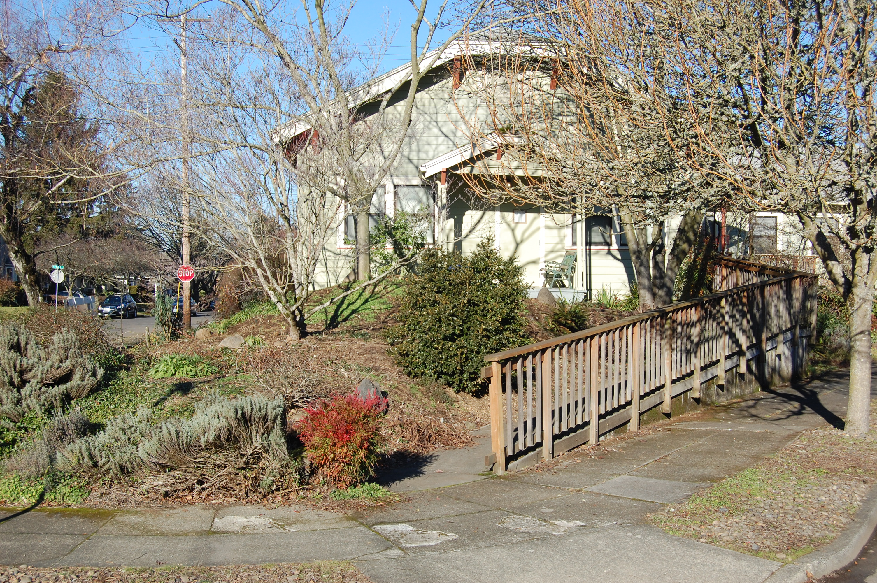
In 1923, the Alameda Park Community Church was freshly built and attracting children from throughout the neighborhood. Construction of the church the year before created quite a stir and was even delayed due to a court injunction (check out this post which tells that story), but the building was eventually allowed to be sited in the triangular property near the corner of NE Regents and Mason. This view is looking north, standing at the southern tip of the triangle. Houses in the background of the 1923 photo are still there, but no longer visible due to vegetation and more recent construction (including a new wing of the church, visible on the right in the color photo). Click either photo to enlarge.
Known originally as “the bunaglow church,” the design of the building was carefully chosen to fit into a neighborhood fixated on building restrictions that prohibited everything but residential structures. Today the building is the home of the Subud Center.


We attended your lecture tonight at the Mission Theater and Pub. Thank you so much, it was wonderful. We live just outside of Alameda on NE 35th Ave and Prescott (facing 35th Ave). It is a 1919 Dutch Colonial and we have some history of the house as about 10 years ago, we met the little girl, Gladys, who gre up here (she was in her 90s and has since passed away). Her uncle was the architect. I can dig up this history if you are interested in houses outside the Alameda boundary, but close. Again, thank you so much.
Hi Randy and Nancy. Thanks for your comment. I’m definitely interested in learning more and have sent you an e-mail to continue the discussion.
That triangle sticks out in a bunch of rectangular blocks. Was there a reason for designing a block with a corner cut off?
The un-grid like layout of the block was a consequence of fitting the sweeping crescent of Regents Drive into the overall Alameda Park plat. In order to make that work, it was going to produce some unusual shaped blocks. You can see similar odd pieces of pie (with houses on them) at Regents and Bryce, 26th and Alameda and 27th and Bryce.
Are you saying that Regents existed before Alameda Park was platted? If so, is there a map of the area before platting started?
Regents and The Alameda were signature streets that were part of the original design of the plat, and that became prominent in the marketing of the new subdivision. They weren’t here before, but they became necessary just given the landform the original designers had to work with: the Alameda Ridge running southeast-northwest, and the need for a street to climb the ridge and link the lower plat and upper plat (Regents). Anytime you mess with the grid, you’re going to get some unusual angles, and the builders had no choice but to depart from the grid due to the topography they were working with. There was an Indian trail that passed through the area prior to platting that cut from southeast to northwest essentially along the Alameda Ridge, and it appears in an 1852 General Land Office survey map. There’s a 1906 Portland real estate map you can click into under “The Maps” tab here on the website, and many other maps of the area prior to development are available from the City of Portland Archives and other sources.