Grant Park Grocery & Market

Grant Park Grocery and Market, about 1933. Photo courtesy of Jerry Hoffelner

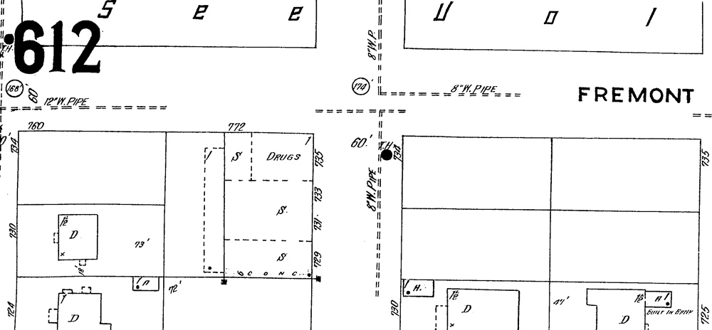
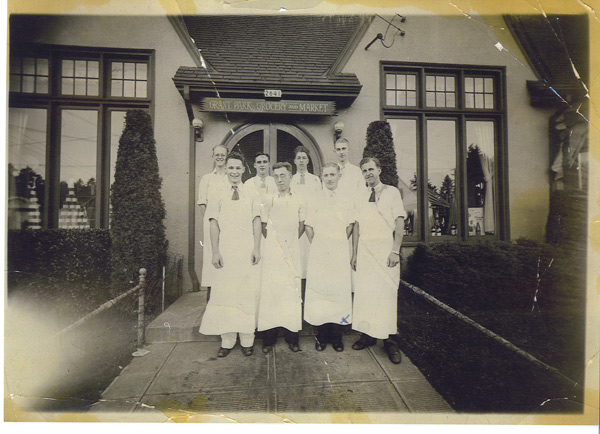
Grant Park Grocery and Market, NE 33rd and Knott, about 1933. Photo courtesy of Jerry Hoffelner. The man in the first row, second from the right with the blue “x” penned onto his apron, is Jerry’s dad, George Hoffelner. The other men have yet to be identified. Can you help?

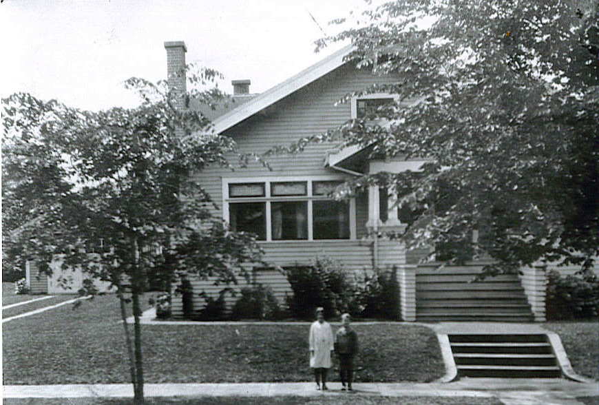
I’m researching a very old house near 29th and Knott. One of the many people who lived in the house over the years worked for a while at the Grant Park Grocery and Market, which we know today as the Family Medical Group office on the southwest corner of NE 33rd and Knott.

The image above, taken about 1933, shows the grocery staff decked out in their white aprons ready for action. Like many small stores, these guys often delivered the groceries direct to your door…an idea recently picked up on by some of the modern mega-grocery stores.

This image is taken on the east face of the building (facing 33rd). The original entrance for the market was not on the diagonal at the corner like it is today, though it seems there was always an entry there. My hunch is that was the entry to the pharmacy and fountain that used to be there. The grocery business was owned and operated by Ernest Bjorklund. Next time you are stopped at the light there, have a good look at this interesting building and tip your hat to Mr. Bjorklund and his squad of helpful grocery clerks.

I’m looking for any help with memories, stories, photos or information about either the Grant Park Market or the pharmacy and fountain.

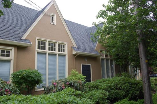
Here’s a shot of that same spot today. The door appears to be an “emergency exit” today. The graceful lights are gone, as is the cool curved doorway and the sidewalk ramp leading to the door (it’s now just part of the garden bed).

Grant Park Grocery and Market building, June 2008

Memory Fragments | An old man and his dog

In the last week, I’ve spoken with three men — three Alameda boys — who grew up in the neighborhood in the 1930s and 1940s. None of them live here any longer, though fragments of memories from their growing up years are crystal clear.

We’ve been concentrating on overlapping memories about a single person and situation. Even though these three were all here, living just a couple blocks from each other, it’s interesting to see what has been remembered and what hasn’t.

Our point of focus has been an elderly man who lived near NE 33rd and Shaver. Our timeframe is the 1930s. This man owned a dog — which is an important part of the memory — and was reportedly quite a character. One of our Alameda boys remembers him as living in an old home in the 33rd Street Woods, which was what everyone called Wilshire Park when it was just a wild patch of trees and brush. Another remembers him living in the big Craftsman (now painted yellow) near 33rd and Shaver, or possibly in a boarded-up house at 39th and Shaver, and that he owned the chunk of land south of Shaver from 33rd to 35th. Maybe he was here before all the commotion of development beginning in about 1910. Those fragments are not particularly clear. The third boy doesn’t remember him at all.

1220-wilshire-park.jpg

Here’s the Sanborn Map from 1924 that shows the 33rd Street Woods (now Wilshire Park). Note the outhouse situated in the northwest corner, and “Campaign Street” (now Skidmore). Marguerite Avenue is now NE 37th. This is a detail from Sanborn panel No. 1220. Click for a larger view.

Here’s the story we’ve been reassembling from memory fragments: Reportedly, this old man used to walk through the neighborhood with his big dog, which one of the boys remembered as a “police-type dog.” He didn’t drive, so when he needed to travel somewhere, he would walk to the end of the streetcar line at NE 29th and Mason and wait for the Broadway Streetcar. Sometimes during these intervals, he would lay down and nap on the grass of the home at 29th and Mason (the turquoise one, which is a special house for other reasons…a subject for a future post).

So — operating from reassembled memory fragments here — as the man slept sprawled out on the front yard, passersby grew concerned for his health and attempted to wake him, prompting the dog to bark and to bite. This apparently happened a good few times…enough that the police knew about the sleeping man and the big dog, and avoided being pulled into the situation. Was he Mr. Volk? Mr. Volkman? Mr Wilshire? His name was in the air, but not something that stuck with these 10-year-old boys.

It’s been an interesting contrast this week. A good portion of my Alameda research centers on what has been documented in black-and-white: building permits, census data, newspaper clippings, plats. The human dimension — the memories and stories — is much more malleable, often more difficult to track down, and way more precious.

Time is of the essence to capture these memories.

Post script: be sure to have a look at this follow-up hand-drawn map provided by one of the “Alameda boys,” along with another story about the old man.

What You Can Do | Alameda Oral Histories

A recent visitor to this blog asked if there was anything he could do to help with capturing the history of the Alameda neighborhood. Absolutely.

goat-and-kids.jpg

Bruce Morrison, the little boy who grew up in my house, remembered the day his younger sister Jean and brother Robert took a ride on the goat and cart out in front of the house. You never know what might turn up in an oral history interview!

There’s no time like the present to be reaching out to long-time residents to gain their insight and memories about what it’s been like to live in Alameda over the years. I’ve done dozens of oral history interviews with Alamedans and have developed a template of questions over time (which you can access by clicking here) that may be helpful.

Put on the coffee pot and invite your elder neighbor over for a trip down memory lane. Or better yet, bring a snack over to their house, where they might be more comfortable. Grab a tape recorder so you don’t miss anything. Start general and get specific. And fight the instinct to fill the silence. Just ask the question and listen. I’ve learned some interesting stories that would otherwise simply be lost to time.

Let me know if there is something I can do to support your oral history endeavor…sometimes it’s helpful to have a map of the neighborhood or old photo. I can send you something, if you like.

In fact, I’ll even offer to help conduct and transcribe the interview if you’ll help set it up. Just say the word. Personal memories are a non-renewable resource. Time is of the essence.

I’d be glad to post any oral history interviews you conduct here on the blog for neighbors to read and enjoy.

Sanborn Fire Insurance Maps | 1924 Snapshot in Time

What started out as a monumental effort to map fire risk in neighborhoods built from combustible materials has become a trove of information for old house researchers. The Sanborn Company started out in the 1860s mapping neighborhoods and buildings to help give fire insurance underwriters information upon which to write their insurance policies. The maps show in impressive detail the construction materials of every structure in a neighborhood, the heat source of institutional buildings, the location and size of water mains, and basic construction information (as in, where was the front porch?), etc.

alameda-school.gif

The outline of Alameda School, 1924, showing the location of the boiler and incinerator, and standpipes for water. Detail from Sanborn Plate 613, Volume 6.


The scope of the mapping effort is almost unbelievable: 12,000 U.S. towns and cities were mapped, most of them several times, by an army of surveyor / mapmakers. With this information, volumes of maps were drawn up and published producing a durable snapshot in time of neighborhood development. And all of this in the era before digitial mapping techniques.

Writer and public historian Kim Keister writes: “Stated simply, the Sanborn maps survive as a guide to American urbanization that is unrivaled by other cartography and, for that matter, by few documentary resources of any kind.”

A quick spin through a few of the maps from Alameda, made in 1924, provides some interesting insight. Remember, this is before the address change of the 1930s, so the numbers you see won’t make sense today. You can click on any of these images for a closer look at the map selection.

Below, just look at how few homes there were in this part of the neighborhood. In some cases, streets weren’t even in yet. The northern part of the neighborhood — the Alameda Park Addition shown on the plat map here on the blog — was developed first, when the areas south of Alameda Elementary School were just open fields.


614.jpg

Detail from Plate 614, Volume 6.


From time to time you come across a building that must have pre-dated the grid of the neighborhood, like this one below where the building is sitting at odd angles to the street. Sometimes, you’ll find barns and outbuildings showing as well.

626-detail.jpg

Detail from Plate 626, Volume 6

Check out this spot up at Alberta and NE 26th: my guess is that a lot of the wood and supplies to build our houses came out of here. Today it is a parking lot:

alberta-lumber.gif

Detail from Plate 552, Volume 5.


Here’s a snapshot of the Alameda business district, which housed a dry goods store, a shoe repair, and a drug store. More on that in future posts. That’s Fremont running left and right, and NE 24th running up and down.

612.jpg

Detail from Plate 612, Volume 6

Small versions of these maps are available on-line through Multnomah County Library, which also has a hard copy of the original maps (so does the Oregon Historical Society). They are amazing and colorful documents to behold. If you have the time and interest, they’re well worth a look. I’ve printed out copies and assembled them together to give a full map of the neighborhood, circa 1924. An interesting snapshot. Click here for a link to the Library’s Sanborn database. If you click over to the Library site to look at the Alameda-related Sanborns, have your library card number ready, and look for the Portland, Oregon Sanborns from 1924. We are in both Volume 5 and Volume 6.

When Research Pays Off

pair-1-then.jpg pair-1-now.jpg

In the 1940s, after 30 years of exposure and wear-and-tear, the family living here decided to remodel their deteriorating front porch. They removed the columns and poured a concrete deck. Then they enclosed it with casement windows and turned it into a sun porch. Below is what it looked like when we moved in in the late 1980s:

Front porch, December 1989

Our detective work on the reconstruction showed the ghosts of some early columns and other features, but we had to use our imaginations to guess at what it looked like originally. I had been looking for members of the family who lived in our house (one single family was here from 1912 until 1959, which is a good long time for one family to be in the house…we were lucky in that). Through determined research, I found the little boy who grew up here…he was in his 90s when I found him. That’s Bruce Morrison in the cap with his hand on his dad’s shoulder on the left side in the photo below. We had lunch together and he told me all about growing up in our house.

pair-3-then.jpg

pair-3-now.jpg

In addition to sharing all kinds of stories about the house and neighborhood, Bruce put me on to a bunch of photographs of the house from the teens and early 1920s. Jackpot! We couldn’t believe our eyes. We were generally right about the columns, but the idea of the extended porch, with its false pedestal corners, was well beyond our imaginations.


Photo courtesy of Morrison Family

So, we sat down at the drawing board, old photos in hand, and did some scaling of the ghost porch using measurements of house parts visible then and still here today. And then we found a very talented and patient carpenter to put it all back together.


pair-2-then.jpg

pair-2-now.jpg


roof-then.jpgroof-now.jpg

After a little landscaping and reconstruction of some long-gone sidewalks, we’re confident the family who moved in those long years ago would clearly recognize the place today. Research pays off: you might be surprised at what you’ll learn.