A friendly reader has shared a photograph from her great-grandparents’ photo album and wondered about where it was taken, when, and what it depicts. We love a good photo detective mystery like this, which enables a deep dive back into the landscape of the 1900s. Have a good look at it for detail, and then we’ll discuss:
Courtesy of Phillips Family Archive
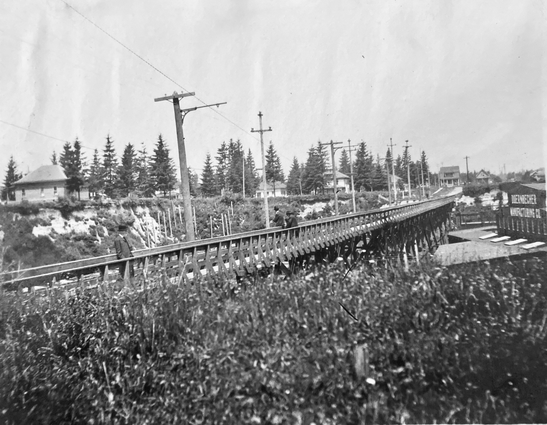
You’re looking north at a newly-completed wooden streetcar and pedestrian trestle bridge over Sullivan’s Gulch (where today’s Banfield / I-84 runs) at about NE 28th Avenue, just south of today’s Hollywood West Fred Meyer. The trestle existed for only a short time–from 1903 to 1908–before pressures from a growing Portland replaced it with a concrete span, which was later echoed by new bridges at NE 21st and then at NE 33rd. Its short lifespan says so much about development about this part of the city during the years immediately after the Lewis and Clark Exposition, which ushered in waves of change for Portland.
But first, the trestle: 800 feet long, an average height over the ground of 35 feet, costing $2,000 to build, including simply a rail line and a narrow sidewalk on the east side of the span. Built between November 1902 and January 1903 by the City & Suburban Railroad, one of the several streetcar companies that served Portland during those years, later subsumed into the Portland Railway Light and Power Company system.
And here’s where it gets interesting: City & Suburban built the trestle under contract to the Doernbecher Manufacturing Company, a furniture factory, which was Portland’s largest private employer at the time and which operated a sprawling five-acre factory site at the bottom of the gulch just beneath the trestle. Thousands of workers made the trip into and out of the gulch each day and having a means of easy access was helpful for the company, which had opened the factory just a few years earlier in 1899. If you haven’t heard about the factory, you can read more and see photos in this piece, which was the second installment of a series we’ve written on the history of Sullivan’s Gulch. Today’s giant U-Store storage complex is the skeleton of what once was Doernbecher Manufacturing.
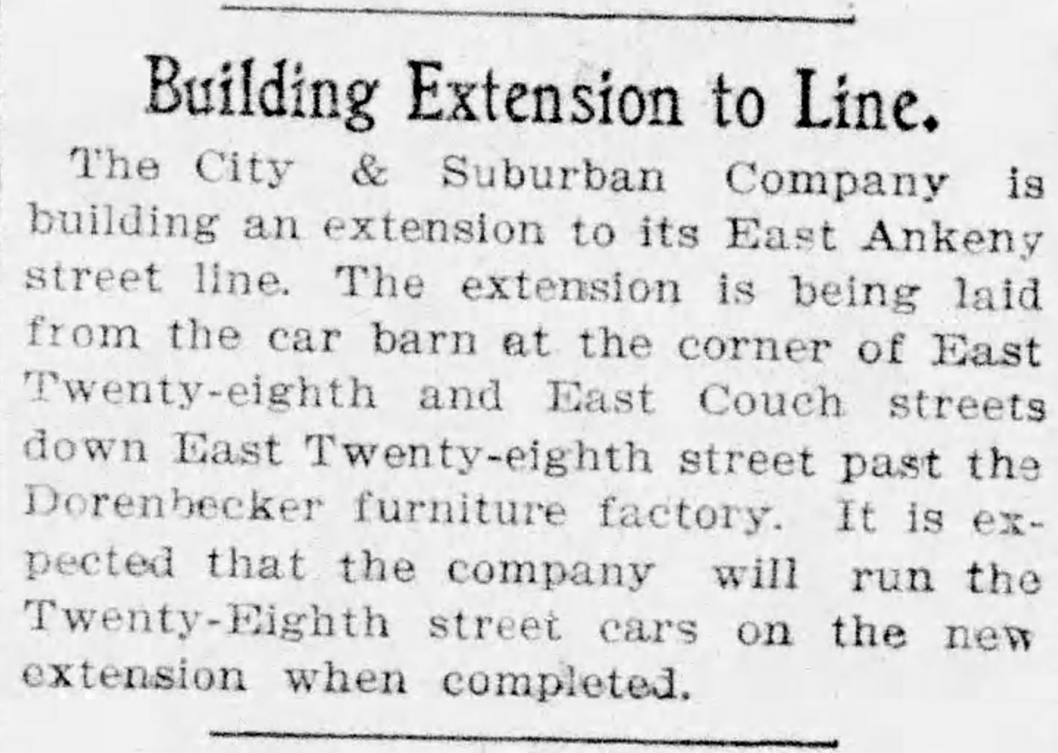
City & Suburban Railroad operated the East Ankeny Line, which terminated in the streetcar barns that once stood near NE 28th and Couch, about a mile due south. For the executives at Doernbecher, it was an obvious proposition to pay the railroad to extend its line north straight up 28th, build the trestle and two prominent stairways down, so workers could come and go conveniently. Meanwhile, City & Suburban was also eyeing service to the neighborhoods taking shape to the north of the gulch, and the possibility of a loop with the existing streetcar service that ran up Broadway into Irvington and later Alameda.
And so it was in August 1902 when construction of the line extension began:
From The Oregon Journal, August 19, 1902
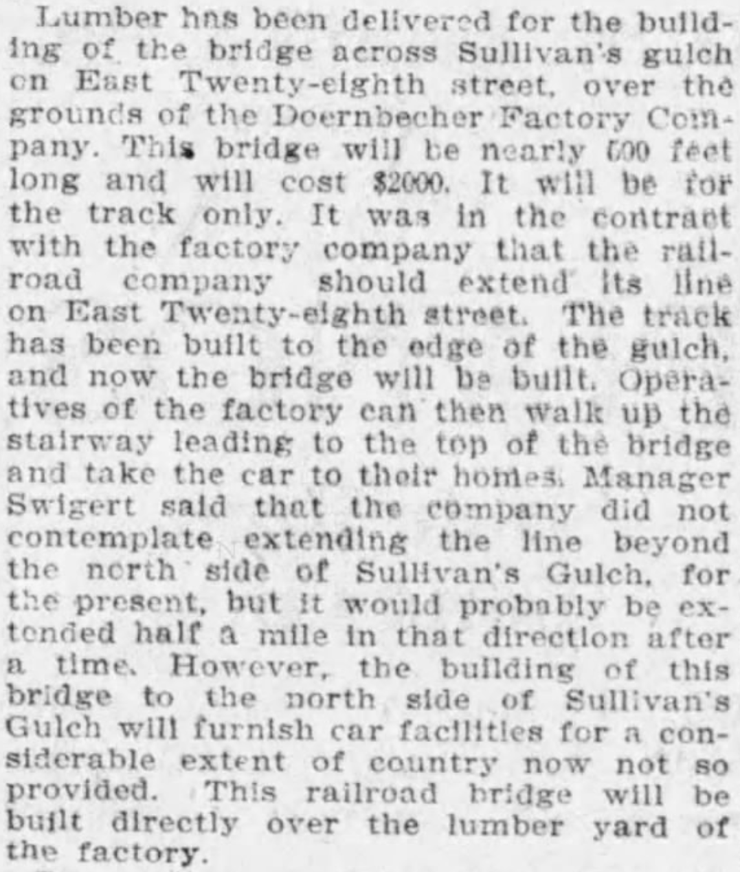
By November, the extension was in and grading was underway at the lip of the gulch to prepare for the trestle. Wood was being stockpiled for construction:
From The Oregonian, November 12, 1902
Trestle construction began in earnest in December and was completed in January. Later that year, the East Ankeny Line was extended a bit farther north to an end-of-the-line stop at NE 28th and Halsey. The envisioned loop with the Broadway Streetcar never materialized.
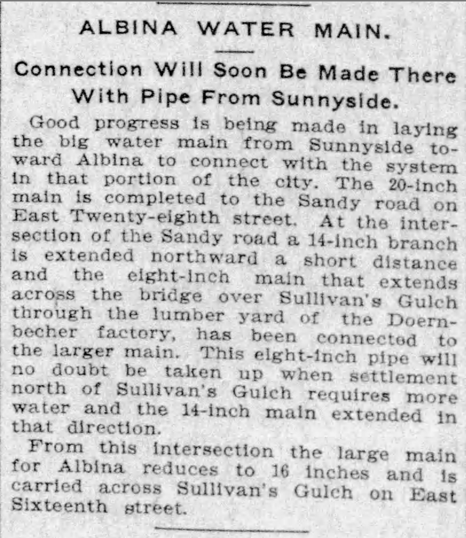
The trestle enabled a broader infrastructure that began to serve middle Northeast Portland. In November 1903, an 8-inch water main was secured to the wooden structure carrying public water for the first time into this part of the city:
From The Oregonian, November 5, 1903
In 1907, following the Lewis and Clark Exposition and with home construction and residential land speculation fever running high, residents of the area began to lobby for a wider multi-use crossing of the gulch in this area. The trestle was replaced in 1909 by construction of a concrete viaduct.
The story of sleuthing the photograph is interesting too:
We knew the Doernbecher story in this location, and could see the “Doernbecher Manufacturing Company” painted on the side of the building in the photo. The alignment of the Doernbecher building, slightly angled to the crossing, is still evident today in what may well be the very same building.
The homes pictured at the edge of the gulch, several of which are still standing today along NE Wasco and Multnomah streets, provide a tell-tale indicator this view looks north.
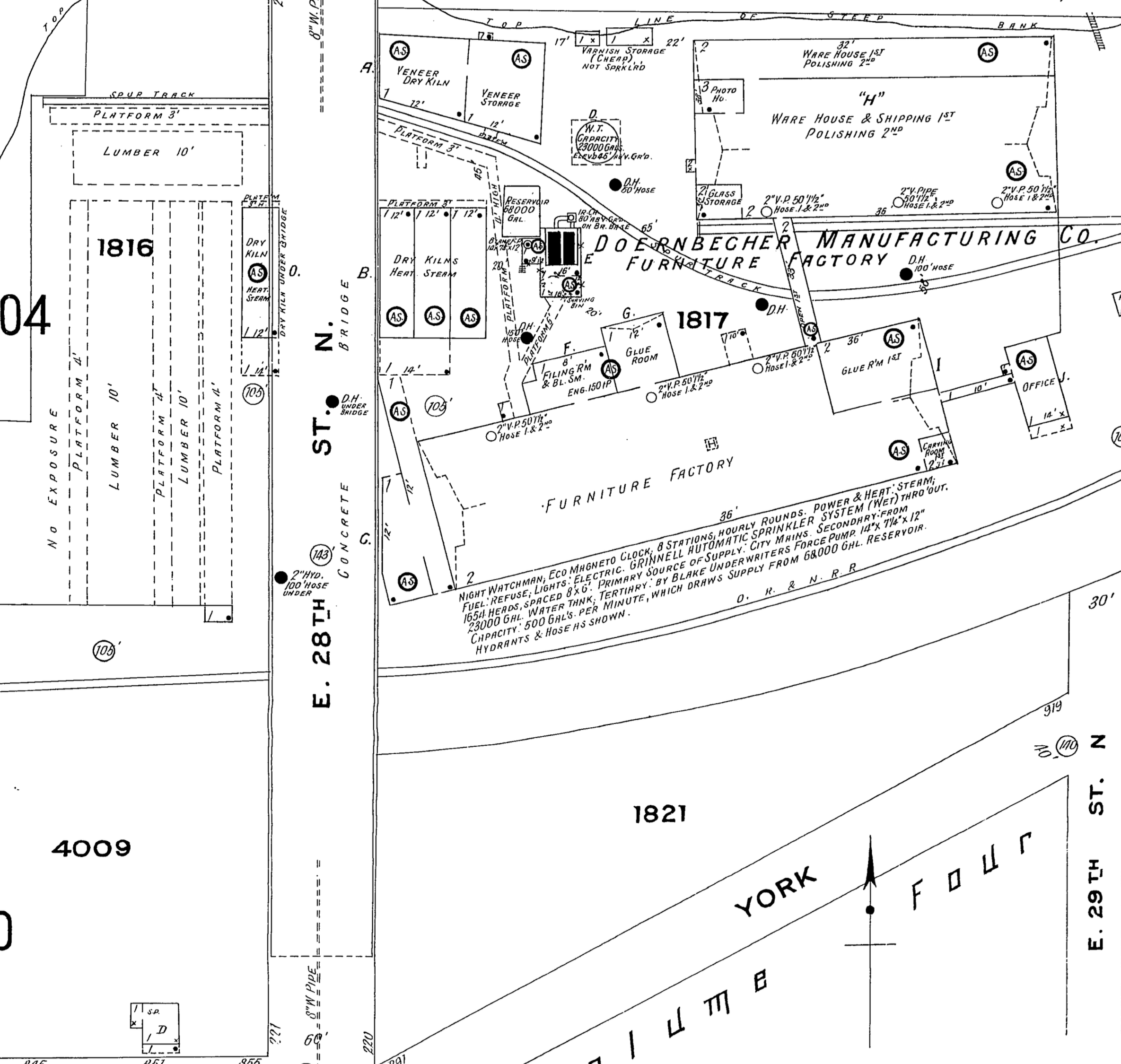
The Sanborn Fire Insurance Map from 1909 also helped, lining up nicely with the Doernbecher lumberyard seen in the old photo through the rungs of the trestle railing and mentioned in the news stories. Knowing the buildings were to the right (upgulch) and the lumber yard was to the left (downgulch) also confirmed direction of the view.
Detail from 1909 Sanborn Fire Insurance map.
The Sanborn also shows the Oregon Railway and Navigation mainline (much later the Union Pacific) which travels through the gulch and was the reason Doernbecher cited the factory there in the first place. The bowler-hatted gentlemen on the trestle walkway are probably looking down as a freight train passed by underneath. Look carefully and you can see the electric and telegraph lines that followed the tracks running perpendicular to the trestle in the mid-ground. The 1909 Sanborn shows the concrete bridge which replaced the trestle.
Do you have old photos you’re trying to make sense of? We’re always glad to help.
The AH blog has been quiet lately because it’s been a very busy winter on many research fronts: specific homes and their builders and people; intersections that are undergoing significant change; the incredible story of three very specific long-lost panels of ornamental glass and the wonder of window restoration and sash making; puzzling questions about everything from street alignments (why is that bend there?), to front porches (what happened to my front porch?). Some interesting things to share in the weeks ahead.
Meanwhile, here are four fresh photos to wake things up a bit, echoing through from our recent series on Sullivan’s Gulch and the arrival of the Banfield Expressway.
You’ve driven past these buildings a million times: part of today’s big U-Store complex on the north side of the Banfield (I-84) at NE 28th, just west of the Hollywood West Fred Meyer.
Here’s a link to the installment from our Sullivan’s Gulch series that references the Doernbecher Furniture Company buildings, which you can still find today if you turn east off of NE 28th at Sullivan Street, just south of the Banfield. Go down that hill, through the tunnel, cross the tracks and take a look. The crossing is in the same place as it appears in this 19-teens photo above, courtesy of the Oregon Historical Society.
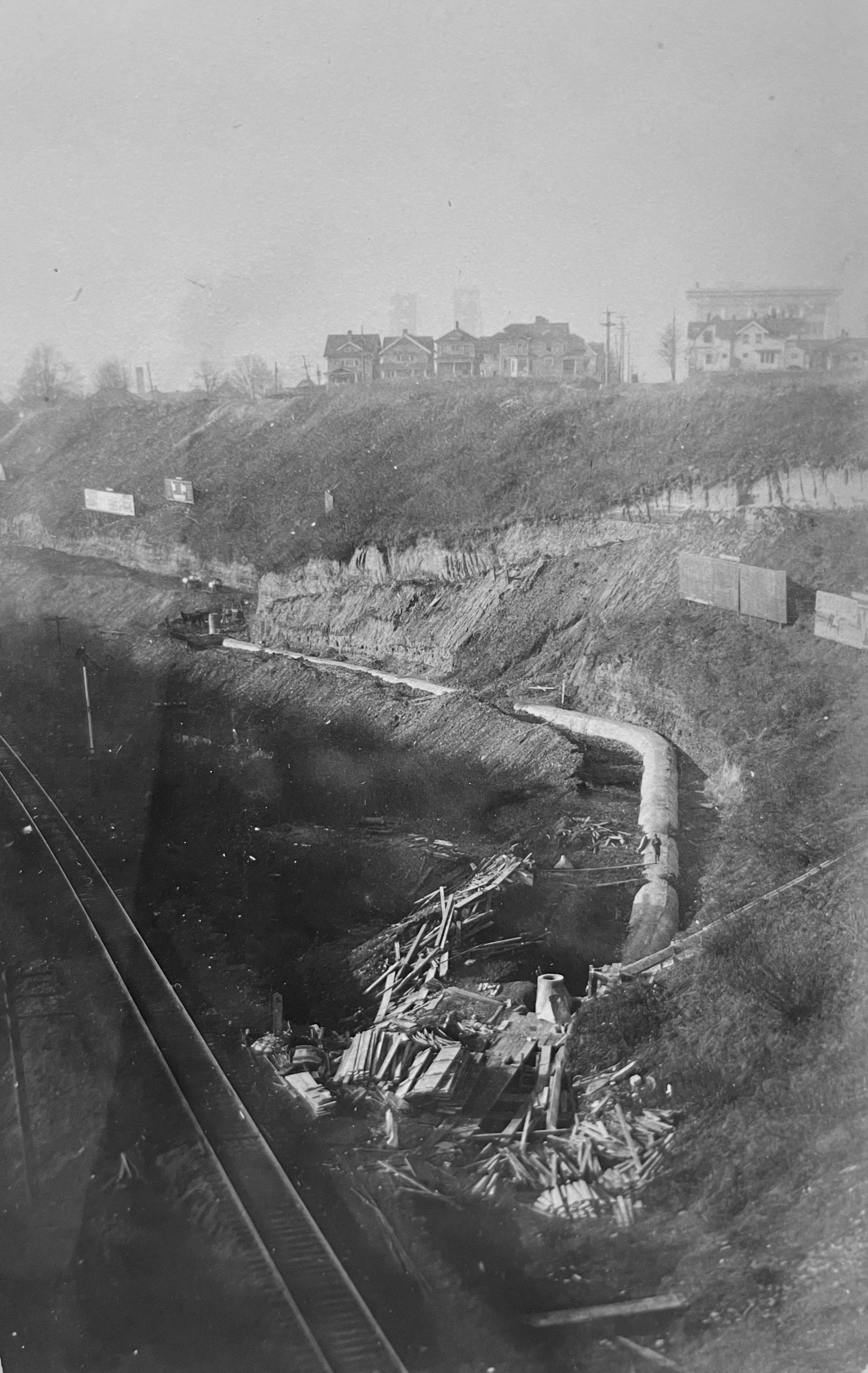
Here’s an even earlier westward view of the Gulch that we’ve come across, taken in the early 1900s just below where the State of Oregon office building is today on Lloyd Boulevard. The photo was taken to document progress on the trunk sewer that was constructed down the gulch (you can see it there in the bottom…the man is walking along the top of it). By triangulating the photo with old Sanborn Fire Insurance maps, our hunch is the houses on the brow of the gulch are at the corner of 7th and Irving. Look carefully, you can see the two towers of the Steel Bridge through the haze to the west.
Trunk sewer in Sullivan’s Gulch, looking west. From OHS photo file on Sullivan’s Gulch
The trunk sewer–and what went in it–was the source of legal wrangling between the various new subdivisions upstream that all wanted to dump their waste into it (but didn’t want to pay for it). The contents were still headed for open water in the Willamette River (not good), but the trunk sewer was an improvement over earlier more primitive ways of sewage disposal.
And our last gem below shows a 1930s view of the clubhouse at the old Lloyd Golf Course. This graceful building, now gone, sat near NE Irving at about 13th (across from Benson High School) and was the gateway to the old golf course.
Here’s more about the Lloyd Golf Course era, and one last photo below from AH reader Steve Goodman showing the building’s later days after the golf course was gone (and when Steve was learning to wash dishes in the dishroom of this very building).
Continuing our four-part series on Sullivan’s Gulch. The first chapter examined homestead and early railroad history. In this chapter we explore how manufacturing shaped the area during the first half of the 20th Century.
In the early 1900s, the railroad came to define Sullivan’s Gulch, connecting Portland to points east and serving a growing manufacturing presence in the gulch proper and along its shoulders.
From The Oregonian, May 7, 1911.
Engineers had filled in the marshlands at the mouth of the gulch where it met the Willamette River in an attempt to keep seasonal flooding from damaging rail infrastructure. On frigid months, the ponds that formed there—about where today’s I-84 merges with Interstate 5—were used as ice skating rinks by residents of nearby eastside neighborhoods. Other nearby gulches were used as sewers and dumping grounds, some were filled in.
The rails up the gulch were necessary infrastructure for a growing Portland, and they were a major attraction, particularly for neighborhood kids. Here’s a memory from former resident Bob Frazier, shared in the January 27, 1952 edition of the Oregon Journal:
“The gulch was a terrible place for kids, but at the time it was wonderful. In a way, living by the gulch was something like living next to a roundhouse. The trains puffing through Sullivan Gulch never failed to attract us and stir our fiendish little imaginations. Whenever we could sneak away from home for a few minutes, our crowd of 4 and 5-year-olds would bee-line for the gulch to watch No. 17, which as I recall came through sometime between nap-time and supper-time. The whistle of No. 17, screeching toward the Willamette, will, I fear, become meaningless to the next generation.”
For Frazier and his gang—and several generations of kids as surrounding neighborhoods built up—the gulch was a land of forbidden adventure that included digging caves into the slopes, hunting pheasants, building rope swings, playing with fire, and playing in deep puddles.
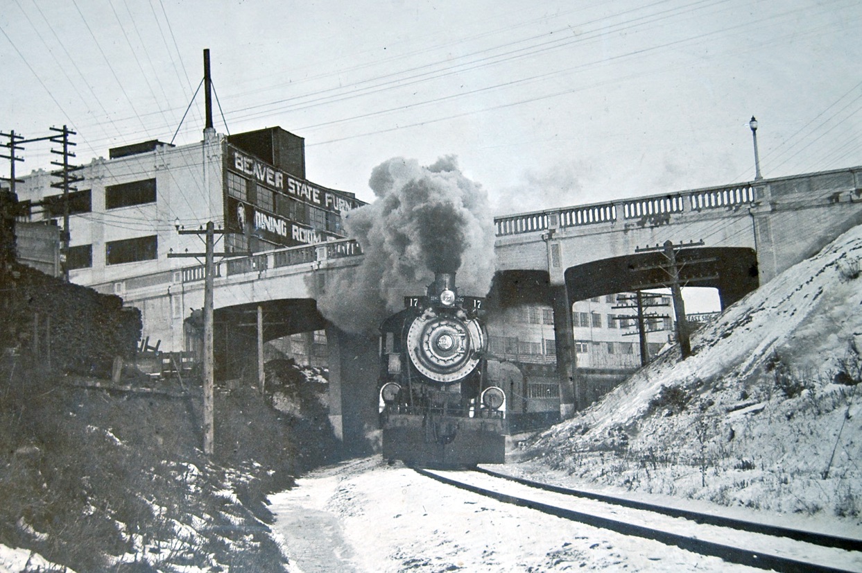
The legendary Oregon Railway & Navigation Engine 17 passing under the NE 33rd Avenue viaduct, January 20, 1929. The Beaver State Furniture building to the left is today’s graffiti-covered former Gordon’s Fireplace Shop at NE 33rd and Broadway. Note how much narrower the gulch was than today: major widening in the 1950s made room for the Banfield Expressway, requiring replacement of the viaduct.
Heavy manufacturers quickly found the value and utility of locating their factories along the rail line in the bottom of the gulch and along its sides: cheap close-in property not suitable for residential development; easy trans-shipment of products to distant markets; good access to workers from eastside neighborhoods, including a handy link with the streetcar system.
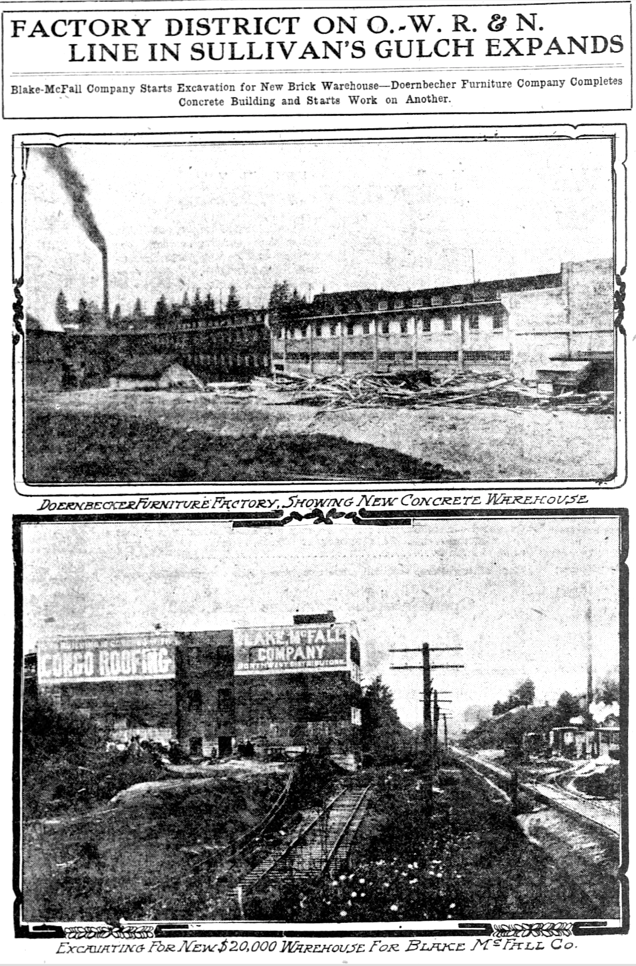
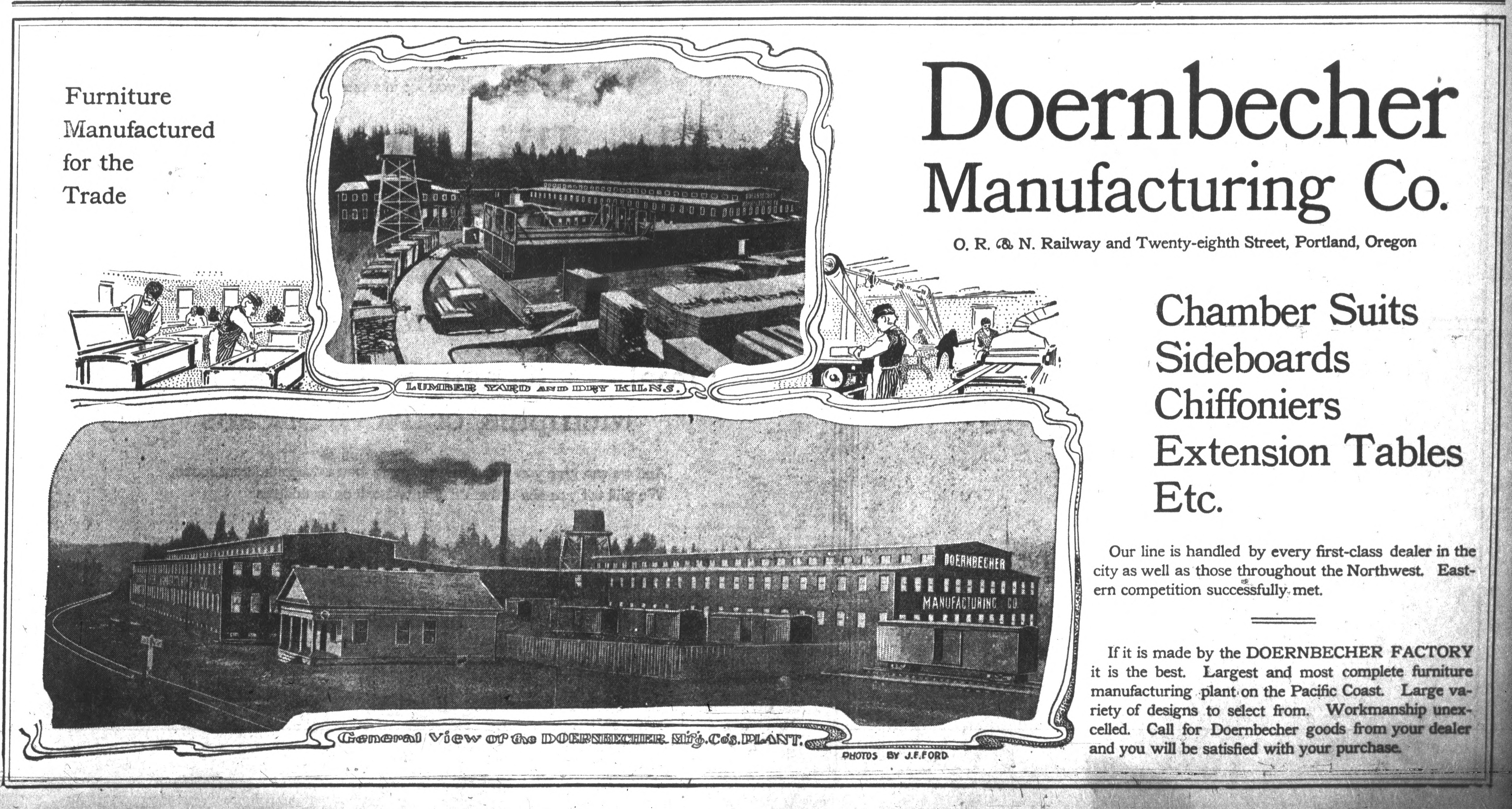
In 1899, the Doernbecher Manufacturing Company acquired five acres of property in the gulch at NE 28th on the north side of the tracks, where they built what TheOregon Journal referred to as “The biggest furniture factory under one roof in the world.”
From The Oregon Journal, December 25, 1904.
With thousands of factory workers reporting to this area each day, access and transportation became crucial. In 1902, a viaduct at 28th carried the 28th Street Streetcar on a spur north from the Montavilla line across the gulch where it stopped at Halsey. Two large stairways led down the north side of the gulch to the factory below. Today, it might be hard to imagine all of the activity in this area, but up until the 1940s (and the booming shipyards associated with the war effort), the Doernbecher factory had the largest industrial payroll in the Portland area.
A view of the Doernbecher Furniture Factory, looking toward the northwest, from The Oregonian, February 25, 1912. The bluff of Sullivan’s Gulch is visible behind.
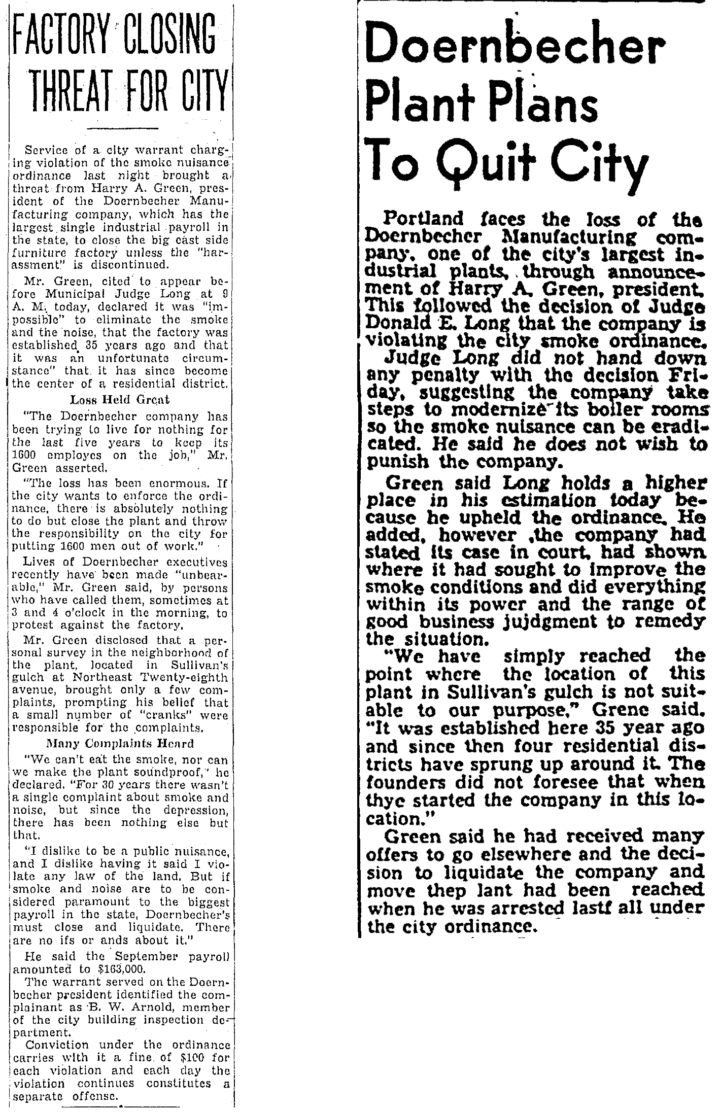
By the early 1930s, residential development had completely surrounded the Doernbecher factory and while the neighbors appreciated the employment opportunities, they were having a hard time breathing and were tired of cleaning up the soot that came out of the Doernbecher chimneys.
The factory generated its own power from wood-fired boilers that belched thick smoke and ash. In August 1933, neighbors lined up to protest at city hall, including a demonstration that left an impression on at least one newspaper reporter from the Oregon Journal, writing on August 26, 1933:
“The protestants, in virtually every talk that was made, urged that they did not desire the factory removed or shut down, that they are in full sympathy with the undertaking to give more employment but that they do feel that they have submitted to the smoke nuisance as long as it can be endured and are entitled to relief.”
“A spectacular feature of the hearing was the marching up to the council desk, where the committee sat, of groups of housewives and their depositing on the desks of bags and packages of soot and cinders they had swept up in their homes.”
Company president Harry A. Green was actually arrested on October 15,1935 for continuing to ignore a city ordinance about nuisance smoke. In a hearing that week before Municipal Judge Donald E. Long, Green threatened to close and liquidate the company.
From The Oregon Journal, October 16, 1935 (left) and The Oregonian, March 21, 1936
Here’s another look at the factory—this one taken in 1947—showing that the company didn’t actually close, but continued with its operations, and with heavy smoke. In fact, the factory continued to operate until 1955 when it closed, according to Harry Green, due to unfavorable union negotiations. Today, the area functions as a giant public storage facility and in a fitting twist of history, hosts several small craft furniture studios.
Looking northwest, NE 28th and Sandy crossing at a diagonal left to right, 1947. The NE 28th Avenue viaduct spans the gulch, and a portion of the roof of the Doernbecher plant. Note the smoke plume. Source: City of Portland Archives A2005-001-577.
The street that today leads down into the gulch, under the Banfield, across the tracks and into the old factory building? It’s NE Sullivan Street.
The former Doernbecher Furniture Factory today, Google Streetview.
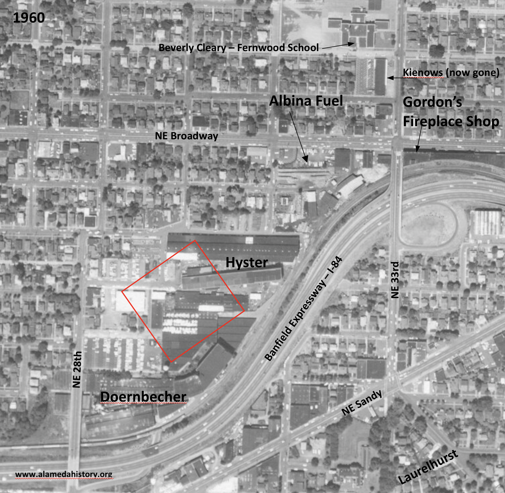
Just up-gulch to the east, where the ravine bends to the north, was more heavy industry and manufacturing. First a foundry, then a machine shop and other metal manufacturing, the site of today’s Hollywood West Fred Meyer eventually became the sprawling industrial campus of Willamette Hyster, later known simply as Hyster, where the company made forklifts and other heavy equipment. Hyster operations in the gulch began in the 1940s and took over parts of the surrounding neighborhood. Over the years, Hyster acquired and demolished an estimated 17 nearby homes on the flats above the gulch north and west of the factory to make room for its operations
Detail of a 1960 aerial photo that shows the location of Hyster and its neighbors. The red outline is the approximate location of today’s Hollywood West Fred Meyer. Note that the NE 33rd exit off the Banfield was east of 33rd. Photo courtesy of University of Oregon Map and Aerial Photography Library.
Hyster’s immediate gulch neighbor to the northeast was Albina Fuel, a storage yard for all things combustible: wood, sawdust, coal and heating oil. And all surrounded by a growing neighborhood that was closing in on both sides of the gulch (and within two blocks of a busy elementary school).
An early 1940s view looking south (Broadway in the foreground) at Albina Fuel at Broadway and 33rd. The viaduct over the gulch is visible in the background, with neighborhood houses just beyond. Photo courtesy of Albina Fuel.
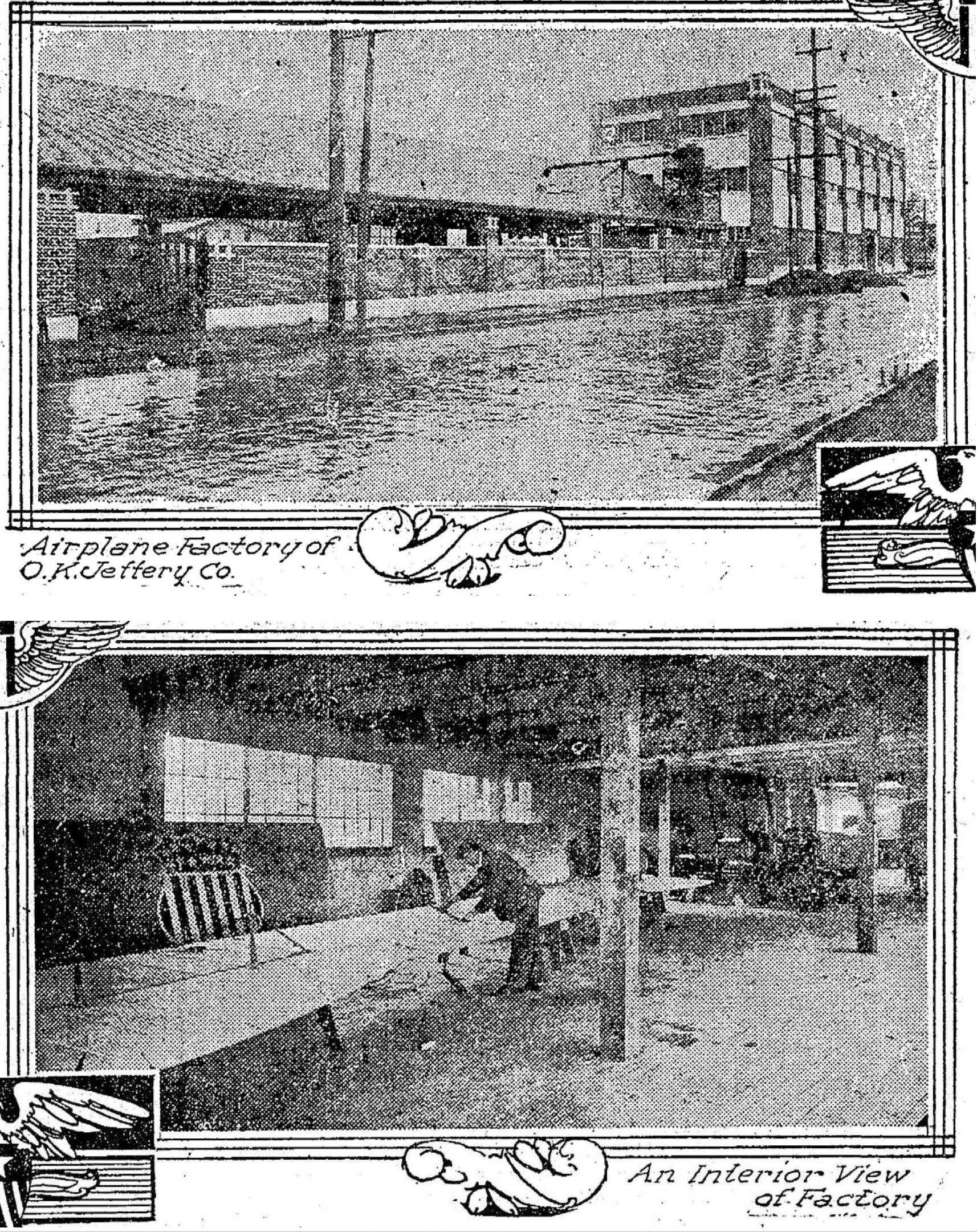
It wasn’t just heavy manufacturing at this big bend in the gulch: A factory built in 1911 by the Oregon Home Builders at the southeast corner of 33rd and Broadway—which many of us probably remember as Gordon’s Fireplace Shop and Tarlow’s Furniture before that—was a huge cabinet and carpentry shop for its first few years.
Oregon Home Builders constructed its built-ins and kitchen cabinetry here until charismatic company president and budding pilot Oliver K. Jeffery transformed it—briefly in 1917 until funding reality caught up—into a place where spruce aircraft parts were built.
From The Oregonian, January 1, 1918. Top photo looks east on NE Broadway just east of NE 33rd.
In an August 5, 1917 story in The Oregon Journal, Jeffrey was quoted as saying his workers were cutting 25,000 board feet of spruce parts daily for airplane stock and that the product would be shipped to eastern finishing plants. He told reporters: “Large orders for finished material have been secured by my company and the present force of 26 men will soon be doubled.” The plant closed a few months later.
Many different products have been manufactured in this building over the years: excelsior, pasta, furniture. It even hosted street-facing retail including barber shops and diners in the 1940s and 1950s. From the 1960s into the late 1970s, the building was Tarlow Furniture. Today, it’s become a canvas for graffiti artists and vandals while its current owners go through the permit process for redevelopment, which will include ground floor retail and a preschool, with apartments on the second and third floors.
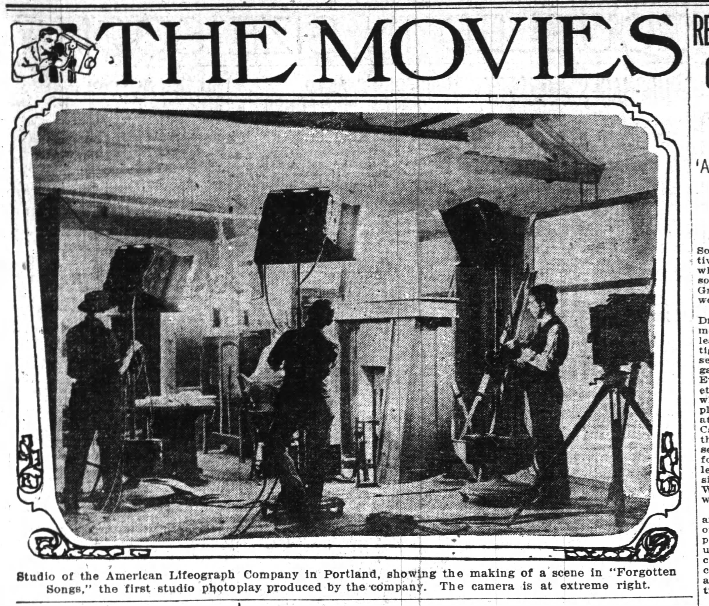
One little-known early Sullivan’s Gulch product was the movie business. The American Lifeograph Film Company started in 1911 as this new industry was just taking hold…for a brief time Portland could have become Hollywood. From its headquarters on the south edge of the gulch at NE 33rd and Wasco, the company made dozens of silent films. But a major fire in March 1923 wiped them out and competition from Hollywood pulled that energy and talent south.
The American Lifeograph Company had a large movie studio building at NE 33rd and Wasco, just a few blocks south of the Oregon Home Builders workshop. This photo shows the studio in a story from the Oregon Journal on February 4, 1914. The studio burned in 1923 ending the company’s presence in Portland.
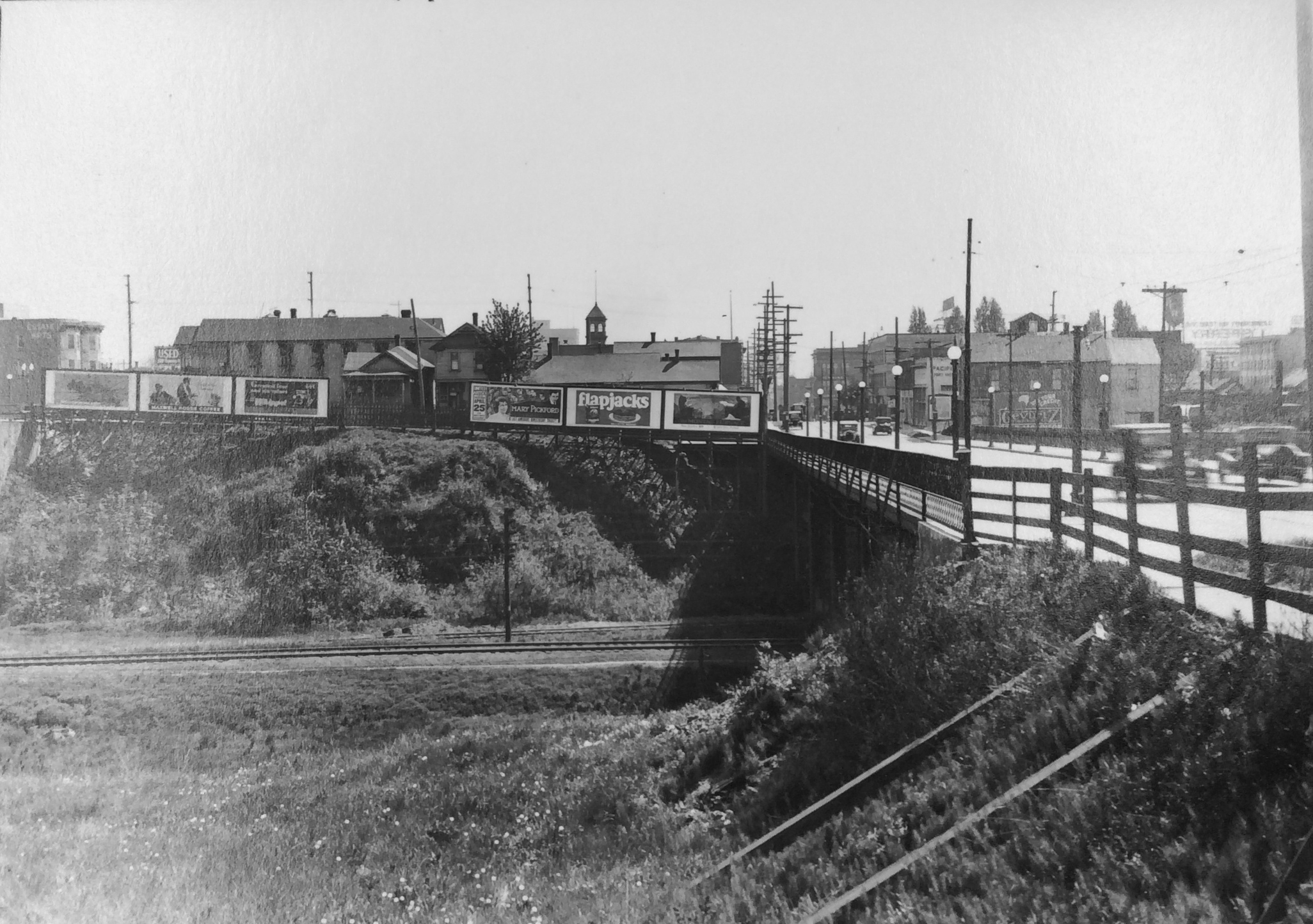
Aside from all this teeming industry down in the ravine, just getting across the gulch has been a challenge for the ages, and received constant newspaper attention in the early 1900s as the city strategized about bridge construction and how to pay for it. Here’s a look to the south in the teens at the Grand Avenue bridge over the gulch.
Completion of the 21st street viaduct in October 1912 cost $70,000 and at the time was one of the most modern structures of its kind. The grand opening on October 21, 1912 featured a parade of “loaded auto-trucks, followed by a number of giant steamrollers” as if to make the point that it was sturdy.
Looking east toward the brand new 21st Street Viaduct, 1912 Source: Oregon Historical Society.