Epilogue: Gravel Hill 25 years later

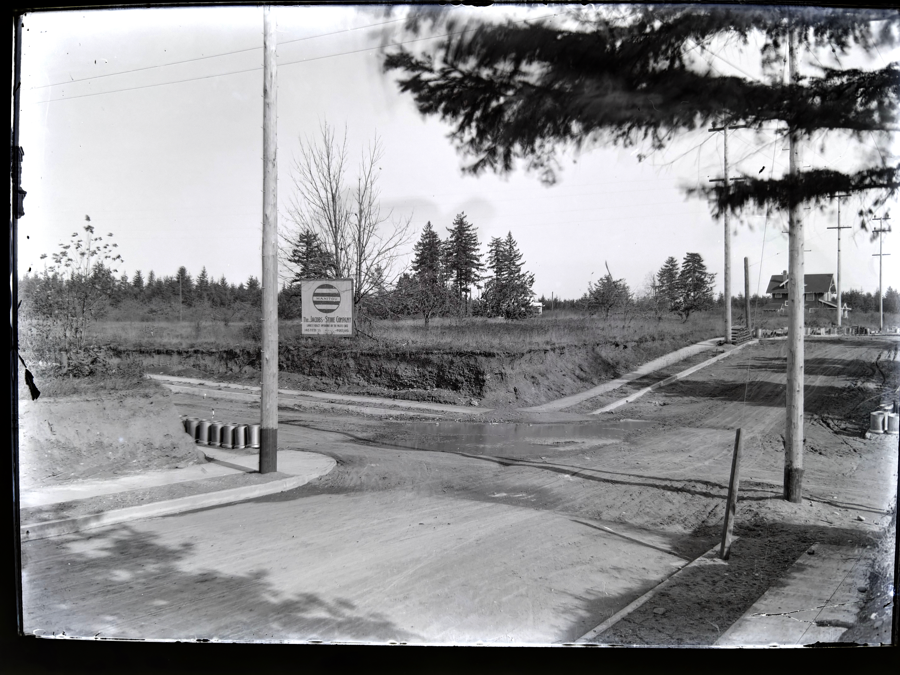
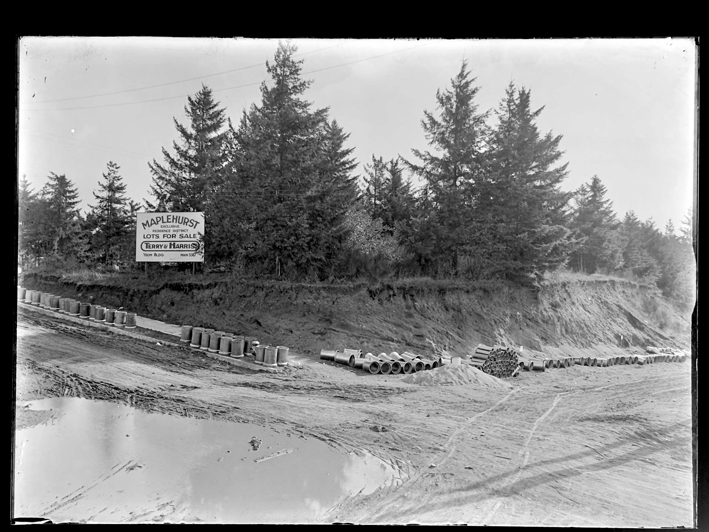
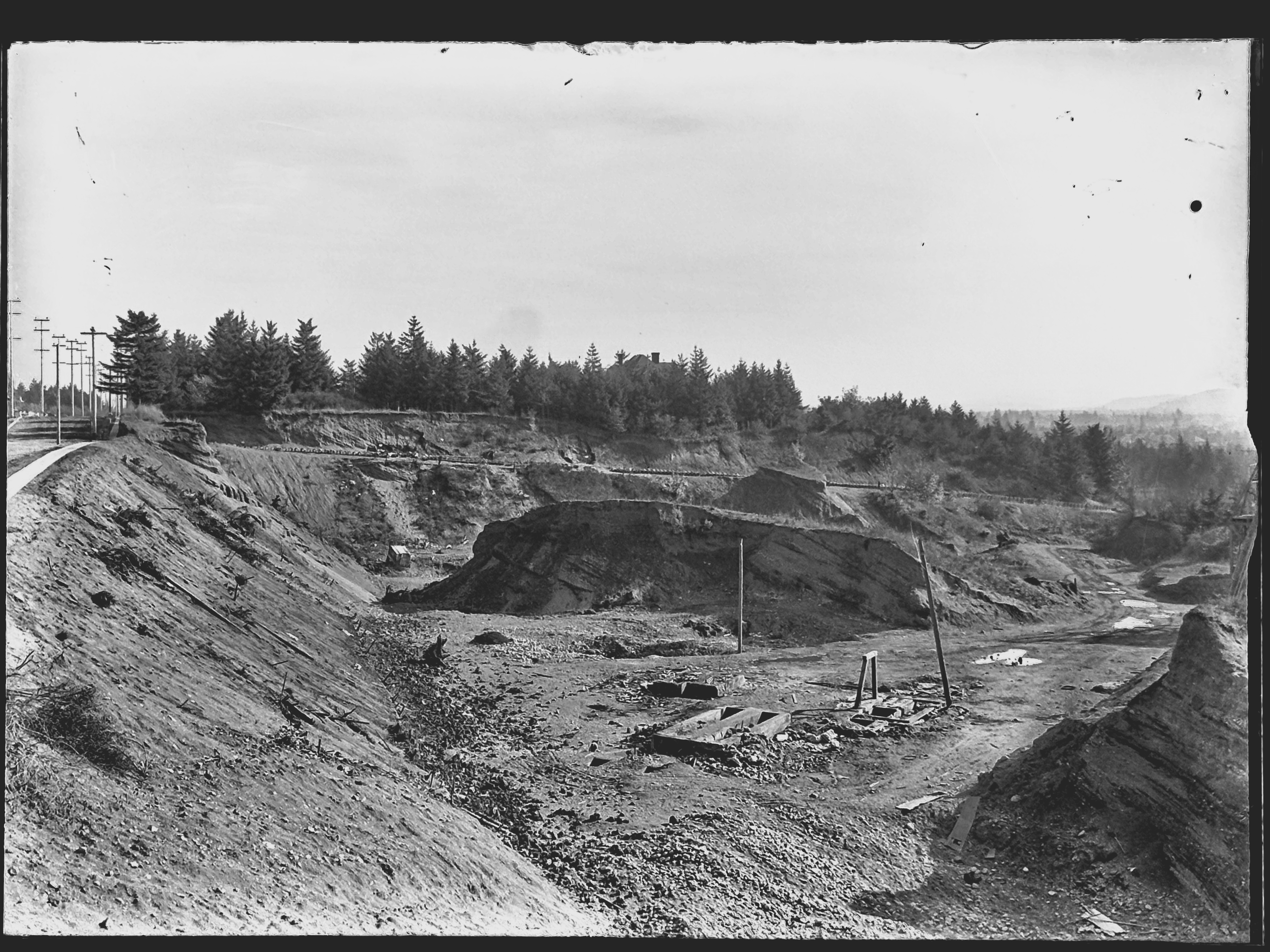
It’s been like time travel, studying the discovered photos from 1913 that take us back to the intersection of NE 33rd and Fremont, the giant gravel pit that once defined that hillside, the stairs leading up Alameda Ridge, and the unstable cutbank above Fremont.

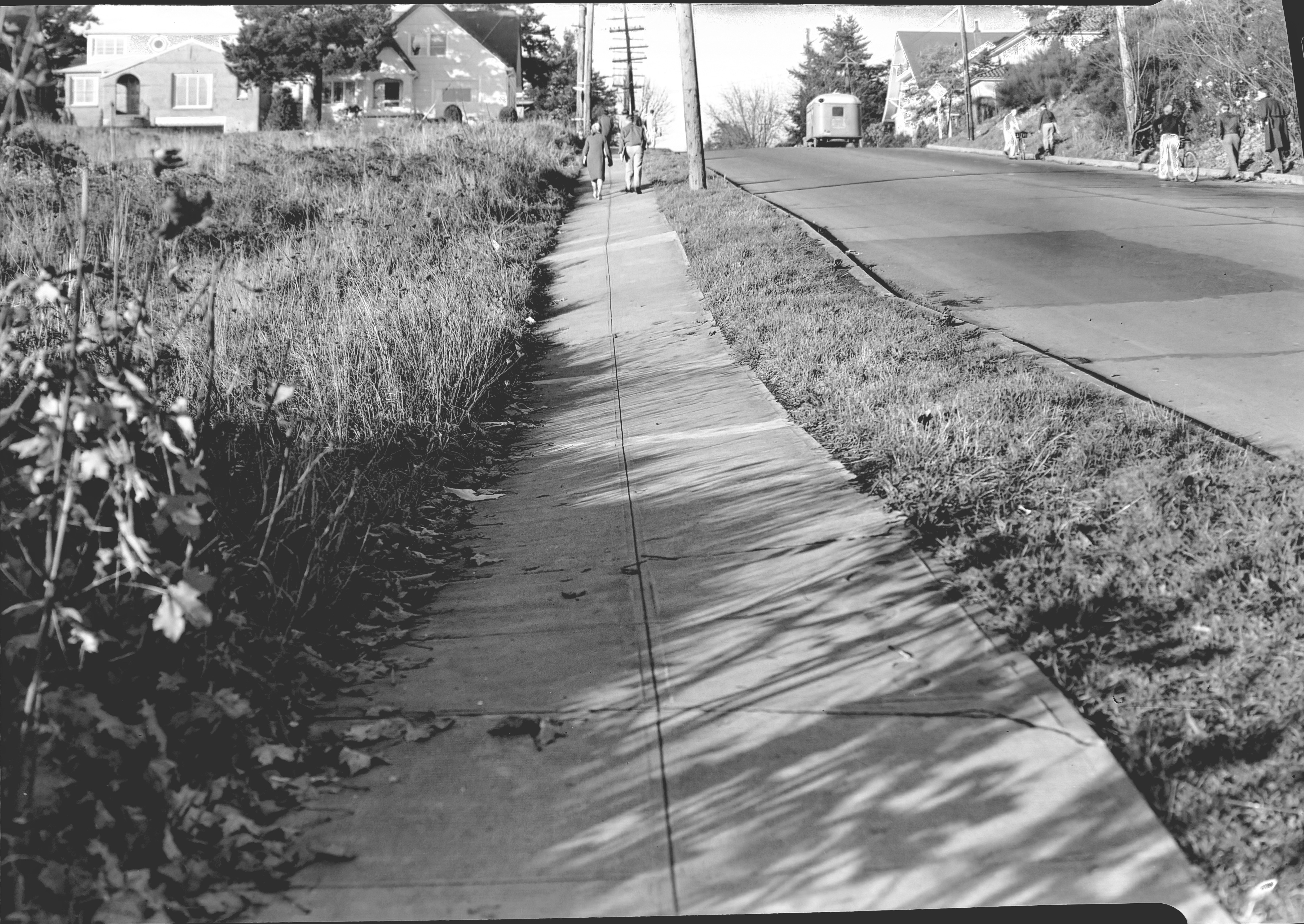
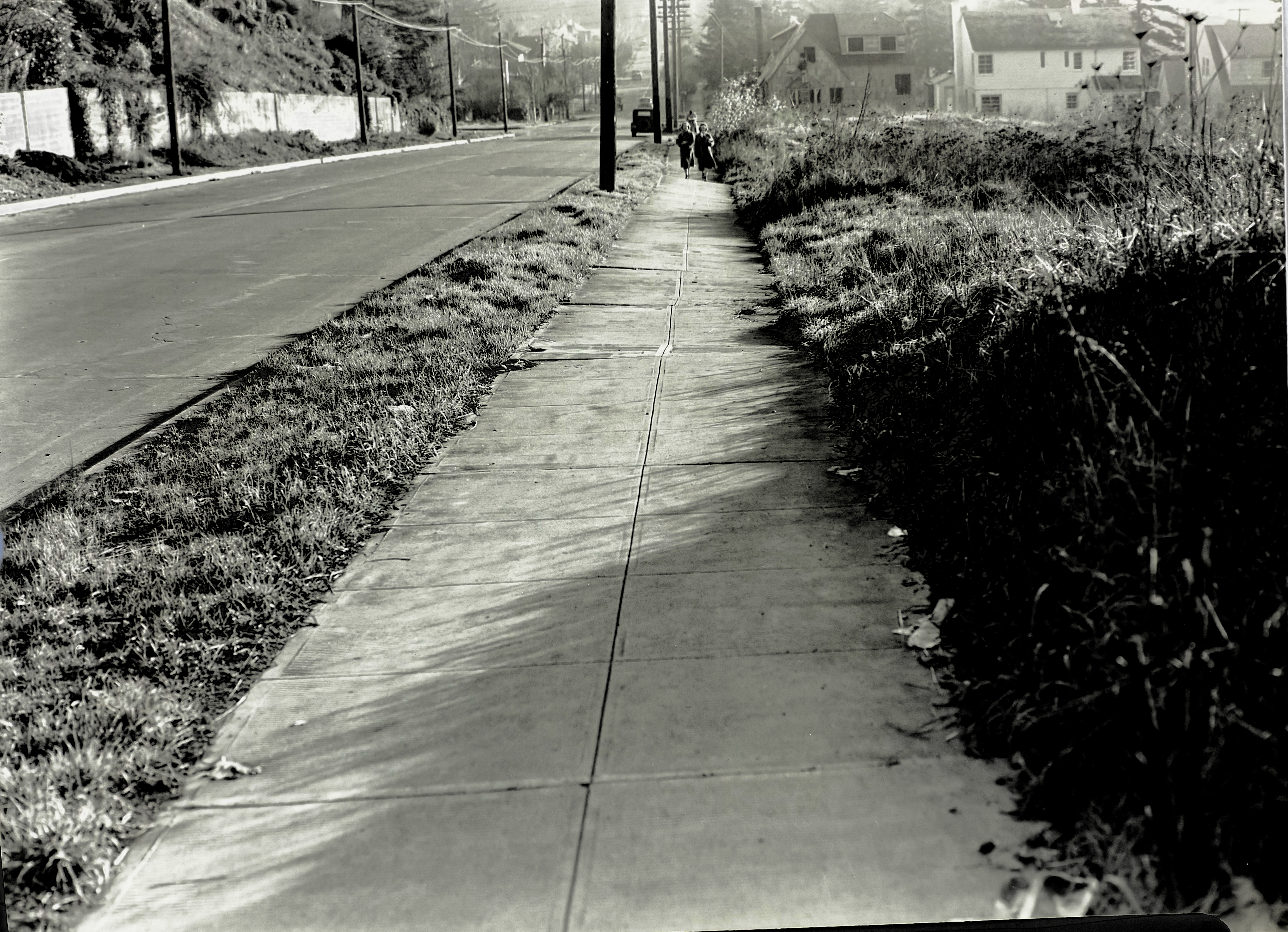
Here are two more views of the general vicinity taken 25 years later that show us how the slope was settling after being filled with garbage and soil. Photographed by the Public Works Department on November 21, 1938, these views look uphill and downhill on 33rd from just below the top of the hill. Click in for a good look and then we’ll discuss:

Looking north along the west side of NE 33rd, just downslope from NE Fremont. Image A2009.009.1272, courtesy of City Archives.

Looking south along the west side of NE 33rd, just downslope from NE Fremont. Image A2009.009.1271, courtesy of City Archives.

Judging by the sunlight and shadows–and what looks like an exodus from Grant High School–these photos were taken in the afternoon of that November day. The uphill photo shows just how much the mid-slope has settled, with the curb and street surface buckling and the entire sidewalk heaving to the west. Nothing has been built on these vacant lots, probably because they were still settling.

Look a bit farther up the hill and you can see two brand-new Ken Birkemeier houses at far left (3279 NE Fremont), perched on what had been the cutbank, and the bungalow to its east at the corner (3289 NE Fremont). Across the street farther east you can see the high-peaked roof of the home at 3304 NE Alameda, and the distinctive tile roof of the Mediterranean-style house at 3301 NE Fremont.

Also interesting to note: no signal light controlling the intersection, nor is there a stop sign facing 33rd (can’t read what is on that sign, but it’s not the standard octagonal STOP sign we know today, which was in common use by 1938). Perhaps Fremont had the stop sign and 33rd had the right of way.

Yet to be built at the top of the hill on the southwest corner was a mid-century home and swimming pool that would eventually collapse into the old pit area and be replaced in the 1990s by a much larger house (and geotechnical engineering). We wrote about it here: The lost house at 33rd and Fremont.

The downhill photo looking south shows just how much the sidewalk wants to fall off into the old pit. Below the pedestrians you can see a house under construction–3289 NE Klickitat, also by Ken Birkemeier who was very busy in this part of the neighborhood during those years.

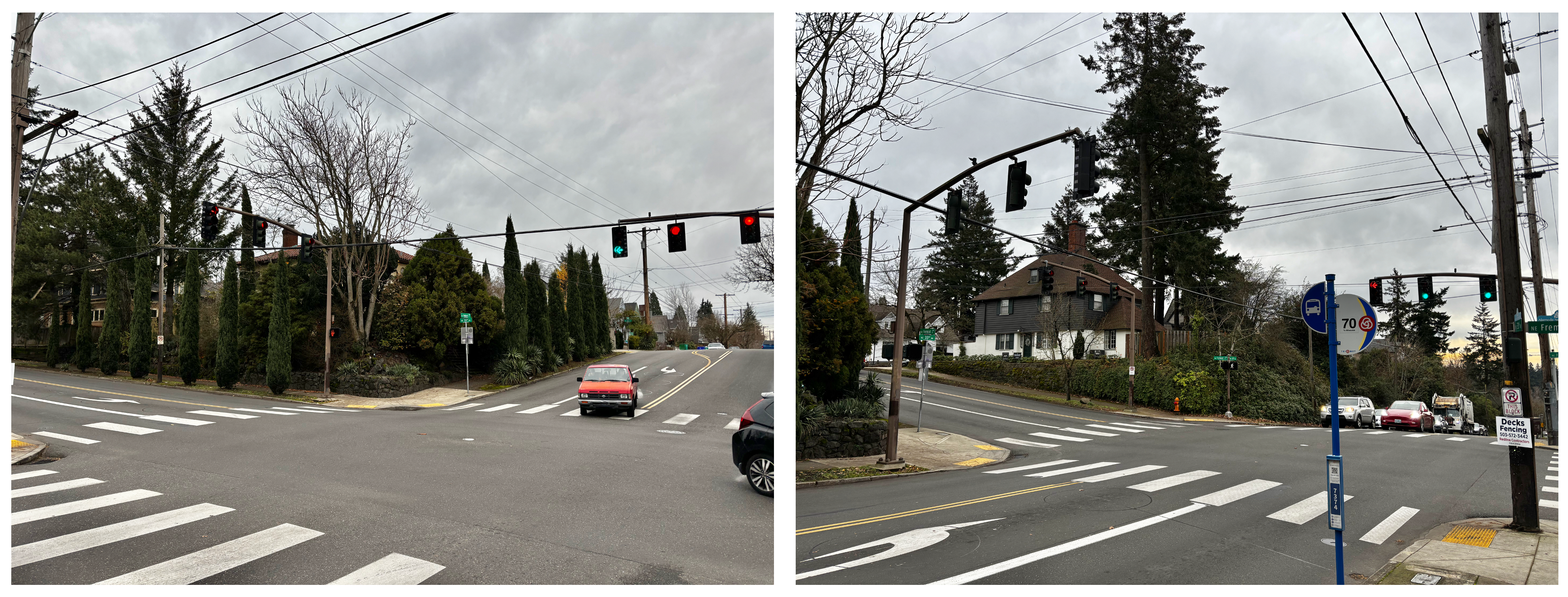
Today we have Google streetview to document so many aspects of our neighborhood, but it’s been a treat to turn back the clock with these and the 1913 photos. We’re always on the lookout for early photos of our Northeast neighborhoods. Stay tuned for more findings. The promised Columbia Slough photo from 1913 is next.

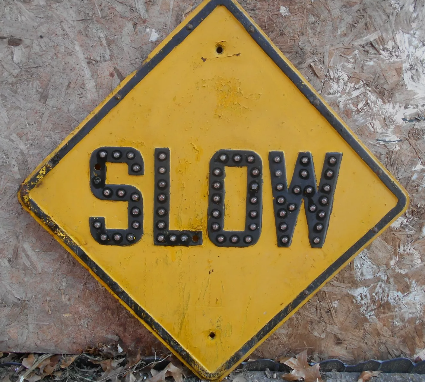
Post Script: Attentive Reader John Golightly adds his observations that the sign at the intersection probably was a “SLOW” sign, which we agree with. Here’s a photo of a 1930s-era slow sign in its characteristic diamond shape:

1913 Photos: Dueling Subdivisions at NE 33rd and Fremont

To really understand the next installment of photos from the 1913 collection, it helps to visualize what the middle part of Portland’s eastside looked like then, and what was going on in the economy and life of the city. Following the Lewis and Clark Exposition, which put Portland on the map in so many ways, our population exploded: from 90,426 people in the 1900 census, to 207,214 by 1910.

Like shock waves rippling out across what had been a mostly agricultural landscape, development pressures began to reshape the dirt roads, orchards, dairies and forested clumps of the middle eastside. Meanwhile the economy began to heat up in the early teens as speculators, home buyers and homebuilders jockeyed to take advantage of the growing marketplace. Maps and a few precious photos from the early 1900s show this place as mostly undeveloped open lands, dotted with barns, scattered farm houses and dirt roads.

By 1913, the fields and hills of the middle eastside had been platted out into subdivisions, and the infrastructure of sewer, water, electricity and roads was trying to catch up with the vision sold by developers. In some places, a grid of streets existed, and a sprinkling of single family homes was being built, making visible the conversion from agriculture to residential use. To the north closer to Alberta, construction had been underway since the middle of the 00’s. Eastside neighborhoods closer to the river–Albina, Irvington, Ladd’s Addition, Woodlawn, the Peninsula–had been platted and growing as early as the 1890s.

Back in the day, the intersection of NE 33rd and Fremont–the focal point of this 11-photo series of glass plate negatives from City Archives–was a north-south wagon road to the Columbia River, and access point for the giant gravel pit near the top of the ridge. Surrounded on all sides by planned development, the intersection was in transition from dirt path to thoroughfare.

On the northeast side of the intersection, the Jacobs-Stine Company was ready to sell you a lot in the Manitou Subdivision. Just across Fremont to the southeast, the Terry & Harris Company wanted you to see the lots in Maplehurst. Our photographer from the Department of Public Works captured both views. Meanwhile, the mud puddle in the middle of the intersection reminded everyone the reality that for the moment, this was still a fairly rural place.

Looking to the northeast along Fremont from the southwest corner of NE 33rd and Fremont (33rd is passing from upper left to lower right). The house in the distance at right is today’s 3415 NE Fremont (built in 1912). Curbs and sidewalks are in (thanks to Elwood Wiles and Warren Construction), and ceramic sewer pipe is stacked near the curb awaiting installation. The Jacobs-Stine Company, boasting on its sign of being “The largest realty operators on the Pacific Coast,” was owned in part by Fred Jacobs, who would later die when his car tumbled off Stuart Drive in Alameda a few blocks from here, giving rise to the nick-name of that street as Deadman’s Hill. Photo courtesy of City Archives, image A2009.009.3613.

Looking to the southeast from the northwest corner of 33rd and Fremont. 33rd runs down the hill on the right. Fremont follows the slight rise to the left as it heads east. Sewer construction is evidently about to begin. Photo courtesy of City Archives, image A2009.009.3614.

Left photo is similar to top, looking northeast. Right photo is similar to bottom, looking southeast.

Maplehurst was platted in 1910 by Mary Beakey, who named a street for her family (labeled as A Street on the plat). It’s a relatively small subdivision–only three blocks and 43 lots, and exists up against a plat called Irene Heights, which was developed by the Barnes family, containing the Barnes mansion and multiple former Barnes family homes.

NE 33rd wasn’t the only north-south thoroughfare passing through a landscape in transition. One half section to the east (our landscape was gridded into sections, townships and ranges by surveyors in the 1850s), NE 42nd Avenue was experiencing its own growing pains.

Up next: The Alameda stairs. Our Department of Public Works photographer captured the brand-new stairways transiting the slope between Fremont and Alameda Terrace (known as Woodworth before the Great Renumbering of the early 1930s).

1913 photos reveal new perspective at Gravelly Hill – 33rd and Fremont

Every now and then in my research, I’ll find something—a memory, photograph, map or  document—that really sticks with me and defines the way I think about a place.

This month I found a batch of mis-identified photographs when searching at City of Portland Archives that resulted in an absolute jackpot from 1913, opening a fresh window into the past near NE 33rd and Fremont.

Once known as Gravelly Hill, the area was indeed a gravel pit for many years in the late 1800s, and later the repository for all of the eastside’s household garbage between 1923-1924, then known as the Fremont Sanitary Landfill.

But before the landfill, back in 1910 as subdivisions crowded in around the big pit, questions were raised about the basic stability of Fremont Street, which was just below the brow of the Alameda ridge and ran right along the north edge of the pit. Developer Benjamin Lombard, who platted the adjacent Olmsted Park about that time, even sued the city for violating its own ordinance about gravel pits.

So, no secret: that slope South of Fremont was a gravel pit.

But as it turns out, it wasn’t just a gravel pit. It was a GIANT gravel pit. See for yourself:

You’ll want to click into this for a good look. Looking east along Fremont toward NE 33rd from about today’s NE 32nd Avenue. Sewer pipe stacked along the eastern edge of NE 33rd, which slopes downhill left to right. The roof of the house visible at treeline in the center is the Barnes Mansion, 3533 NE Klickitat, which was then brand new. City Archives Photo: A2009.009-3611 (mislabeled as Lombard Street)

In 1913, a photographer for the Department of Public Works visited the pit and brought back 11 amazing images that got buried in the archives. They’re large-format glass plate negatives, not prints, and for years have been filed away in envelopes under “Lombard Street” at City Archives. I suspect few people have ever seen them. A few weeks back, something else I was looking for led me to these glass negatives.

I photographed each plate and made positive prints to be able to better visualize the scenes. And as I studied that first picture and figured out it wasn’t showing Lombard Street, but Fremont Street, I knew this would be a find to remember.

After that first photo, there were these next two, clearly taken as a pair, to illustrate the depth and breadth of the pit. Both are unquestionably tied to the Gravelly Hill landscape. Here I’ve melded them together to create a single image:

Looking north into the gravel pit at NE 33rd and Fremont, December 1913. Click to enlarge. View would be from between today’s Siskiyou and Klickitat streets, looking uphill. The house at far left is today’s 3251 NE Alameda Terrace. The house at far right is the top of today’s 3305 NE Alameda. A sign is visible at upper right for a new subdivision, placed in the cutbank on the northeast corner of 33rd and Fremont. Segments of sewer pipe are visible stacked there. Today, the pit is filled with three city blocks and more than 50 homes. City archives photos, left: A2009.009.3619; right: A2009.009.3620.

Here’s a bit more context from neighborhood historian R.A. Paulson, writing in The Community Press on October 1, 1975:

“From the earliest recollections of those familiar with the area, this was a worked out gravel pit, the excavation of which had been finished many years before but still showing the signs of one-time activity. As late as 1919 and 1920, the pit formed a precipice going down sharply from near Fremont possibly 100 feet or so to the level of Klickitat and extending between 32nd place and 33rd Ave. Coming from the west, Kllickitat Street was unpaved east of about 29th with the cement sidewalks ending there but even between 26th and 29th these sidewalks were impassable because of the overgrown bushes and small trees.


“The gravel pit had been a lush source of rock and gravel for someone way back and the solid bank of this material had originally sloped down from Fremont at the same grade as the present 33rd Ave. This had been scooped out over a period of perhaps 50 years or more and most likely went into improving the lanes, roadways and public highways for miles around, certainly for the country roads that became 33rd Ave. and Fremont Street.


“The bed of the pit showed evidence that work and even habitation had gone on there but at the time of World War 1, only a monolith of stone, too difficult to remove with pick and shovel, reared upward from the new level.”

Here’s a detail from a 1925 aerial photo that shows the extent of the pit and the still-forming street infrastructure. The pit covered two-plus blocks, from NE 33rd to NE 31st, between Fremont and Klickitat.

Detail from a 1925 aerial photo showing the intersection of Fremont and 33rd, labels added for reference. Dashed lines indicate eventual location of NE 32nd Place and NE 32nd Avenue. Click to enlarge. Aerial photo courtesy of City of Portland Archives.

Stay tuned for eight other gems in this collection that are just as knock-your-socks-off amazing as these three. Next up: we’ll take a close look at the intersection of NE 33rd and Fremont 111 years ago, absolutely recognizable to today’s eye.