In 1913, nearby property owners and the Department of Public Works were concerned about the stability of the slope above Fremont Street in the stretch between NE 30th and NE 33rd. Fremont itself was perched along the north edge of a giant gravel pit that had been mined for decades and would eventually be filled with garbage to build it back up to grade.
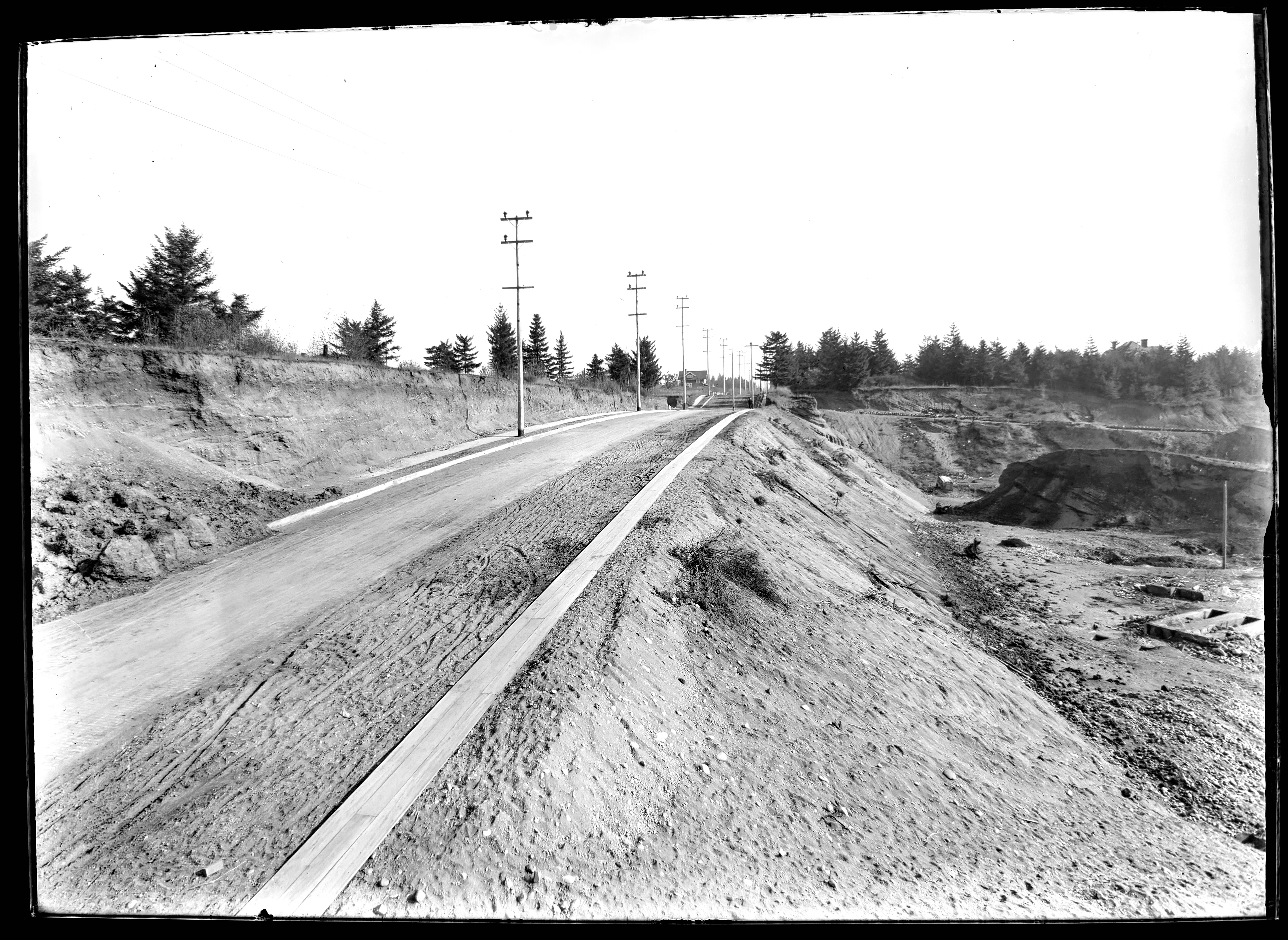
NE Fremont Street looking east near today’s 32nd Place, in 1913. Click in for a closer look. Gravel pit to the right (south) and cutbank above to the left (north). House in the center is 3415 NE Fremont. In the distance, sewer pipe is stacked down the hill along the east side of 33rd and a person faces the photographer at the intersection. A wooden plank sidewalk runs along the south side of Fremont. The gravel and dirt streets were paved the following year. Photo courtesy of City Archives, A2009.009.3615.
The cutbank slope above Fremont angled up 50-75 feet to the southern edges of the brand-new Alameda Park and Olmsted Park subdivisions, which flattened out to the north atop Alameda Ridge. With nothing to hold the cutbank in place, dirt and gravel would periodically slide down, covering sidewalks and curbs and spilling out onto Fremont Street.
A Department of Public Works photographer was there to document the slope. These are the last three in the series we’ve been sharing of re-discovered images at City Archives that are labeled as “Lombard Street.”
Moving farther west on Fremont, the photographer noted two other slides that had covered sidewalks and curbs.
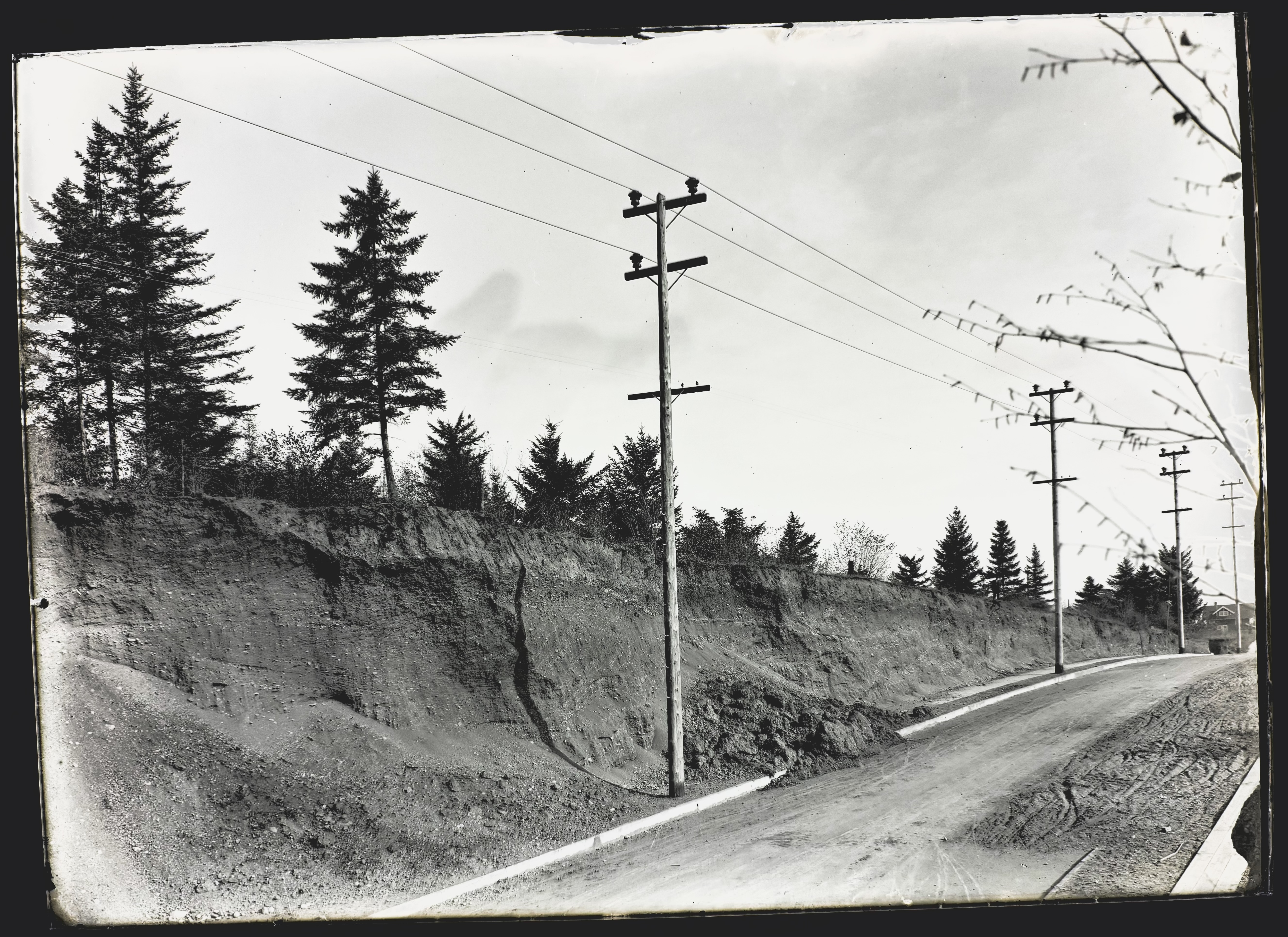
NE Fremont Street. Looking east just below the crest of Alameda Ridge, seen from between today’s NE 32nd and NE 31st. Photo courtesy of City Archives, A2009.009.3616.
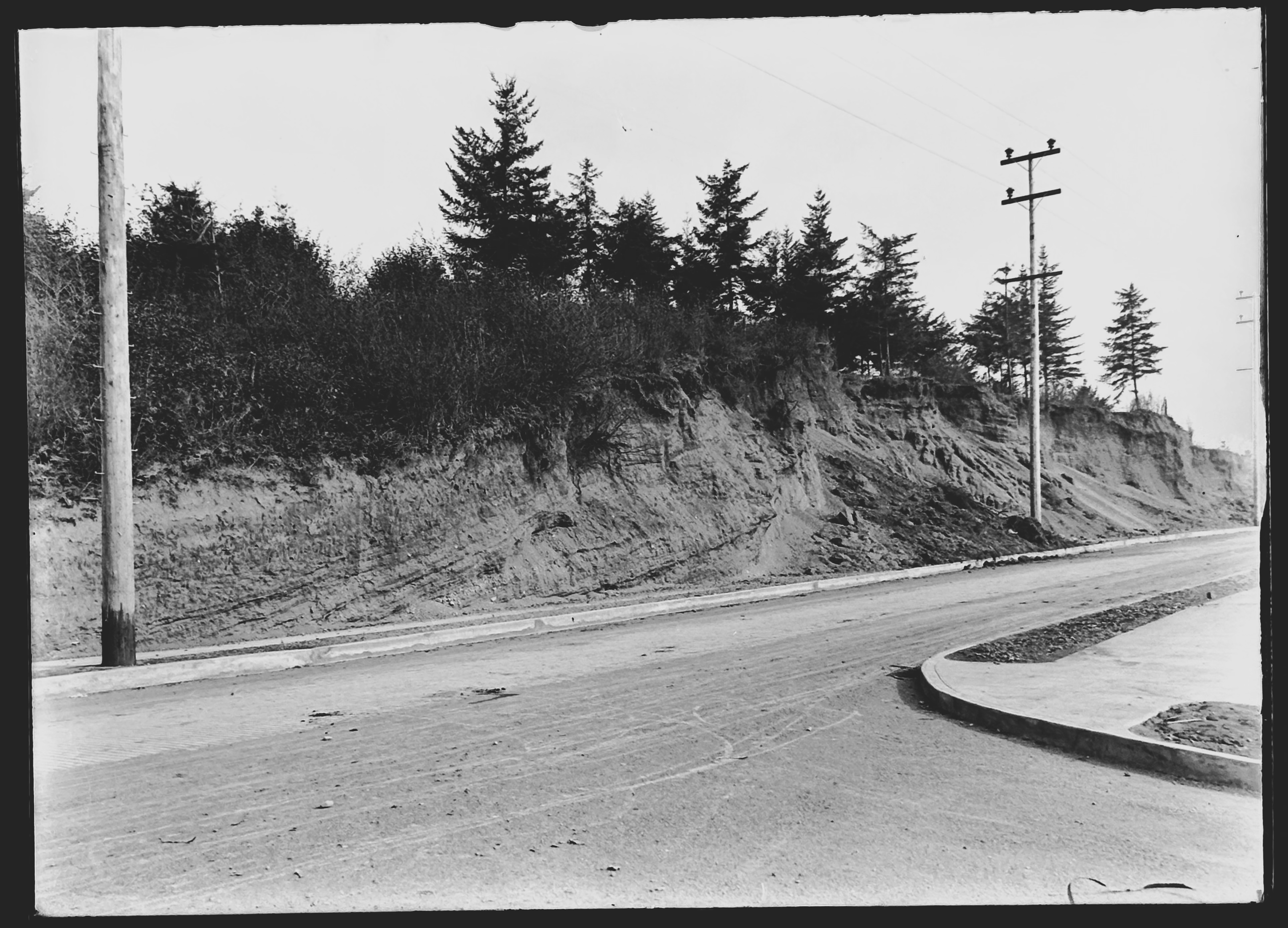
Fremont Street running left and right, seen from the corner of NE 31st, which leads downhill at bottom right. Looking northeast toward the top of Alameda Ridge. Photo courtesy of City Archives, A2009.009.3618.
Be sure to take a look at this view as well, a low-elevation oblique photo from 1930 that shows the cutbank, the slope below Fremont (now filled with garbage and grown over with brush) and lots of other neat things to look at.
No big surprise both slopes were on the move. Geologists remind us Alameda Ridge is basically a giant gravel bar, deposited more than 15,000 years ago by the great Missoula floods that shaped our region. In the years after these photos were taken, vegetation returned to the cutbank slope and houses (and stairways) were built, increasing the surface stability.
Attentive reader and friend of Alameda Brian Rooney tracked down a great graphic that shows the east-west pendant gravel bar of Alameda Ridge that formed downstream (west) of Rocky Butte during the great floods. Helps visualize the old “Gravelly Hill” ridgeline. The arrow points out the intersection of 33rd and Fremont:
A detail from a comprehensive poster explaining the Missoula Floods by the Oregon Department of Geology and Mineral Industries. Thanks Brian!
Up Next – A bonus photo from Public Works: the Columbia Slough in 1913.


