For more than a century, the old church at the southeast corner of NE 24th and Broadway has been one of our neighborhood’s most visible landmarks, its distinctive Arts and Crafts steeple and bracketed gables signaling “turn here” to generations of neighbors heading home to Irvington, Alameda and points north.
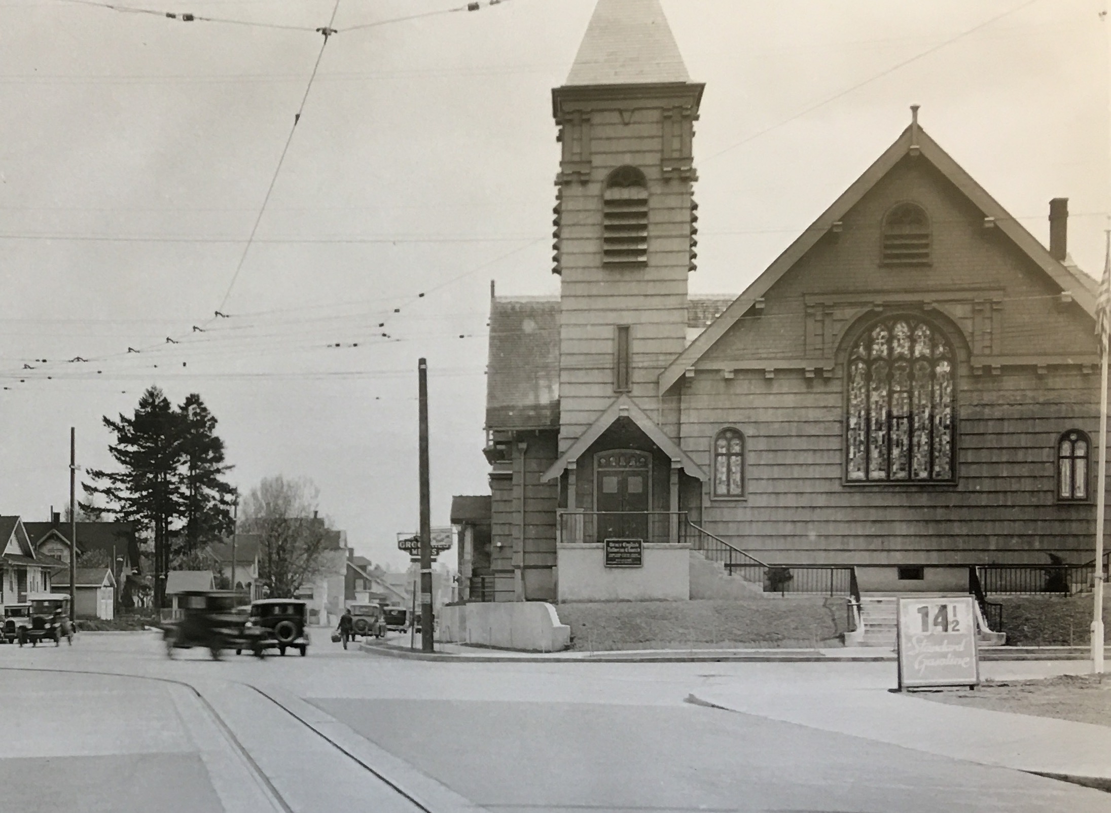
Looking east on Broadway at the corner with NE 24th Avenue, about 1930. Courtesy of Portland City Archives, image 1999-004.319
Built at a time when much of the surrounding land was in transition from agriculture to residential and all the surrounding streets were gravel, this time traveler has witnessed generations of change.
Today, the old church is in the middle of its own significant change, having narrowly avoided being torn down and replaced by a five-story condominium. The Metropolitan Community Church sold the building in April 2019 to two northeast Portland business partners who are now adapting the old church into a brewery.
If you’ve recently passed by in the evenings and seen the stained glass windows all lighted up, you might have wondered what was happening. Neighborhood residents Brody Day and Dustin Harder have been busy taking things apart inside to see exactly what they have to work with and to coordinate with architects, engineers and designers as they develop the concept for the Steeplejack Brewing Company, which they hope to open in the summer of 2021.
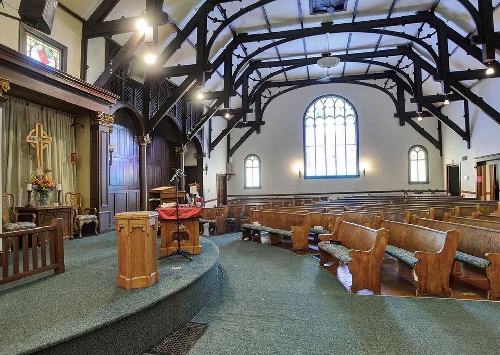
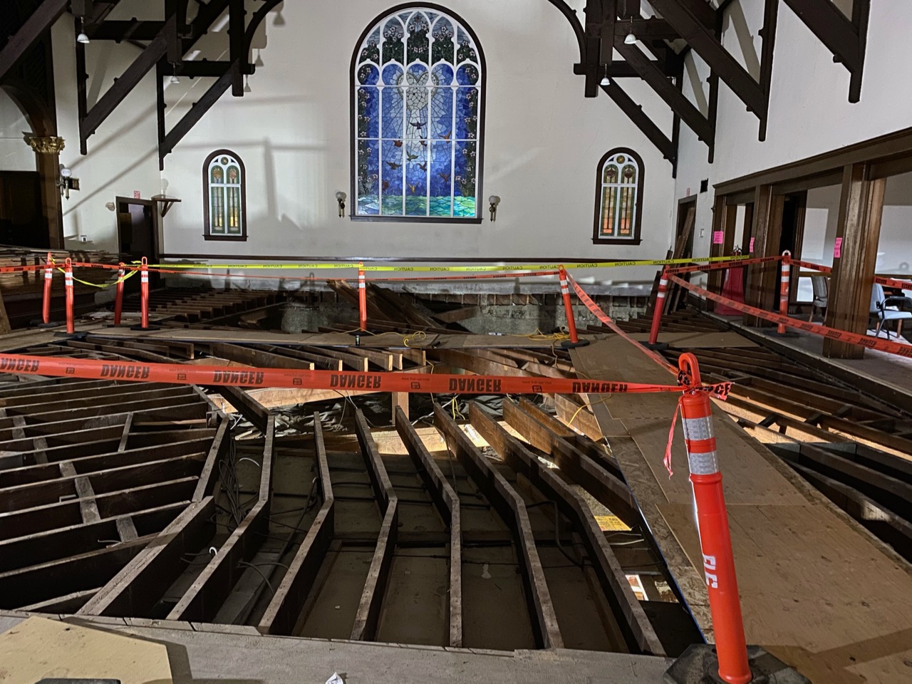
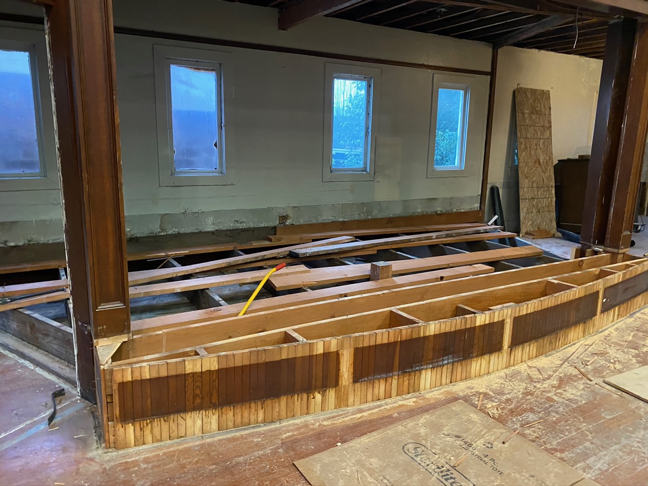
The main sanctuary with pews (left), and recently with flooring material removed revealing floor joists. Photo courtesy Harder-Day.
Harder and Day are old college roommates from UC Santa Cruz who shared their first beer together in Austria way back when during a memorable study abroad term. That experience ignited a passion for brewing in Day who went on to become an accomplished home brewer and nationally recognized judge for brewing competitions. Over the years, Day has traveled across North America judging beers (and visiting breweries) and has always thought about how he’d like to start a commercial brewery of his own.
Following a move to Portland, Day connected with Harder and the two started planning a brewing business. In 2018 they began looking at properties and found the old church for sale, then owned by the Metropolitan Community Church of Portland. The congregation had been in the building since 1977 and had made the difficult decision to downsize to a building in Southeast Portland, putting the old church on the market for just over $1 million.
Day and Harder were one of two bids for the building: the other was from a local developer who wanted to demolish the church and build a five-story condo on the site. In April 2019, following a meeting with the pastor and the congregation—and assurance that Harder and Day wanted to keep the building intact—they successfully closed the deal.
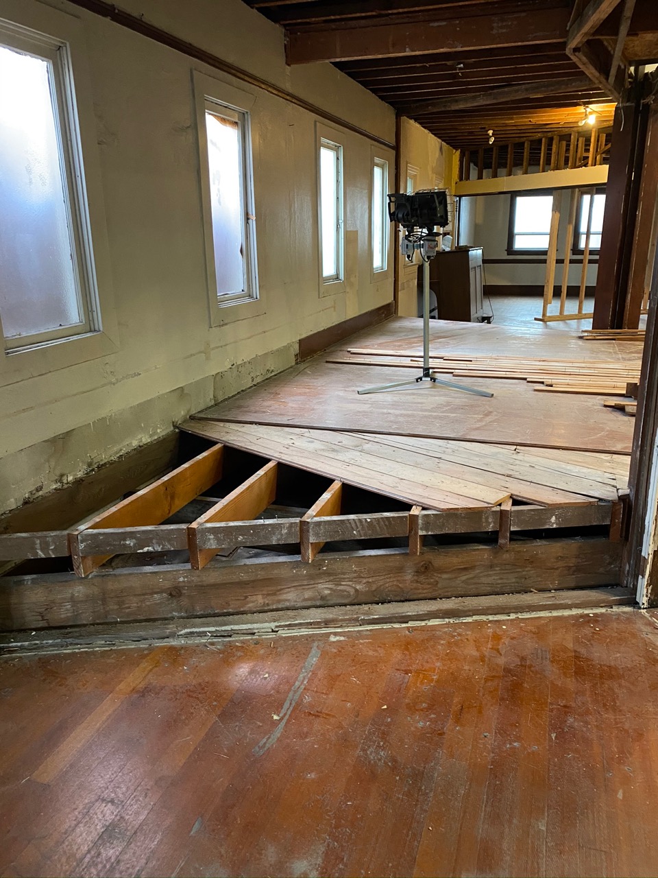
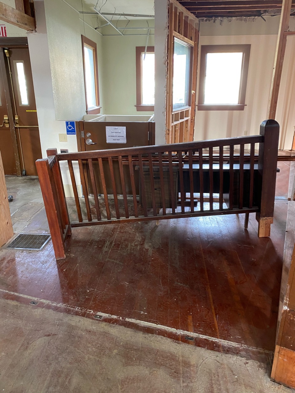
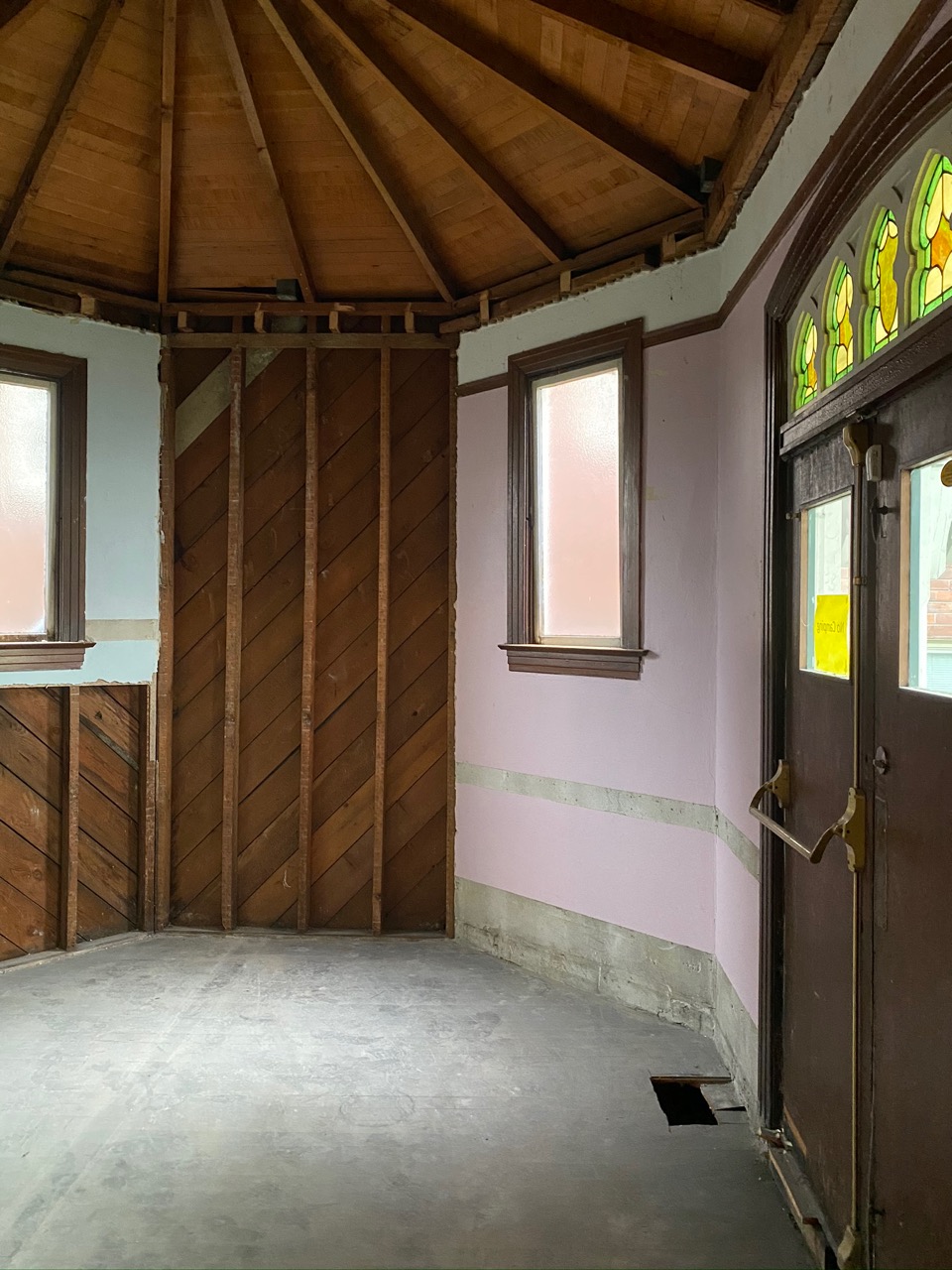
Since then, it’s been a flurry of design activity, permitting meetings with the city and explorations of the old building to discover what they were working with structurally, and with the building’s fascinating history.
Opened in October 1909 as the First Universalist Church of Good Tidings, the building has been home to four separate church congregations over the years: First Universalist Church from 1909-1917; Grace English Lutheran Church 1919-1963; First Church of Divine Science, 1963-1977; and Metropolitan Community Church of Portland from 1977-2019.
The church cornerstone was laid by U.S. President William Howard Taft on October 3, 1909 in front of a crowd of 15,000 onlookers who crammed the streets in all directions to watch and listen as Taft set the stone and told the crowd he hoped the church would thrive.
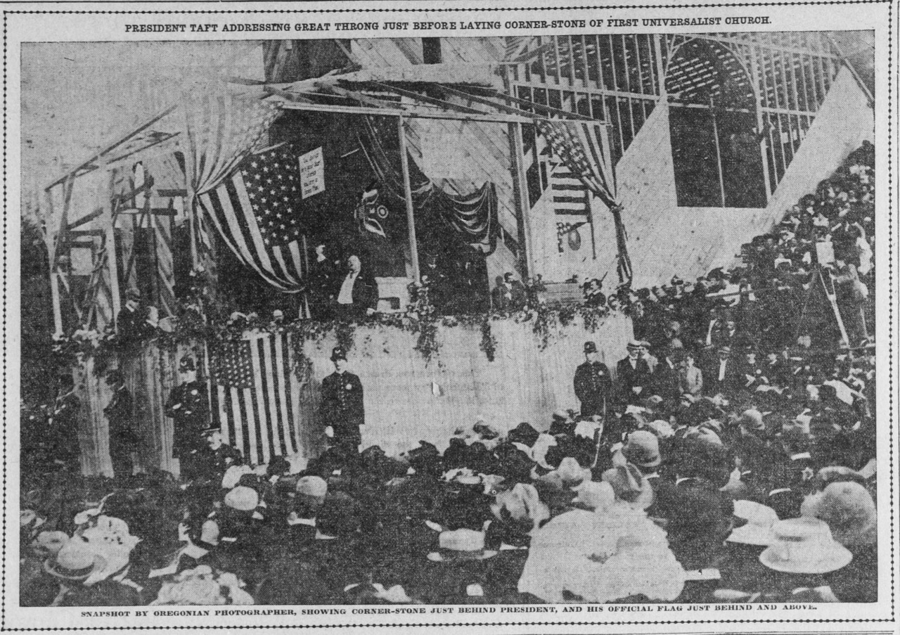
From The Oregonian, October 4, 1909. Taft is pictured here during the cornerstone ceremony. Note church construction still underway in the background (click to enlarge).
A time capsule set by Taft in the cornerstone has since been opened by earlier church congregations. But the building remains one of few in Portland with the distinction of having been dedicated by a U.S. President. Day hopes to re-establish a time capsule in the same location when the business opens in the summer of 2021.
Over the years, the church has been a source of community and a venue for so many rites of passage: baptisms and christenings, weddings, funerals and the day-to-day offering of hopes and prayers. Day recognizes and affirms the sacred aspects of the building’s former life and wants to honor the space and the stories in a respectful way. His hope is that the building can once again be a community gathering spot, a comfortable place where neighbors of all ages—including families—just want to be.
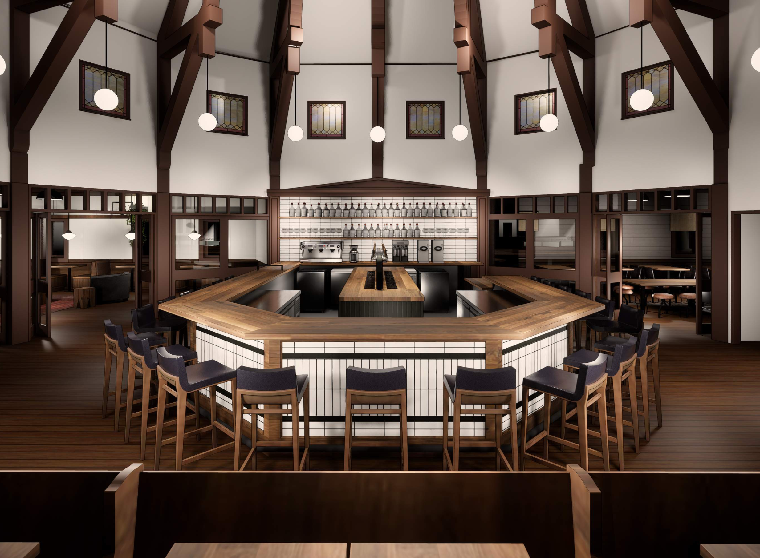
One key element of the interior will be the brewing deck, which will be front and center at eye level in the bar, allowing visitors a close look at the brewing process.
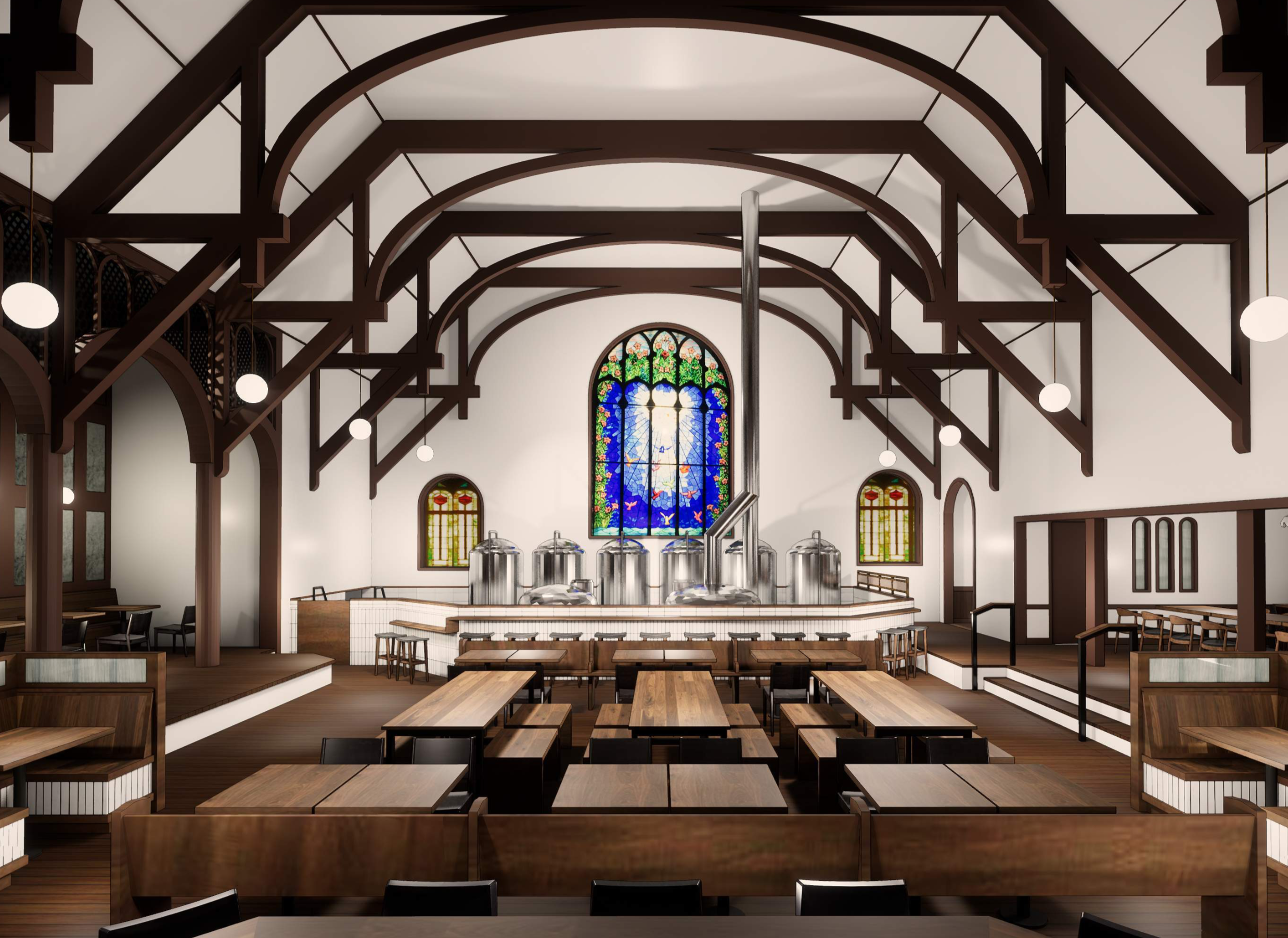
Rendering of the brewing deck area above, and bar below. Courtesy Harder-Day and Open Concept Architecture.
Steeplejack will serve its own beers brewed on site and will feature guest taps as well. In his years as judge and beer connoisseur, Day has found there aren’t enough breweries who make great tasting low-alcohol content beers. Steeplejack intends to have the finest selection of excellent “sessionable” beers (which means you can have a few without being over the limit for the drive home).
The food menu is still in development, but Day says he’s thinking about a simple and affordable menu of a few excellent dishes that will make people want to come back.
He’s also thinking about how adaptive re-use of the building can carry through to other aspects of the new brewery. All of the tables, chairs and furniture, for instance, will be built from wood salvaged during the interior remodel.
One of the spaces Day is most excited about is the bell tower and steeple itself, which will be opened up from the inside so visitors can look up and admire the matrix of full-dimension structural wood—all cut and placed by hand in a time before power tools.
“The biggest surprise in all of this for me is how extremely well this building was built,” says Day. “So much of what we’re doing in the design is to showcase the quality of the craftsmanship and the pride they took in their work.”
And the name? A steeplejack was the most daring and accomplished worker on a job willing and able to climb to the highest and most precarious perch. To take a risk, to climb with confidence, to get a job done that most others couldn’t or wouldn’t want to do.
The pandemic has slowed things down, without a doubt, but Day is philosophical and feels the unanticipated interruption has actually allowed time to work out the details of their designs and plans, and to prepare the permitting pathway with the city. Watch for construction to begin in earnest soon with significant maintenance and upkeep on the exterior walls, windows and roof, and interior construction to create a tap room, brewing area and other interior brewery and restaurant spaces.