We’ve had the opportunity recently to look into the origins of what is known today as the Concordia neighborhood, and even though it had different names way back when, no big surprise that today’s neighborhood draws its name from nearby Concordia University.
Opened in 1907 on six acres of land that was then at the edge of Portland city limits, Concordia College was a simple two-story wood frame building home to the Oregon and Washington District of the Evangelical Norwegian Synod. Operating primarily as a high school program for young men until the 1950s, Concordia gradually evolved into a junior college, added a co-ed mission and additional facilities in the 1950s, and became a full-fledged four-year college in 1977.
Here’s an article from The Oregonian on December 15, 1907 that provides some context and mentions a few early references that AH readers will recognize. Have a look (click to enlarge).

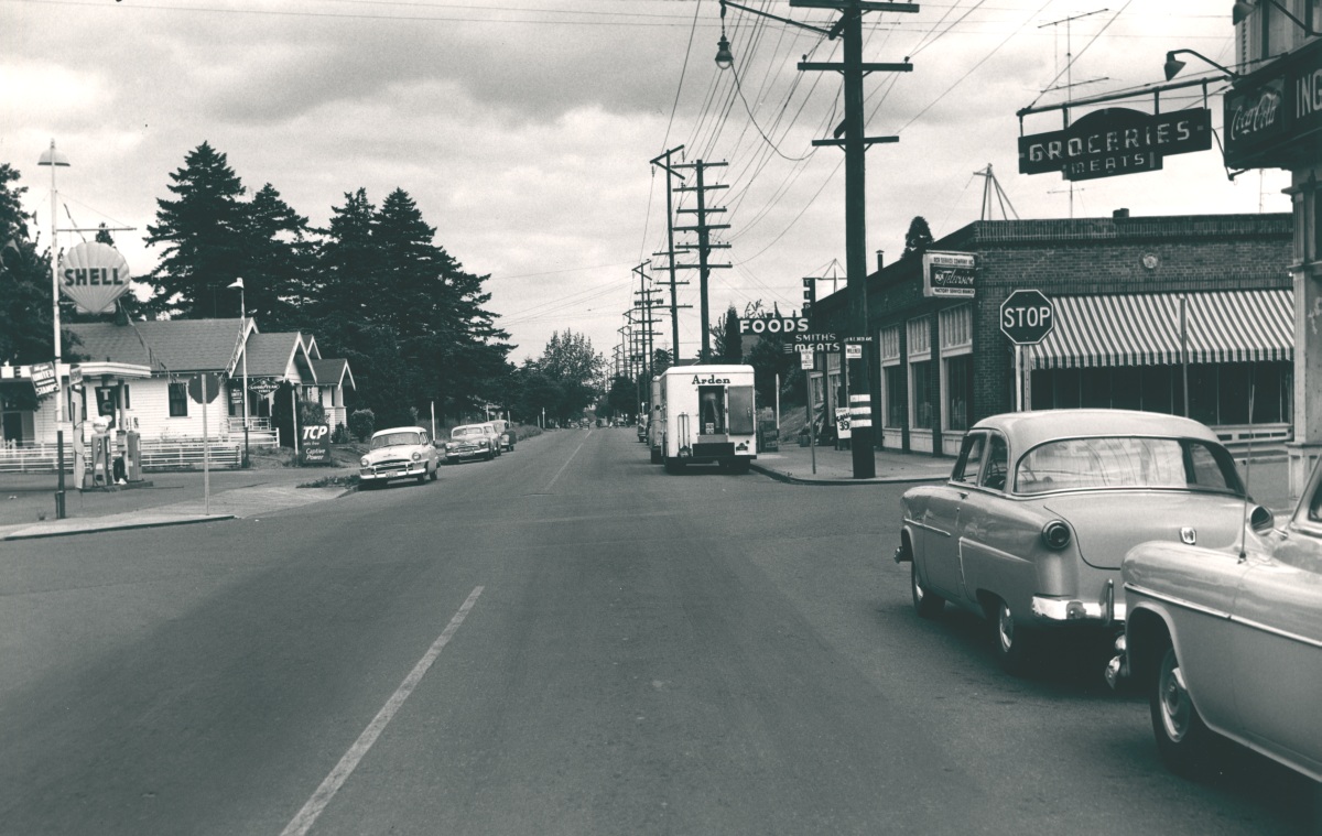
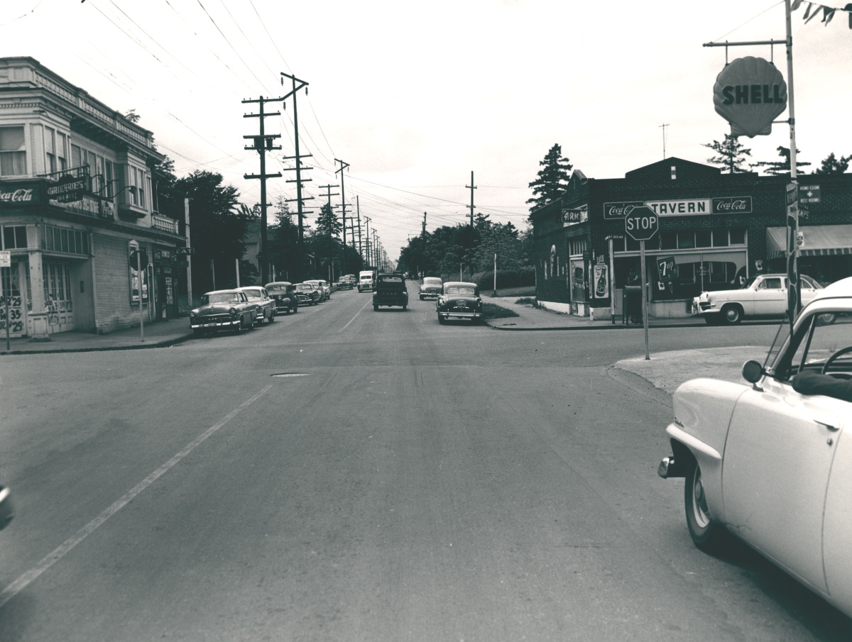
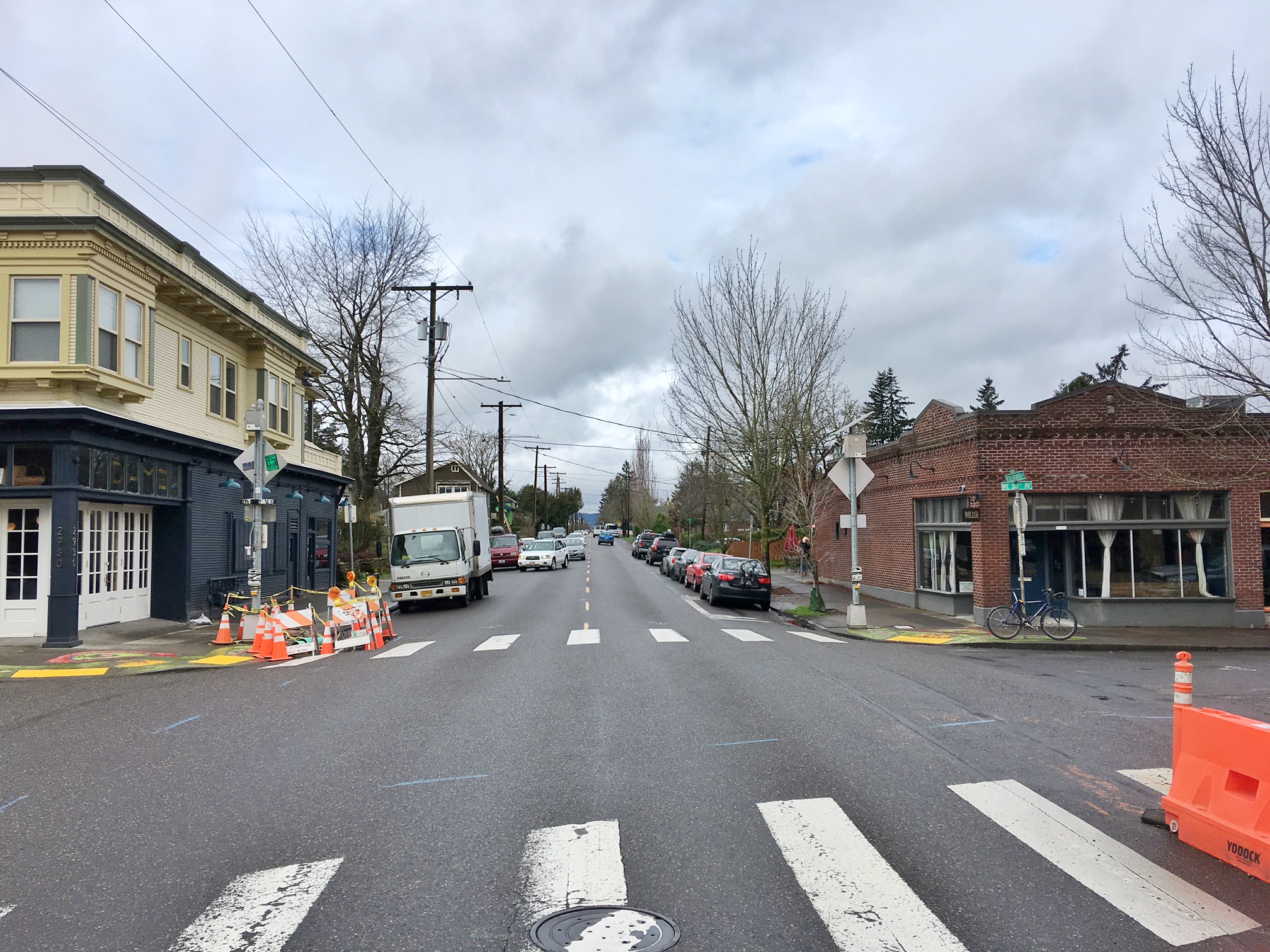
We’ve written about that stop at the end of the Alberta carline mentioned above, which was the corner of NE 30th and Ainsworth. Check out our post and a 1944 photo of the streetcar parked there.
So ok, no big surprise about the Concordia name we know today. But peel back a layer of history to reveal earlier names, and it gets interesting.
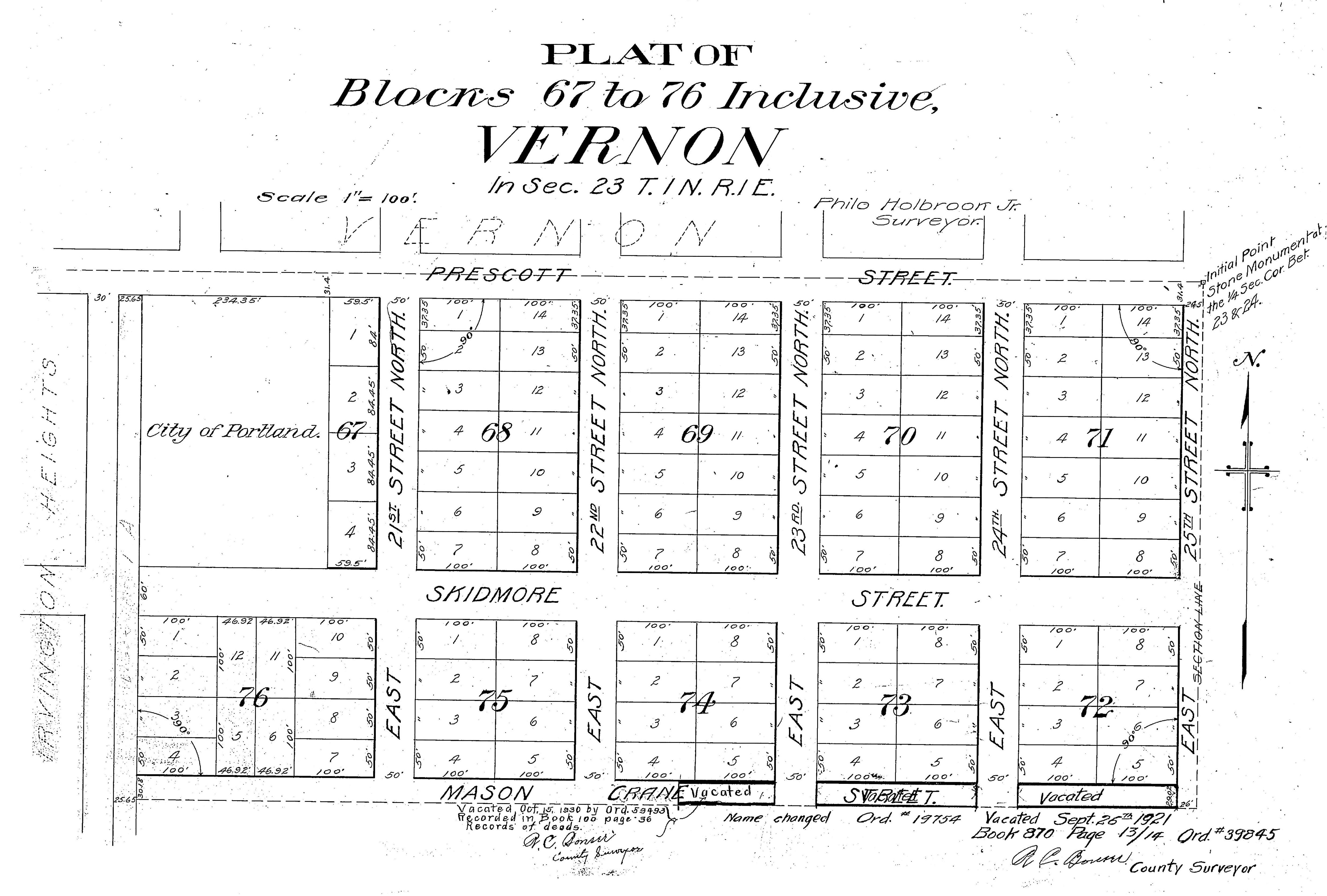
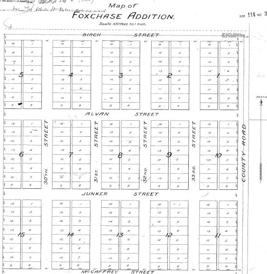
Back then, if you lived in the area north of Killingsworth and south of Dekum between 20th and 33rd, you would have told someone you lived in Irvington Park (not to be confused with Irvington), or maybe the Town of Creighton, or the Heidelberg Addition, or even Foxchase, all place names making up today’s Concordia neighborhood that stem from the title of survey plats filed by the real estate operators who gridded out the fields and forests on these gentle south slopes above the Columbia River.
The Town of Creighton (like the Town of Wayne adjacent to Alameda) wasn’t actually a town, more like the idea of a town, hatched by property speculators in 1883, drawn out as a kind of map and filed with the Multnomah County surveyor. Remember back then this neck of the woods was well outside the city limits. The Town of Creighton plat is unrecognizable today: its tentatively drawn tree-related street names didn’t carry through time: Maple, Walnut, Beech, Locust, Birch. Creighton’s only legacy is the location of boundary lines on today’s map: north of Killingsworth, east of 25th, south of Rosa Parks and west of 33rd.
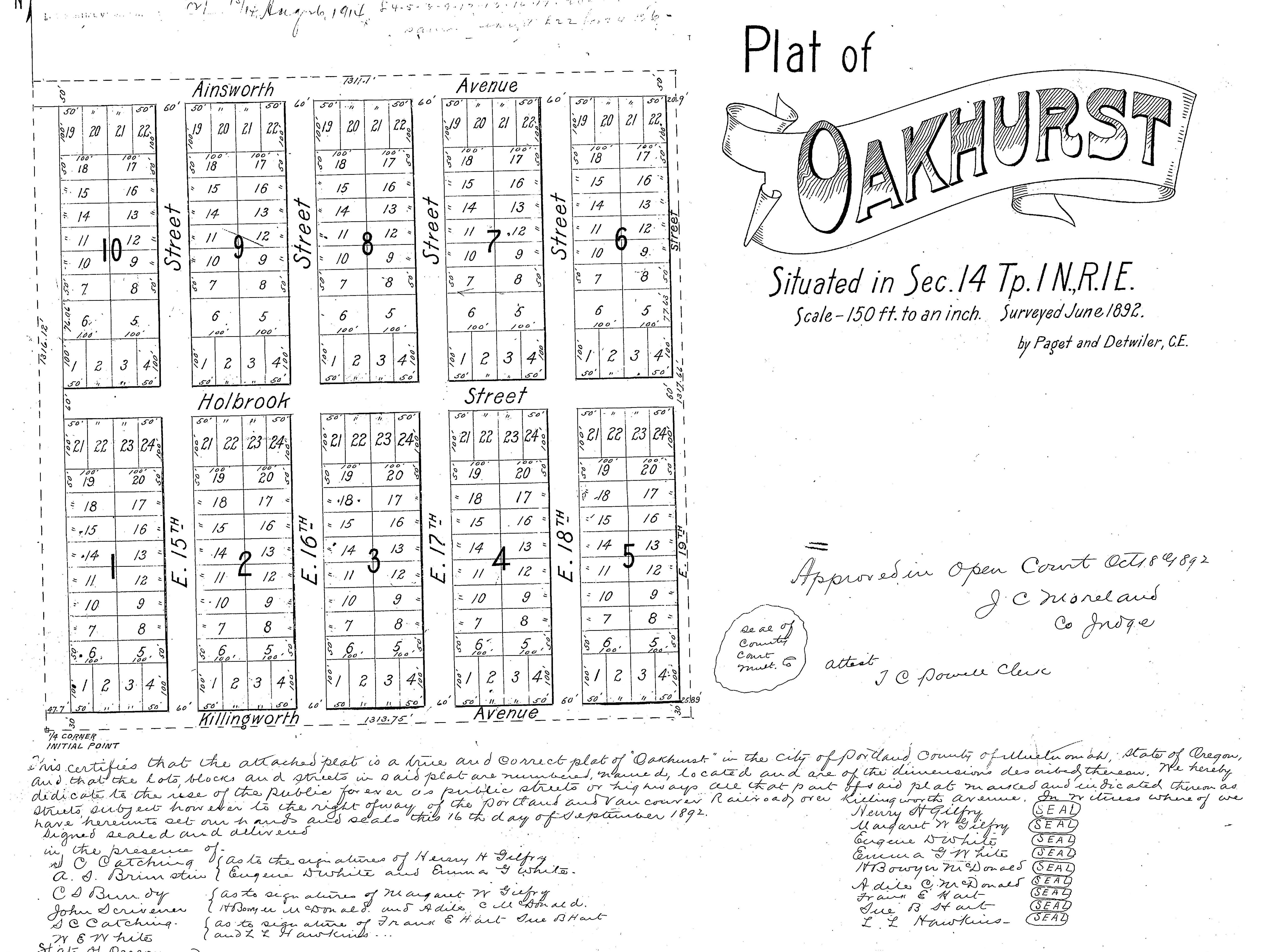
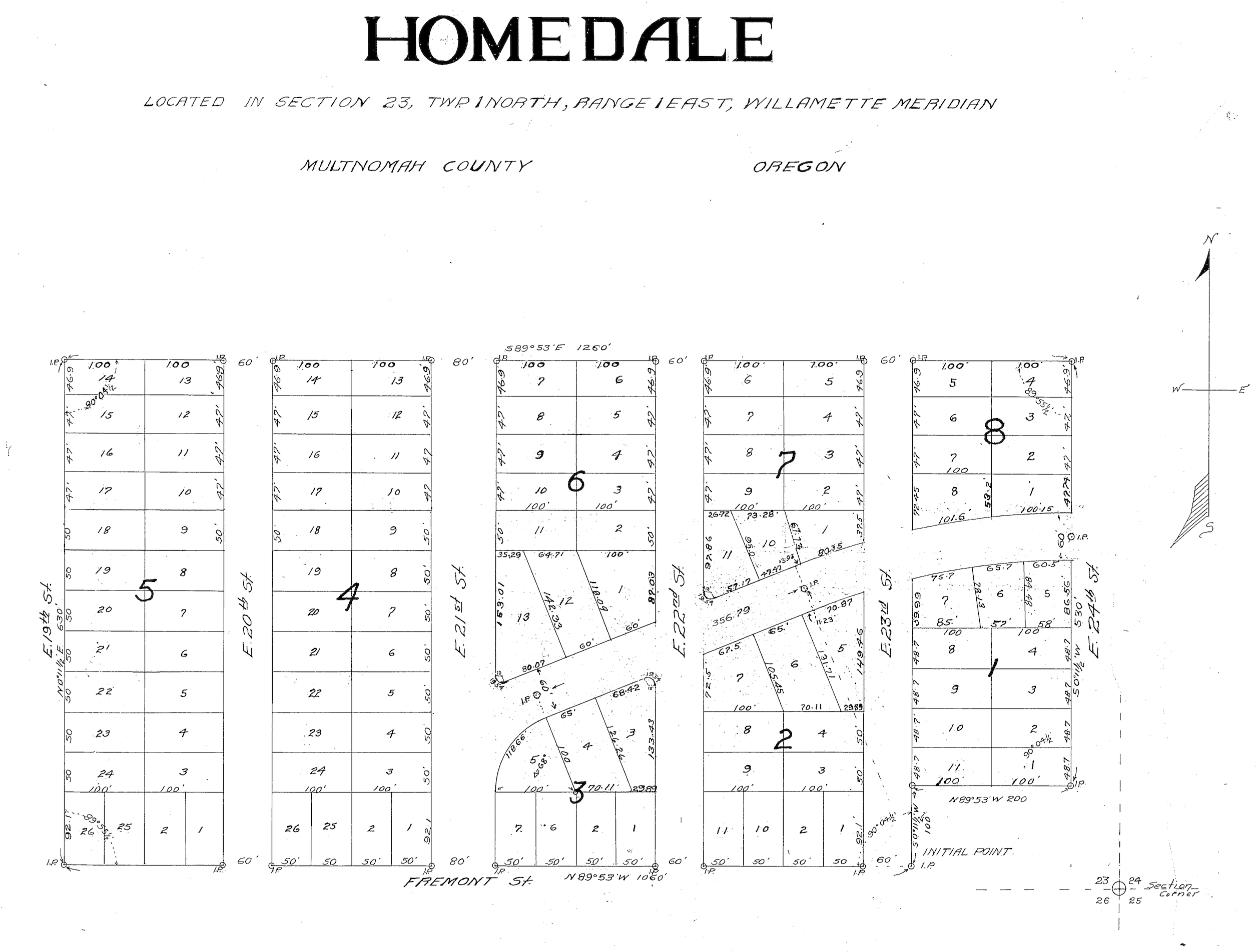
Take a look below at the Irvington Park plat, filed in 1890 and trading on the name of Irvington, a subdivision south of Fremont (the same one we know today). Note that in this view of the Irvington Park plat, west is up. You’ll see some familiar names, and some that didn’t make it through the years, Click to enlarge, it’s a big file:
Maybe you’ve figured out that “Riggen Street” is today’s Holman, and that “North Street” is Rosa Parks Way. 33rd on this plat is actually today’s 32nd place and 34th is 33rd. Details, details.
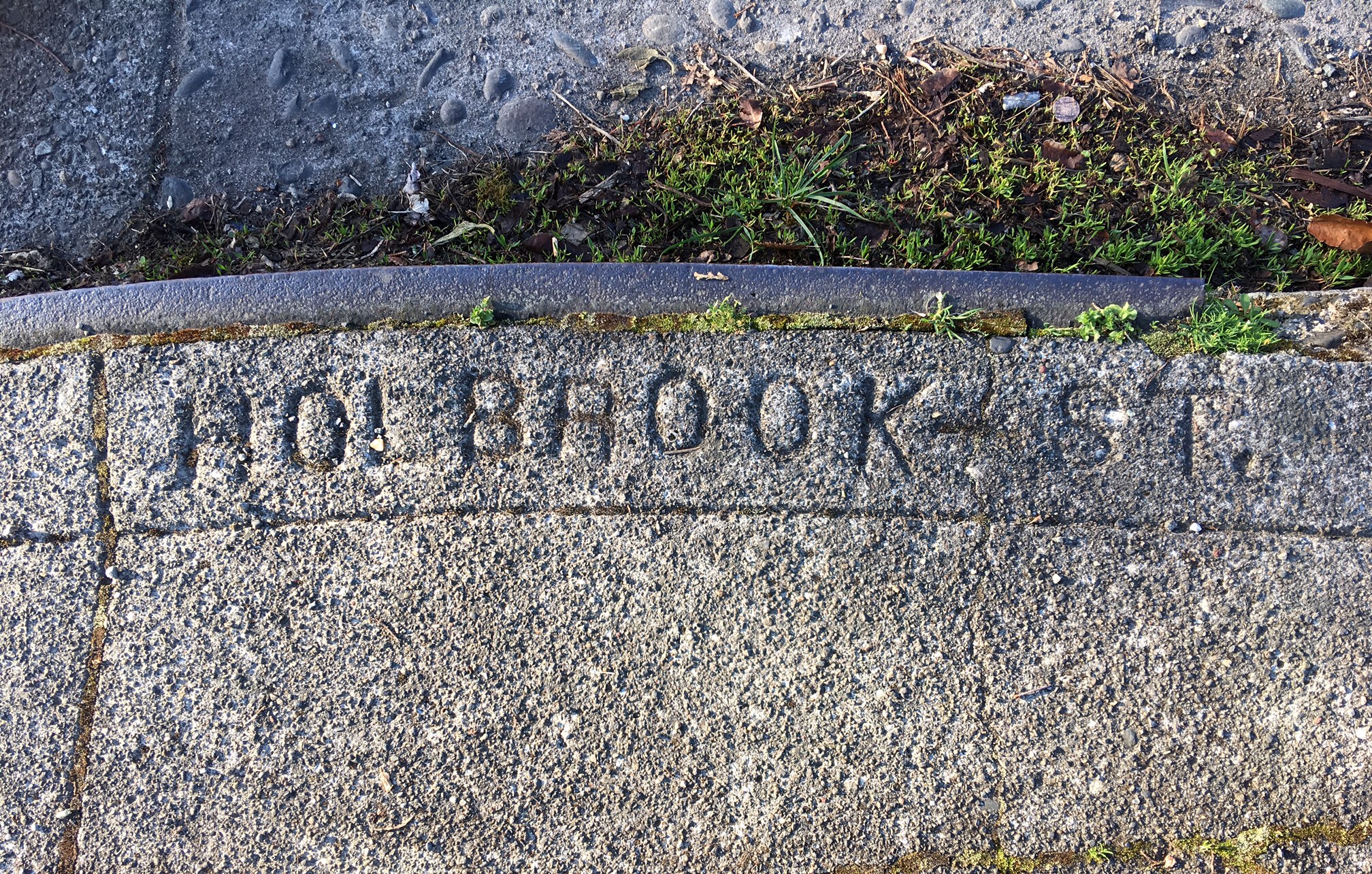
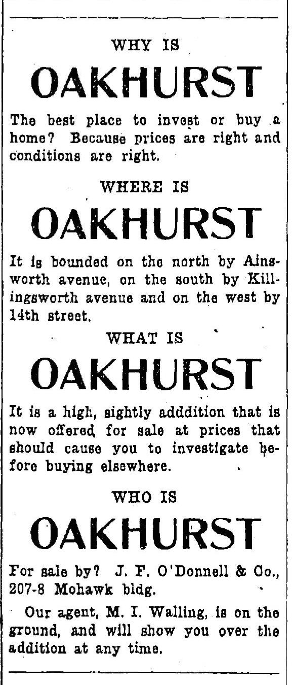
One of the interesting aspects of Irvington Park was how aggressively real estate man F. B. Holbrook marketed it during its early years, and how he coat-tailed on Irvington, located more than a mile south as a crow flies, which he had no actual business relationship with. Have a look at this ad, which ran in The Oregonian on July 10, 1907:
And here’s another gem, from September 16, 1907.
Yes, there were lots of trees: a nice way of saying this subdivision was way the heck out there.
Trading on the name of someone else’s success wasn’t a new idea. Alameda Park developers did the same with their own outrageous 1910 brochure, plus when Alameda was plumbed for sewers back in 1910, they even attempted to freeload (so to speak) on Irvington’s existing sewer system.
Even The Oregonian got into the act of promoting Irvington Park. Here’s a piece from July 23, 1913.
There’s a fascinating history to the Irvington Park lands that runs deeper, to 1866 when 49 acres were transferred from the United States government to Henry McIntire as part of a bounty land claim deed that was a reward for McIntire’s military service. The lands changed hands quickly after that, owned briefly by a private individual, then by Willamette University, and then by the Salem Flouring Mills. During the early 1880s the lands were even owned by William H. and Jennie Creighton (of “Town of Creighton” fame) before they defaulted on a mortgage payment to the Salem Flouring Mills. Mr. Creighton started out as a produce and shipping broker and proceeded into real estate speculation, as it seemed every Portland businessman did in those days.
By the early 1890s, the lands were in the hands of an unimaginatively named group called the Investment Company, owned by big-time Portland developers including William M. Ladd (who incidentally was a principal in the Salem Flouring Mills) and Edward Quackenbush. Selling lots in Irvington Park was just one of their many enterprises.
And deeper yet: elderly residents of Irvington Park we have interviewed report that when the ground was first disturbed to make streets and lots almost 100 years ago, Native American objects and artifacts were frequently found, which makes sense given the proximity to the Columbia Slough and Columbia River. These lands, like every inch we live on today, are part of the ceded lands of the Confederated Tribes of the Grand Ronde. Unfavorable treaty agreements in the 1850s removed indigenous people from these original homelands and then systematically broke the lands up to development through actions like the Donation Land Claim Act and related bounty land claim provisions. Any stone tools or arrowheads found today should rightly be returned to the Confederated Tribes of the Grand Ronde.
Over time, as Concordia College’s physical presence began to expand, the underlying plat names in the adjacent neighborhood fell out of usage in favor of what was becoming a local landmark, as in “we live over near Concordia,” and the previous deep history was forgotten. The mid-1970s marks the first official reference to the Concordia neighborhood that we could find either in daily news reporting or in city reference documents.
Read more about the “finest corner in Concordia,” a summer’s evening trip from 1915 to NE 30th and Ainsworth.